Rothwell is a historic market town and residential suburb in the south-east of the City of Leeds, sitting between Leeds and Wakefield and close to major routes like the M1 and A1 link road. It forms a distinct town within the metropolitan borough, with its own centre, parks and neighbourhood identity while functioning as a popular commuter base for Leeds city centre and surrounding employment hubs.
- Early Origins and Medieval Roots
- From Coal and Cloth to Commuter Town
- Local Government and Joining the City of Leeds
- Population, Housing and Everyday Life
- Town Centre, Shops and Local Services
- Parks, Green Space and Outdoor Life
- Transport Links and Commuting into Leeds
- Education, Community and Local Identity
- Historic Churches, Nonconformity and Faith
- Health, Welfare and Changing Social Conditions
- Economy, Work and Crime Profile Today
- Rothwell’s Place in the Wider Region
- Why Rothwell Works as an Evergreen Leeds Topic
Rothwell lies within the Rothwell ward of Leeds and had a population of around 20,600 at the 2021 census, reflecting steady growth from about 20,354 residents in 2011. The town also covers nearby communities such as Rothwell Haigh and Royds Green, with strong links to Oulton, Woodlesford, Middleton and other parts of south Leeds.
Early Origins and Medieval Roots
Rothwell’s history stretches back to at least the Domesday Book, which recorded the local settlements of Middleton, Thorpe, Rothwell, Carlton and Lofthouse as an ordered agricultural society under English thanes before Norman rule. At that time much of the surrounding land had already been cleared from forest for farming, and the area developed around a hall and stockade typical of early medieval lordships.
Through the medieval period the manor of Rothwell belonged to the powerful de Lacy family and later passed to other landowners, underpinning a rural economy of fields, woods and small industries. The parish church of Holy Trinity, which has medieval origins, became a key religious and social focus, while local roads connected the community to Leeds, Wakefield and the wider West Riding.
From Coal and Cloth to Commuter Town
By the nineteenth century Rothwell had shifted from a purely agricultural village to a mixed industrial community with extensive collieries, mills and related works. John Marius Wilson’s Imperial Gazetteer in the 1870s described Rothwell township as having mines, a gasworks, mills and works for glue, rope and twine alongside a growing population and several hundred houses.
Methodism took strong root in this industrial era; John Wesley preached in the district from the mid‑eighteenth century, and regular Methodist meetings and chapels followed as mining communities expanded. The arrival of tramways and later improved road transport encouraged people to work in Leeds and Wakefield while living in Rothwell, beginning the long-term trend from pit village to commuter town.
Local Government and Joining the City of Leeds
Modern Rothwell’s civic shape dates largely from Victorian and twentieth‑century reforms. A Local Board was created in 1873 for Rothwell, Rothwell Haigh and Royds Green, which under the energetic leadership of Joseph Charlesworth delivered the town’s first piped water supply and sewerage system. In 1892 this local authority area expanded to include Lofthouse‑with‑Carlton and Thorpe, reflecting the growing importance of coordinated services.
Rothwell Urban District continued until the national reorganisation of local government in 1974, when it was abolished and its area became part of the metropolitan borough of the City of Leeds. During the passage of the 1972 Local Government Act there was a campaign to place Rothwell in the new Wakefield district instead, and MPs briefly backed this before the House of Lords restored the link to Leeds, cementing Rothwell’s position in the modern city.
Population, Housing and Everyday Life
Today Rothwell is a medium‑sized community within Leeds, with aggregated census figures suggesting more than 22,000 residents when the wider built‑up area is considered. The population is slightly majority female and spread across just under 10,000 households, giving a suburban feel with a mix of family homes, terraced streets and newer developments.
Demographic profiles show Rothwell as predominantly White British, with that group making up around 92% of residents, and Christianity remains the largest recorded religion at just over half the population. The main age band is 40–59 years, indicating a strong base of working‑age adults, and around 30% of households consist of people living alone, ranging from younger professionals to older residents who value local amenities and services.
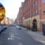
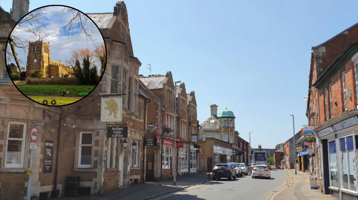
Town Centre, Shops and Local Services
Rothwell’s town centre offers a compact but varied mix of high street chains, independent shops, cafés, restaurants and traditional pubs focused around Commercial Street and the surrounding streets. This combination makes the area useful for day‑to‑day shopping, banking, takeaway food and everyday errands without needing to travel into Leeds city centre.
In 2007 the centre underwent a significant redevelopment designed to improve the public realm while respecting the conservation area status and historic character. This project pedestrianised and restored the historic route of Commercial Street, creating a more attractive, walkable core and setting a framework for future investment in small businesses and services.
Parks, Green Space and Outdoor Life
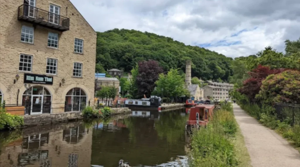
Rothwell is well known across Leeds for its green spaces, which give the town a semi‑rural feel despite its proximity to motorways and industrial areas. Local residents and visitors have easy access to parks, playing fields and walking routes that link into the wider countryside of south Leeds and the Aire–Calder corridor.
Family‑focused guides highlight multiple things to do in and around Rothwell, including play areas, nature walks, sports facilities and days out suitable for children. These amenities support an active, outdoorsy lifestyle, which is a key part of the town’s appeal for families moving out of inner‑city Leeds while still wanting short travel times and strong community networks.
Transport Links and Commuting into Leeds
For a Leeds Times audience, Rothwell’s transport connectivity is one of its defining strengths. The town sits close to the A1/M1 link road, placing both Leeds and Wakefield, as well as further destinations along the motorway network, within straightforward driving distance. Woodlesford railway station, just to the east, provides regular trains into Leeds in around ten minutes, giving residents a practical rail commuting option.
Frequent bus services connect Rothwell directly to Leeds city centre, with the 446 route between Commercial Street and Leeds City Bus & Coach Station typically taking about 24 minutes and running roughly every 15 minutes at busy times. Journey planners list car and taxi options of around 12 minutes for the 6.3‑mile trip into central Leeds, demonstrating why Rothwell is popular with car‑owning commuters who still want fast access to work and entertainment in the city.
Education, Community and Local Identity
Rothwell’s role as a self‑contained town within Leeds is reinforced by its schools, churches, community groups and sports clubs, which together create a strong local identity. Historically the area shifted from a close‑knit mining community to a more mixed commuter society, and local historians note that this sometimes led to a weakening of knowledge about the countryside and traditions among newer residents.
At the same time, the arrival of teachers, clergy and professionals from outside has brought fresh perspectives and reinforced education and civic life. Modern Rothwell balances this blend of long‑standing families and in‑comers through events, voluntary organisations and local facilities that help maintain a sense of belonging, echoing wider patterns across Leeds’s suburban towns.
Historic Churches, Nonconformity and Faith
Religion has long shaped Rothwell’s landscape and social fabric. The Church of England parish church at Rothwell stands as a visible marker of continuity, with medieval roots and later restorations reflecting centuries of worship and local commemoration. Parish records, memorials and architecture together chart the story of local landowning families, miners, traders and community leaders.
Nonconformist traditions, particularly Methodism, became prominent from the mid‑eighteenth century when John Wesley began preaching in the district, returning several times over a span of about twenty years. Chapels and meeting houses followed, serving the growing mining population and creating a culture of lay preaching, mutual support and social reform that remained influential well into the twentieth century.
Health, Welfare and Changing Social Conditions
The shift from rural village to industrial community brought significant health and welfare challenges, which local and city authorities tried to address over time. A key institution for the wider south‑Leeds area was the New Union Workhouse and Infirmary for the Hunslet Union, later taken over and renamed St George’s Hospital under Leeds authorities in the 1930s and then integrated into the NHS from 1948. Although not in the modern town centre, such facilities shaped many Rothwell families’ experiences of poverty relief, healthcare and social policy.
Improved public health measures introduced by bodies such as the Rothwell Local Board, including piped water and sewerage systems, played an important role in reducing disease and supporting population growth. Over time, as living standards rose and heavy industry declined, Rothwell’s health profile shifted towards the contemporary mix of aging populations, lifestyle‑related conditions and access to city‑wide NHS services familiar across suburban Leeds.
Economy, Work and Crime Profile Today
Modern Rothwell’s economy is more diverse and service‑oriented than its coal‑mining past, with many residents commuting to jobs in Leeds, Wakefield or along the motorway corridor. Area‑insight profiles describe parts of the ward as including both low‑income neighbourhoods and areas of average wealth, reflecting a mixed but generally stable socioeconomic picture.
Crime indices rank Rothwell as having a relatively low crime rate compared with some urban areas, which contributes to its reputation as a comfortable place to live for families and older residents. Like many towns near major routes, a high proportion of the area experiences traffic noise, but this is balanced by quiet residential streets and accessible parks which soften the impact of nearby roads.
Rothwell’s Place in the Wider Region
Although it is now firmly part of the City of Leeds, Rothwell’s location between Leeds and Wakefield and near historic routes has long given it strategic importance in the West Yorkshire landscape. From Domesday-era agricultural clearings and medieval manorial estates through to collieries, tramways and today’s bus corridors and motorway junctions, the town tells the story of changing connections across the region.
Cultural historians have even linked Rothwell to broader European narratives, with research tracing unexpected ties between the town and fourteenth‑century Portuguese diplomatic history, demonstrating how local places can intersect with international events. For a Leeds Times readership, Rothwell offers a lens on how a once‑rural community has adapted to industrialisation, deindustrialisation and metropolitan governance while retaining a distinct identity.
Why Rothwell Works as an Evergreen Leeds Topic
Rothwell’s combination of deep history, strong transport links, accessible green space and evolving demographics makes it an enduringly relevant subject for Leeds‑focused readers. It appeals to people researching places to live, planning days out, exploring family history or understanding how different parts of Leeds developed across the centuries.
As the city continues to grow and infrastructure projects such as bus interchanges and road improvements evolve, Rothwell is likely to remain at the forefront of discussions about sustainable commuting, suburban development and community identity in south and east Leeds. For local residents, prospective movers and curious visitors alike, the town stands as a long‑term, evergreen thread in the wider story of Leeds and West Yorkshire.