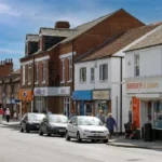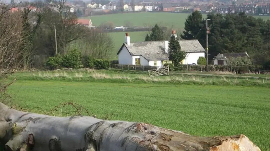
Garforth is an east Leeds settlement with a strong mix of open farmland, former railway corridors, woodland, local green spaces and historic landmarks. Its position between Leeds and the countryside gives photographers access to varied landscapes without travelling far from the city.
- What makes Garforth a good location for landscape photography?
- Where can you photograph the Leeds Country Way around Garforth?
- What is the Linesway and why is it useful for photography?
- Which Garforth green spaces provide useful local photography backgrounds?
- Where can you photograph woodland around Garforth?
- Which local views are best for photographing open countryside?
- Can you photograph water and rivers near Garforth?
- How does Garforth’s industrial history influence photography?
- Which historic features can photographers include in local views?
- What are the best times of day for photography in Garforth?
- What camera equipment works best for Garforth photography?
- How should photographers plan a Garforth photography walk?
- Is Garforth suitable for smartphone and beginner photography?
- How can photographers explore Garforth responsibly?
- What makes Garforth useful for an all-year photography itinerary?
- Why should Garforth be included in a Leeds photography itinerary?
The area works particularly well for landscape, nature, architectural and local-life photography. The surrounding public rights of way connect Garforth with Barwick-in-Elmet, Scholes, Swillington, Allerton Bywater and the River Aire. Leeds City Council identifies the Leeds Country Way as a 62-mile circular route around Leeds and lists the Linesway as a three-mile disused railway route between Garforth and Allerton Bywater.
Photography opportunities change throughout the year. Spring brings fresh vegetation and longer daylight. Summer provides extended evening shooting conditions. Autumn adds woodland colour and lower-angle sunlight. Winter exposes field patterns, branches and architectural details.
Garforth also has a significant industrial and community history. Mining shaped the settlement and its landscape. Local heritage records identify connections with the Gascoigne family, coal mining and the Miners’ Welfare movement. Archaeological discoveries near Garforth also demonstrate that the surrounding landscape has a much older history than its modern appearance suggests.
What makes Garforth a good location for landscape photography?
Garforth combines open countryside, woodland, former railway paths, water landscapes and historic features within a compact area. This variety gives photographers different compositions, foregrounds, horizons and seasonal subjects without requiring long-distance travel or specialist access.
The strongest feature of Garforth photography is its landscape variety. The settlement sits within a transition between built-up east Leeds and open agricultural land. Footpaths extend from residential areas towards fields and countryside.
The Leeds Country Way is particularly useful because its Garforth section provides access to several landscape types. The official route description records a section from Barwick-in-Elmet to Garforth of approximately 5.5 miles, followed by a 5.5-mile section from Garforth towards the River Aire.
This creates opportunities for photographers who want to combine local views with longer walks. A single outing can include fields, hedgerows, woodland, old railway infrastructure, village edges and river landscapes.
The area also benefits from varied elevation. Small rises around Garforth and the surrounding countryside create opportunities for wider views across agricultural land. Lower paths provide more enclosed compositions.
For photographers using smartphones, compact cameras or interchangeable-lens cameras, the area offers accessible subjects without requiring advanced equipment. A standard zoom lens handles most local landscape scenes. A telephoto lens is useful for distant architectural details, wildlife observation and compressed field patterns.
Where can you photograph the Leeds Country Way around Garforth?
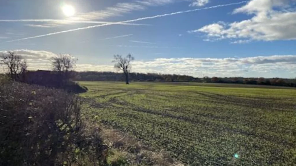
The Leeds Country Way provides one of the most extensive photography opportunities around Garforth, linking fields, hedgerows, woodland, old railway infrastructure and countryside views across a documented long-distance walking route.
The Leeds Country Way is a 62-mile circular footpath around Leeds. Leeds City Council divides the route into four main stages, with shorter sections available for walkers who do not want to complete the full circuit.
The Garforth section is especially useful for photography because the route moves between different landscape environments.
From Barwick-in-Elmet towards Garforth, the route crosses field paths and follows tracks towards the northern edge of Garforth. The official description then directs walkers through Main Street and Church Lane before reaching a path leading towards the old railway line.
This transition produces several photographic compositions. Fields create broad horizontal lines. Hedgerows create natural frames. Tracks create leading lines. Railway infrastructure introduces strong linear geometry.
The route from Garforth towards the River Aire provides another distinct photographic environment. The route follows the Linesway, continues towards Brecks Wood and passes Mount Pleasant Picnic Site before moving towards Little Preston and the River Aire.
Early morning is useful for long shadows across fields. Late afternoon provides directional light along paths and hedgerows. Overcast conditions work well for woodland and architectural detail because reduced contrast produces more even exposure.
Photographers should follow the signed public route and avoid entering cultivated fields outside designated paths.
What is the Linesway and why is it useful for photography?
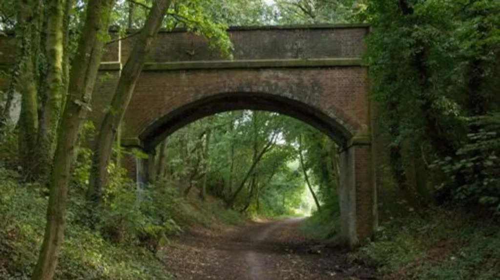
The Linesway is a three-mile disused railway route between Garforth and Allerton Bywater. Its linear form, vegetation, embankments and connections with surrounding countryside create strong opportunities for railway heritage, woodland, seasonal and environmental photography.
The Linesway is one of the most distinctive photography environments in the Garforth area. Leeds City Council describes it as a three-mile disused railway route between Garforth and Allerton Bywater.
Former railway routes have a distinctive visual structure. Their paths often maintain long, straight alignments through vegetation. This gives photographers natural leading lines extending towards a vanishing point.
The route is also useful for seasonal photography. Vegetation changes considerably between spring, summer and autumn. Winter exposes the underlying railway alignment and surrounding branches more clearly.
The connection between Garforth and the Linesway is particularly valuable because it creates a practical route from the settlement into the wider countryside. The Leeds Country Way uses the old railway line after leaving the Garforth area.
Railway heritage also provides historical context. The modern path represents a transport landscape that has been reused for recreation. Photographing it therefore captures both the physical environment and the changing function of local infrastructure.
Photographers should avoid climbing embankments, entering restricted areas or positioning themselves close to active railway infrastructure. The public route should remain the basis of the photography walk.
Which Garforth green spaces provide useful local photography backgrounds?
Garforth contains several officially recognised green spaces, including BarleyHill Park, White House Lane, The Chase, Hollinhurst Wood and local recreation grounds. These spaces provide accessible subjects for nature, community, seasonal and everyday landscape photography.
Leeds City Council lists numerous green spaces within the Garforth and Swillington area. Its parks byelaws schedule identifies BarleyHill Park, White House Lane, The Chase, Hollinhurst Wood and several local green spaces.
These sites provide a different photography experience from the open countryside.
BarleyHill Park is useful for local park photography, seasonal vegetation and everyday community scenes. The Chase provides another local green-space setting. Hollinhurst Wood introduces woodland textures, tree trunks, paths and changing seasonal foliage.
Small green spaces are valuable for photographers who want accessible subjects. They reduce the need for a long excursion and provide opportunities for short photography sessions.
Woodland photography benefits from attention to texture rather than only distant views. Tree trunks, fallen leaves, paths and gaps between branches provide strong compositions.
Local parks also work well for documenting seasonal changes. Photographing the same location in spring, summer, autumn and winter creates a visual record of landscape transformation.
Some local facilities have specific restrictions. Leeds City Council lists dog exclusion areas and other restrictions at particular recreational facilities, so photographers should check current signage and local rules before working in busy public spaces.
Where can you photograph woodland around Garforth?
Hollinhurst Wood and surrounding wooded sections provide opportunities for close landscape compositions, seasonal colour, tree textures and shaded pathways. Woodland photography around Garforth works particularly well when photographers use paths, natural frames and changing light rather than relying only on wide views.
Hollinhurst Wood is officially listed by Leeds City Council as a woodland area within the Garforth and Swillington area.
Woodland offers a different visual environment from open farmland. The canopy reduces the visible horizon and creates layered compositions. Paths become natural leading lines, while tree trunks create vertical structures.
Spring is useful for fresh foliage and woodland-floor detail. Summer provides dense green vegetation. Autumn introduces leaf colour and fallen-leaf textures. Winter reveals branches and woodland structure.
Morning and late afternoon provide directional light between trees. Diffused daylight also works well because woodland scenes often contain deep shadows and bright openings.
A wide-angle lens captures paths and large trees. A standard lens handles details and environmental compositions. A macro or close-focusing lens is useful for leaves, bark, fungi and small natural details.
Photographers should remain on public paths where applicable and avoid damaging vegetation. Woodland environments are particularly sensitive to repeated off-path movement.
Which local views are best for photographing open countryside?
The agricultural land around Garforth provides broad views of fields, hedgerows, tracks and rural horizons. Public footpaths around the settlement create elevated and ground-level perspectives that reveal the structure of the surrounding countryside.
Open countryside is one of the most important photographic assets around Garforth. The Leeds Country Way provides documented access through fields and rural tracks between Garforth and neighbouring settlements.
Field landscapes benefit from careful horizon placement. A low camera position gives greater importance to foreground textures. A higher viewpoint reveals field boundaries, roads and hedgerows.
Hedgerows are particularly useful as compositional boundaries. They divide the frame and create depth between foreground and distant landscape.
Farm tracks also create strong leading lines. A track entering from the lower corner of a photograph directs attention towards the horizon.
Weather has a major visual effect. Cloud formations add structure to broad skies. Mist reduces distant visibility and creates atmospheric separation. Clear weather increases distant detail.
Photographers should use public rights of way and avoid crossing crops or private land. The presence of a visually attractive field does not automatically create public access.
The official Leeds Country Way information provides route descriptions and mapping guidance, making it a reliable starting point for planning a countryside photography walk.
Can you photograph water and rivers near Garforth?
Yes. The Garforth countryside connects with routes towards the River Aire, while nearby lakes and wetland landscapes provide opportunities for reflections, vegetation, bird observation and wider waterside compositions under appropriate public-access conditions.
The Leeds Country Way section from Garforth towards the River Aire passes through rural landscapes before reaching the riverbank. The official route description includes Mount Pleasant Picnic Site, Little Preston and a later riverside section.
Water photography benefits from reflections and horizontal composition. Calm conditions create clearer reflections. Wind introduces texture and movement across the water.
The surrounding landscape also adds context. Trees, banks, bridges and paths create foreground elements around water.
Swillington Park Lakes are listed by Leeds City Council as Leeds Nature Areas within the Garforth and Swillington area.
Water environments require particular care. Wet ground can become slippery. Riverbanks can contain steep edges and unstable surfaces. Photographers should remain on appropriate paths and maintain a safe distance from water.
Wildlife photography should also prioritise distance and non-disturbance. A long lens provides better results than approaching animals closely.
How does Garforth’s industrial history influence photography?
Garforth’s industrial history adds historic depth to its landscapes through former mining associations, community buildings, railway infrastructure and surviving local features. These elements provide photographers with opportunities to document the relationship between industrial development and the modern countryside.
Coal mining had a major influence on Garforth. Leeds heritage documentation identifies local connections with the Gascoigne family and mining activity, while surviving features and records provide evidence of the community’s industrial past.
The former railway environment is another important component. The Linesway demonstrates how transport infrastructure can transition from industrial use into a recreational route.
This historical layer changes how local photography can be approached. A photograph of a path through vegetation can also document the remains of a former transport corridor.
Garforth’s historic buildings and community spaces provide additional subjects. The local heritage assessment identifies the Garforth Miners’ Welfare Hall, which was erected in 1924 by the Garforth Miners’ Welfare Institute.
As you explore the modern landscape, you are crossing land shaped by centuries of settlement and industry. Read about the full to understand its origins.
Historical photography works best when architecture and landscape are documented together. This approach preserves the relationship between individual buildings and their wider setting.
Which historic features can photographers include in local views?
Historic features around Garforth provide architectural and documentary subjects that complement countryside photography. St Mary’s Church area, mining-related heritage and older community buildings help connect modern local views with the settlement’s historical development.
St Mary’s Church is included within Leeds City Council’s Garforth and Swillington parks schedule. The area also contains cemetery and memorial-related heritage.
Historic churchyards provide architectural details, stone textures, paths and mature vegetation. These subjects work well for documentary photography and close architectural compositions.
Garforth also has direct connections with its mining history. A Leeds heritage assessment records a gravestone associated with John Backhouse, a young mine worker killed in a Garforth colliery explosion in 1856.
Such details demonstrate why local photography extends beyond scenic landscapes. Buildings, memorials and historic surfaces document social history.
Photography in churchyards and around memorials should remain respectful. Photographers should avoid obstructing visitors, touching memorials or entering restricted areas.
The best documentary images place individual historic details within their local environment. This provides geographical context rather than presenting isolated objects.
What are the best times of day for photography in Garforth?
Early morning and late afternoon provide strong directional light for fields, woodland, paths and buildings, while overcast conditions suit detailed landscapes. Seasonal daylight changes the shooting window, so photographers should plan around sunrise, sunset and weather conditions.
Morning light is useful for landscapes because the sun remains relatively low. Long shadows reveal field contours, paths and vegetation.
Late afternoon produces similar directional effects. The lower sun creates texture across open fields and illuminates trees from the side.
Midday light is stronger and creates shorter shadows. It remains useful for documentary photography, architecture and detailed subjects where consistent visibility matters.
Overcast conditions provide soft illumination. This is particularly useful in woodland, where direct sunlight can create extreme contrast between bright openings and shaded ground.
Winter offers shorter daylight hours but lower sun angles. Summer provides longer opportunities for evening photography.
Photographers should check current weather and daylight information before leaving. Conditions around open countryside can change quickly, particularly when walking longer routes.
What camera equipment works best for Garforth photography?
A lightweight camera with a standard zoom lens is sufficient for most Garforth landscapes. A wide-angle lens expands foreground scenes, while a telephoto lens isolates distant details, wildlife and architectural features without requiring specialist equipment.
A 24–70mm equivalent lens handles general landscape work effectively. Wider focal lengths capture paths, woodland and expansive skies.
A 70–200mm equivalent lens is useful for distant subjects. It also compresses layers of fields and vegetation, producing a stronger relationship between foreground and background.
A tripod is useful for low-light landscapes and controlled compositions. It is less practical on busy paths or during longer walks.
A polarising filter can reduce reflections and increase definition in some outdoor conditions. Its effect depends on the angle of the camera relative to the sun.
Smartphones also perform well in good daylight. Modern computational photography handles exposure and dynamic range effectively for casual landscape documentation.
The most important equipment remains suitable footwear, weather protection, spare battery capacity and enough storage. Garforth photography often involves walking between multiple viewpoints.
How should photographers plan a Garforth photography walk?
A successful Garforth photography walk starts with a mapped public route, suitable footwear, weather information and a clear photographic objective. Planning the route prevents unnecessary detours and helps photographers reach preferred landscapes during useful daylight conditions.
Start by selecting the photographic theme. A countryside session requires different planning from an architectural or woodland session.
Use official route information when planning walks. Leeds City Council publishes detailed information for the Leeds Country Way and other public rights of way.
Check access conditions before travelling. Public rights of way can change because of maintenance, temporary restrictions or land-management requirements.
Parking is another consideration. Leeds City Council lists a car park on Barleyhill Road in Garforth, with current parking arrangements published by the authority.
Public transport and walking connections can reduce the need for parking, particularly for photographers planning a one-way route.
Carry a phone with offline mapping where possible. A small torch is useful if returning after sunset. Weatherproof clothing protects both photographer and equipment.
Most importantly, photograph from locations where public access is permitted. Do not enter private farmland, railway property or restricted land for a better composition.
Is Garforth suitable for smartphone and beginner photography?
Garforth is suitable for beginners because its landscapes contain simple photographic structures such as paths, fields, trees, buildings and horizons. These subjects help new photographers practise composition, exposure, perspective and natural-light techniques without specialist equipment.
Beginners can start with the rule of thirds, leading lines and foreground-background separation.
The Linesway provides straightforward leading lines. A path or former railway alignment naturally directs attention through the frame.
Open fields provide opportunities to practise horizon placement. Keeping the horizon level is especially important in broad landscape photography.
Woodland provides opportunities to practise exposure. Bright sky openings can easily become overexposed, so photographers should monitor highlights.
Historic buildings provide opportunities to practise perspective. Moving the camera position changes how architectural lines appear.
Smartphone users can also experiment with panoramic views, portrait orientation and close details. Taking the same scene from several positions demonstrates how composition changes the visual balance.
Beginner photographers should prioritise observation over equipment. Garforth offers enough environmental variety to develop practical skills across multiple photography genres.
How can photographers explore Garforth responsibly?
Responsible photography means remaining on public routes, respecting private property, protecting wildlife, following local rules and avoiding damage to vegetation or heritage features. Good photographic practice preserves access and protects the landscapes that attract visitors.
Public rights of way exist for defined purposes and should be respected. Leeds City Council provides official information for recreational routes and public rights of way across the district.
Do not cross cultivated fields to reach a preferred viewpoint. Do not climb historic structures. Do not enter railway infrastructure.
Wildlife photography requires additional care. Maintain distance and avoid disturbing birds or animals, particularly during nesting and breeding periods.
Litter should be taken home. Dogs should remain under appropriate control, and photographers should follow local restrictions.
Respect residents when photographing residential areas. Avoid photographing through private property or creating obstruction on narrow paths.
These practices protect the landscape and maintain positive relationships between visitors, residents, landowners and local authorities.
Explore More Area Guide
Garforth Seasonal Guide & Activities 2026
Garforth Evening Guide: Dining & Leisure 2026
What makes Garforth useful for an all-year photography itinerary?
Garforth supports year-round photography because its fields, woodland, railway paths, water landscapes and historic features change visually with season, weather and daylight. Returning to the same viewpoints produces a consistent record of landscape transformation.
Spring provides fresh vegetation and increasing daylight. Woodland becomes greener, while field boundaries become more visually distinct.
Summer offers the longest daylight period. Evening walks provide extended opportunities for landscape photography.
Autumn is particularly useful for woodland photography because changing foliage adds colour and texture. Fallen leaves also introduce strong foreground detail.
Winter reveals landscape structure. Bare trees expose paths, buildings and distant features that dense foliage hides during summer.
The same location can therefore produce substantially different photographs throughout the year. This is useful for residents, photographers building portfolios and visitors documenting a trip.
Garforth also works as part of a wider east Leeds itinerary. The Leeds Country Way connects it with neighbouring communities and countryside, while the Linesway provides a route towards Allerton Bywater.
Why should Garforth be included in a Leeds photography itinerary?
Garforth offers a practical combination of countryside, woodland, former railway infrastructure, local heritage and accessible green space. Its location within the wider Leeds rights-of-way network makes it an effective base for varied landscape and local-view photography.
Garforth is not limited to one landmark or single viewpoint. Its photographic value comes from the relationship between several landscape systems.
Open fields provide broad compositions. Woodland provides texture. The Linesway provides linear infrastructure. Local parks provide accessible green space. Historic buildings and mining heritage add documentary context. Routes towards the River Aire introduce water and riverside landscapes.
This variety makes Garforth suitable for different audiences. Tourists can combine photography with countryside walking. Residents can explore familiar surroundings from a new perspective. Digital nomads and business travellers can use shorter local walks during free periods.
The area’s official route network strengthens its value for walking-based photography. Leeds City Council documents the Leeds Country Way as a 62-mile circular route and the Linesway as a three-mile disused railway route.
Garforth therefore provides a strong example of local photography within the Leeds area. The best results come from combining careful route planning, responsible access, seasonal awareness and attention to the area’s distinctive landscape and heritage.
What are the best photography locations in Garforth?
The best photography locations in Garforth include the Leeds Country Way, Linesway, Hollinhurst Wood, BarleyHill Park, surrounding countryside, Swillington Park Lakes and historic areas. Each location provides different landscape, woodland, heritage and local-view photography opportunities.