Garforth is a historic settlement in east Leeds where archaeology, medieval farming, coal mining, railways, churches, schools and community buildings provide accessible ways to explore the past. For families, its history is especially useful because many stories connect directly with streets, landmarks and countryside still visible today.
- Why is Garforth an interesting place for families to explore local history?
- What does the Domesday Book tell families about Garforth?
- What Roman and Anglo-Saxon discoveries have been made near Garforth?
- How can children understand Garforth’s medieval farming landscape?
- How did coal mining change Garforth?
- How did the Gascoigne family influence Garforth’s history?
- What can families learn from Garforth’s old railway?
- What is the historical importance of Parlington Lane and its railway?
- Which historic buildings can families see in Garforth?
- How can families turn a Garforth visit into a history activity?
- Where can families research Garforth history and family history?
- How does Garforth’s history remain relevant today?
Why is Garforth an interesting place for families to explore local history?
Garforth offers families a compact introduction to local history, covering Roman and early medieval archaeology, medieval farming, coal mining, Victorian transport, education, religion and twentieth-century growth. Children can connect historical dates with buildings, roads, railway infrastructure, landscapes and archaeological discoveries.
Garforth’s history stretches well beyond the modern town. Leeds City Council’s Garforth Neighbourhood Plan states that the precise date when the settlement first developed is unclear, but archaeological evidence indicates activity in the wider area before the medieval period. The local landscape sits on the Magnesian Limestone belt east of Leeds, an area associated with fertile agricultural land.
The name Garforth is generally interpreted as Anglo-Saxon. The neighbourhood plan explains it as deriving from two elements associated with a ford and a triangular piece of land. The area became part of the Kingdom of Northumbria in AD 617. Archaeological evidence found near Parlington Hollins also indicates earlier settlement activity.
For children, this provides a useful starting point. Local history does not begin with a single famous building. It develops through evidence from land, roads, buildings, objects and written records.
Garforth also demonstrates how one settlement changed as its economy changed. Farming shaped the medieval landscape. Coal mining expanded during the industrial period. Railways connected the town with wider markets. Housing growth during the twentieth century transformed its physical appearance.
That sequence makes Garforth suitable for a family history walk because different periods can be discussed during the same visit.
What does the Domesday Book tell families about Garforth?
The Domesday Survey of 1086 provides the first detailed written description of Garforth, recording a church, a priest, four villagers and one smallholder. These figures represent recorded household heads rather than the entire population, so the actual medieval community was larger.
The Domesday Book was a major survey commissioned by William the Conqueror after the Norman conquest of England. It recorded landholding, resources and obligations across much of England.
The Garforth entry provides an important historical snapshot. According to Leeds City Council’s local history account, the manor measured approximately 1.5 miles by 1.5 miles and included a church, a priest, four villagers and one smallholder in the Domesday record.
Children should not interpret the figure of four villagers as meaning that only four people lived in Garforth. Medieval surveys frequently recorded households or heads of households rather than every individual. Families, children and other residents were therefore not fully represented in such figures.
This makes Domesday an excellent opportunity to explain how historians interpret evidence.
A useful family activity is to compare the medieval settlement with modern Garforth. A child can ask how many houses, schools, shops, roads and public buildings exist today and then consider why a medieval survey recorded a much smaller community.
The exercise demonstrates population growth without requiring specialist historical knowledge.
The Domesday evidence also confirms that a church already existed in the settlement by 1086. This establishes the religious importance of Garforth during the early medieval period and provides a connection between documentary history and the historic buildings that remain visible.
What Roman and Anglo-Saxon discoveries have been made near Garforth?
Archaeological discoveries near Garforth provide direct evidence of people living in the area more than 1,000 years ago. A previously unknown cemetery contained more than 60 individuals, while a lead coffin and later Saxon artefacts reveal high-status activity.
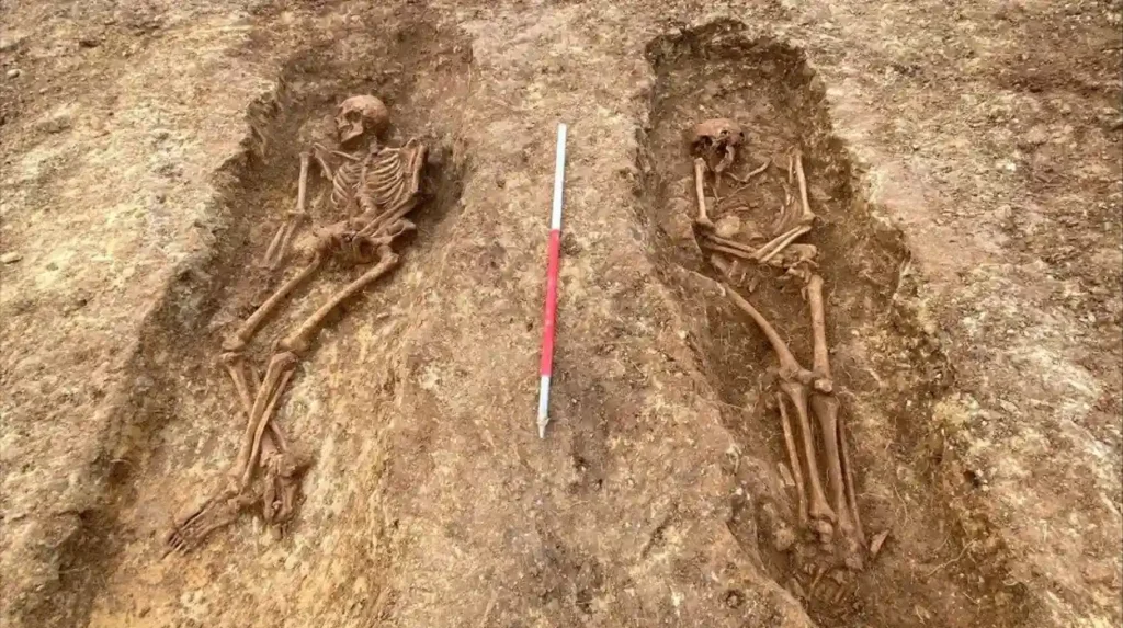
One of Garforth’s most important modern archaeological discoveries was announced by Leeds City Council in 2023. Archaeologists uncovered a previously unknown cemetery containing the remains of more than 60 men, women and children who lived in the area more than a thousand years ago.
The excavation also produced an ancient lead coffin dating from around 1,600 years ago. Leeds Museums and Galleries described the burial as belonging to a woman aged approximately 25 to 35. The grave contained items including a bracelet, glass bead necklace and a finger ring or earring.
For families, archaeology makes the past particularly tangible. Written records describe people, but excavated objects provide physical evidence of how individuals lived, dressed and were buried.
The Garforth discoveries also connect late Roman and early Saxon history. This period covers major changes in Britain following the end of Roman imperial rule.
In 2025, Leeds City Council reported another important discovery: a gilded Saxon pectoral cross believed to date from the eighth century. The object was made from solid silver covered with a thin layer of gold leaf.
The cross is significant because high-quality objects of this type were associated with important people in Saxon society. Its discovery adds to archaeological evidence for high-status individuals in the Leeds area.
Children can use these discoveries to understand how archaeologists reconstruct history from objects, burial sites and physical remains rather than relying exclusively on books.
How can children understand Garforth’s medieval farming landscape?
Garforth’s medieval history remains visible through traces of its former agricultural landscape. Ridge-and-furrow earthworks survive in grassed areas, while the settlement’s position on fertile Magnesian Limestone helped support farming before industrialisation transformed the local economy.
Medieval farming was central to Garforth’s development. Before large-scale industrial mining, land around the settlement supported agricultural activity.
Ridge and furrow is one of the most recognisable physical traces of medieval agriculture. It consists of long, raised ridges separated by shallow furrows created through repeated ploughing.
Leeds City Council identifies traces of Garforth’s medieval field system in grassed areas including Garforth Golf Course.
This provides families with a useful way to explain how landscapes preserve history. A field does not need a building or monument to contain archaeological information.
Children can look at the shape of the land and consider why repeated ploughing produced long parallel features.
The agricultural landscape also helps explain why settlements developed where they did. Soil, water, transport routes and access to productive land influenced communities for centuries.
The Magnesian Limestone belt east of Leeds provided productive farmland. This geological background forms part of Garforth’s wider historical story because geology influenced agriculture and later contributed to the area’s industrial development.
The transition from agricultural land to industrial settlement is therefore not a sudden change. It reflects a long process in which land use responded to economic opportunities.
How did coal mining change Garforth?
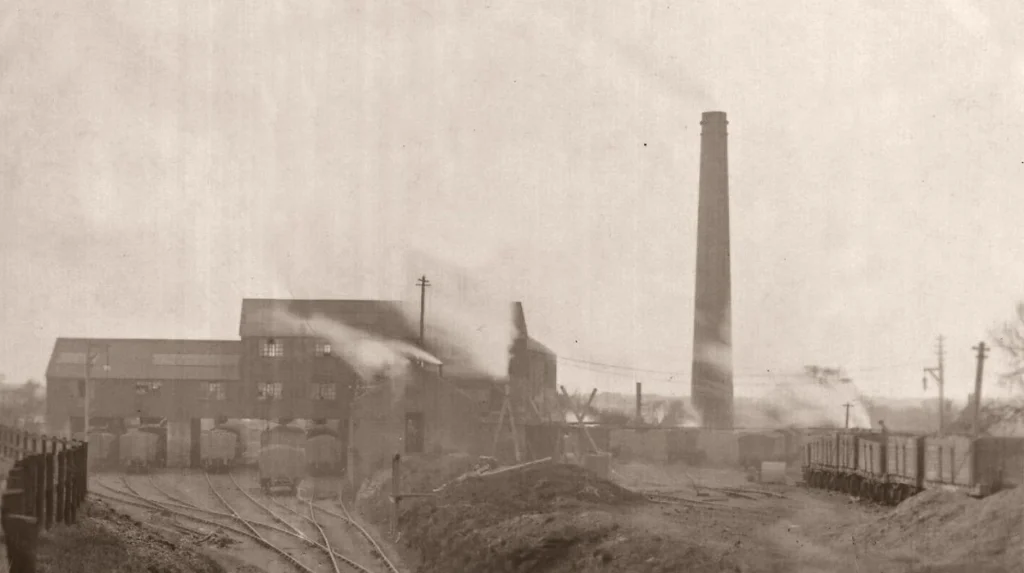
Coal mining transformed Garforth from an agricultural settlement into an industrial community. Mining existed locally for centuries, but industrial production expanded after the Gascoigne family developed deeper workings, with shafts sunk between 1830 and 1840 and pits operating until 1930.
Coal is one of the most important subjects for understanding Garforth’s nineteenth-century development.
Leeds City Council’s historical research records mining in the area from at least the medieval period, probably from the thirteenth century. The Gascoigne family later expanded coal extraction, initially through relatively shallow workings.
A major change occurred between 1830 and 1840, when the first deeper shafts were sunk. Mining then operated on a more industrial scale.
The growth of the pits affected the population. Garforth’s population was recorded as 782 in 1831 and had increased to 3,224 by 1899. That represents an increase of more than four times over approximately seven decades.
For children, these figures demonstrate the connection between employment and population growth.
People moved into growing industrial communities because mines created employment. Housing, schools, transport infrastructure, shops and community organisations developed alongside the workforce.
Mining was also physically demanding and carried serious risks. Leeds City Council’s account records significant flooding at the colliery during the 1870s and 1880s. The pits eventually closed in 1930.
Families exploring Garforth today can therefore use the modern town to discuss a period when coal shaped everyday life.
As you explore the modern town, you are crossing land shaped by centuries of change. Read about the full [Insert Anchor Text for Garforth History Article Here] to understand its wider origins and development.
How did the Gascoigne family influence Garforth’s history?
The Gascoigne family became major landowners in Garforth by the late eighteenth century and played a central role in local coal mining, transport and education. Their influence connected Garforth with the wider Parlington estate and the industrial economy of West Yorkshire.
The Gascoigne family held substantial land in the area by the late eighteenth century. Their influence extended beyond land ownership into coal extraction and transport.
Their collieries required routes for moving coal from mining areas towards markets. This requirement helped produce a network of wagonways and later railway infrastructure.
The relationship between landownership and industry is particularly useful for teaching children how local economies operated. A family controlling land could influence mining, transport and development across a large estate.
The Gascoigne connection also appears in education. Leeds City Council’s Garforth heritage information records that the former East Garforth School was built in 1843 and that the Gascoigne family provided the school to educate families of miners employed in their collieries.
This is an important example of how industrialisation affected more than employment. Mining influenced where people lived, how children were educated and how communities were organised.
The surviving historic buildings associated with this period therefore provide evidence of social history as well as architectural history.
What can families learn from Garforth’s old railway?
Railways changed Garforth’s connections with Leeds, surrounding communities and wider markets. Garforth station opened in 1834, while the historic station footbridge dates from around 1900 and demonstrates the engineering standards used by the North Eastern Railway.
Railway history is another accessible way to introduce children to industrialisation.
Garforth station opened in 1834 under the Leeds and Selby Railway. Historic England records that the railway was leased by the York and North Midland Railway in 1840 and purchased outright in 1844. It subsequently became part of the North Eastern Railway in 1854.
The station’s surviving footbridge is itself a listed structure. Historic England dates it to around 1900 and describes its construction in cast and wrought iron. It follows a standard North Eastern Railway design.
For children, railway infrastructure provides visible evidence of engineering.
A family can examine the bridge’s structure and discuss why railway companies needed strong pedestrian crossings, standardised designs and durable materials.
The railway also changed the geography of Garforth. Transport connections supported the movement of workers and goods and strengthened links with Leeds and other settlements.
This is an important reason why transport history belongs in a local history guide. Roads and railways influence where people work, where businesses operate and how communities expand.
What is the historical importance of Parlington Lane and its railway?
Parlington Lane preserves evidence of Garforth’s industrial transport network. The route carried coal from Gascoigne collieries towards Aberford before becoming part of the Aberford-Garforth Railway in 1837, which continued operating until 1924.
Parlington provides an important connection between Garforth’s mining history and its wider transport network.
Historic England records that Parlington Lane was used as a horse-drawn wagonway during the eighteenth and early nineteenth centuries. It carried coal from the Gascoigne family’s Garforth collieries to a coal staith at Aberford on the Great North Road.
In 1837, the wagonway became part of the Aberford-Garforth Railway. The railway remained in use until 1924.
The route therefore demonstrates a transition from horse-drawn industrial transport to railway technology.
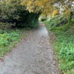
Parlington also contains evidence of former coal extraction. Historic England records circular depressions associated with former shafts or bell pits in Parlington Hollins. The former railway alignment survives in places as a pathway.
These landscape features are valuable for family exploration because they show that industrial heritage is not restricted to museums.
A path, cutting, embankment or depression can represent a former industrial system.
The Dark Arch is another notable feature. Historic England states that it was constructed around 1813 for Richard Oliver Gascoigne and was designed to conceal coal traffic on the wagonway from the hall and gardens.
Which historic buildings can families see in Garforth?
Garforth’s historic buildings include St Mary the Blessed Virgin Church, former Methodist buildings, an old coaching inn site and former school buildings. Together they demonstrate the religious, educational, transport and social institutions that supported the expanding nineteenth-century community.
Historic buildings provide an immediate way for children to connect historical dates with physical places.
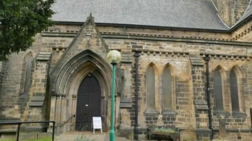
The Church of St Mary the Blessed Virgin on Church Lane was built in 1844 to designs by architect George Fowler Jones. Historic England lists it at Grade II and describes its use of dressed Magnesian Limestone and an Early English architectural style.
The building demonstrates the importance of religious institutions during Garforth’s nineteenth-century population growth.
Another important building is the former Methodist Church and Sunday School. Leeds City Council’s heritage information records the first Methodist chapel in Garforth as dating from 1806. The chapel was enlarged in 1824, a Sunday school was established in 1826 and a later chapel was built in 1872, with the present building dating from 1876.
These dates provide an excellent chronology for children.
They show how religious buildings expanded alongside population growth and community organisation.
The former East Garforth School, built in 1843, provides another connection with industrial society. Its history links education directly with the Gascoigne family’s mining operations.
Families can therefore identify three connected institutions: church, school and workplace. Together they explain how a nineteenth-century industrial community functioned.
How can families turn a Garforth visit into a history activity?
A Garforth history visit works best as a sequence connecting archaeology, medieval farming, churches, mining, education, railways and modern community life. Families can use visible buildings, paths and landscapes as prompts instead of relying entirely on formal museum displays.
A simple family history activity begins with a map.
Children can identify the modern town centre, Church Lane, railway station, historic buildings and routes towards the surrounding countryside. The aim is to understand how the settlement occupies the same landscape used by previous generations.
A second activity is a historical timeline.
Start with the early settlement evidence, move to the 1086 Domesday Survey, then medieval farming, eighteenth-century coal extraction, nineteenth-century industrial mining, railway development, twentieth-century pit closure and modern expansion.
The dates provide structure without requiring children to memorise extensive historical detail.
A third activity involves looking for changes in land use.
Families can compare built-up areas with open countryside and ask what the land was used for before modern housing expanded.
Garforth’s population growth provides a useful numerical example. The increase from 782 people in 1831 to 3,224 in 1899 demonstrates the scale of change associated with industrial employment.
The Leeds Country Way also provides a route through the wider landscape. The official Leeds City Council route includes a section from Barwick-in-Elmet to Garforth and another from Garforth towards the River Aire, using paths, tracks and the former railway line known as the Linesway.
This creates an opportunity to combine walking with historical observation.
Explore More Area Guide
Garforth Peaceful Morning Walks and Outdoor Places, Leeds
Garforth Meeting Places and Social Spaces Guide | Garforth
Where can families research Garforth history and family history?
Leeds Libraries provides substantial resources for researching Garforth and wider West Yorkshire history, including newspapers, maps, photographs, directories, electoral registers and parish records. Garforth Community Hub and Library also hosts heritage activity and provides accessible community facilities.
Garforth Community Hub and Library is an important modern resource for local research. Leeds City Council lists facilities including free Wi-Fi, public computers, accessible toilets, a café and accessible building features.
Leeds Libraries’ Heritage and Research department at Leeds Central Library provides a much larger historical collection. The service holds more than 180,000 heritage items, including books, newspaper archives, journals, directories, maps, photographs, electoral registers, playbills and parish records.
These resources support family-history research as well as local-history projects.
A child researching a relative from Garforth can learn how historians build evidence from several records rather than relying on one source.
The library’s digital and physical resources also make it possible to compare historic maps with present-day geography.
Leeds Libraries has also scheduled a Garforth local history workshop for 29 September 2026 at Garforth Community Hub and Library. The event focuses on exploring Garforth’s history through collections available at Leeds Central Library and forms part of the Leeds400 programme.
This demonstrates that Garforth’s history remains an active area of research rather than a closed historical subject.
How does Garforth’s history remain relevant today?
Garforth’s history remains visible through its buildings, railway, landscape, archaeological discoveries, community facilities and surviving routes. Understanding these features explains why the settlement developed, how its population changed and how industrial heritage continues to shape the modern town.
Modern Garforth is the result of several major phases of development.
The industrial period created population growth and infrastructure. The closure of the pits in 1930 ended the area’s large-scale coal-mining era, while later housing development expanded the settlement during the 1960s and 1970s. Leeds City Council identifies transport connections and proximity to Leeds as major factors in later growth.
This history explains why modern Garforth contains both older buildings and newer residential areas.
It also explains why railway infrastructure remains important. Historic transport routes continue to influence movement through the area, while former industrial routes survive as paths and landscape features.
Archaeology adds another layer. The discovery of a 1,600-year-old cemetery and an eighth-century Saxon cross demonstrates that Garforth’s historical importance extends far beyond the Victorian industrial period.
For families, this creates a clear historical sequence: early settlement, medieval agriculture, coal extraction, industrial expansion, railway development, twentieth-century change and modern community life.
Garforth therefore works particularly well as a local-history destination because its past can be studied through physical evidence. Churches, railway structures, historic routes, archaeological finds, former schools and countryside all contribute to the historical record.
The result is a family-friendly introduction to how places change over time and how historians use evidence to understand those changes.
What is Garforth famous for?
Garforth is known for its coal-mining heritage, railway history, historic churches, medieval agricultural landscape and important archaeological discoveries, including Roman-era and Anglo-Saxon evidence.