Garforth is a historic settlement east of Leeds with evidence spanning medieval agriculture, religious heritage, railway development, coal mining and community history. Its historic interest is distributed across churches, streets, buildings, transport infrastructure, former mining landscapes and local records rather than concentrated in one museum.
- What makes Garforth an interesting place for history enthusiasts?
- Where can you explore Garforth’s medieval history?
- Why is St Mary the Blessed Virgin important to Garforth history?
- What can Garforth railway station tell visitors about local history?
- Which Garforth buildings reveal the town’s industrial history?
- Where can you find evidence of Garforth’s coal-mining past?
- What historic streets and buildings should you see around Garforth?
- Can Garforth’s local history be explored through libraries and archives?
- How can you plan a history-focused day in Garforth?
- Why is Garforth’s history important to the wider Leeds story?
- What should history enthusiasts remember when visiting Garforth?
For history enthusiasts, Garforth works particularly well as a walking destination. Its historic features can be connected through the town centre, Church Lane, railway area and surrounding open land. The modern settlement also retains physical reminders of industries and communities that shaped its development.
Leeds City Council’s Garforth Neighbourhood Plan identifies evidence of early settlement, medieval agriculture, railway development, coal mining and significant local buildings. The plan records that the first detailed description of Garforth appears in the Domesday Survey of 1086.
What makes Garforth an interesting place for history enthusiasts?
Garforth is historically significant because its landscape records several periods of development, including early settlement, medieval farming, nineteenth-century railways, coal mining and twentieth-century community life, with surviving churches, buildings, railway structures, landscape features and documentary collections providing tangible evidence.
Garforth’s history is not represented by one period alone. The settlement developed through successive changes in land use, transport, industry, housing and community institutions.
The area lies on the Magnesian Limestone belt east of Leeds. Leeds City Council’s historical account states that this fertile agricultural area was probably cultivated during the Roman period. Archaeological evidence near Parlington Hollins also indicates earlier settlement activity.
The name Garforth is generally associated with Anglo-Saxon origins. The Garforth Neighbourhood Plan explains the name as deriving from two words meaning a ford beside a triangular piece of land. The settlement later became part of the wider historical development of the Leeds region.
The strongest documentary milestone is the Domesday Survey of 1086. At that time, Garforth was recorded as a manor measuring approximately 1.5 miles by 1.5 miles, with a church, priest, four villagers and one smallholder. Medieval population figures in Domesday were incomplete because only household heads were counted.
This early record provides the starting point for understanding Garforth as an established medieval settlement rather than simply a modern Leeds suburb.
Where can you explore Garforth’s medieval history?
The clearest medieval connections in Garforth are found through its historic settlement pattern, Church Lane, St Mary’s churchyard and surviving traces of agricultural land use, particularly ridge-and-furrow earthworks that preserve evidence of medieval farming practices.
Medieval Garforth was closely connected with agriculture. Farming shaped the organisation of land around the settlement, and traces of medieval field systems remain visible in parts of the modern landscape.
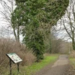
Ridge and furrow is one of the most useful physical clues. It consists of long, raised ridges and parallel depressions created by repeated medieval ploughing. Garforth’s Neighbourhood Plan records surviving traces in grassed areas, including land associated with Garforth Golf Course.
These earthworks are important because they show how agricultural land was physically organised before modern farming machinery transformed the countryside.
A history-focused visitor should therefore look beyond individual buildings. Open land can contain archaeological information even when no medieval structure survives above ground.
Church Lane provides another important historical connection. The area around St Mary’s church demonstrates how religious buildings remained central to Garforth’s settlement identity.
The modern landscape therefore contains several layers. A road, field or open area can represent a much older land-use pattern even when its present function is completely different.
For visitors researching Garforth’s medieval development, local historical records provide an important companion to physical exploration. Leeds Libraries has a heritage programme, including a Garforth local history workshop scheduled for September 2026 that focuses on unique collections held through the library service.
As you explore the modern town, you are crossing land with a deep heritage. Read about the full to understand its origins.
Why is St Mary the Blessed Virgin important to Garforth history?
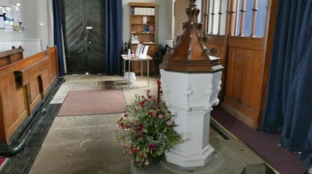
St Mary the Blessed Virgin on Church Lane is an important nineteenth-century landmark because the listed church was built in 1844 by architect George Fowler Jones using Magnesian Limestone, while its location connects modern Garforth with the settlement’s earlier religious history.
The Church of St Mary the Blessed Virgin is one of Garforth’s most prominent historic buildings.
Historic England records the church as a Grade II listed building. It was constructed in 1844 to designs by George Fowler Jones. The building uses dressed Magnesian Limestone and has a slate roof.
Its architectural design follows the Early English style. The building has a cruciform plan, meaning its principal layout forms the shape of a cross. It includes a nave, north and south aisles, transepts, a chancel and a crossing tower with a broach spire.
The architectural details provide useful evidence of nineteenth-century religious design. Tall lancet windows, buttresses, moulded doorways and carved architectural features contribute to its historic character.
The church is particularly valuable for understanding Victorian Garforth. The nineteenth century brought major changes to the settlement through population growth, industrialisation, transport and coal mining.
The churchyard also provides historical evidence through memorials and gravestones. Such features connect architectural history with individual lives and local industries.
One documented example is the gravestone of John Backhouse. The Garforth Neighbourhood Plan identifies his memorial as a connection with the town’s mining history. Backhouse worked as a hanger-on at a local coal mine and died in a mining explosion in 1856 at the age of 15.
This makes the churchyard more than an architectural site. It is also a place where visitors can examine evidence of Garforth’s industrial and social history.
What can Garforth railway station tell visitors about local history?
Garforth railway station demonstrates how nineteenth-century railway development changed the settlement, with the Leeds and Selby Railway opening the station in 1834 and a surviving Grade II listed cast-and-wrought-iron footbridge dating from around 1900.
Railway history is one of Garforth’s strongest historical themes.
Garforth station opened in 1834 as part of the Leeds and Selby Railway. Historic England records that the station was later leased by the York and North Midland Railway in 1840 and purchased outright in 1844. It became part of the North Eastern Railway in 1854.
The railway connected Garforth to a rapidly expanding nineteenth-century transport network. The Leeds and Selby route was designed to provide an important connection between Leeds and the River Ouse at Selby.
Historic England’s records explain that engineer James Walker reviewed the proposed route in 1829. The planned railway passed through Cross Gates, Garforth and Milford and covered just over 19 miles. Parliament authorised the railway in 1830, and the route was fully opened by December 1834.
The station therefore belongs to an important phase in British transport history.
One of the most interesting surviving structures is the footbridge. Historic England lists the Garforth Station footbridge at Grade II. It was constructed around 1900 using cast and wrought iron and follows a standard North Eastern Railway design.
The structure features an elliptical arch divided into four sections, roundels, decorative railings and iron balusters. These details provide visible evidence of railway engineering and architectural design from the period.
For history enthusiasts, the station is significant because it demonstrates how infrastructure itself becomes heritage. Railway tracks, bridges, station buildings and platforms reveal how people and goods moved during industrial expansion.
The station also provides a useful starting point for a walking-based history itinerary because it links directly with Garforth’s later urban development.
Which Garforth buildings reveal the town’s industrial history?
Garforth’s industrial history is strongly represented by buildings connected with coal mining and worker welfare, particularly the Miners’ Welfare Hall and Garforth Country Club, which demonstrate how mining influenced employment, social life, education and community institutions.
Coal mining fundamentally influenced Garforth’s nineteenth- and twentieth-century development.
The Garforth Neighbourhood Plan identifies several buildings and structures with historic connections to the mining industry. These include the Miners’ Welfare Hall and Garforth Country Club.
The Miners’ Welfare Hall on Main Street dates from 1924. It was established by the Garforth Miners’ Welfare Institute on land donated by the Gascoigne family, who owned local mines. Funding came from the Central Miners’ Welfare Committee and weekly subscriptions paid by miners.
The building illustrates an important feature of industrial communities. Mining shaped not only employment but also social institutions.
The hall later accommodated Garforth Library from 1939 to 1943. It subsequently continued as a community centre. Its history therefore connects industrial welfare with education, recreation and civic activity.
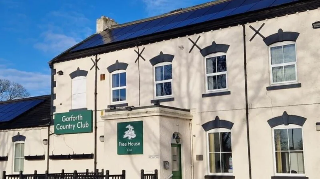
Garforth Country Club has an earlier industrial connection. The original part of the building dates from 1865. The Gascoigne family had it built as a reward for miners who did not strike that year. The building hosted lectures, magic lantern shows, chess and other social activities.
These buildings provide a different perspective from churches and railway structures. They show the social history of workers and employers.
For visitors, this industrial heritage is especially useful because it demonstrates how coal mining affected everyday community life. The history is visible through buildings designed for social, educational and welfare purposes rather than through mining infrastructure alone.
Where can you find evidence of Garforth’s coal-mining past?
Evidence of Garforth’s coal-mining past survives through historic buildings, memorials, former mining locations and the town’s documented relationship with the Gascoigne family, whose ownership of local mines influenced employment, community facilities and settlement development.
Coal mining became a defining part of Garforth’s modern history.
The Garforth Neighbourhood Plan records local mining references to collieries including Isabella and The Sisters. These names appear in historical accounts of mining accidents and employment.
The story of John Backhouse provides a particularly clear example. He was only 15 when he died in a mining explosion in 1856. His gravestone in St Mary’s churchyard preserves a direct connection between an individual, the mining industry and the wider community.
Mining history can therefore be approached through documentary research as well as physical remains.
The Gascoigne family also appears repeatedly in Garforth’s industrial history. Their ownership of local mines affected the town’s economic structure and contributed to the development of community facilities.
The Miners’ Welfare Hall demonstrates how mining wealth and labour organisation translated into community infrastructure.
Garforth’s mining history also explains why some apparently ordinary buildings deserve attention. Their significance comes from the people who used them and the industries that supported them.
History enthusiasts should distinguish between surviving heritage structures and former industrial sites. Not every historic mining location remains visibly intact. Documentary evidence, maps, memorials and community archives are therefore important for reconstructing the industrial landscape.
What historic streets and buildings should you see around Garforth?
Garforth’s historic streets provide a concentrated view of architectural and social change, particularly around Main Street, Church Lane and older parts of the settlement, where churches, community buildings, traditional properties and transport infrastructure reveal different stages of development.
A walking tour is one of the most effective ways to understand Garforth’s built history.
Main Street is particularly relevant because it contains buildings associated with community and industrial heritage. The Miners’ Welfare Hall is an important example.
Church Lane provides another strong historical route because it leads towards St Mary the Blessed Virgin and its churchyard.
The architectural character of older properties also helps visitors identify changes in building materials and construction styles. Garforth’s position on the Magnesian Limestone belt influenced the availability and use of local stone.
The combination of stone buildings, brick structures, nineteenth-century religious architecture and railway infrastructure demonstrates how Garforth changed as its population and economy expanded.
A useful historical walk should not treat buildings as isolated attractions. Their relationship to roads, fields, railway lines and community facilities provides a clearer understanding of how the settlement functioned.
The Garforth Neighbourhood Plan also identifies a range of historic buildings and features as having local heritage value. This local approach is important because heritage significance extends beyond nationally listed buildings.
Visitors should therefore look for changes in building scale, materials, street alignment and the relationship between older buildings and newer development.
Can Garforth’s local history be explored through libraries and archives?
Garforth’s history can be explored through Leeds Libraries and local heritage collections, which provide documentary evidence that complements buildings, streets and landscapes, including dedicated local-history activity focused on Garforth and its historical collections.
Physical heritage sites provide only part of the evidence.
Leeds Libraries provides access to heritage and research resources covering the history of Leeds and surrounding communities. Its programme includes a dedicated Garforth local history workshop at Garforth Community Hub and Library in September 2026.
Local libraries are valuable to history enthusiasts because many historical questions cannot be answered from surviving buildings alone.
Maps can reveal former field boundaries, roads, railways and industrial sites. Photographs can show buildings before alteration. Local newspapers can provide evidence of community events, accidents, businesses and employment. Historical directories can identify residents and occupations.
These sources help visitors interpret the physical landscape more accurately.
A visitor interested in Garforth’s mining history, for example, can use local records to investigate collieries, mining families, employment and industrial accidents. Railway researchers can compare historical maps with the modern station area.
This documentary approach also reduces the risk of assuming that every old-looking building has the same historical significance.
For digital nomads and business travellers with limited free time, a library-based heritage visit provides a practical indoor activity. It also works well when weather limits outdoor walking.
How can you plan a history-focused day in Garforth?
A history-focused Garforth day works best as a connected route beginning with the settlement’s early history, continuing through Church Lane and St Mary’s, then examining railway heritage, mining-related buildings and local historical collections.
Begin by establishing Garforth’s historical timeline. The settlement appears in the Domesday Survey of 1086, while its railway history begins with the opening of the Leeds and Selby Railway in 1834.
Continue towards Church Lane and St Mary the Blessed Virgin. Examine the church’s nineteenth-century architecture and the historic memorials within the churchyard.
The next stage is railway history. Garforth station provides a direct connection with the transport expansion of the nineteenth century. The Grade II listed footbridge is particularly useful for visitors interested in railway engineering.
Continue into the town centre to examine buildings associated with industrial and community history. The Miners’ Welfare Hall provides evidence of the relationship between coal mining, worker organisation and community facilities.
Garforth Country Club provides another perspective on nineteenth-century mining society. Its 1865 origins connect the building with the Gascoigne family and local mining history.
Finish with documentary research through Leeds Libraries or local heritage resources. A library visit adds historical context that cannot always be obtained from a street-level walk.
This route combines archaeology, architecture, transport, industrial history, social history and documentary research without requiring a large number of separate attractions.
Explore More Area Guide
Garforth Green Corridors and Open Spaces: Local Guide
Garforth Places for an Unplanned Day Out | The Leeds
Why is Garforth’s history important to the wider Leeds story?
Garforth’s history is important to Leeds because it demonstrates how an established agricultural settlement became integrated into regional transport, industrial and urban systems, with medieval land use, coal mining, railway expansion and community institutions contributing to the area’s modern identity.
Garforth provides a useful example of how settlements around Leeds developed over centuries.
Its early history was shaped by agriculture and land organisation. Medieval ridge-and-furrow remains demonstrate the importance of farming before industrialisation.
The nineteenth century brought major structural changes. The railway connected Garforth with Leeds and Selby, placing the settlement within an expanding regional transport network. The station opened in 1834, only a few years after the railway had been authorised by Parliament.
Coal mining then influenced employment, housing and community institutions. The history of the Miners’ Welfare Hall and Garforth Country Club demonstrates how industrial development affected social life as well as economic activity.
Religious buildings provide another layer. St Mary the Blessed Virgin represents Victorian architectural and religious development, while its churchyard preserves memorial evidence connected with earlier generations.
Together, these elements show why local history is important. A small settlement can preserve evidence of national developments in agriculture, industrialisation, railway engineering, religious architecture, labour organisation and urban growth.
Garforth’s heritage therefore deserves consideration as part of the wider history of Leeds and West Yorkshire rather than as an isolated local story.
What should history enthusiasts remember when visiting Garforth?
History enthusiasts should approach Garforth as a layered heritage landscape rather than a single attraction, combining medieval field evidence, St Mary’s church, railway infrastructure, mining-related buildings, memorials, streets and library collections to understand the settlement’s complete historical development.
The most important feature of Garforth is the connection between its different historical periods.
The Domesday record establishes the medieval settlement. Ridge-and-furrow earthworks preserve evidence of agricultural organisation. St Mary the Blessed Virgin represents nineteenth-century religious architecture. The railway station and listed footbridge document transport expansion. Mining buildings and memorials preserve industrial and social history.
These elements should be read together.
A history enthusiast visiting Garforth can therefore move from archaeology to architecture, from transport history to industrial heritage, and from physical structures to documentary evidence.
The town’s heritage also continues to receive attention through local research and library activity. Leeds Libraries’ Garforth history workshop demonstrates the continuing relevance of local collections and community research.
Garforth is consequently well suited to visitors who want to investigate how ordinary places preserve evidence of major historical changes.
Its history is visible in the landscape, buildings, transport infrastructure, memorials and community institutions. Examining these features together provides the strongest understanding of why Garforth remains an important historical destination within the Leeds area.
What is Garforth famous for historically?
Garforth is historically known for its medieval settlement, agricultural landscape, coal-mining industry and railway development. The Leeds and Selby Railway reached Garforth in 1834, while local mining later played a major role in the town’s economic and community development.