Garforth offers a slower side of Leeds through walking routes, open spaces, historic streets, community facilities and former railway corridors. The town sits in east Leeds and provides easy access to countryside without requiring a long journey from the city. Its mix of local amenities and green infrastructure suits visitors looking for a quieter day.
- What makes Garforth suitable for a change of pace?
- Which walking routes offer a slower experience in Garforth?
- How can visitors use Garforth’s green spaces for a quieter day?
- What can visitors see around Garforth’s historic centre?
- Why is St Mary’s Church an important stop on a Garforth visit?
- How does Garforth’s mining history affect the character of the area?
- Where can visitors combine walking with local heritage?
- Can Garforth work for visitors who want a short outdoor break?
- Which Garforth places suit a quiet morning?
- How can visitors plan a slower Garforth itinerary?
- Why are Garforth’s former railway routes important to visitors?
- How does Garforth connect a slower visit with wider Leeds?
- What should visitors remember when exploring Garforth at a slower pace?
- Why does Garforth remain relevant for slower local travel?
The strongest change-of-pace experiences in Garforth are based around walking, observing the local landscape, exploring heritage and using community spaces. The Leeds Country Way passes through Garforth, while The Linesway follows a former railway route between Garforth and Allerton Bywater. Leeds City Council also records a substantial public-rights-of-way network across the wider district.
Garforth also has a history that reaches from medieval settlement to coal mining, railway development and modern suburban growth. The Garforth Neighbourhood Plan records evidence of early settlement, a Domesday reference from 1086 and later industrial development.
What makes Garforth suitable for a change of pace?
Garforth suits a slower visit because it combines accessible countryside, local walking routes, green spaces, heritage sites, community facilities and rail connections within a compact Leeds settlement. Visitors can move between outdoor and indoor activities without planning a full-day excursion.
A change of pace does not require leaving the Leeds urban area. Garforth provides a practical middle ground between city access and countryside surroundings.
The town has public rights of way connecting built-up areas with fields, former railway routes and rural landscapes. Leeds City Council records 859 kilometres of public rights of way across Leeds, including 650 kilometres of footpaths, 199 kilometres of bridleways and 11 kilometres of byways.
This network gives visitors several ways to structure a relaxed visit. A short walk can form the main activity, while a longer route provides a fuller countryside experience.
Garforth also has a useful railway connection. Garforth railway station is on Station Road and is managed by Northern. The station has step-free access in some directions, lifts, toilets, passenger assistance, bicycle storage and 250 parking spaces.
The combination of rail access and walking routes is particularly useful for visitors who want to avoid a car-based itinerary.
Which walking routes offer a slower experience in Garforth?
The Linesway and Leeds Country Way provide the clearest slower-paced walking options around Garforth. The Linesway is a three-mile former railway route, while the Leeds Country Way is a 62-mile circular route divided into shorter sections.
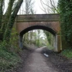
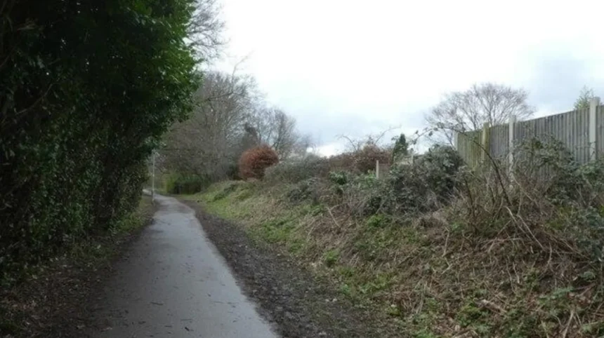
The Linesway is one of Garforth’s most distinctive outdoor routes. Leeds City Council describes it as a three-mile disused railway route between Garforth and Allerton Bywater. Its former railway alignment creates a different walking environment from ordinary residential pavements.
The route also forms part of the wider Leeds Country Way network. The official Leeds Country Way route enters Garforth from the direction of Barwick-in-Elmet before continuing through the town and towards the River Aire.
Visitors do not need to complete a long-distance route to experience the countryside. Short sections provide a manageable outdoor activity.
The Leeds Country Way itself extends for 62 miles around Leeds. Leeds City Council divides the route into four principal stages of approximately 15 miles, with shorter five-mile sections also available.
This structure allows visitors to choose a distance that matches their available time.
The Garforth section connects the town with rural landscapes around Barwick-in-Elmet, Scholes, Little Preston and the River Aire. The route therefore provides a direct transition from local streets to fields, tracks and countryside.
For a slower visit, the most useful approach is to select one section rather than treat the entire long-distance route as a challenge.
How can visitors use Garforth’s green spaces for a quieter day?
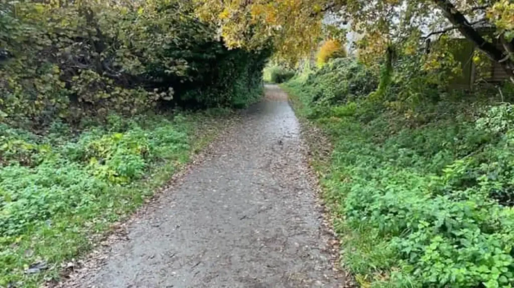
Garforth’s green spaces provide straightforward places for walking, recreation and time outdoors without requiring a major excursion. Barley Hill Park, Glebelands Recreation Ground, East Garforth Recreation Ground, Hollinhurst Wood and White House Lane are among the locally recorded green spaces.
Leeds City Council’s parks information identifies several green and recreational areas around Garforth and Swillington. These include Barley Hill Park, Firthfield, Glencoe Estate, Goosefields, Longmeadows, Primrose Hill Drive, The Chase, White House Lane and Hollinhurst Wood.
The variety is important because each space serves a different local function.
Barley Hill Park is classified by Leeds City Council as a community park. East Garforth Recreation Ground and Glebelands Recreation Ground are recorded as recreation grounds. Hollinhurst Wood is classified as a woodland area.
Glebelands Recreation Ground provides a particularly practical option for combining open space with community activity. It is used for sports and local events and has facilities that support different types of visitors.
These spaces work well when the objective is not to accumulate attractions but to spend time outdoors at a comfortable pace.
The Garforth Neighbourhood Plan also identifies green infrastructure as an important part of the area’s environmental and community framework. Its objectives include protecting green spaces, maintaining access to green infrastructure and enhancing the rural environment.
What can visitors see around Garforth’s historic centre?
Garforth’s historic centre combines Main Street, Church Lane, St Mary’s Church and community buildings with later residential and commercial development. These locations reveal how the settlement developed from an older village into a larger east Leeds community.
Main Street remains an important route through central Garforth. Church Lane provides access towards St Mary’s Church and the local cricket ground.
The Garforth Neighbourhood Plan records the settlement’s long history. The name is generally considered Anglo-Saxon in origin, while the Domesday Survey of 1086 provides the first detailed written description of Garforth. At that time, the manor measured approximately 1.5 miles by 1.5 miles and included a church, priest, four villagers and one smallholder in the recorded assessment.
The recorded population was an underestimate because Domesday assessments counted heads of families rather than every individual.
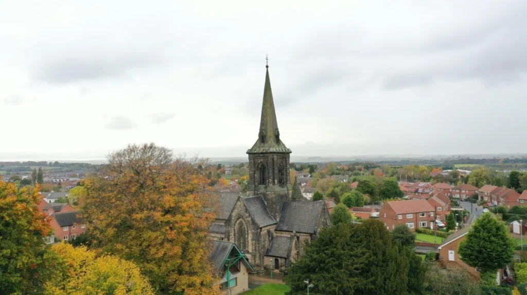
St Mary’s Church provides one of the clearest historic landmarks. Historic England records the present church as dating from 1844 and identifies its architect as George Fowler Jones. The building uses dressed Magnesian limestone and has an Early English architectural style.
As you explore the modern site, you are crossing land with a deep heritage. Read about the full to understand its origins.
This historical context gives visitors a reason to examine the town’s streets and buildings rather than treating Garforth solely as a starting point for countryside walks.
Why is St Mary’s Church an important stop on a Garforth visit?
St Mary’s Church is an important Garforth landmark because the present building dates from 1844, stands on a site associated with earlier worship and forms part of the town’s historic landscape. Its architecture and churchyard connect modern Garforth with earlier settlement.
The present St Mary’s Church was constructed in the nineteenth century. The Church of England’s heritage record identifies it as St Mary the Virgin in Garforth.
Local historical research records an earlier church on the site. The Story of Garforth notes that the church is referenced in the Domesday Book and that remains associated with an Early English church dating to around 1200 were found during demolition of the previous building.
The current church therefore represents one stage in a much longer religious history.
The surrounding churchyard also contains evidence connected with Garforth’s industrial past. The Garforth Neighbourhood Plan records a gravestone associated with John Backhouse, who worked in a Garforth coal mine and died in a mining explosion in 1856 at the age of 15.
This illustrates how local heritage extends beyond prominent buildings.
A visit to the church and surrounding streets provides a quieter alternative to conventional attraction-based tourism. It is particularly suitable for visitors interested in architecture, local history and the relationship between historic buildings and modern communities.
Visitors should check current access arrangements before entering any working place of worship.
How does Garforth’s mining history affect the character of the area?
Coal mining shaped Garforth’s economy, population and community institutions during the industrial period. Mining heritage remains visible through historic buildings, memorials, records and local landscapes, giving visitors a way to understand how the town developed beyond its earlier agricultural settlement.
Garforth’s earlier landscape was strongly agricultural. The Neighbourhood Plan records evidence suggesting cultivation in the area during the Roman period and identifies medieval ridge-and-furrow remains in places such as Garforth Golf Course.
Industrialisation introduced a different economic structure.
Coal mining became a major influence on Garforth’s development. The historical record includes references to Garforth Colliery and other local mining operations.
Community institutions developed alongside the mining economy. The Garforth Neighbourhood Plan identifies the Welfare Hall on Main Street as a significant building. It was erected in 1924 by the Garforth Miners’ Welfare Institute on land donated by the Gascoigne family.
The building later housed Garforth Library between 1939 and 1943 before the library moved because of limited space. The Welfare Hall subsequently became a community centre used by local groups.
This history adds another dimension to a slower visit. Visitors can observe how public buildings, streets and community spaces reflect changes in employment and population over time.
Where can visitors combine walking with local heritage?
A walking-based heritage visit can connect Garforth Main Street, Church Lane, St Mary’s Church, the local library area and nearby former railway routes. This approach combines architecture, community history, transport heritage and countryside without requiring a long-distance journey.
Main Street provides a useful starting point because it connects several central parts of Garforth.
Church Lane then leads towards St Mary’s Church and the cricket ground. The area contains historic buildings and routes associated with the settlement’s development.
The cricket ground has its own long local history. The Story of Garforth records that Garforth Cricket Club was formed in 1877 and later developed its ground on Church Lane.
The modern visitor can therefore combine a short walk with observations of sporting, religious and residential heritage.
The local library adds another community dimension. Garforth Community Hub and Library is on Lidgett Lane and provides library services, digital assistance, events and activities. Visit Leeds records accessible toilets, wheelchair accessibility, baby-changing facilities and other visitor facilities.
For visitors interested in local history, Leeds Libraries also maintains dedicated Garforth research material. Its Garforth research guide includes church records, local historical collections, photographs and archives associated with Garforth Historical Society.
The result is a compact cultural route that does not depend on major visitor attractions.
Can Garforth work for visitors who want a short outdoor break?
Garforth works well for short outdoor breaks because visitors can combine a railway journey, central streets, local green spaces and a section of a walking route within one visit. The area supports flexible itineraries ranging from a brief walk to several hours outdoors.
A short visit can begin at Garforth railway station.
National Rail records the station at Station Road, LS25 1PY. It has 250 parking spaces, bicycle storage, lifts and passenger assistance facilities.
From the station, visitors can move towards the central area and then select an activity based on available time.
A short itinerary can focus on the central streets and St Mary’s Church. A longer visit can include a green space or part of The Linesway.
Visitors with several hours can connect local streets with the Leeds Country Way. The official route provides detailed directions and maps, while the Garforth section links the town with surrounding countryside.
This flexibility is useful for domestic business travellers and visitors with spare time between appointments.
It also suits digital nomads who need a change from a city-centre environment. Garforth Community Hub and Library provides online support and public facilities, although visitors should not assume that every public facility is designed as a dedicated coworking space.
Which Garforth places suit a quiet morning?
A quiet Garforth morning can centre on a short walk, a green space, local heritage and time in the community hub. The Linesway, central streets, St Mary’s Church area and local recreation grounds provide different ways to begin the day without a busy attraction schedule.
The Linesway provides an obvious early walking option because its former railway alignment creates a linear route away from conventional town-centre traffic.
A central alternative is a heritage-focused walk around Main Street and Church Lane.
St Mary’s Church provides an architectural focal point, while the surrounding streets reveal different phases of Garforth’s development. Historic records show the importance of agriculture, mining, railways and community institutions in shaping the settlement.
For visitors who prefer open recreational areas, Glebelands Recreation Ground and other local green spaces provide alternatives to a heritage walk. Leeds City Council’s records identify several recreation grounds and local green spaces across Garforth.
A morning itinerary therefore does not need to include multiple commercial attractions.
The slower format is the attraction itself: walking, observing the environment, using local facilities and allowing enough time to understand the area.
How can visitors plan a slower Garforth itinerary?
The most practical slower Garforth itinerary uses one main activity rather than several attractions. Visitors can choose a walking route, heritage route, green-space visit or community stop, then add nearby places without creating a rushed schedule.
A walking-focused visit can use The Linesway as the central activity. Leeds City Council identifies the route as three miles long and linking Garforth with Allerton Bywater.
A countryside-focused visit can use a section of the Leeds Country Way. The route is 62 miles overall, but the council provides shorter sections and detailed directions.
A heritage-focused visit can centre on Main Street, Church Lane and St Mary’s Church. Historic records provide context for the town’s medieval origins, Victorian development and industrial history.
A community-focused visit can include Garforth Community Hub and Library, where visitors can access library services and local activities.
The choice should also reflect weather and daylight. Countryside paths require suitable footwear, and visitors should follow public-rights-of-way guidance.
Leeds City Council provides information about the definitive public-rights-of-way network, open-access areas and route conditions.
Why are Garforth’s former railway routes important to visitors?
Former railway routes give Garforth a distinctive connection between industrial heritage and modern recreation. The Linesway demonstrates how an infrastructure corridor associated with transport and industry now functions as a three-mile walking route between Garforth and Allerton Bywater.
Railways played an important role in the development of settlements across industrial Yorkshire.
Garforth retains an active railway station, while former railway corridors provide a different kind of visitor experience. The contrast between active rail travel and a disused railway walking route illustrates how transport infrastructure changes over time.
The Linesway is particularly valuable because it combines history with practical recreation. Instead of functioning only as a heritage feature, the former railway alignment provides an accessible outdoor route.
The route also connects with wider walking infrastructure.
Leeds City Council lists The Linesway alongside longer routes such as the Leeds Country Way and the Trans Pennine Trail.
This network gives Garforth relevance beyond its immediate town centre.
For visitors seeking a change of pace, former railway infrastructure offers a straightforward way to explore the landscape while remaining connected to the area’s industrial history.
How does Garforth connect a slower visit with wider Leeds?
Garforth connects a slower local experience with the wider Leeds countryside through railway services, public rights of way, the Leeds Country Way and regional walking connections. Visitors can therefore explore locally while remaining within the transport and geographic network of Leeds.
Garforth is part of the City of Leeds while retaining a distinct town environment.
Its railway station provides a direct transport point, while public rights of way extend into surrounding countryside. National Rail records the station’s facilities and transport information, while Leeds City Council provides official walking-route information.
The Leeds Country Way is especially important because its 62-mile circular route links many parts of the Leeds district. Garforth forms one section of this larger network.
The wider rights-of-way system also creates opportunities for visitors to continue beyond the immediate town.
This makes Garforth useful for travellers who want a local experience rather than a conventional city-centre itinerary. A visitor can spend several hours in the town and surrounding countryside without travelling far from Leeds.
The area’s future relevance also relates to green infrastructure. The Garforth Neighbourhood Plan identifies the protection and improvement of green spaces, countryside access, habitats and outdoor recreation as important planning objectives.
That framework reinforces the role of walking and open space within Garforth’s long-term local identity.
Explore More Area Guide
Garforth Places Worth Revisiting | Leeds Guide
Garforth Catch-Up Places | Cafés & Restaurants in Leeds
What should visitors remember when exploring Garforth at a slower pace?
Visitors should plan around public access, weather, walking distance, opening times and local conditions. A slower Garforth experience works best when routes are checked in advance, suitable footwear is used and historic or community sites are treated as working places rather than tourist attractions.
Public rights of way are maintained within a formal network. Leeds City Council provides a definitive map and information about access rights.
Visitors should remain on designated paths where required and follow signs, gates and local access instructions.
Countryside walking also requires appropriate footwear, particularly after wet weather. Former railway paths and rural tracks can have different surfaces from pavements.
Opening hours also matter. Garforth Community Hub and Library has published opening times that vary by day, with Sunday listed as closed on Visit Leeds.
Religious buildings have their own access arrangements and services. Visitors should check before planning an interior visit.
Rail users should check live journey information before travelling. National Rail identifies Garforth station facilities but operating conditions and train services remain subject to current travel information.
The key principle is simple: use Garforth’s local scale to reduce pressure on the itinerary.
A visit focused on one route, one heritage area or one green space provides enough time to observe the landscape and understand how the town functions.
Why does Garforth remain relevant for slower local travel?
Garforth remains relevant for slower local travel because its countryside routes, historic environment, community facilities and transport connections support flexible visits without requiring a major destination attraction. Its green infrastructure also forms part of longer-term local planning priorities.
The town provides several layers of experience within a relatively compact area.
Its earliest documented history reaches back to the Domesday Survey. Its later identity developed through agriculture, coal mining, railways, community organisations and residential growth.
Its modern visitor appeal comes from the interaction of these layers.
The Linesway provides a former railway corridor for walking. The Leeds Country Way connects the settlement to a 62-mile countryside route. Local parks and recreation grounds provide everyday green space. St Mary’s Church provides a historic architectural landmark. Garforth Community Hub and Library provides a civic and cultural facility.
These features create a different type of visitor experience from a concentrated attraction district.
For tourists, Garforth provides a local perspective on east Leeds. For residents, it offers accessible outdoor and community activities. For digital workers, it provides an alternative environment to central Leeds, with library facilities available for public use. For business travellers, its rail connection and short walking routes provide practical ways to use spare time.
The result is a place where changing pace does not mean leaving the city region. It means using Garforth’s walking routes, green spaces, heritage and community infrastructure differently.
For visitors seeking calm alternatives, that combination is the central feature of Garforth: a locally focused experience built around movement, history, open space and time rather than a packed attraction schedule.
What are the best places in Garforth for a slower day out?
The Linesway, Leeds Country Way, local green spaces, St Mary’s Church and Garforth’s central streets provide calm options. These places support walking, heritage exploration and outdoor time without requiring a packed itinerary.