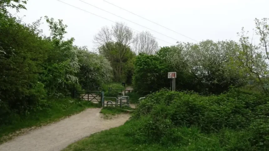
Garforth is an eastern Leeds settlement with a strong mix of green space, former railway routes, woodland, recreation grounds and nearby nature reserves. A clear summer day provides ideal conditions for exploring these outdoor locations on foot, by bicycle or as part of a wider day trip.
- What makes Garforth a good place to explore on a clear summer day?
- Which Garforth walking route is best for a summer day?
- Where can visitors find parks and green spaces in Garforth?
- Is Hollinhurst Wood worth visiting in summer?
- Where can visitors enjoy nature around Garforth?
- Can you combine Garforth’s outdoor routes with local heritage?
- What can visitors see around Garforth’s historic landscape?
- What outdoor activities are suitable for families in Garforth?
- Are Garforth’s outdoor spaces suitable for cycling?
- What is a good half-day outdoor itinerary for Garforth?
- How can visitors plan a longer summer day around Garforth?
- What should visitors consider before exploring Garforth in summer?
- Why is Garforth relevant for future outdoor tourism in Leeds?
- What makes Garforth different from a typical Leeds day out?
The area combines an established village and town landscape with countryside connections. Garforth sits within the Leeds district and has direct links towards Leeds, Allerton Bywater, Swillington, Kippax and the wider Aire Valley. Its outdoor network includes the Lines Way, Leeds Country Way connections, local green spaces and recreation grounds.
Summer visitors can build a short walk around Garforth itself or use the settlement as a starting point for longer outdoor excursions. The choice depends on available time, walking distance, transport and the type of landscape being explored.
What makes Garforth a good place to explore on a clear summer day?
Garforth combines accessible green spaces, walking routes, woodland, historic landscapes and nearby wildlife sites, making it suitable for short walks, longer outings, photography, cycling, family recreation and relaxed outdoor exploration during pleasant summer weather.
Garforth’s geography creates several different outdoor experiences within a relatively compact area. The settlement lies on a high ridge between the River Aire and River Wharfe landscapes, while its wider surroundings contain former railway corridors, agricultural land, woodland and former industrial sites.
Leeds City Council identifies numerous outdoor sites within the Garforth and Swillington area. These include BarleyHill Park, Hollinhurst Wood, Swillington Park Lakes, The Chase, East Garforth Recreation Ground and several local green spaces. The council’s classification system distinguishes between community parks, recreation grounds, woodland areas, nature areas and local green spaces.
This variety gives summer visitors different ways to use the same area. A short afternoon visit can focus on a local park. A longer outing can follow a former railway route. A wildlife-focused trip can continue towards Fairburn Ings or other Aire Valley destinations.
Clear weather also improves visibility across open areas. Longer daylight hours allow visitors to combine walking with cafés, local facilities and nearby attractions without requiring a full-day itinerary.
Which Garforth walking route is best for a summer day?
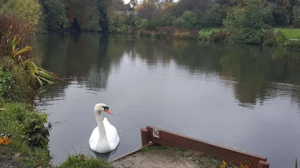
The Lines Way is one of the most useful walking routes for a summer visit because it follows a three-mile disused railway between Garforth and Allerton Bywater, providing a direct outdoor route through the eastern Leeds landscape.
The Lines Way is a former railway alignment that now functions as a recreational route. Leeds City Council lists it as a three-mile walking route between Garforth and Allerton Bywater.
Its former railway character gives the route a distinctive structure. Instead of following a conventional country lane, visitors travel along an alignment created for historic transport infrastructure. The relatively linear form also makes it useful when planning an out-and-back walk.
The route connects with the wider network of paths around Garforth. The Garforth Neighbourhood Plan identifies the Lines Way as an important green corridor and supports protecting and improving its connectivity. The plan also identifies opportunities to connect the Lines Way with other local green spaces.
A clear summer day suits the Lines Way particularly well because longer daylight creates more time for walking. Visitors can choose a shorter section rather than completing the full route. Cyclists and walkers can also incorporate the route into wider journeys, subject to the conditions and access arrangements applying to the path.
The route also provides an opportunity to understand Garforth’s industrial and transport history while experiencing its modern green infrastructure.
As you explore the modern route, you are crossing land shaped by centuries of settlement and industry. Read the full [Garforth History and Heritage Guide] to understand its origins.
Where can visitors find parks and green spaces in Garforth?
Garforth has several designated parks, recreation grounds, woodland areas and local green spaces, including BarleyHill Park, East Garforth Recreation Ground, Hollinhurst Wood, The Chase and nearby Swillington Park Lakes.
Leeds City Council’s official parks information provides a useful framework for understanding Garforth’s outdoor spaces. BarleyHill Park is classified as a community park, Hollinhurst Wood as a woodland area and Swillington Park Lakes as a Leeds nature area. East Garforth Recreation Ground is listed as a recreation ground.
These categories reflect different purposes.
A community park provides a general recreational setting. A recreation ground is more closely associated with active outdoor use. Woodland provides a different environment, with tree cover and natural habitat. A nature area places greater emphasis on ecological value.
Visitors should therefore choose a site according to the type of summer activity they want. Open recreational space suits informal outdoor activity. Woodland is appropriate for shaded walking and nature observation. A designated nature area provides stronger opportunities for observing habitats.
Garforth also contains smaller local green spaces. The council’s list includes Firthfield, Glencoe Estate, Goosefields, Hanbury Place, Longmeadows, Primrose Hill Drive, White House Lane and other locations.
These smaller areas are particularly relevant to residents and repeat visitors. They provide local outdoor access without requiring a major excursion.
Is Hollinhurst Wood worth visiting in summer?
Hollinhurst Wood is a useful summer destination for visitors seeking a woodland setting near Garforth, offering a change from open recreation grounds and former railway routes while providing tree cover and a more enclosed natural environment.
Leeds City Council identifies Hollinhurst Wood as a woodland area within the Garforth and Swillington area.
Woodland changes the character of a summer walk. Trees provide shade, vegetation creates habitat for insects and birds, and the route feels different from open grassland. These characteristics make woodland particularly relevant during periods of strong sunshine.
Visitors should use established paths and respect local access arrangements. Woodland environments contain living habitats that require protection from littering, uncontrolled dogs and unnecessary disturbance.
A summer woodland visit also works well as part of a mixed itinerary. A morning walk along an open route can be followed by a shaded woodland section before returning towards Garforth’s built-up centre.
For photographers, woodland provides different visual conditions from open countryside. Tree trunks, foliage, paths and filtered light create a varied environment without requiring travel to a distant rural destination.
Where can visitors enjoy nature around Garforth?
Visitors can explore local green spaces and extend their journey towards Aire Valley nature sites, including Swillington Park Lakes and RSPB Fairburn Ings, where wetlands, grasslands, woodland and water provide habitats for wildlife.
Swillington Park Lakes is officially classified by Leeds City Council as a Leeds nature area. It forms part of the wider collection of green and natural spaces around Garforth and Swillington.
For a larger wildlife-focused excursion, RSPB Fairburn Ings provides a significant nearby destination. The reserve lies between Leeds, York and Wakefield and occupies a landscape transformed from former coal-mining land into wetlands, reedbeds, wet grassland, woodland and open water.
Fairburn Ings demonstrates how former industrial landscapes can become important wildlife habitats. The RSPB states that the reserve has become a site for breeding and wintering wildfowl and supports species including bittern, bearded tit, Cetti’s warbler, little egret and spoonbill.
Summer visitors can therefore use Garforth as part of a broader eastern Leeds and Aire Valley nature itinerary.
The RSPB provides trail maps and accessibility information for Fairburn Ings. Its visitor facilities include parking, bicycle racks and accessible toilets. The reserve also has specific rules relating to dogs and drones, helping protect wildlife and visitor safety.
Can you combine Garforth’s outdoor routes with local heritage?
Garforth’s outdoor routes connect with a settlement recorded in the Domesday Book of 1086, allowing visitors to combine walking and green-space exploration with evidence of medieval settlement, historic churches, former railways and later industrial development.
Garforth has a documented history extending back more than nine centuries. Archaeological research records the settlement in the Domesday Survey of 1086. Historical research also identifies Church Garforth and the wider settlement’s medieval development.
The settlement changed considerably during the nineteenth and twentieth centuries. Historical records describe Garforth as an agricultural settlement that later developed through coal mining and associated industries. Evidence of coal extraction in the wider area dates back centuries, while nineteenth-century maps show farms, orchards, quarries, sand pits and coal mines.
This historical development remains relevant when exploring the landscape today. Former railway corridors such as the Lines Way represent the transport infrastructure associated with industrial development. Green spaces also occupy land shaped by changing patterns of agriculture, settlement and industry.
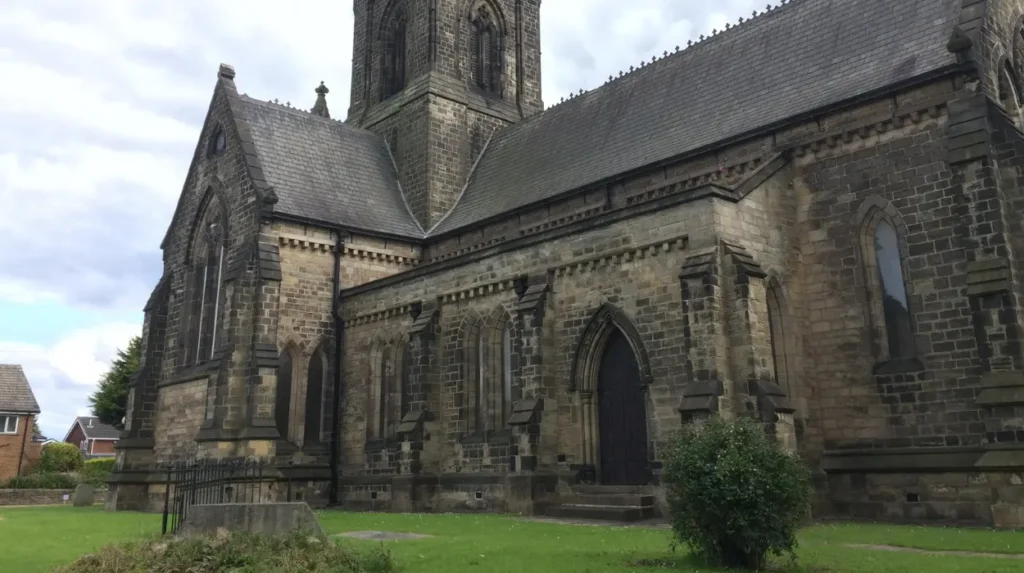
The historic core contains Church Lane and St Mary’s Church. Archaeological research identifies Church Garforth as an important historic settlement area, with evidence of earlier churches on the site of the present building.
A summer walking itinerary therefore does not need to separate heritage from nature. The two subjects are closely connected through Garforth’s landscape.
What can visitors see around Garforth’s historic landscape?
Visitors can explore Church Garforth, Church Lane, St Mary’s Church and former transport landscapes while walking through modern Garforth, creating an outdoor itinerary that connects medieval settlement patterns with later agricultural, railway and industrial development.
The historic landscape is particularly visible around Church Garforth. Archaeological settlement research identifies Church Lane as the location of the historic core, while St Mary the Blessed Virgin Church occupies a site with earlier ecclesiastical history. The current church dates from 1844.
Garforth’s name also has an established historical record. Its Domesday spelling was recorded as “Gereford”, followed by several variations before the modern spelling became established.
The wider landscape contains further evidence of historical change. Garforth’s position on the ridge influenced settlement and movement, while the arrival and development of coal mining and railways changed the area’s economic structure.
A clear summer day is particularly suitable for exploring this history because visitors can walk between different locations rather than viewing heritage sites only as isolated buildings.
Historical exploration also adds context to the Lines Way. A former railway route is not simply a recreational path. Its alignment represents an earlier transport system and explains part of the physical structure of the surrounding landscape.
What outdoor activities are suitable for families in Garforth?
Families can use Garforth’s parks, recreation grounds, walking routes and nearby nature sites for activities such as walking, cycling, wildlife observation, informal play and short outdoor excursions suited to different ages and activity levels.
Family visits work best when the route matches the group’s available time and mobility. A local recreation ground provides a straightforward option for a shorter visit. A walking route provides more structured outdoor activity. A nature reserve adds wildlife observation and educational value.
East Garforth Recreation Ground is officially listed as a recreation ground, while BarleyHill Park is designated as a community park. Garforth also has several playground locations recorded within the Leeds parks system.
Families can therefore create different levels of activity without travelling far. Younger children can use suitable play facilities and open spaces. Older children can participate in walking, cycling and wildlife observation.
Summer visits should include practical preparation. Water, sun protection, suitable footwear and weather-appropriate clothing are important for longer outdoor periods. Visitors should also check local conditions before setting out.
Wildlife locations require additional care. At Fairburn Ings, the RSPB asks visitors to keep dogs under control because wildlife disturbance affects animals’ energy use and survival.
Are Garforth’s outdoor spaces suitable for cycling?
Garforth is suitable for cycling as part of a wider outdoor itinerary, particularly where former railway alignments and connected paths provide practical routes, although cyclists should check current access conditions and follow signs for shared paths.
The Lines Way is particularly relevant because it follows a disused railway alignment between Garforth and Allerton Bywater. Leeds City Council includes the route within its recreational walking network.
The wider Garforth neighbourhood contains additional paths and green corridors. The local neighbourhood plan identifies connections involving the Lines Way, Leeds Country Way and other routes around the settlement.
Cyclists should treat shared routes as shared public spaces. Pedestrians have priority where signs or local rules require it, and speed should reflect the path’s width, visibility and level of pedestrian use.
A summer cycling itinerary can begin near Garforth and follow a former railway route before returning to the settlement. Longer riders can use Garforth as one section of a wider eastern Leeds cycling journey.
Cycling also gives visitors an efficient way to combine several outdoor locations in one day. However, route planning remains important because not every green corridor provides the same surface, access or cycling status.
What is a good half-day outdoor itinerary for Garforth?
A practical half-day itinerary starts with a morning walk through Garforth, continues along a suitable green route such as the Lines Way, adds a local park or woodland stop, and finishes with refreshments or further exploration near the town centre.
Start the day with a walk through the historic parts of Garforth. Church Lane provides an opportunity to see the settlement’s older character and connect the modern town with its medieval history.
Continue towards a suitable green corridor. The Lines Way provides a clearly defined three-mile recreational route between Garforth and Allerton Bywater.
After the walk, choose a local green space for a slower outdoor stop. BarleyHill Park, East Garforth Recreation Ground or another suitable local green space provides a different environment from the former railway route. Leeds City Council officially recognises these sites within its parks and recreation framework.
The final part of the visit can focus on food, coffee or local facilities in Garforth. This structure prevents the day from becoming solely a long-distance walking excursion.
Visitors with additional time can extend the itinerary towards a nearby wildlife destination. Fairburn Ings provides a much larger nature-focused experience with wetlands, woodland, grassland and bird habitats.
How can visitors plan a longer summer day around Garforth?
A longer summer day can combine Garforth’s historic centre, the Lines Way, local green spaces and a nearby nature destination such as Fairburn Ings, creating an itinerary that moves from settlement and heritage to countryside and wildlife.
A full-day plan should use geographical grouping to reduce unnecessary travel. Begin in Garforth with the historic settlement and a short walk. Continue to the Lines Way for outdoor activity before taking a break.
The second half of the day can focus on the wider landscape. Swillington Park Lakes is listed as a Leeds nature area, while Fairburn Ings offers a dedicated wildlife reserve experience.
Fairburn Ings has a visitor centre, parking, bicycle facilities and accessible toilets. The RSPB also provides accessibility information and trail maps to help visitors plan their route.
The reserve’s former industrial history also complements Garforth’s own industrial heritage. Both locations demonstrate how landscapes shaped by coal mining and transport infrastructure now support recreation and wildlife.
Visitors should allow sufficient time for travel between locations and check opening information, access restrictions and weather conditions before departure.
What should visitors consider before exploring Garforth in summer?
Visitors should check weather conditions, route access, footwear requirements, water supplies, wildlife guidance, parking arrangements and local restrictions before exploring Garforth, especially when combining several outdoor locations during a long summer day.
Summer weather can change quickly in Yorkshire. A clear morning does not guarantee identical conditions throughout the afternoon. Visitors should check the forecast before beginning a longer route.
Walking footwear should match the surface. Former railway paths, woodland trails, grass and public rights of way can have different conditions. Rain before a visit can create muddy sections even when the day itself is sunny.
Wildlife sites require additional preparation. Fairburn Ings has designated parking, bicycle facilities and accessible infrastructure, but the RSPB advises visitors not to park on roads, verges or gateways because this obstructs residents and emergency services.
Visitors should also follow local rules concerning dogs, cycling and wildlife. At Fairburn Ings, dogs should remain on leads and under control, while drone take-off and landing requires permission from the site management team.
For longer walks, carry drinking water and plan rest points. Mobile phone coverage should not replace basic route preparation.
Explore More Area Guide
Garforth Meeting Points and Gathering Spots | The Leeds
Garforth Best Places for a Relaxed Coffee Break
Why is Garforth relevant for future outdoor tourism in Leeds?
Garforth’s combination of rail connections, green corridors, former industrial landscapes and access to wider countryside gives it an important role in connecting urban Leeds with recreational landscapes across the eastern part of the district.
Garforth already functions as a link between Leeds and the surrounding countryside. Its railway stations provide public transport access, while walking routes and green corridors connect the settlement with neighbouring communities.
Future transport changes are also relevant. In August 2026, the West Yorkshire Combined Authority published updated plans for Thorpe Park Rail Station between Cross Gates and Garforth. The proposed station is designed to improve connections between east Leeds and the city centre, while existing Garforth and East Garforth stations are not proposed for closure.
Improved connectivity supports the wider principle of sustainable leisure travel. Visitors can use public transport to reach Garforth and then explore selected routes on foot.
The local neighbourhood plan also places emphasis on protecting and improving the Lines Way and strengthening connections between existing green spaces.
This makes Garforth relevant beyond a single summer visit. Its outdoor infrastructure forms part of a wider network connecting settlement, heritage, recreation and nature.
What makes Garforth different from a typical Leeds day out?
Garforth offers a combination of town-based heritage, former railway routes, local parks, woodland and nearby wildlife landscapes, allowing visitors to experience several types of outdoor environment without travelling deep into rural Yorkshire.
Garforth’s strongest feature for summer exploration is the relationship between different landscapes. The Lines Way provides a former railway environment. BarleyHill Park provides community recreation space. Hollinhurst Wood provides woodland. Swillington Park Lakes provides a designated nature area. Fairburn Ings extends the experience into a major wildlife reserve.
The settlement’s history adds another layer. Garforth was recorded in Domesday in 1086 and later developed through agriculture, mining, transport and urban growth.
For tourists, this creates a useful alternative to central Leeds attractions. For residents, the same network provides accessible outdoor activities close to home. Digital nomads and business travellers can also use the area for short breaks from indoor work, although outdoor sites should be treated primarily as recreational spaces rather than guaranteed work locations.
A clear summer day provides the strongest opportunity to connect these places into one itinerary. Longer daylight, open skies and dry walking conditions make it easier to move between heritage sites, green corridors and nature destinations.
Garforth is therefore best understood as an outdoor gateway within eastern Leeds. Its value comes not from one single attraction but from the connected landscape of paths, parks, woodland, heritage and wildlife that surrounds the settlement.
What are the best places to explore in Garforth in summer?
The Lines Way, BarleyHill Park, Hollinhurst Wood, East Garforth Recreation Ground and Swillington Park Lakes are among the main outdoor places to explore. They provide walking, recreation, woodland and nature experiences.