Horsforth is a suburban area in north-west Leeds with a landscape that extends well beyond its busy commercial streets. Its less prominent routes include woodland, historic lanes, community green spaces, old buildings, public footpaths and countryside edges. These locations reveal a quieter side of Horsforth and provide useful options for visitors who want to explore beyond the main shopping and dining areas.
- What makes Horsforth worth exploring away from the main streets?
- Where can you explore Horsforth’s green spaces away from the centre?
- Why is Church Lane important for discovering hidden Horsforth?
- What can you discover around Low Lane and St James’s Church?
- Where can you find quieter walking routes around Horsforth?
- Which quieter heritage features should visitors look for?
- Can Horsforth’s local facilities provide a quieter break from sightseeing?
- How can visitors connect Horsforth’s quiet places into one exploration?
- What should visitors know before exploring Horsforth’s quieter areas?
- Why are Horsforth’s less obvious places important to its identity?
Leeds City Council identifies Horsforth Hall Park as a community park around six miles north-west of Leeds city centre. The council also recognises Hunger Hills Woods as a local urban woodland with an active volunteer group. Together, these spaces create a network of green areas away from the busiest parts of Horsforth.
The area also contains significant historic buildings. St Margaret’s Church on Church Lane is a Grade II listed building dating mainly from the late nineteenth century, while St James’s Church on Low Lane dates from 1847–48. Historic England also records listed buildings along Church Lane, including the Old Vicarage and historic houses with an adjoining smithy.
For visitors, discovering these locations requires a different approach from following the busiest commercial route. The most useful strategy is to explore Horsforth as a collection of connected neighbourhoods, green spaces, historic lanes and walking routes.
What makes Horsforth worth exploring away from the main streets?
Horsforth’s quieter areas combine public parks, woodland, historic buildings, residential lanes, footpaths and countryside edges. These places provide a broader picture of the area and connect modern Horsforth with its agricultural, religious, architectural and suburban development.
The main streets provide convenient access to shops, cafés, restaurants and everyday services, but they represent only one part of Horsforth’s physical character. Away from them, the settlement becomes more residential and green.
Leeds City Council’s parks information lists Horsforth Hall Park as a community park, while its parks byelaws identify additional local green spaces and recreation grounds in Horsforth. These include Cragg Hill Recreation Ground, King George’s Playing Fields, Stanhope Recreation Ground, Newlay public open space and several smaller local green spaces.
This distribution is important for visitors because Horsforth does not depend on one single attraction. Its quieter character comes from the relationship between several smaller destinations.
A walk can therefore include a historic church, a wooded area, an open park and a residential lane without requiring a long journey between completely separate parts of Leeds.
The area’s location also makes it suitable for short visits. Someone with several hours between appointments can use a green space or library. A leisure visitor can combine heritage buildings with a longer walk. Local residents can use the same routes for regular outdoor activity.
Where can you explore Horsforth’s green spaces away from the centre?
Horsforth Hall Park, Hunger Hills Woods, Cragg Hill Recreation Ground and other local green spaces provide accessible alternatives to the main streets. They offer walking routes, open areas, woodland, recreation facilities and quieter places for spending time outdoors.
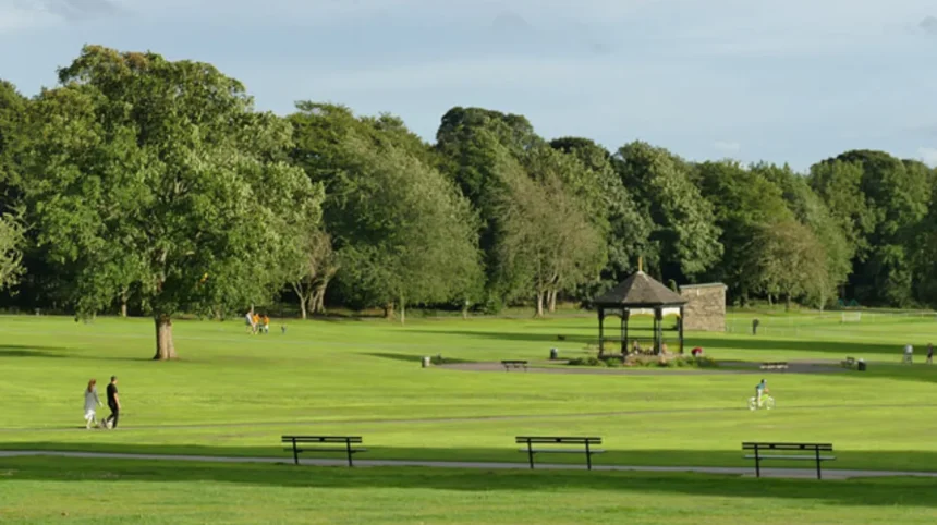
Horsforth Hall Park is the largest and most established green-space destination in this part of the area. Leeds City Council describes it as a large community park on Hall Lane. Facilities include scenic walks, a cricket pitch, a Japanese garden, a trim trail, a skate park and children’s play facilities.
The park also has accessible paths and wheelchair-accessible entrances. Two disabled parking bays are available in the main car park off Hall Lane. This makes the site relevant to visitors with different mobility requirements.
Horsforth Hall Park is not simply an open recreational area. Its present landscape reflects the grounds associated with the former Horsforth Hall. Leeds’ conservation documentation states that the hall was built between 1699 and 1707 and demolished in the early 1950s. The grounds retain archaeological and historic significance.
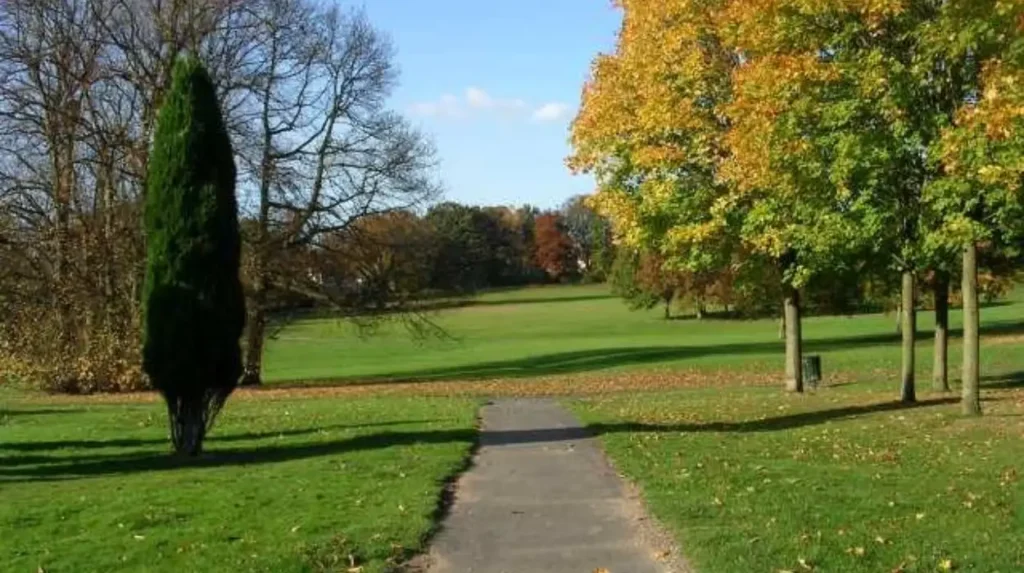
Hunger Hills Woods provides a different environment. Leeds City Council describes it as a small urban woodland on the edge of Horsforth. The Friends of Hunger Hills Woods group organises regular events and action days, including activities during spring and summer.
The woodland’s position near Hall Park makes it particularly useful for visitors who want to extend an outdoor walk. Instead of treating the park as an isolated destination, visitors can view the park and woodland as part of a wider green corridor.
Cragg Hill Recreation Ground and other local open spaces provide additional options. Leeds City Council’s official parks information confirms their inclusion within Horsforth’s network of recreation grounds and local green spaces.
These smaller sites are useful when the objective is not sightseeing in the conventional sense. They support walking, outdoor exercise, local recreation and short breaks from built-up streets.
Why is Church Lane important for discovering hidden Horsforth?
Church Lane is one of Horsforth’s strongest routes for combining quieter streets with historic buildings. It contains St Margaret’s Church, listed houses, the Old Vicarage and other heritage features that demonstrate how the settlement developed around older buildings and lanes.
Church Lane provides a clear change of character from Horsforth’s busier commercial areas. Its architectural interest is concentrated around historic buildings and the setting of St Margaret’s Church.
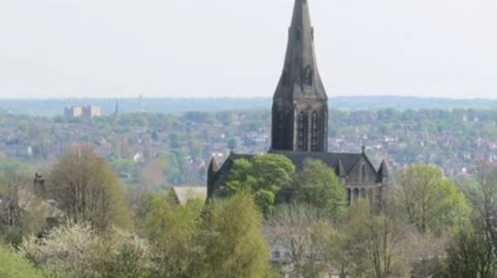
St Margaret’s Church is Grade II listed on the National Heritage List for England. Historic England records the church as dating from 1877–83, with its spire completed in 1902. It was designed in the Early English architectural style using coursed squared sandstone.
The church’s position also has historical significance. Historic England research records that it replaced an eighteenth-century chapel known as the Bell Chapel. When St Margaret’s was built, it stood relatively detached from the main settlement on the lower slopes of the Hunger Hills.
That location helps explain why Church Lane works as a heritage route. The street connects architecture with landscape rather than presenting historic buildings as isolated monuments.
Several other listed buildings reinforce the character of the lane. Historic England records 10–14 Church Lane as Grade II listed. Number 14 and its adjoining smithy are also separately recorded as a listed building. The Old Vicarage on Church Lane has Grade II status as well.
Visitors should treat listed buildings as heritage features rather than assuming they are publicly accessible interiors. Historic England explains that listed buildings are protected because of their special architectural or historic interest, and many are not open to the public.
As you explore the modern site, you are crossing land with a deep heritage. Read about the full [Insert Anchor Text for Horsforth History Article Here] to understand its origins and development.
Church Lane therefore works best as a slow architectural walk. The focus is on the relationship between the street, historic buildings, church setting and surrounding landscape.
What can you discover around Low Lane and St James’s Church?
Low Lane provides another route into Horsforth’s historic landscape, with St James’s Church forming its principal listed landmark. The church dates from 1847–48 and demonstrates the area’s nineteenth-century religious and architectural development.
St James’s Church stands on Low Lane and is Grade II listed. Historic England records its construction in 1847–48 to designs by C. W. Burleigh of Leeds. It is built from coursed sandstone and has a slate roof.
The building follows the Early English style and contains a nave, aisles and chancel. Historic England’s listing also records architectural details including pointed arches, traceried windows, buttresses and a bellcote.
Low Lane demonstrates an important feature of Horsforth’s heritage geography. Historic buildings are distributed across roads that now function as ordinary residential and local routes. Their historic importance is therefore easy to overlook when travelling through the area for everyday purposes.
For visitors, the most useful approach is to look beyond individual buildings and understand the wider street pattern.
A route incorporating Low Lane can complement a visit to Church Lane and Horsforth Hall Park. These locations represent different periods and functions within the settlement.
St James’s Church represents nineteenth-century religious development. Church Lane contains a cluster of historic buildings associated with the older village landscape. Hall Park retains the grounds and surviving features associated with the former Horsforth Hall estate.
Together, these locations provide a compact introduction to the evolution of Horsforth without requiring a dedicated museum visit.
Where can you find quieter walking routes around Horsforth?
Quieter walking opportunities are concentrated around Hall Lane, Hunger Hills, Church Lane, West End Lane and local public footpaths. These routes connect green spaces and residential areas while providing access to parts of Horsforth that are less commercially focused.
Walking away from the main streets changes the way Horsforth is experienced. Commercial frontages give way to walls, trees, houses, historic buildings, recreation grounds and open land.
Leeds’ Horsforth Design Statement identifies several important landscape features. It records Horsforth Hall Park south of Hall Lane, Hunger Hills Wood and views towards surrounding hills. It also identifies extensive rolling farmland west of West End Lane with long-distance views.
These landscape characteristics make West End Lane particularly relevant for visitors interested in Horsforth’s transition between suburban development and open countryside.
Public rights of way are another important part of the local walking network. Leeds City Council maintains the definitive map of public rights of way and publishes notices when routes are formally changed.
In September 2026, Leeds City Council made an order concerning Horsforth Public Footpath No. 50. The order concerns a diversion of approximately 138 metres onto a new route of approximately 137 metres near Hall Park Avenue and Church Lane.
This is a useful reminder that walking routes can change and visitors should check current local information before following a specific public footpath.
For short visits, a route around Hall Lane and Hall Park provides a straightforward introduction. Longer walks can incorporate Hunger Hills, Church Lane and the countryside edge around West End Lane.
The practical value of these routes extends beyond tourism. Walking provides a way to reach green spaces without relying on a car and creates links between residential districts, public facilities and recreational areas.
Which quieter heritage features should visitors look for?
Horsforth’s quieter heritage features include listed churches, historic houses, former estate landscapes, traditional stone buildings and archaeological evidence. These features are distributed across ordinary streets, making careful observation essential when exploring beyond recognised attractions.
Horsforth’s heritage is not limited to large landmarks. Historic England’s records show a wider collection of listed structures across the area.
The Old Vicarage on Church Lane is Grade II listed. The listing recognises its special architectural and historic interest.
Number 14 and its adjoining smithy provide another example of a historic property type associated with older village life. Historic England records the structure as Grade II listed.
There is also evidence of earlier activity beneath and around the modern settlement. Leeds City Council’s conservation documentation records three Roman coins discovered during the laying out of Horsforth Cemetery in 1909. The coins were dated between AD 238 and 260.
The same documentation records prehistoric rock-art discoveries, including a ring-marked boulder found near Low Hall and a Bronze Age carving near the allotments west of Rose Terrace.
These discoveries demonstrate the long chronological range of Horsforth’s landscape. The present suburban environment sits above layers of prehistoric, Roman, medieval, agricultural and industrial activity.
For visitors, this means that a quiet lane can have more historical relevance than its appearance suggests.
The most appropriate way to explore such areas is to observe architecture, street alignment, boundary walls, mature trees and changes in land use without entering private property.
Can Horsforth’s local facilities provide a quieter break from sightseeing?
Horsforth Community Hub and Library provides a practical indoor stop away from conventional tourist attractions. It offers library services, free Wi-Fi, public computers, accessible facilities, room hire and community services from its Town Street location.
The Horsforth Community Hub and Library is located on Town Street in LS18 5BL. Leeds City Council states that the one-stop centre and library share the same building.
The facility includes free Wi-Fi and free computer access with Microsoft Office and internet services. This makes it relevant to digital nomads, business travellers and visitors who need a practical indoor workspace during a longer stay.
The building also provides public toilets, accessible toilets, disabled parking and lift access. Support dogs are welcome.
The hub is therefore different from a café-based work stop. It provides public services rather than functioning primarily as a commercial hospitality venue.
The facility also hosts community activity. Leeds City Council provides information about local services, job support and room bookings through the hub. A dedicated jobshop operates on the first and third Wednesday of each month.
Visitors interested in Horsforth’s everyday life can therefore use the hub as part of a broader local exploration. It offers a direct connection to the community rather than focusing solely on visitor attractions.
Its location also makes it a useful starting point for exploring nearby streets and facilities before moving towards greener or historic parts of Horsforth.
How can visitors connect Horsforth’s quiet places into one exploration?
A practical Horsforth exploration can connect the community hub, Church Lane, St Margaret’s Church, Hunger Hills, Horsforth Hall Park and West End Lane. This creates a varied route combining local services, heritage, woodland, recreation and countryside.
The strongest approach is to treat Horsforth as a connected landscape rather than a list of isolated attractions.
Start around the central community area and move towards Church Lane. This introduces the historic side of Horsforth through St Margaret’s Church and the listed buildings surrounding it.
Continue towards Hunger Hills and Hall Park to change from an architectural environment to a green one. The relationship between these areas is supported by Leeds’ own planning and conservation documents, which identify links between Hunger Hills, Hall Park and West End Lane.
Horsforth Hall Park provides facilities for different types of visitors. Its scenic paths suit walking, while the cricket pitch, trim trail, Japanese garden, skate park and play areas provide other forms of recreation.
Visitors with additional time can extend their route towards West End Lane and the surrounding countryside edge. The landscape becomes more open, with the Leeds conservation assessment recording rolling farmland and longer views to the west.
A separate route can use Low Lane and St James’s Church for a more concentrated heritage walk. Historic England’s records make this particularly suitable for visitors interested in nineteenth-century architecture.
The important point is that these routes should be adjusted to available time and walking ability. Horsforth contains both short local walks and longer connections through green and residential areas.
Explore More Area Guide
Horsforth Food and Drink Guide: Cafés, Restaurants & Markets
Horsforth Best Outdoor Spots for Fresh-Air Breaks
What should visitors know before exploring Horsforth’s quieter areas?
Visitors should check current access information, respect residential areas, remain on public routes and follow local park regulations. Conditions and public rights of way can change, while some historic buildings are private or protected sites rather than visitor attractions.
Horsforth’s quieter areas include residential streets and privately occupied historic properties. Visitors should therefore distinguish between viewing a building from a public route and entering its grounds.
Historic England confirms that listed buildings receive legal protection under the Planning (Listed Buildings and Conservation Areas) Act 1990. The National Heritage List identifies buildings and sites of special architectural or historic interest.
Park regulations also apply. Leeds City Council’s current Public Spaces Protection Order information states that dogs must be kept on leads in the Japanese Garden at Horsforth Hall Park. Certain playground areas have dog exclusion requirements.
The wider park network is maintained through Leeds City Council’s Parks and Countryside service. The council’s current strategy identifies Horsforth Hall Park among Leeds’ parks and notes that city parks provide facilities including walking routes, gardens, sports pitches and playgrounds.
Walking routes also require attention to current information. The September 2026 footpath diversion order for Horsforth Public Footpath No. 50 shows that official routes can be altered through formal legal processes.
These practical considerations support responsible exploration. Stay on public paths, follow signs, respect residents, observe dog-control rules and check current council information before setting out on a longer walk.
Why are Horsforth’s less obvious places important to its identity?
Horsforth’s less obvious places show how a modern Leeds suburb retains connections with earlier village life, historic estates, religious buildings, woodland, farmland and community spaces. They provide the wider context behind the area’s present-day streets and services.
The identity of Horsforth is not represented solely by its commercial centre. Its physical structure contains evidence from different periods of development.
The former Horsforth Hall grounds demonstrate the relationship between historic estates and today’s public park. The hall itself disappeared in the twentieth century, but the landscape associated with it remains part of Horsforth Hall Park.
St Margaret’s Church demonstrates another layer. Its construction in the late nineteenth century reflected a growing local population and the need for a larger church. Historic England research records that the earlier Bell Chapel had become too small for the expanding congregation.
The surviving listed buildings on Church Lane provide further evidence of the earlier settlement pattern. Low Lane adds another historic religious landmark through St James’s Church.
Green spaces provide the environmental layer. Hunger Hills Woods remains a local urban woodland, while Hall Park functions as a community park with recreation and landscaped areas.
Modern community facilities add another layer. Horsforth Community Hub and Library provides public services, Wi-Fi, computers and community support within the established settlement.
Together, these elements create a more complete understanding of Horsforth.
Exploring away from the main streets therefore serves a clear purpose. It reveals the landscape, architecture, public spaces and community infrastructure that explain how Horsforth developed into its present form.
For tourists, this creates a broader local experience. For residents, it provides additional routes and spaces close to home. For digital workers and business travellers, it creates practical places for short breaks and quiet working periods.
Horsforth’s quieter areas remain relevant because they preserve the relationship between the area’s past and its modern suburban role within Leeds. The combination of historic lanes, listed buildings, woodland, parks, public paths and community facilities makes the area more than a commercial destination.
The most useful way to discover Horsforth away from the main streets is therefore to follow its secondary routes. Hall Lane, Church Lane, Low Lane, Hunger Hills and West End Lane each reveal a different part of the local landscape.
These routes provide the context needed to understand Horsforth as a place shaped by historic estates, religious development, countryside, twentieth-century suburban growth and modern community life.
What are the best places to discover away from Horsforth’s main streets?
Horsforth Hall Park, Hunger Hills Woods, Church Lane, Low Lane, West End Lane and the surrounding public footpaths provide quieter places to explore. These areas combine green spaces, historic buildings, woodland, countryside views and local community facilities.