Leeds has over 1,100 km of existing and planned cycle routes, including 170 km of segregated or off‑road paths, making it one of the most developed urban cycling networks in the UK. This article explains how to discover fresh routes in and around Leeds using maps, apps, local knowledge, and official networks so you can ride safely while avoiding repetition.
- What types of cycling routes exist around Leeds?
- How can you use official maps and councils to find routes?
- Which cycling apps help you discover new routes in Leeds?
- How can you explore local cycle‑route databases and clubs?
- What are the main cycling corridors and loops you can try?
- How can you use local geography and landmarks to invent routes?
- How often should you change routes and what distance is ideal?
What types of cycling routes exist around Leeds?
Leeds offers a mix of on‑road and off‑road routes, each suited to different skill levels and purposes. The main categories are signed city‑centre cycle lanes, segregated cycleways, canal and river towpaths, greenway paths on former railways, and unpaved bridleways into the surrounding countryside. Many of these routes are part of Leeds City Connect, the local cycle‑journey‑planning system, which bundles maps for specific corridors such as the Aire Valley Towpath, the Lines Way greenway, and radial routes into the city centre from suburbs like Armley, Aireborough, and Horsforth.
Off‑road examples include the Aire Valley Towpath, a roughly 16‑mile traffic‑free corridor that runs from near Kirkstall Abbey through Bramley Falls, Rodley Nature Reserve, and Apperley Bridge towards Bingley. Another key route is the Lines Way, a greenway of about 4 miles stretching from Garforth to Woodlesford, often used by commuters and longer‑distance riders. The perimeter of Roundhay Park also functions as a long‑distance urban‑park route, typically forming 8–10 km loops when combined with feeder paths.
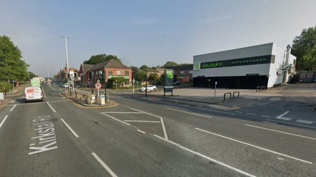
Each route type has distinct characteristics. On‑road lanes are usually painted or protected bike lanes on streets such as Kirkstall Road and Lady Lane, often linked by the City Centre Cycle Improvements scheme. Off‑road and greenway routes are typically paved or compacted paths that avoid motor traffic almost entirely and are ideal for families, commuters, and longer recreational rides. From a safety and comfort perspective, off‑road routes generally have lower traffic conflict, smoother surfaces, and better lighting where they pass through parks or regenerated waterfronts such as Leeds Dock and the South Bank. On‑road routes, while sometimes faster, require more awareness of traffic signals, junctions, and shared‑space schemes, especially in busy central areas targeted by the City Centre Cycle Improvements.
How can you use official maps and councils to find routes?
Leeds City Council provides several tools that let you discover new cycling routes without relying solely on commercial apps. The Cycle City Connect journey planner and associated local route maps highlight continuous signed routes into and around the city centre, including Aireborough Greenway, Aire Valley Towpath, and the Armley–city‑centre corridor. These maps distinguish between traffic‑free paths, segregated cycleways, and on‑road cycle lanes, often colour‑coded or labelled by route number. Some sections are also designated as part of the National Cycle Network, such as parts of route 697 on the Lines Way, which are maintained to a consistent standard.
Council maps also show where routes are under construction or planned as part of wider schemes such as the City Centre Cycle Improvements, so you can anticipate future off‑road options when planning longer‑term route changes. To use these effectively, start by opening the online interactive map for Cycle City Connect and selecting a neighbourhood you want to explore outside your usual route. Trace a path that combines a main corridor such as the Aire Valley Towpath with a radial route such as Armley–city‑centre to create a lollipop or loop structure, then export or print the route for reference. You can repeat this exercise once a month to systematically rotate through different districts and avoid boredom.
Where council maps are incomplete, you can cross‑check with the Walk, Wheel, Cycle Trust’s National Cycle Network map, which overlays the same corridors as the local system but adds longer‑distance context into West Yorkshire and beyond. This helps you identify if a local greenway connects to a regional trail, such as links toward the Aire and Calder Navigation towpaths or the Pennine foothills. Using both local and national maps in combination ensures you do not miss linkages that can turn a short local loop into a longer, more varied route.
Which cycling apps help you discover new routes in Leeds?
Digital route‑planning apps have become the primary way many riders in Leeds find fresh segments. Platforms such as Bikemap, komoot, and the bicycle‑routing mode in general mapping services let you filter by distance, elevation, and surface type. Bikemap alone lists several hundred community‑created routes in and around Leeds, including over 750 individual tracks, from short city loops to long‑distance rides along the Leeds and Liverpool Canal and the Aire Valley Towpath. You can filter by road bike, mountain bike, or gravel, then sort by length or popularity to uncover lesser‑known paths that differ from your usual routes.
Komoot is popular among more experienced riders because it allows you to set preferences for quiet roads, off‑road, or bike paths and then generates a route that stays close to those constraints. Users in Leeds often switch to the OpenCycleMap layer within komoot to see all cycle‑specific paths before exporting the route to a GPS device or phone‑based navigation app. When using any app in Leeds, start by narrowing your search radius to a specific district such as Horsforth, Burley, or Garforth and filtering routes by family‑friendly or traffic‑free options to find new, low‑stress routes. Then save five to ten interesting routes per month and rotate through them, adjusting distance and elevation to match your fitness changes over time.
These apps also help you avoid monotony by showing alternative branches off your regular path. For example, an Aire Valley Towpath route can branch via Rodley Nature Reserve or Apperley Bridge, creating a slightly different loop each time. By combining app‑generated routes with your knowledge of local infrastructure, you maintain flexibility while staying within safer, well‑marked corridors.
How can you explore local cycle‑route databases and clubs?
Beyond municipal maps and mainstream apps, local clubs, forums, and community‑driven platforms can reveal routes that are not yet visible on official cartography. Leeds cycling clubs such as Leeds Phoenix Velo, Leeds Metropolitan Cycling Club, and various Road Cycling UK groups publish route files and ride reports on platforms such as Strava, Ride With GPS, and club websites. These clubs often document loop routes starting from key locations such as Burley Park Station, Wellington Place, or Garforth, which you can adapt to your own starting point.
The Salt Mill Loop from Burley Park is a well‑known intermediate‑level route of about 41 km that combines canal towpaths, greenways, and quiet country lanes into a single loop. Local cycling forums and subreddits such as r/Leeds cycling threads also host user‑recommended paths and real‑time feedback on road conditions, surface quality, and hazards. Comparing these crowdsourced comments with council‑issued route descriptions helps you prioritise new segments that are both safe and enjoyable.
For very short exploratory rides, many riders in Leeds use platforms such as Tripadvisor to browse “best biking trails around Leeds”, which aggregate user‑rated routes close to parks and urban‑bike parks such as the Leeds Urban Bike Park. These listings often include short, traffic‑free loops suitable for quick after‑work or weekend rides. By combining one club‑ or forum‑sourced route per month with your usual app‑based planning, you can ensure you are constantly discovering new route segments while staying within the broader network of signed corridors.
What are the main cycling corridors and loops you can try?
Leeds has several well‑defined cycling corridors that you can combine into fresh loops rather than repeat the same straight‑line commute. The Aire Valley Towpath forms a traffic‑free spine running from near Kirkstall Abbey through Bramley Falls, Rodley Nature Reserve, Apperley Bridge, and on towards Bingley and the Five Rise Locks. Parallel to this, Lines Way offers a shorter but still scenic greenway route between Garforth and Woodlesford, often used as a commuter or mid‑distance loop.
For city‑centre‑oriented riding, the City Centre Cycle Improvements network links western, southern, eastern, and Holbeck gateways via dedicated cycle infrastructure, creating multiple possible loop shapes. A typical commuter loop might start at Wellington Place, run along the riverside to Leeds Dock, then return via the South Bank and back‑to‑work routes, forming a 4–6 km loop that you can repeat or vary by adding side trips. Outside the core urban area, Roundhay Park provides a longer perimeter loop of about 8–10 km there and back from central Leeds, suitable for lunch‑break or evening rides.
To keep routes fresh, treat each corridor as a modifiable template. Use the Aire Valley Towpath as a base but change your turnaround point between Rodley, Apperley Bridge, or Bingley every few weeks. Use Lines Way as a lower‑distance training corridor, slightly altering your start and end points to weave in nearby residential streets with minimal traffic. This method ensures you explore the same broad corridor repeatedly while experiencing different micro‑segments each time, reducing mental fatigue and improving route‑reading skills.
How can you use local geography and landmarks to invent routes?
Leeds’ topography and built environment make it easy to construct new routes by using natural and man‑made features as reference points. Major axes include the River Aire, the Leeds and Liverpool Canal, and the Leeds and Wakefield section of the A65, which together form a skeleton you can connect with greenways and quiet streets. A practical way to invent routes is to choose two landmarks and then find a viable path between them that avoids busy roads.
From Kirkstall Abbey north to Roundhay Park, you can mix the Aire Valley Towpath with connected parks and local roads instead of using the A65. From Garforth to Leeds Dock, you can combine Lines Way with riverside paths and then loop back via the South Bank. When inventing routes, keep elevation and surface in mind. Leeds’ western edge rises toward the Pennines, so loops that head west such as from Wellington Place toward Thwaite Mills and then back along the river involve moderate climbs but return on smoother, traffic‑free paths. In contrast, routes along the Aire Valley Towpath or the South Bank are mostly flat and suitable for recovery rides or beginners.
For safety, always verify that junctions and crossings you plan to use align with council‑provided routing, especially where routes cross busy roads such as the A65 or A58. If an invented route seems to cross a high‑traffic area without dedicated facilities, redesign it to use a nearby signed cycle corridor or a quieter parallel street. Over time, you can build a personal route bank of 10–15 distinct invented loops, each tied to a pair of landmarks, and rotate through them monthly to minimise repetition while staying within the safest parts of the network.
How often should you change routes and what distance is ideal?
To stay engaged and avoid overuse injuries, cyclists in Leeds typically reshape their route set every four to six weeks. Local route‑data platforms show that many riders maintain a mix of short 3–6 km loops, medium 8–15 km loops, and longer 15–40+ km routes and rotate between them depending on the season and their schedule. For commuting, a fresh route every 6–8 rides is often enough to prevent monotony without forcing constant re‑learning of directions. For leisure cyclists, adding one entirely new corridor such as switching from Aire Valley Towpath to Lines Way–Garforth–Roundhay Park every month keeps the riding experience dynamic.
In terms of distance, in‑city loops around Leeds generally range from 4–6 km for quick lunch‑break rides, 8–10 km for after‑work or evening rides, and 15–25 km for weekend training or tourism. Longer routes such as the Salt Mill Loop of about 41 km should be reserved for days when you have time and are properly equipped, since they combine canal paths with rural lanes and require more planning. By systematically varying distance, route structure, and corridor type while keeping most of your rides within the official cycle‑network corridors, you reduce both mental fatigue and physical strain while maintaining a safe, ever‑fresh cycling experience in and around Leeds.