Key Points
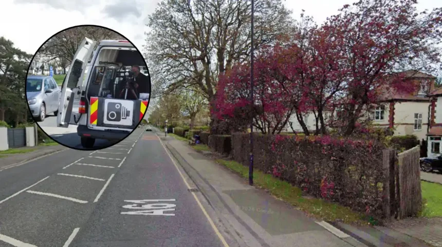
- Enforcement Deployment: A total of 24 mobile speed camera locations have been published for deployment across Leeds over the coming week.
- Managing Organisations: The operations are being carried out by the West Yorkshire Police Camera Enforcement Unit working directly on behalf of the West Yorkshire Safety Camera Partnership.
- Dual Site Selection: Cameras are deployed to two primary categories of sites across the city, split between core casualty reduction locations and community concern sites highlighted by local residents.
- Speed Zone Breakdown: The list encompasses 11 designated sites in 30 mph speed zones, 10 sites operating in 40 mph zones, and three sites located within 50 mph zones.
- Operational Flexibility: Enforcement authorities maintain that while locations are published in advance for transparency, enforcement vans may be relocated without prior notice depending on operational demands.
LEEDS (The Leeds Times) November 9, 2026 — Mobile speed cameras are once again active across key routes in Leeds this week as road safety authorities enforce speed limits to reduce traffic collisions and improve driver compliance.
- Key Points
- Where will mobile speed cameras operate in 30 mph zones across Leeds this week?
- Where will mobile speed cameras operate in 40 mph zones across Leeds this week?
- Where will mobile speed cameras operate in 50 mph zones across Leeds this week?
- What is the official background behind the deployment of mobile speed cameras in Leeds?
- How will this deployment affect local motorists and residents in Leeds?
Where will mobile speed cameras operate in 30 mph zones across Leeds this week?
In 30 mph enforcement zones, mobile speed camera vans will operate across 11 key locations:
- A61 Wakefield Road / Leeds Road, Rothwell — Enforcement will take place between Middleton Lane and Leadwell Lane.
- A65 Otley Road, Guiseley — Cameras are positioned between the A6038 Bradford Road junction and B6153 Park Road.
- Broad Lane, Sandford — Mobile enforcement is located between Whitecote Hill and Waterloo Lane.
- Otley Old Road — Enforcement is stationed between Holtdale Approach and Spen Lane (noting static infrastructure remains present on site).
- A58 Whitehall Road, Drighlington — Coverage spans from 40 metres east of King Street to 75 metres east of Old Lane.
- King Lane, Leeds — Vans are positioned between 200 metres north of Alwoodley Lane and 50 metres north of the Ring Road.
- Queenswood Drive, Leeds — Enforcement is situated between Queenswood Gardens and 229 Queenswood Drive.
- Dewsbury Road, Leeds — Mobile units will monitor traffic between Victoria Road and Holmes Street.
- Harewood Road, Collingham — Active enforcement is deployed along key stretches of Harewood Road.
- Tong Road — Monitoring covers the area between Pipe and Nook Lane and Whingate.
- A635 Penistone Road — Cameras are active between Huddersfield Road and 300 metres north-east of Sude Hill Terrace.
Where will mobile speed cameras operate in 40 mph zones across Leeds this week?
Road safety enforcement across 40 mph thoroughfares covers 10 primary sites:
- A653 Dewsbury Road, Woodkirk — Enforcement is stationed between Lowry Road and Quarry Lane.
- A58 Easterly Road, Leeds — Mobile units cover the stretch between Easterly Grove and Boggart Hill Drive.
- A61 Harrogate Road, Alwoodley — Cameras are located between Fir Tree Lane and Alwoodley Lane.
- A639 Leeds Road, Rothwell — Operations run between the Rothwell Lane / Calverley Road junction and Junction 44 of the M1 motorway.
- A639, Methley — Monitoring is active between the junction of The Hollins and 110 metres east of Green Row.
- Stanningley Road, Bramley — Mobile units operate between Henconner Lane and Back Christ Church View.
- A660 Leeds Road, Pool — Enforcement spans from Cabin Road to 290 metres west of 6 Cragg View (National Speed Limit sign boundaries).
- A657 Carr Road — Enforcement covers the route between Clara Drive and 45 metres north-east of Carr Wood Gardens.
- A65 Abbey Road — Monitoring is sited between Butlers Wharf and Back De Lacy Mount.
- A647 Bradford Road — Cameras operate between Dawson’s Corner and Gain Lane (Thornbury Gyratory).
Where will mobile speed cameras operate in 50 mph zones across Leeds this week?
Higher-speed corridors across Leeds operating under 50 mph speed limits include three specific mobile enforcement areas:
- A62 Gelderd Road, Gildersome — Operations are positioned between 42A Gelderd Road and the Railway Bridge.
- A6120 East Leeds Orbital Road — Mobile monitoring covers designated sections along the outer route.
- A63 Selby Road, Swillington — Camera units enforce speed compliance along the arterial stretch through Swillington.
Explore More Local Leeds News
Pudsey Waterloo Primary School Hosts Open Day in West Leeds 2026
Pudsey Parish Church Hosts Sensory Friendly Bonfire without Bangs Pudsey 2026
What is the official background behind the deployment of mobile speed cameras in Leeds?
Mobile speed camera enforcement throughout Leeds is managed by the West Yorkshire Police Camera Enforcement Unit operating on behalf of the West Yorkshire Safety Camera Partnership. The partnership coordinates traffic safety initiatives across the wider West Yorkshire region, combining police resources with local authority highways intelligence.
Deployments are divided into two operational categories: core camera sites and community concern sites. Core camera sites are selected following data analysis identifying high collision rates, serious casualties, or documented patterns of excessive speed.
Community concern sites are established following requests from local residents, parish councils, or ward members where public safety concerns have been raised regarding speeding vehicles.
Mobile camera vans utilize high-precision laser speed measurement apparatus operable from within marked vehicles. These units can monitor traffic in both directions, capturing vehicle speed and registration details.
The West Yorkshire Safety Camera Partnership routinely publishes intended weekly enforcement locations to encourage self-compliance and reduce vehicle speeds across the network. However, enforcement authorities retain operational discretion to redeploy units to alternative sites without notice in response to emerging traffic risks or urgent safety requirements.
How will this deployment affect local motorists and residents in Leeds?
The publication of the 24 mobile speed camera locations directly impacts motorists, commuters, commercial drivers, and local residents across the Leeds metropolitan district.
For motorists and commercial vehicle drivers, the presence of visible mobile speed enforcement vans serves as an active compliance driver. Drivers traveling through key arterial corridors such as the A61, A647, A65, and A6120 East Leeds Orbital Road face increased likelihood of enforcement for exceeding posted speed limits. Fixed penalty notices, financial fines, and penalty points on driving licences remain the direct legal consequence for non-compliance, while severe driver speed infractions can result in court summonses and potential driving disqualifications.
For local communities and residents residing near designated community concern sites — such as Queenswood Drive, Stanningley Road, and broad residential stretches in Rothwell, Guiseley, and Bramley — the deployment is designed to mitigate speed-related hazards.
Sustained camera presence aims to lower overall traffic speeds, reduce collision risks, and enhance pedestrian safety near residential areas, school routes, and pedestrian crossings. Furthermore, public knowledge of published camera locations fosters wider speed limit adherence across adjacent local road networks.