Garforth is an established town in the east of Leeds, West Yorkshire. It sits close to open countryside while retaining direct connections with Leeds and the wider rail network. This combination makes Garforth suitable for visitors seeking a quieter day away from heavily visited urban attractions.
- Why is Garforth suitable for a quiet and peaceful day out?
- Which green spaces in Garforth are best for peaceful outdoor time?
- What is Hollinhurst Wood like for a quiet walk?
- Is the Linesway a good peaceful walking route near Garforth?
- Can you enjoy Garforth’s history without visiting a busy attraction?
- What can you see around Garforth Main Street and Church Lane?
- Is Garforth Station useful for a peaceful day trip without a car?
- How can you plan a peaceful half-day or full day in Garforth?
- Why does Garforth’s railway and industrial history matter to a peaceful visit?
- What should visitors consider before choosing a quiet place in Garforth?
- Why is Garforth relevant for slow tourism and future leisure travel?
A peaceful day out in Garforth focuses on low-intensity activities. Walking, nature observation, heritage exploration, photography and quiet outdoor recreation are central options. The area does not depend on large visitor attractions to provide a complete day. Its green spaces, former railway paths, village streets and historic buildings create the main visitor experience.
Leeds City Council records a range of local green spaces and recreational areas within Garforth and the surrounding Swillington area. Its parks schedule includes Hollinhurst Wood, The Chase, Aberford Road/Brierlands local green space, East Garforth Recreation Ground and Glebelands Recreation Ground.
Garforth also has a strong railway heritage. Garforth station opened in 1834 as part of the Leeds and Selby Railway. Archaeological and historical research identifies the railway as a major influence on the settlement’s nineteenth-century growth.
For visitors arriving by train, the station provides a practical starting point for exploring the town. National Rail lists step-free access from the main entrance, lifts, toilets and passenger assistance.
Why is Garforth suitable for a quiet and peaceful day out?
Garforth offers a quieter day out through green spaces, woodland paths, heritage sites and relaxed village routes. The area combines countryside access with railway connections, making it practical for visitors seeking fresh air, gentle walking, historic surroundings and unhurried time.
The main advantage is the compact relationship between built-up Garforth and its surrounding countryside. A visitor does not need to travel deep into rural West Yorkshire to find outdoor space. Local paths and green areas provide access to quieter surroundings close to residential streets.
Garforth is also different from major Leeds visitor destinations because its attractions are distributed rather than concentrated around one large visitor site. The experience is therefore based on movement between places, observation and outdoor activity.
The town’s railway connection adds another practical advantage. Garforth station is served by Northern services, providing a direct public transport option for visitors travelling from Leeds and other destinations. Current National Rail information confirms the station’s accessibility facilities and passenger-assistance arrangements.
For digital nomads and business travellers, the same characteristics create useful downtime. A short walk along a local route provides a clear break from work without requiring a full-day excursion. Cafés and local services around the central area can also be incorporated into a slower schedule.
The most suitable approach is to choose one principal outdoor location and combine it with a heritage or village section. This avoids unnecessary travel and keeps the day focused on relaxation.
Which green spaces in Garforth are best for peaceful outdoor time?
Quiet places in Garforth include Hollinhurst Wood, The Chase, local green spaces, St Mary’s Church surroundings and the Linesway. Each setting supports slower activities, from woodland walking and nature observation to heritage appreciation and short countryside routes around the village.
Leeds City Council’s parks information identifies Hollinhurst Wood as a woodland area and The Chase as a local green space within Garforth. Other recorded local spaces include Aberford Road/Brierlands, Firthfield, Glencoe Estate, Goosefields, Hanbury Place, Longmeadows, Primrose Hill Drive and White House Lane.
These places serve different recreational purposes. Woodland provides tree cover and a natural environment. Local green spaces provide open areas within the residential landscape. Recreation grounds provide more formal public outdoor space.
Hollinhurst Wood is particularly relevant to visitors looking for a nature-focused stop. Woodland walking is a low-intensity activity that requires little equipment. It is suitable for quiet observation, photography and a short break outdoors.
The Chase provides another local option within the Garforth area. Its classification as local green space confirms its role within the area’s public open-space network. Visitors should follow local signs, paths and applicable park rules when using these spaces.
A peaceful outdoor visit also benefits from choosing appropriate times. Early daytime periods generally provide a calmer setting than busy community activity periods. Visitors should check local conditions before travelling, particularly after prolonged rainfall when paths can become muddy.
Green spaces are also useful for short visits. A traveller with only one or two hours does not need to plan a complete walking expedition. A short woodland or local-space visit fits easily around a train journey, meal or work commitment.
What is Hollinhurst Wood like for a quiet walk?
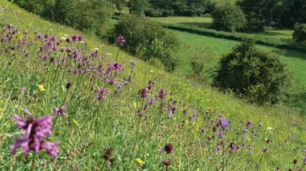
Hollinhurst Wood is a designated woodland area within Leeds City Council’s Garforth and Swillington parks schedule. Its setting supports quiet walking, with trees, paths and natural surroundings creating an environment for visitors seeking an outdoor break away from busy areas.
Hollinhurst Wood belongs within the area’s recognised public green-space structure. Leeds City Council’s parks byelaws schedule specifically records it as a woodland area. This gives the location a clear administrative identity within Garforth’s recreational landscape.
The woodland environment suits visitors who want a natural setting without travelling far from the town. Walking is the simplest activity. Nature observation and photography are also appropriate because the setting provides trees and seasonal vegetation.
A woodland visit should remain low impact. Visitors should stay on established paths where provided, avoid damaging vegetation and take litter home or use designated bins. Dogs should remain under appropriate control and visitors should follow any displayed local restrictions.
Hollinhurst Wood also works well as part of a broader Garforth itinerary. It does not need to occupy an entire day. A visitor can spend time outdoors before returning towards the village centre for refreshments or heritage exploration.
The woodland setting also provides seasonal variation. Spring brings new vegetation, summer provides fuller tree cover, autumn produces changing foliage and winter exposes more of the woodland structure. These changes make repeat visits useful without requiring a different destination.
For visitors prioritising peace, the woodland is more appropriate than an activity-led attraction. Its value comes from the setting itself rather than scheduled entertainment.
Is the Linesway a good peaceful walking route near Garforth?
The Linesway is a three-mile disused railway route between Garforth and Allerton Bywater. Leeds City Council identifies it as a recreational route. Its linear layout provides straightforward walking through former railway landscape, making it suitable for exercise, fresh air and observation.
The Linesway is one of the strongest options for visitors seeking a longer but straightforward walk. Leeds City Council identifies it as a three-mile route along a disused railway between Garforth and Allerton Bywater.
Its railway origin is significant. The route represents a change in land use from transport infrastructure to recreational space. This gives the walk a clear connection with Garforth’s industrial and railway past.
The route forms part of a wider walking network. Leeds City Council’s description of the Leeds Country Way records the Garforth section and explains how the old railway line, now called the Linesway, connects with countryside routes towards the River Aire.
This makes the Linesway suitable for visitors who prefer a defined route rather than an open-ended exploration of local streets. The former railway alignment also provides a logical direction of travel.
The Linesway has value for different activity levels. A visitor can use part of the route for a shorter walk or incorporate a longer section into a broader countryside itinerary. The key advantage is flexibility.
The route also has historical relevance. The Story of Garforth records a former railway connection from the village towards Allerton Bywater and the coal-mining landscape. The modern path therefore forms part of a much longer local transport history.
As you explore the modern route, you are crossing land with a deep heritage. Read about the full to understand its origins.
Can you enjoy Garforth’s history without visiting a busy attraction?
St Mary’s Church provides a calm heritage stop on Church Lane. The present building was completed in 1845 after its foundation stone was laid in 1844. Its churchyard and architecture add historic character to a peaceful visit focused on heritage.
Garforth’s heritage is distributed through the village rather than concentrated inside one major museum. This makes heritage exploration compatible with a quiet day out.
St Mary’s Church is one of the most significant historic buildings in the area. The present church was constructed in 1845, following the laying of its foundation stone on 22 July 1844. It was consecrated on 14 November 1845.
The history of the site extends further back. The Story of Garforth records that a church existed in the village by the time of the Domesday Book and that remains of an earlier Early English church dating to around 1200 were discovered during demolition of the previous building.
The current building was designed by John Fowler Jones. Its tower reaches approximately 120 feet and forms a recognisable landmark within Garforth. The church also contains stained glass associated with the Gascoigne family and other historical features.
Visitors should distinguish between outdoor heritage viewing and access to the interior. Church opening arrangements and services vary, so anyone wishing to enter should check the church’s current information before travelling. The parish website provides current service and visitor information.
Church Lane also connects naturally with the wider village. This makes St Mary’s Church suitable as part of a walking circuit rather than an isolated destination.
What can you see around Garforth Main Street and Church Lane?
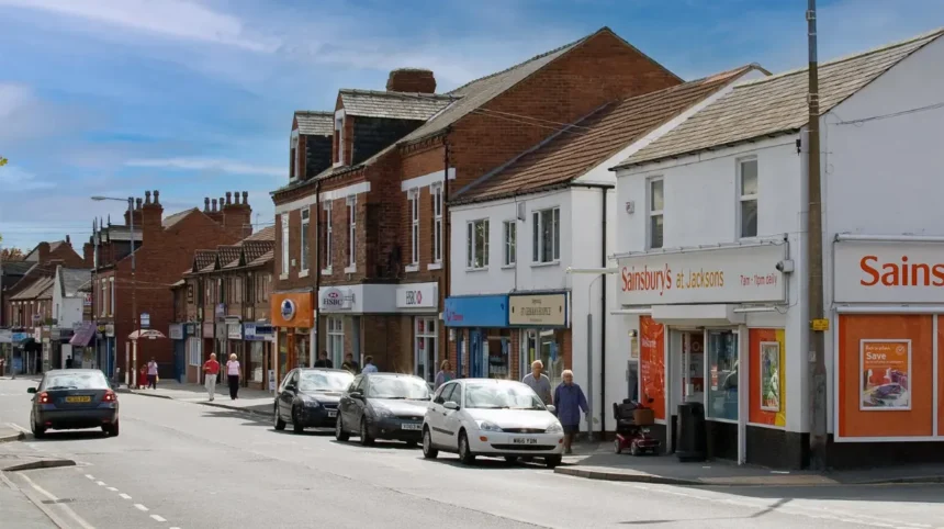
Main Street and Church Lane provide a compact way to experience Garforth’s village character without committing to a long walk. Historic buildings, local services and routes towards St Mary’s Church create a slower urban visit suited to observation, photography and exploration.
Garforth’s central streets provide an alternative to outdoor walking. They allow visitors to explore the settlement through architecture, local businesses, public spaces and historic routes.
The Story of Garforth organises local heritage around a route beginning at Garforth station and continuing along Aberford Road towards Townend. Another section covers Townend, Main Street and Lidgett Lane, followed by Lidgett Lane, Church Lane and St Mary’s Church.
This structure demonstrates how the village can be explored as a connected heritage environment. Visitors do not need to rely on a large attraction to understand the character of Garforth.
Aberford Road also has strong railway associations. Garforth station opened in 1834, while the current station buildings date from the nineteenth century. Historical research records the railway as an important factor in Garforth’s development during the Industrial Period.
Main Street provides a more urban experience than the woodland or Linesway. It is therefore useful when weather conditions reduce the appeal of longer outdoor walking.
A quiet walking circuit can begin near the station, continue through Aberford Road and Main Street, and then move towards Church Lane. Visitors can adjust the duration according to available time.
Photography is another suitable activity. Historic buildings, street layouts and church architecture provide subjects without requiring commercial attractions or organised entertainment.
Is Garforth Station useful for a peaceful day trip without a car?
Garforth’s railway station makes a peaceful day trip practical without requiring a car. National Rail lists step-free access through the main entrance, lifts, toilets and passenger assistance. The station connects Garforth with rail services, supporting visits from Leeds and West Yorkshire.
Garforth station is on Station Road and is managed by Northern. National Rail records the station as Garforth, code GRF. It provides passenger facilities including lifts, toilets, accessible toilets, baby-changing facilities and passenger assistance.
The station’s history also contributes to the character of a visit. The Leeds and Selby Railway opened Garforth station in 1834. Historical sources identify this railway as one of the important transport developments affecting the settlement’s nineteenth-century expansion.
Current railway information lists routes involving Leeds and York, with Northern timetables providing services across the wider network. Travellers should check the latest timetable before setting out because service patterns change.
The station’s accessibility information is particularly relevant for visitors planning a lower-effort day. National Rail identifies step-free access from the main entrance on Station Road and lifts connecting platforms through the newer footbridge arrangement.
The second entrance from Aberford Road has different accessibility characteristics. National Rail states that its narrow footpath and curved highway make it unsuitable for wheelchair and mobility-scooter users. The Station Road entrance is therefore the more appropriate access point for those requiring step-free platform access.
For a quiet day out, travelling by train also reduces the need to plan parking. The station can function as the beginning and end point of a walking itinerary.
How can you plan a peaceful half-day or full day in Garforth?
A quiet Garforth day out works best when the route matches the desired pace. Woodland suits nature observation, the Linesway suits steady walking, and Church Lane suits heritage. Combining an outdoor location with a village stop creates a balanced, unhurried itinerary.
A half-day itinerary can begin at Garforth station. From there, visitors can explore Aberford Road and Main Street before continuing towards Church Lane and St Mary’s Church.
The route works particularly well for travellers interested in architecture and local history. It avoids the need for extensive transport between attractions because several points of interest sit along connected village streets.
A longer visit can add the Linesway. The three-mile route between Garforth and Allerton Bywater provides a more substantial outdoor element. Visitors who want a shorter walk can use part of the route rather than completing its entire length.
Another approach starts with woodland. Hollinhurst Wood provides a nature-focused section, followed by a return towards the built-up area for refreshments and heritage exploration.
The best itinerary depends on the visitor’s priority. Nature-focused visitors should allocate more time to woodland and walking routes. Heritage-focused visitors should prioritise Church Lane, St Mary’s Church, Main Street and the station area.
Visitors should also consider daylight hours, weather and ground conditions. Woodland and former railway routes require suitable footwear after wet weather. Public rights of way and recreational routes should be used responsibly.
A peaceful day does not require a tightly scheduled programme. Leaving time between stops supports slower exploration and reduces unnecessary travel.
Why does Garforth’s railway and industrial history matter to a peaceful visit?
Garforth’s railway history explains how the settlement developed from a rural village into a connected industrial-period community. The 1834 railway opened links with Leeds, Selby and York, while former railway land now provides recreational routes for modern visitors.
Garforth’s modern recreational landscape is closely connected with its industrial history. The railway is the clearest example.
The Leeds and Selby Railway opened Garforth station in 1834. Archaeological research describes the line as one of Britain’s early main railway routes and identifies it as the first main line built in Yorkshire.
The railway improved connections with Leeds, Selby and York. Research into Garforth’s settlement history identifies the railway as a significant influence on commuter development, housing and the expansion of the village during the nineteenth century.
The former railway infrastructure also influenced today’s walking landscape. The Linesway follows a disused railway route between Garforth and Allerton Bywater. This represents a direct transition from industrial transport infrastructure to recreational use.
Garforth therefore provides an example of how historic infrastructure continues to influence present-day leisure. A visitor walking the Linesway is using a route shaped by the area’s former transport economy.
The same historical context appears around the station and Aberford Road. The Story of Garforth records railway structures, station buildings, bridges and former industrial connections along the route.
This history adds substance to a peaceful walking day. Visitors can combine physical activity with an understanding of how the landscape developed.
Explore More Area Guiide
Garforth Accessible Places for Visitors With Mobility Needs 2026
Garforth Dog-Friendly Places and Walks Guide
What should visitors consider before choosing a quiet place in Garforth?
Visitors should choose a location according to walking ability, weather, available time and preferred activity. Woodland suits nature observation, the Linesway suits longer walking, and village heritage routes suit shorter exploration with easier access to local services and transport.
The first consideration is distance. The Linesway is three miles in length, while village heritage routes can be shortened according to available time.
The second consideration is surface and weather. Outdoor paths can become muddy following rain. Appropriate footwear improves comfort and reduces the risk of slips.
The third consideration is accessibility. Garforth station has step-free access through its main Station Road entrance, but the Aberford Road entrance has restrictions for wheelchair and mobility-scooter users.
The fourth consideration is the purpose of the visit. Nature observation requires a different environment from architectural photography. Visitors should choose the location before travelling rather than attempting to cover every part of Garforth.
The fifth consideration is respect for residential areas and community facilities. Garforth is a lived-in town rather than a dedicated tourist site. Visitors should keep noise levels low, use appropriate paths and respect private property.
The sixth consideration is checking current information. Railway timetables, church access, local events and temporary path restrictions can change. National Rail, Northern, Leeds City Council and St Mary’s Church provide the most relevant current information for transport, public spaces and church access.
These practical considerations help maintain the peaceful character that makes Garforth attractive for slower visits.
Why is Garforth relevant for slow tourism and future leisure travel?
Garforth’s quiet attractions remain relevant because they combine accessible transport, local history and open-air recreation. The area sits within Leeds while retaining countryside connections and former railway routes. This balance supports short breaks, slower tourism and downtime without requiring a major journey.
Slow tourism focuses on spending more time in a place rather than moving rapidly between major attractions. Garforth fits this model through its connected walking routes, village heritage and green spaces.
The area’s location within Leeds provides a strong advantage. Visitors can access local countryside and historic surroundings without travelling to a remote rural destination.
The railway strengthens this position. Garforth station provides public transport access and passenger facilities, while former railway infrastructure now contributes to recreational walking.
The combination is useful for several visitor groups. Tourists can use Garforth for a quieter alternative to central Leeds. Residents can explore local green spaces. Business travellers can use walking routes during downtime. Digital nomads can combine a short outdoor break with time around the village centre.
The area’s heritage also provides long-term relevance. St Mary’s Church, the railway station, historic street routes and former railway alignments represent different phases of Garforth’s development. These features remain fixed points within the local landscape even as individual businesses and services change.
The strongest peaceful day out therefore does not depend on a single attraction. It depends on the relationship between nature, heritage, walking and transport.
Garforth provides that relationship within a compact area. Visitors can start at the railway station, explore historic streets, reach Church Lane and St Mary’s Church, continue towards a green space, or follow the Linesway for a longer outdoor experience.
For travellers seeking a calm destination near Leeds, this combination provides a practical and information-rich alternative to crowded city-centre attractions.
What are the best peaceful places to visit in Garforth?
Garforth offers several quiet options, including the Linesway, Townclose Hills Local Nature Reserve, Barley Hill Park, Hollinhurst Wood and local heritage areas around Main Street and Church Lane.