Garforth is a historic town in east Leeds with a strong railway, mining, religious and community heritage. Its compact centre makes it suitable for visitors with limited time. Several landmarks sit close enough together to form a practical short walking itinerary.
- What makes Garforth worth visiting for a short historic break?
- Why should you visit St Mary the Blessed Virgin Church?
- What can you see at Garforth railway station in a short visit?
- Which mining heritage landmarks can you see around Garforth?
- Why is Garforth Country Club an important historic stop?
- What historic buildings and streets should you see around Main Street?
- How can you fit Garforth’s landmarks into a short visit?
- What does Garforth’s landmark heritage reveal about the town today?
The town’s present character reflects several distinct phases of development. Garforth began as an agricultural settlement, expanded through coal mining, gained an important railway connection in the nineteenth century, and developed into a substantial residential and commuter community.
Leeds City Council’s Garforth Neighbourhood Plan records evidence of early settlement, including Roman-era agricultural activity in the wider area. The document also states that the name Garforth is probably Anglo-Saxon and relates to a ford beside a triangular piece of land. Garforth appears in the Domesday Survey of 1086, when the manor included a church, a priest, four villagers and one smallholder.
That long history is visible in a surprisingly small area. A short visit can therefore combine a medieval settlement context, a nineteenth-century church, railway heritage, mining history and surviving community buildings without requiring a full-day excursion.
What makes Garforth worth visiting for a short historic break?
Garforth is worth visiting because several historic landmarks are concentrated around its traditional centre and railway corridor, allowing visitors to experience religious, industrial, transport and community heritage within a short period. The town also provides direct rail connections with Leeds and other West Yorkshire destinations.
Garforth is part of the City of Leeds but has a distinct town identity. Its position east of Leeds places it within the Magnesian Limestone landscape of West Yorkshire. The underlying geology influenced agriculture, building materials and the appearance of historic structures.
The earliest documented history is associated with settlement and farming. The Domesday Survey provides the first detailed written description of Garforth in 1086. The Garforth Neighbourhood Plan identifies a church, priest and small population within the medieval manor at that time.
The nineteenth century transformed the town. Coal mining became a major influence on employment, settlement and local institutions. The Gascoigne family controlled important mining interests in the area, while railway development created a direct connection with Leeds and the wider regional economy.
This combination explains why Garforth contains landmarks from different periods rather than one single historic architectural style.
For visitors with limited time, the most efficient approach is to concentrate on the railway station, Aberford Road, Main Street and Church Lane. These areas reveal the relationship between transport, industry, religion and community life.
The town also connects with wider countryside routes. Leeds City Council identifies the Garforth section of the Leeds Country Way as a 5½-mile route between Barwick-in-Elmet and Garforth, followed by another 5½-mile section from Garforth towards the River Aire.
A short visit does not require completing these longer routes. Instead, they demonstrate how closely Garforth’s built environment is connected with surrounding agricultural and open landscapes.
Why should you visit St Mary the Blessed Virgin Church?
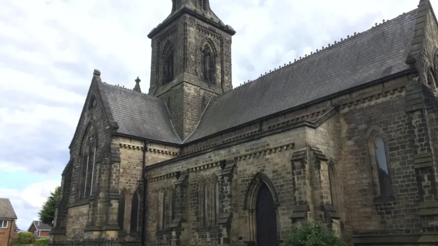
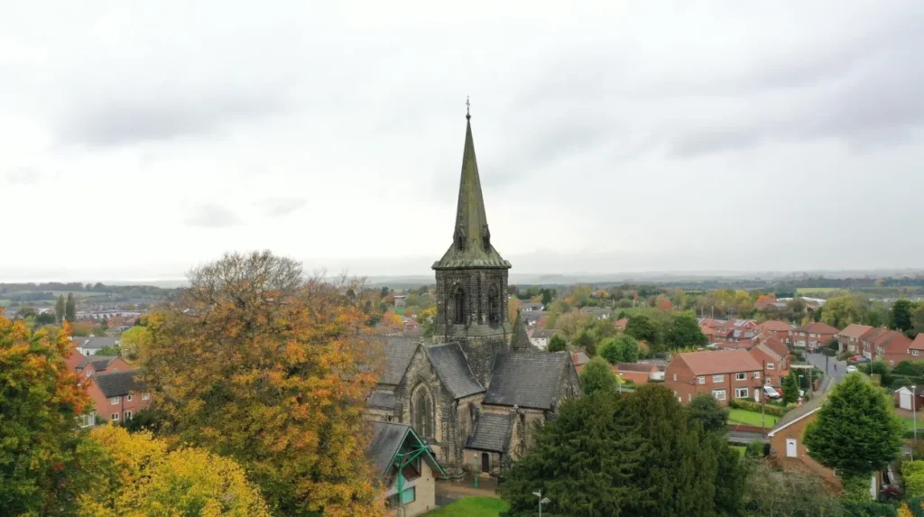
St Mary the Blessed Virgin Church is one of Garforth’s most important architectural landmarks. Built in 1844 by architect George Fowler Jones, its Magnesian limestone construction, Early English design, tower and spire make it a key heritage stop on Church Lane.
St Mary the Blessed Virgin Church stands on Church Lane and is officially listed at Grade II by Historic England. The church was constructed in 1844 to designs by George Fowler Jones, an architect associated with numerous ecclesiastical buildings in northern England.
The building uses dressed Magnesian limestone, reflecting the geology and traditional building materials of the region. It has a slate roof and a cruciform plan. The architectural arrangement includes a nave, north and south aisles, transepts, chancel and crossing tower.
The tower terminates in a broach spire, giving the building a strong vertical presence within the surrounding streetscape. Historic England identifies the architectural style as Early English, with tall lancet windows and other characteristic details.
For a short visit, the church is particularly useful because it provides several layers of local history in one location.
The building represents Victorian religious expansion. Its construction reflects the growth of Garforth during the period when industrial activity and population increased. The church therefore belongs to the same broad period of transformation that produced many of the town’s mining and railway-related buildings.
The churchyard also contains evidence connected with Garforth’s industrial past. The Garforth Neighbourhood Plan identifies the gravestone of John Backhouse as a heritage feature. Backhouse was a teenage mine worker employed as a “Hanger On” and was killed in a colliery explosion in 1856.
This detail makes the churchyard more than a religious site. It provides physical evidence of the people who worked in Garforth’s coal industry.
Visitors should allow time to examine the church exterior, churchyard and surrounding Church Lane. The area provides a compact introduction to Victorian architecture, local burial history and the town’s industrial development.
As you explore the modern site, you are crossing land with a deep heritage. Read about the full [Insert Anchor Text for History Article Here] to understand its origins.
What can you see at Garforth railway station in a short visit?
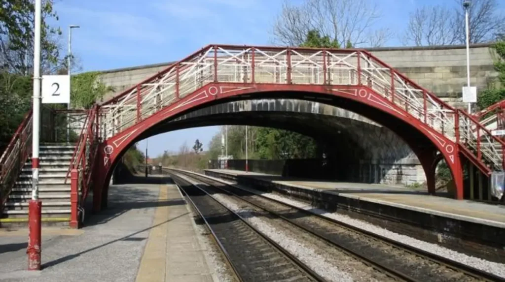
Garforth railway station is both a practical arrival point and a historic landmark. The station opened in 1834 with the Leeds and Selby Railway, while its Grade II-listed footbridge dates from around 1900 and represents the engineering heritage of the North Eastern Railway.
Garforth railway station provides one of the clearest examples of how transport changed the town. The Leeds and Selby Railway opened the station in 1834, placing Garforth on one of the important early railway routes serving the region. Historic England confirms the station’s 1834 origin and identifies its historic railway footbridge as a separate listed structure.
The footbridge is especially significant. Historic England lists it at Grade II and dates it to around 1900. It is constructed from cast and wrought iron and follows the standard design of the North Eastern Railway. Its elliptical arch, decorative railings and roundels provide recognisable railway engineering details.
The bridge was added after the station opened. Before its construction, the adjacent road bridge provided the crossing arrangement. The footbridge therefore represents a later phase in the station’s development.
The railway also played an important economic role. Garforth was already associated with coal production, and railway infrastructure improved the movement of passengers and goods. The wider Leeds and Selby Railway also supported industrial transport across eastern West Yorkshire.
Modern visitors can appreciate this history without taking a long walk. The station itself is an appropriate first stop because it combines accessibility with heritage value.
Northern currently provides passenger information and facilities at Garforth station. The station has two platforms and step-free access onto the platforms through the main entrance, with lifts and stairs connecting to the footbridge.
For visitors arriving by train, the station also provides an efficient starting point for exploring Aberford Road and the town centre.
The current transport function is therefore part of the landmark’s historical significance. Garforth station is not simply an old railway site preserved for display. It remains part of the active transport network.
Which mining heritage landmarks can you see around Garforth?
Garforth’s mining heritage survives through historic buildings, memorials, graves and community institutions rather than a single preserved colliery complex. The Miners’ Welfare Hall, mining-related gravestones and former social buildings provide accessible evidence of the town’s coal-mining past.
Coal mining was central to Garforth’s nineteenth- and early twentieth-century development. The industry influenced employment, population growth, transport infrastructure and community organisations.
The Gascoigne family had major mining interests in the district. Their involvement is particularly visible in historic buildings connected with miners and their social life.
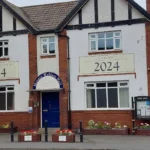
The Miners’ Welfare Hall on Main Street is one of the strongest surviving examples. The Garforth Neighbourhood Plan dates the building to 1924 and records that it was erected by the Garforth Miners’ Welfare Institute on land donated by the Gascoigne family. Funding came from the Central Miners’ Welfare Committee and weekly subscriptions from local miners.
The building also had an important civic function. It housed Garforth Library between 1939 and 1943 before the library moved because of limited space. The hall subsequently continued as a community facility, demonstrating how mining-era institutions evolved into wider community assets.
For visitors, the hall is best viewed as part of a Main Street heritage walk. Its importance lies in what it represents: organised leisure, education, welfare and community life associated with the mining workforce.
Mining history is also visible at St Mary’s churchyard. The gravestone of John Backhouse links the site directly to the dangers faced by young workers in Garforth’s collieries. The Garforth Neighbourhood Plan records that he was 15 when he died in a 1856 explosion.
These surviving details provide a more complete understanding of industrial Garforth. The coal industry was not simply an economic activity. It shaped institutions, families, public buildings and the town’s social structure.
Visitors interested in industrial history should therefore combine the Welfare Hall with the churchyard and railway station. Together, the three locations show how coal production, workers and transport were interconnected.
Why is Garforth Country Club an important historic stop?
Garforth Country Club is a significant nineteenth-century community building on Aberford Road. Its original section dates from 1865 and was commissioned by the Gascoigne family for miners, linking the building directly with Garforth’s industrial and social history.
Garforth Country Club stands on Aberford Road and has a documented connection with the Gascoigne mining interests.
The Garforth Neighbourhood Plan identifies the original part of the building as dating from 1865. The Gascoigne family had it built as a reward for miners who did not strike during that year.
Its original role reveals an important feature of industrial communities. Employers and mining owners supported dedicated spaces for recreation, education and social activity. The building hosted lectures, magic lantern shows and chess, demonstrating that miners’ social institutions extended beyond workplace functions.
For a short visitor itinerary, the Country Club works particularly well with Garforth railway station because both are located along the Aberford Road corridor.
The building also helps explain the relationship between the Gascoigne family and the town. Their influence was expressed through mining operations as well as through land, buildings and community institutions.
Its historic importance therefore comes from both architecture and social history.
A visitor does not need to spend a long period at the building to understand its significance. The key details are its 1865 origins, connection with Garforth’s miners and role as a social and educational venue.
It also demonstrates why Garforth should not be understood only through surviving churches or railway infrastructure. Industrial heritage is embedded in ordinary-looking community buildings across the town.
What historic buildings and streets should you see around Main Street?
Main Street is one of the best areas for a quick architectural walk because it brings together traditional town buildings, the Miners’ Welfare Hall, community facilities and routes towards Church Lane. Its historic character reflects Garforth’s transition from village to industrial town.
Main Street provides the strongest sense of Garforth as a traditional town centre. It links commercial activity with older residential and community buildings and provides routes towards Church Lane and the historic church.
The Garforth Neighbourhood Plan identifies historic architectural features in the town, including buildings with distinctive brickwork brackets at the eaves. Such details demonstrate how local construction traditions contribute to the character of the street.
A short architectural walk should focus on façades, rooflines, brickwork and the relationship between buildings and the street. These features often provide more useful historical evidence than isolated monuments.
The Miners’ Welfare Hall is particularly important because it sits within this wider streetscape. Its 1924 construction represents the later industrial period, while other buildings reflect earlier phases of development.
The town’s historic identity is therefore layered rather than uniform.
Church Lane provides another important connection. Leeds City Council’s Leeds Country Way route through Garforth specifically directs walkers along Main Street and then into Church Lane near the library before continuing towards the cricket ground and old railway alignment.
This route illustrates how the town centre connects with open land and former railway infrastructure.
Visitors with only 60 to 90 minutes should avoid trying to cover every street. A focused route from the station through Aberford Road, Main Street and Church Lane provides a stronger historical overview.
The area also works for visitors combining sightseeing with everyday activities. Garforth remains a functioning town rather than a museum site, so shops, cafés, services and transport facilities are integrated into the historic environment.
Explore More Area Guide
Garforth Quiet Places and Peaceful Days Out 2026
Garforth Accessible Places for Visitors With Mobility Needs 2026
How can you fit Garforth’s landmarks into a short visit?
A practical short visit starts at Garforth railway station, continues along Aberford Road to Garforth Country Club and then moves towards Main Street and Church Lane. Finish at St Mary’s Church for architecture, churchyard history and links with Garforth’s mining past.
The most efficient itinerary depends on available time, but the town’s compact arrangement supports a simple sequence.
For a 30-minute visit, concentrate on Garforth station and its historic railway setting. The Grade II-listed footbridge provides the clearest heritage feature at the station. Historic England records its construction around 1900 and its North Eastern Railway design.
For a 60-minute visit, add Aberford Road and the exterior of Garforth Country Club. This introduces the mining and social history associated with the Gascoigne family and local miners. The Country Club’s original section dates from 1865.
For a 90-minute visit, continue to Main Street and Church Lane. The Miners’ Welfare Hall adds a twentieth-century mining-community landmark, while St Mary the Blessed Virgin Church adds Victorian religious architecture.
For a two-hour visit, spend more time around the churchyard and historic streets before considering a short section of the Leeds Country Way or another local green-space route.
Leeds City Council lists numerous parks and green spaces in the Garforth and Swillington area, including Barley Hill Park, The Chase, Hollinhurst Wood and East Garforth Recreation Ground.
Visitors should distinguish between a landmark-focused visit and a countryside walk. The Leeds Country Way sections around Garforth cover substantial distances, with each relevant section measuring approximately 5½ miles.
That makes the route unsuitable for visitors who have only a few minutes before a train or appointment.
Transport also supports short visits. Northern currently provides services from Garforth and publishes timetable information for routes including Leeds–York and Halifax–Hull services.
The railway station therefore allows visitors to treat Garforth as a short excursion from Leeds rather than requiring a full-day commitment.
What does Garforth’s landmark heritage reveal about the town today?
Garforth’s landmarks reveal a town shaped by agriculture, coal mining, railway development, religion and community institutions. Its heritage remains relevant because historic buildings and transport infrastructure continue to form part of the everyday townscape rather than existing separately from modern life.
Garforth’s heritage is best understood as a sequence of connected developments.
The earliest phase was agricultural and rural. The medieval settlement recorded in Domesday provides evidence of an established community with a church and agricultural economy.
The industrial period brought deeper change. Coal mining created employment and strengthened connections with regional markets. The Leeds and Selby Railway opened in 1834, creating a faster transport connection with Leeds and Selby.
Victorian expansion produced St Mary the Blessed Virgin Church in 1844. The later nineteenth century produced community institutions such as the original 1865 section of Garforth Country Club.
The twentieth century added further layers, including the Miners’ Welfare Hall in 1924. These buildings demonstrate how industrial communities developed formal institutions for recreation, education and welfare.
Today, the railway continues to serve passengers, while community buildings remain part of the town’s social infrastructure. This continuity gives Garforth a distinctive heritage character.
The town also demonstrates how local history can be experienced without entering a major museum. A station footbridge, churchyard, community hall and historic street can collectively provide evidence about engineering, religion, labour, architecture and social organisation.
For short-stay visitors, this is the main practical advantage of Garforth. The town offers a concentrated collection of heritage points within an active modern community.
Its landmarks also connect Garforth with the wider history of Leeds. Railway development linked the town to the regional economy, while coal production contributed to the industrial growth of eastern Leeds and surrounding West Yorkshire.
The surviving landmarks preserve different aspects of that process. St Mary’s records Victorian religious expansion. The station records railway modernisation. The Welfare Hall records organised working-class community life. The Country Club records nineteenth-century mining-era social provision.
Together, they provide a factual framework for understanding Garforth beyond its present-day role as a residential and commuter town.
A concise landmark route
Visitors with limited time can therefore use a straightforward sequence: Garforth railway station → historic station footbridge → Aberford Road → Garforth Country Club → Main Street → Miners’ Welfare Hall → Church Lane → St Mary the Blessed Virgin Church and churchyard.
This route prioritises the landmarks with the strongest documented historical connections and avoids requiring a long countryside walk.
Garforth’s value for a short visit comes from this concentration. The town does not require an extensive itinerary to reveal its history. Its railway infrastructure, church, mining heritage and community buildings provide a compact record of how a small settlement developed into an important part of east Leeds.
For tourists, the route provides a practical heritage stop. For residents, it offers a structured way to revisit familiar streets. For business travellers and visitors with limited downtime, it provides a manageable introduction to local history without travelling into central Leeds.
Most importantly, Garforth’s landmarks remain connected to the living town. They are not isolated historical exhibits. They sit within the streets, transport routes and community spaces that continue to shape Garforth today.
What are the best landmarks to see in Garforth?
The best landmarks include St Mary the Blessed Virgin Church, Garforth railway station and its historic footbridge, Garforth Country Club, and the Miners’ Welfare Hall. These sites represent Garforth’s religious, railway, mining and community heritage.