Garforth in Leeds is a settlement shaped by medieval origins, Victorian expansion, coal mining, religious institutions, turnpike travel and railway development. Its historic character is not concentrated in one formally designated conservation area. Instead, it survives through individual listed buildings, older street patterns, former industrial sites, historic routes and locally valued buildings.
- What makes Garforth’s streets historically distinctive?
- Is Church Lane the best street for Garforth’s historic character?
- What can you see along Garforth Main Street?
- How does Aberford Road reveal Garforth’s industrial history?
- Why are Wakefield Road and Chapel Lane important to Garforth history?
- What does Garforth’s railway area add to a historic street walk?
- How does mining heritage shape Garforth’s streets and neighbourhoods?
- Does Garforth have a conservation area protecting its historic streets?
- How can you explore Garforth’s historic streets as a walking route?
- Why does Garforth’s historic street character still matter today?
The most useful streets for exploring this character are Church Lane, Main Street, Aberford Road, Wakefield Road, Chapel Lane and the railway surroundings. Together, they show how Garforth developed from separate historic settlements into the modern town.
What makes Garforth’s streets historically distinctive?
Garforth’s historic character comes from its medieval settlement pattern, Victorian buildings, coal-mining heritage, religious buildings, transport routes and surviving historic structures. Church Lane, Main Street, Aberford Road and nearby streets provide the clearest evidence today.
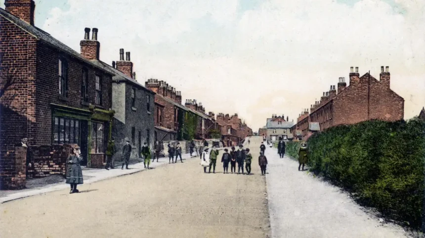
Garforth has a particularly layered history because the present town developed from more than one historic settlement. Historic Landscape Character research records Garforth in the Domesday Survey of 1086 and identifies three separate villages on mid-19th-century Ordnance Survey mapping: West Garforth, Moor Garforth and Church Garforth.
Church Garforth is especially important when examining the origins of the settlement. Its historic core corresponds broadly with the eastern section of modern Church Lane. In the mid-19th century, this area contained a church, Methodist chapel, rectory, grange, cottages and villas. Linear plots behind the buildings also provide evidence of an older settlement arrangement.
The town’s later development was strongly influenced by the coal industry. Garforth became associated with collieries, workers’ housing, schools, chapels and transport infrastructure. This industrial heritage sits alongside older religious and agricultural buildings.
The railway introduced another major layer. Garforth became connected to the wider regional transport network, creating new movement patterns around the station and railway bridges.
This explains why a modern street in Garforth can contain buildings or routes representing very different periods. A short walk can pass Victorian religious architecture, former mining-related development, later housing and transport infrastructure.
Leeds City Council’s Garforth Plan states that the town has eight designated heritage assets, all Grade II listed, while also identifying additional non-designated heritage assets. The plan emphasises the importance of protecting historic features that contribute to Garforth’s identity.
Garforth therefore rewards visitors who examine streets as historical landscapes rather than looking only for individual landmarks.
Is Church Lane the best street for Garforth’s historic character?
Church Lane provides one of Garforth’s strongest historic streetscapes because it follows the core of historic Church Garforth and contains St Mary’s Church, historic religious sites, older residential buildings and evidence of earlier settlement patterns.
Church Lane is the clearest starting point for understanding Garforth’s early development.
Historic Landscape Character research identifies the historic core of Church Garforth with the area corresponding to modern Church Lane. The settlement was relatively small during the mid-19th century, with the church and religious buildings forming its principal landmarks.
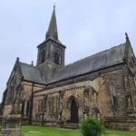
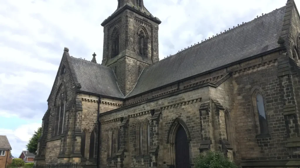
The most important surviving building is the Church of St Mary the Blessed Virgin. Historic England lists it at Grade II. The church dates from 1844 and was designed by architect George Fowler Jones. It is built from dressed magnesian limestone with a slate roof and follows the Early English architectural style.
Its architectural composition includes a nave, aisles, transepts, chancel and crossing tower with a broach spire. Lancet windows, buttresses and moulded doorways contribute to its distinctive Gothic Revival appearance.
The church occupies a site with a much older religious history. Garforth was recorded as having a church in the Domesday Survey of 1086. Archaeological and historical evidence indicates that earlier churches occupied the site before the present building.
Church Lane also demonstrates how historic buildings disappear while street patterns survive. Former properties such as The Grange and Rose Villa were demolished during 20th-century redevelopment. Their loss changed the physical appearance of the street, but the route itself continues to represent the historic settlement.
The lane also contains the historic Methodist tradition of Garforth. A Wesleyan chapel was established on Church Lane in 1806. The congregation expanded during the 19th century as Garforth’s population increased. A larger chapel was built during the Victorian period.
For visitors, Church Lane is therefore important because it combines architecture, religious history and settlement geography in one compact area.
As you explore the modern street, you are crossing land with a deep heritage. Read about the full [Insert Anchor Text for History Article Here] to understand its origins.
What can you see along Garforth Main Street?
Garforth Main Street forms an important part of the town’s historic commercial and residential structure, connecting the central area with Church Lane and providing access to buildings, routes and landmarks associated with Garforth’s expansion.
Main Street is useful for understanding the transition from an older village environment to a larger commercial settlement.
The name itself reflects the street’s role as a principal route through Garforth. Today it contains modern businesses and buildings, but its position within the settlement remains historically significant.
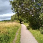
The Leeds Country Way provides a useful modern reference point. The official route enters Garforth from the direction of Barwick-in-Elmet, follows countryside paths and reaches Main Street, then turns into Church Lane near Garforth Library.
This connection demonstrates how the historic settlement remains linked to the surrounding rural landscape.
Main Street also forms part of the wider area around Townend. Local historical records document historic religious buildings, former commercial premises and older structures around the street and its junctions. These buildings illustrate the expansion of Garforth during the 19th and early 20th centuries.
One important aspect of Main Street is its relationship with nearby Church Lane. The two streets should not be viewed separately. Their junction represents a transition between Garforth’s commercial centre and the older Church Garforth area.
The surrounding architecture also demonstrates changes in construction. Older buildings use traditional materials associated with West Yorkshire, including stone and brick, while later buildings reflect 20th-century development.
A historic street does not require every building to be old. Historic character also comes from the alignment of streets, surviving landmarks, building groups, mature trees, plot boundaries and relationships between buildings and roads.
A Tree Preservation Order covering Main Street / Church Lane was made by Leeds City Council in 1992 and confirmed in 1993. This provides an additional example of the environmental features associated with this part of Garforth.
For visitors interested in architectural detail, Main Street works best as part of a longer walking route. It can be combined with Church Lane, Chapel Lane and the central road junctions.
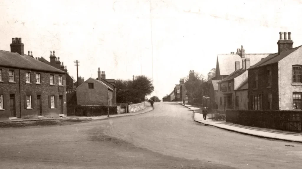
How does Aberford Road reveal Garforth’s industrial history?
Aberford Road reveals Garforth’s industrial and transport history through its relationship with former mining areas, workers’ development, commercial buildings, railway infrastructure and routes connecting Garforth with surrounding settlements and the wider Leeds region.
Aberford Road is one of the most important streets for understanding Garforth’s industrial transformation.
The road forms part of the modern A642, connecting Garforth with the wider road network. Its importance is older than the current highway system because routes through this area supported movement between settlements, industrial sites and markets.
Garforth’s coal industry had a major influence on the surrounding landscape. The Gascoigne family was associated with local landownership and coal mining, while collieries generated employment and supported associated housing, education and transport infrastructure.
The relationship between mining and community development is particularly visible in the historic buildings identified by the Garforth Neighbourhood Plan.
One example is the former East Garforth School, now occupied by a different use. The building dates from 1843 and was associated with the Gascoigne family’s provision of education for mining families. The Garforth Plan identifies the building as having historic value.
Aberford Road also connects with the railway landscape. The Leeds–Selby railway passes through the town, creating bridges and other transport structures that form part of Garforth’s designated heritage.
The railway changed Garforth’s relationship with surrounding communities. It provided a more efficient connection for passengers, workers and goods and reinforced the town’s position within the industrial economy of West Yorkshire.
The wider industrial landscape is also visible through street development. The Garforth Plan describes the town as having substantial post-war development alongside industrial heritage. It identifies mining-related history as a significant part of the local identity.
Visitors walking along Aberford Road therefore see more than a modern arterial route. The road connects several historical layers: mining, education, transport, housing and commerce.
Its current traffic environment also means it is better treated as a route for observation rather than a quiet heritage promenade. Historic buildings should be viewed from safe public positions and crossings should be used where provided.
Why are Wakefield Road and Chapel Lane important to Garforth history?
Wakefield Road and Chapel Lane preserve evidence of Garforth’s strong Methodist tradition and Victorian community development, including former chapels, Sunday schools and buildings associated with religious organisations that served the expanding population.
Religious buildings provide some of the clearest evidence of Garforth’s 19th-century population growth.
Garforth’s Methodist history began with the establishment of a Wesleyan chapel in 1806 on Church Lane. The congregation expanded rapidly enough to require enlargement in 1824 and a Sunday school in 1826.
The development of chapels reflects the social structure of the growing mining community. Religious buildings also served as centres for education, meetings and community activities.
A later Methodist building was constructed near Wakefield Road and Townend. Local historical records identify the Salem Chapel as a significant part of this history. Its foundation stone was laid in 1872, and the chapel opened later that year.
The chapel eventually closed for Methodist worship in 1969, after which the building experienced different uses. It later returned to ecclesiastical use. This sequence demonstrates how historic buildings can survive while their functions change.
Chapel Lane provides another important connection. The Primitive Methodist movement was active in Garforth from the early 19th century. A Primitive Methodist chapel was associated with Chapel Lane, while a later building was constructed in the 1870s. The congregation eventually joined with another Methodist congregation following the 1932 Methodist Union.
The surviving building fabric therefore records both religious history and demographic change.
For heritage-focused visitors, these streets demonstrate that Garforth’s history is not limited to grand buildings. Chapels, schools and community buildings often provide stronger evidence of everyday life.
They also show why historic character should be assessed across a street rather than by looking at a single listed building.
What does Garforth’s railway area add to a historic street walk?
Garforth’s railway area adds an important Victorian transport layer to the town’s heritage, with the station environment, railway bridges and routes showing how rail connections influenced movement, industry, employment and settlement growth across Garforth.
Railways are central to understanding Garforth’s development during the industrial era.
The Leeds–Selby railway passes through the town and created infrastructure that remains visible today. One surviving railway bridge is listed at Grade II, demonstrating the heritage importance of transport infrastructure in Garforth.
The bridge is part of the historic railway environment rather than an isolated architectural object. Its position illustrates how railway construction altered existing roads and created new relationships between different parts of the settlement.
The railway also affected the development of housing and employment. Industrial towns relied on efficient transport for workers and goods. Garforth’s existing coal-mining economy therefore benefited from improved connections.
The station area should be understood alongside the town’s other historic routes. The railway separates and connects parts of Garforth at the same time. Bridges, paths and roads provide the physical links between neighbourhoods.
The Leeds Country Way also uses the wider former railway landscape. Near Garforth, the route follows an old railway line known as the Linesway before continuing towards Brecks Lane and the River Aire.
This creates an opportunity to combine built heritage with landscape history.
Visitors should distinguish between the active railway infrastructure and public paths. Railway tracks and operational railway land are not public walking routes. Heritage exploration should remain on designated public footways and roads.
The railway story also demonstrates how Garforth evolved beyond its original village structure. Its historic identity includes transport technology as well as traditional buildings.
How does mining heritage shape Garforth’s streets and neighbourhoods?
Mining shaped Garforth’s streets through workers’ housing, schools, chapels, industrial buildings, transport routes and community facilities. Although much of the physical mining infrastructure has disappeared, its influence remains visible in the town’s buildings, street patterns and heritage records.
Coal mining is essential to understanding modern Garforth.
The town’s industrial development was connected to local collieries and the wider coal economy of West Yorkshire. Mining generated employment and influenced where people lived, studied and worshipped.
The Garforth Neighbourhood Plan specifically identifies industrial heritage as a major component of the town’s historic identity. It also notes that many developments are relatively recent, meaning surviving historic assets are particularly important for understanding the earlier settlement.
Mining heritage survives through more than pit buildings.
Sisters Villas, for example, form part of the historical residential landscape associated with the Sisters Pit area. The Garforth Plan records the development as dating back to the 19th-century mining period.
The relationship between mining and education is also visible in the former East Garforth School. Its connection with the Gascoigne family’s mining interests demonstrates how industrial employers influenced local institutions.
Religious buildings provide another connection. Growing mining populations required places for worship and community activity. Methodist chapels expanded during the same period of industrial growth.
Street names and neighbourhood layouts therefore provide clues even where the original industrial structures no longer survive.
Garforth’s heritage planning documents also identify non-designated heritage assets. These are buildings or structures that do not have statutory listing but still contribute to local character. The council-backed neighbourhood plan records that its list is not exhaustive and that additional assets can be identified.
This distinction is important for visitors. A building does not need to be Grade II listed to have local historical significance.
Does Garforth have a conservation area protecting its historic streets?
Garforth does not currently have a designated conservation area, so its historic character is protected through individual listed buildings, planning policies, heritage assessments, locally identified assets and other controls rather than one comprehensive conservation-area designation.
This is one of the most important facts to understand when exploring Garforth heritage.
Leeds City Council states that conservation areas protect places with special architectural or historic interest and provide additional planning controls over development, demolition and other changes.
Garforth does not appear on Leeds City Council’s current list of designated conservation areas.
The Garforth Neighbourhood Plan specifically states that there are no conservation area designations within the town. It identifies eight designated heritage assets, all Grade II listed, alongside non-designated heritage assets.
This creates a different heritage landscape from places such as Aberford, which has a designated conservation area.
The absence of a conservation area does not mean Garforth lacks historic character. It means protection operates through different mechanisms.
Listed buildings receive statutory protection because of their special architectural or historic interest. St Mary’s Church is one example. Historic England records its Grade II status and architectural significance.
Non-designated heritage assets are also important. The Garforth Plan identifies buildings and features that contribute positively to local identity and should be considered in planning decisions.
This planning structure explains why individual streets can retain historical significance even when modern buildings dominate sections of the town.
It also places greater importance on documenting local heritage. Historic photographs, maps, archival records and community research help establish how streets changed over time.
For visitors, the practical implication is simple: look beyond conservation-area signs. Garforth’s heritage is distributed across the settlement.
How can you explore Garforth’s historic streets as a walking route?
A practical Garforth heritage walk can connect Main Street, Church Lane, Wakefield Road, Chapel Lane, Aberford Road and the railway environment, combining listed architecture, religious history, industrial heritage and historic transport routes.
A street-based exploration works best when the routes are treated as connected historical zones.
Begin around Main Street and examine the relationship between commercial buildings and the routes leading towards Church Lane. This establishes the modern town centre before moving towards the older settlement.
Continue towards Church Lane. St Mary’s Church provides the strongest architectural reference point. Its Grade II listing and 1844 construction date make it a clear chronological marker.
Look at the surrounding street alignment rather than focusing only on the church. The historic settlement pattern of Church Garforth developed around this area, with older plots and buildings historically extending along the lane.
From the Church Lane area, the historic Methodist sites provide evidence of 19th-century population growth. The former chapel buildings show how religious institutions developed alongside the industrial economy.
The route can then continue towards Wakefield Road and Aberford Road, where transport and industrial history become more prominent.
The railway environment provides another chronological stage. Railway bridges and the station area demonstrate the impact of Victorian transport infrastructure. One railway bridge is Grade II listed.
For a longer walk, the Leeds Country Way provides a countryside extension. The official route connects Barwick-in-Elmet with Garforth and continues through the Linesway towards the River Aire. The Garforth section is approximately 5.5 miles in each of the two described stages.
Walkers should check current route conditions before setting out because paths, crossings and surfaces can change.
This approach turns Garforth into an open-air historical study area. The focus is not on ticking off attractions. It is on identifying how streets, buildings, transport routes and neighbourhoods developed together.
Explore More Area Guide
Garforth Heritage Sites and Stories to Explore 2026
Horsforth Best Places for an Independent Day Trip 2026
Why does Garforth’s historic street character still matter today?
Garforth’s historic streets remain important because they preserve evidence of settlement, religion, coal mining, transport and community development. They also provide a local identity within a modern Leeds suburb and support heritage interpretation, walking and place-based tourism.
Garforth’s historical importance extends beyond individual buildings.
Its streets document the transformation from separate settlements into a larger urban area. Church Garforth represents an older religious and settlement core. Main Street reflects later commercial development. Aberford Road records industrial and transport connections. Railway infrastructure records technological change.
The archaeological evidence around Garforth adds another dimension.
In 2023, Leeds City Council reported the discovery of a previously unknown 1,600-year-old cemetery near Garforth. Archaeologists found a lead coffin believed to contain a high-status late Roman woman and remains belonging to more than 60 men, women and children.
This discovery demonstrates that the historical landscape around Garforth extends far beyond the surviving Victorian buildings.
It also reinforces the importance of archaeological evidence when assessing local history. Modern streets occupy a landscape that has been used and reshaped over many centuries.
For visitors, this gives Garforth a broader historical context. The town is not simply an industrial-era settlement. Its recorded history reaches back to the medieval period and its archaeological record reaches further into the past.
For residents, historic streets provide continuity within a rapidly changing urban environment. Buildings, mature trees, road alignments and community landmarks provide physical reference points between different periods.
For planners, the challenge is maintaining local character while allowing buildings and streets to meet contemporary needs. Leeds City Council’s planning framework recognises the importance of heritage assets and local character in development decisions.
For tourism, Garforth’s distributed heritage creates opportunities for self-guided walking routes rather than relying on a single attraction.
The strongest approach is therefore to read Garforth as a connected historic landscape. Church Lane explains the older settlement, Main Street explains the town centre, Aberford Road explains industrial and transport growth, Chapel Lane and Wakefield Road explain religious and community development, while the railway area explains regional connectivity.
Together, these streets provide a detailed picture of how Garforth developed from historic villages and an industrial community into the modern Leeds settlement visible today.
Which streets in Garforth have the most historic character?
Church Lane, Main Street, Aberford Road, Wakefield Road and Chapel Lane are among the most historically significant streets in Garforth. They connect historic settlement areas with religious buildings, mining heritage, railway infrastructure and older residential development.