Garforth sits within the eastern part of Leeds and has a network of paths, recreation grounds, woodland, informal green spaces and former railway corridors. These spaces provide practical routes for walking and outdoor recreation while connecting the settlement with surrounding countryside.
- What are Garforth’s green corridors?
- Which open spaces can you explore around Garforth?
- How long is The Lines Way and where does it go?
- How do Garforth’s green spaces connect with wider walking routes?
- What can you do along Garforth’s green corridors?
- How do Garforth’s green corridors support wildlife?
- Why are connected green areas important for Garforth?
- How can visitors plan a green-space day in Garforth?
- What is the future importance of Garforth’s green network?
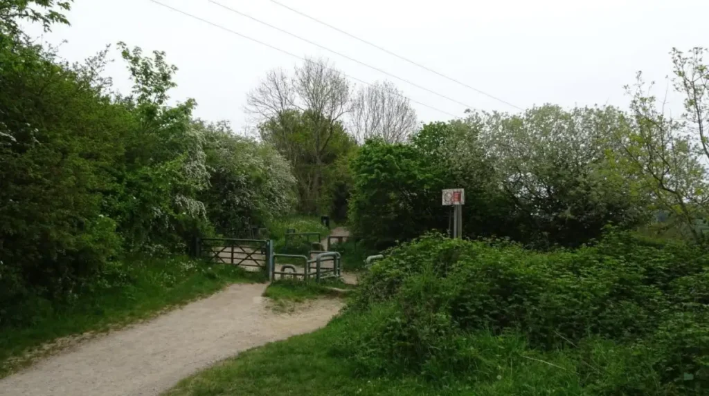
The most significant green corridor is The Lines Way, a former railway route running between Garforth and Allerton Bywater. Leeds City Council lists it among the city’s shorter recreational routes and gives its length as approximately three miles. Yorkshire Wildlife Trust describes the route as 3.5 miles and identifies its connections with several wildlife-rich areas.
Garforth’s wider green infrastructure includes BarleyHill Park, Glebelands Recreation Ground, Hollinhurst Wood, The Chase, White House Lane and other designated local green spaces. Leeds City Council’s parks information formally identifies these sites within the Garforth and Swillington area.
The area also connects with the Leeds Country Way, a 62-mile circular walking route around Leeds. The Garforth section uses the old railway line and provides a connection towards the River Aire.
This combination makes Garforth useful for visitors seeking open-air activities without travelling into central Leeds. The green network also provides opportunities for residents, commuters, families, walkers, cyclists and people looking for quieter outdoor spaces.
What are Garforth’s green corridors?
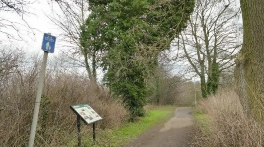
Garforth’s green corridors are connected routes of vegetation, paths and open land linking neighbourhoods with countryside and wildlife habitats. The Lines Way is the clearest example, connecting Garforth with Allerton Bywater as a route for walking, wheeling, cycling and nature.
A green corridor is different from a single park. It functions as a connection between separate green spaces. Leeds City Council defines green corridors and connections as green infrastructure that creates safe and attractive links for people and wildlife, preferably separated from vehicular traffic.
These corridors can include linear parks, woodlands, planted verges, hedgerows and tree-lined routes. Their purpose includes recreation, biodiversity, active travel and connections between public open spaces.
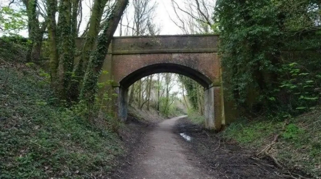
In Garforth, The Lines Way is particularly important because it occupies a former railway alignment. Its relatively continuous route allows visitors to travel through changing vegetation and open countryside without following a conventional road for the entire journey.
The Garforth Neighbourhood Plan also recognises the importance of green infrastructure opportunities and links between existing green spaces. Its planning documentation discusses opportunities to connect green infrastructure and retain trees and hedgerows along public rights of way.
The concept therefore extends beyond a single named destination. Garforth’s green network consists of individual spaces and the routes that connect them.
Which open spaces can you explore around Garforth?
Green space around Garforth includes the Lines Way, BarleyHill Park, Glebelands Recreation Ground, Hollinhurst Wood, The Chase, White House Lane and smaller local spaces. These areas provide different functions, including walking, recreation, informal nature observation, woodland access and neighbourhood connections.
Leeds City Council’s parks byelaws schedule identifies a range of green and recreational locations within the Garforth and Swillington area. These include BarleyHill Park, Firthfield, Glencoe Estate, Goosefields, Hanbury Place, Longmeadows, Primrose Hill Drive, The Chase, White House Lane and Hollinhurst Wood.
These sites do not all provide the same experience. Some are designated local green spaces. Others function as recreation grounds, woodland or community parks.
BarleyHill Park is classified by Leeds City Council as a community park. This gives it a different role from a narrow green corridor because it provides a larger recreational setting.
Glebelands Recreation Ground is another recognised recreational site. The area also includes a skate park, giving it a more activity-focused function.
Hollinhurst Wood is classified as a woodland area. Woodland sites contribute habitat value and provide a different landscape character from open recreation grounds.
The Chase is listed as a local green space. Such spaces contribute to the wider network of accessible outdoor areas within the settlement.
For visitors, the important point is that Garforth does not rely on one large park. Its outdoor character comes from a collection of connected spaces and routes.
How long is The Lines Way and where does it go?
The Lines Way is the main green corridor for a longer route from Garforth. Leeds City Council describes it as a three-mile disused railway route to Allerton Bywater, while Yorkshire Wildlife Trust describes it as 3.5 miles connecting communities and reserves.
The Lines Way follows a former railway alignment between Garforth and Allerton Bywater. Leeds City Council lists it as a three-mile recreational route.
Yorkshire Wildlife Trust describes the corridor as 3.5 miles and highlights its role in connecting several nature-rich areas, including Letchmire Pastures, Hollinghurst Wood, Owl Wood, Pit Plantation and Townclose Hills nature reserves.
The difference between the published distances reflects the way route boundaries and measured sections are defined by different organisations. The practical point remains consistent: The Lines Way provides a substantial linear route between Garforth and Allerton Bywater.
Yorkshire Wildlife Trust identifies a starting point at Ninelands Lane in Garforth, with another access point at Park Lane in Allerton Bywater.
The route is particularly significant because it links communities with natural areas. It is therefore both a recreational path and an element of the local ecological network.
Its railway history also gives the route a distinctive land-use character. The former transport corridor now provides space for walking, cycling, wildlife movement and informal outdoor recreation.
As you explore the modern route, you are crossing land with a deep heritage. Read about the full to understand its origins and the historical development of the settlement.
How do Garforth’s green spaces connect with wider walking routes?
Garforth’s open areas connect through public rights of way, the Lines Way and green links around neighbourhoods. The Leeds Country Way uses the old railway corridor from Garforth towards the River Aire, creating a wider walking network beyond the settlement.
The Leeds Country Way is a 62-mile circular walking route around Leeds. Its Garforth section provides one of the clearest examples of how local paths connect with the wider countryside.
Leeds City Council describes the Garforth-to-River Aire section as approximately 5.5 miles. From the A63, the route passes beneath Selby Road using the old railway line, now known as the Linesway.
This connection gives visitors options beyond simply walking The Lines Way from one end to the other.
A short local outing can focus on the green corridor close to Garforth. A longer walk can use the public rights of way network to continue towards surrounding countryside.
Leeds has an extensive rights of way network. The council records 859 kilometres of public rights of way across the district, comprising 650 kilometres of footpaths, 199 kilometres of bridleways and 11 kilometres of byways.
These routes provide the infrastructure that allows individual green spaces to function as part of a larger outdoor network.
For visitors, this means Garforth works as a starting point rather than simply a destination. A walk can begin near the settlement and continue into surrounding landscapes.
What can you do along Garforth’s green corridors?
Walkers can combine the Lines Way with the Leeds Country Way, local paths and surrounding lanes to create outings. The route between Garforth and the River Aire is about 5.5 miles, with Lines Way forming part of the approach.
Walking is the most straightforward activity across Garforth’s green network. The Lines Way provides a relatively direct linear route, while the Leeds Country Way creates opportunities for longer journeys.
Cycling is another practical activity on suitable sections of the network. The former railway alignment provides a route away from many busy roads, although users should follow current access arrangements and respect signs.
Wheelchair users and people with pushchairs also have an identified route option. Yorkshire Wildlife Trust specifically describes The Lines Way as suitable for wheelchair users and pushchairs.
Nature observation is another reason to explore the corridor. Yorkshire Wildlife Trust highlights overwintering songbirds including long-tailed tits, bullfinches and linnets along The Lines Way.
Different sections provide different experiences. Woodland areas such as Hollinhurst Wood offer denser vegetation, while open recreation grounds provide more spacious settings.
Visitors should remain on public routes, follow local signs and avoid entering land without public access rights. Leeds City Council provides information on public rights of way, access rights and the definitive map for the district.
How do Garforth’s green corridors support wildlife?
Green corridors support wildlife by connecting habitats rather than leaving isolated patches. Trees, hedgerows, grassland and woodland along Garforth’s routes provide movement and shelter for birds, insects and small mammals, strengthening the ecological value of separated green spaces locally.
Wildlife corridors are important because habitats function better when ecological areas remain connected. A continuous or semi-continuous route allows animals and insects to move between suitable areas.
Garforth’s landscape contains several elements that contribute to this network. Trees and hedgerows occur along public rights of way, while woodland and grassland provide additional habitat.
The Garforth Neighbourhood Plan’s examination documentation records the importance of retaining trees and hedgerows along public rights of way and supporting additional planting where appropriate.
The Lines Way demonstrates how a former railway corridor can acquire ecological value after its original transport function ends. Yorkshire Wildlife Trust identifies multiple linked wildlife areas along the route, including Letchmire Pastures and Hollinghurst Wood.
Birds use vegetation for feeding, nesting and shelter. Insects depend on flowering plants and connected vegetation. Small mammals use hedgerows, woodland edges and grassland for movement and cover.
The ecological value of a corridor also depends on management. Excessive disturbance, fragmented vegetation and poorly designed development reduce connectivity. Retaining trees, hedges and natural vegetation strengthens the network.
This is why green corridors have a role beyond recreation. They form part of the environmental infrastructure of a settlement.
Why are connected green areas important for Garforth?
Garforth’s green corridors support outdoor recreation, biodiversity, active travel and local identity. Leeds planning guidance treats connected green infrastructure as important for health, biodiversity and climate adaptation, while local planning documents identify opportunities to retain trees, hedgerows and open spaces.
Leeds City Council states that high-quality accessible natural green spaces close to where people live and work are important for health and wellbeing, biodiversity and climate-change adaptation.
Connected green infrastructure also contributes to placemaking. Instead of treating parks, paths, woodland and hedgerows as separate features, planning policy encourages connections between them.
Leeds guidance states that key connections between green spaces, public rights of way and amenities should provide green links where people can walk, cycle and wheel.
This principle has particular relevance to Garforth because the settlement sits close to open countryside while containing established residential areas and transport infrastructure.
Green corridors provide a practical transition between built-up areas and rural landscapes. They also provide outdoor routes that do not depend entirely on car travel.
The Leeds Green Belt adds a wider planning context. Leeds City Council states that the Green Belt covers approximately 61% of the Leeds district, equivalent to 33,851 hectares. Its primary planning purpose is to prevent urban sprawl and maintain openness rather than serving as a specific environmental or recreational designation.
This distinction is important. Green Belt, public open space, wildlife habitat and green corridors are separate planning concepts, even when they occur within the same landscape.
Garforth’s local green network therefore has several overlapping functions. It supports recreation, movement, ecological connectivity and the relationship between the built settlement and surrounding countryside.
Explore More Area Guide
Garforth Places for an Unplanned Day Out | The Leeds
Garforth Independent Food Businesses: Local Food Guide
How can visitors plan a green-space day in Garforth?
A practical Garforth green-space day starts with The Lines Way, then uses nearby public paths or recreation grounds for additional outdoor time. Visitors should check current route conditions, follow access signs, respect wildlife habitats and use recognised public rights of way.
The Lines Way provides the strongest starting point for visitors seeking a clearly defined green corridor. Ninelands Lane is identified by Yorkshire Wildlife Trust as an access point in Garforth.
A short visit can focus on part of the corridor rather than attempting the complete route. This approach suits visitors with limited time, including people staying locally or using Garforth as part of a wider Leeds itinerary.
A longer outing can combine The Lines Way with the Leeds Country Way. The Garforth-to-River Aire section provides a substantial walking option of approximately 5.5 miles.
Recreation grounds can provide an additional stop when the priority is open space rather than continuous walking. Leeds City Council identifies BarleyHill Park and Glebelands Recreation Ground among the area’s recreational sites.
Nature-focused visitors should allow additional time around woodland and wildlife-rich sections. The Lines Way’s connections with several nature reserves make it suitable for observing seasonal vegetation and birds.
Visitors should also distinguish between public access and private land. A green-looking field is not automatically open to the public. Public rights of way provide specific access rights, while open-access land has separate rules.
Checking the current Leeds public rights of way information before a longer walk provides the most reliable route information. Leeds City Council maintains information about the definitive map and public paths.
What is the future importance of Garforth’s green network?
Garforth’s green network will remain important as Leeds plans development, active travel, biodiversity and climate resilience. Retaining existing vegetation and connecting green spaces gives future neighbourhoods stronger ecological and recreational links while protecting access to outdoor areas.
Leeds planning guidance requires development proposals to retain existing green infrastructure and connect it with adjacent green infrastructure where appropriate. The guidance specifically identifies trees, woodland, hedgerows, meadows and wetlands as components of the wider green infrastructure system.
The same guidance distinguishes green corridors from conventional public open spaces. Corridors function as connections, while public open spaces provide places for recreation, movement, rest and nature observation.
This distinction matters for Garforth’s future because new development can either fragment or strengthen existing networks.
Maintaining continuous routes supports walking and cycling. Retaining vegetation protects habitat. Connecting parks and paths improves access to outdoor space.
The Garforth Neighbourhood Plan also provides a local planning framework for protecting landscape features and improving green infrastructure connections. Its documentation records green infrastructure opportunities and provisions concerning trees, hedgerows and public rights of way.
The wider Leeds approach also includes the Country Parks and Green Gateways initiative, which seeks to link countryside, parks and trails into larger connected landscapes. Leeds City Council identifies recreation, wildlife habitat, countryside protection and community involvement among the initiative’s aims.
For Garforth, this wider approach reinforces the importance of treating paths, woodland, recreation grounds and countryside as parts of a connected landscape.
The result is a green network that serves several purposes at once. It provides places to walk, routes to explore, habitats for wildlife and links between communities and the countryside.
What are the main green corridors in Garforth?
The Lines Way is the main green corridor associated with Garforth. It follows a former railway route towards Allerton Bywater and connects with wider walking routes and wildlife-rich green spaces.