Garforth is an established settlement in east Leeds with direct access to public rights of way, former railway corridors, local green spaces and countryside. It suits visitors who want light outdoor activity without committing to a full-day hike.
- Why is Garforth suitable for short walks?
- What is the Linesway and why is it good for casual explorers?
- Where can you take a short walk without committing to a long trail?
- Can you walk only part of the Leeds Country Way from Garforth?
- How does Garforth’s history shape its walking landscape?
- What can you see along the Linesway?
- Is Hollinhurst Wood suitable for a gentle outdoor visit?
- How accessible are Garforth’s short walks for visitors without a car?
- What should casual walkers know about surfaces and route conditions?
- Which Garforth walk is best for a very short outdoor break?
- How can you combine a Garforth walk with local history?
- Why are short walks useful for casual explorers?
- What is the best short-walk strategy for a first visit to Garforth?
The area provides a useful balance between urban convenience and rural access. Garforth has railway connections, local services and a network of paths that lead towards Allerton Bywater, Barwick-in-Elmet, Scholes and the River Aire.
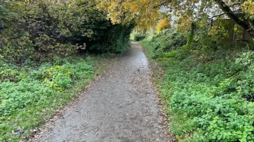
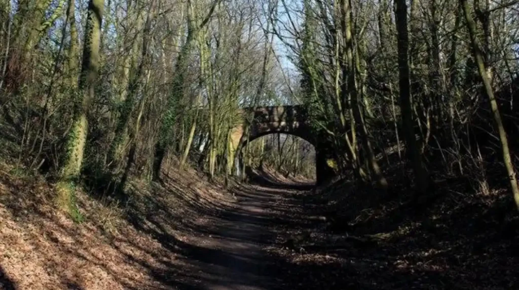
The most useful route for casual explorers is the Linesway, a former railway corridor connecting Garforth with Allerton Bywater. Leeds City Council lists it among the shorter recreational walking routes in the Leeds district and gives the route a length of approximately three miles.
Garforth also contains local green spaces such as The Chase, White House Lane, Hollinhurst Wood, BarleyHill Park and Glebelands Recreation Ground. Leeds City Council identifies these sites within its parks and green-space records.
For visitors, the important point is flexibility. A short walk in Garforth does not require completing a major long-distance trail. The Linesway can be explored as a short out-and-back section, while local green spaces provide opportunities for brief outdoor breaks.
Why is Garforth suitable for short walks?
Garforth suits short walking because it combines residential streets, public footpaths, former railway paths, woodland and open countryside within a compact area. The Linesway provides the clearest straightforward option, while local green spaces support shorter informal outdoor visits.
Garforth sits on the eastern edge of Leeds and has a landscape shaped by agriculture, transport infrastructure and industrial history. This combination creates several walking environments rather than one single type of trail.
The Leeds City Council recreational walking network includes the Linesway as a shorter route. The council describes it as a three-mile disused railway between Garforth and Allerton Bywater.
The former railway alignment is important for casual walkers because its route is more direct than many field-based paths. It also removes much of the road traffic encountered on ordinary town walking.
The surrounding public rights of way create additional connections. Leeds City Council maintains a definitive map and statement for public rights of way, including footpaths, bridleways and byways. The Garforth area has recorded footpath and bridleway infrastructure within this wider network.
This means casual walking can be approached in different ways. A visitor can select a short section of a recognised route rather than treating the entire route as one continuous walk.
Garforth is also practical for visitors travelling without a car. The settlement has railway stations and connections towards Leeds and the surrounding area. This supports walking itineraries that begin or end near public transport rather than requiring a dedicated car journey.
What is the Linesway and why is it good for casual explorers?
The Linesway is a former railway route between Garforth and Allerton Bywater. Leeds City Council records it as about three miles long, while National Cycle Network Route 697 records an open 3.6-mile section with a traffic-free alignment.
The Linesway is the strongest documented choice for a casual walk directly associated with Garforth.
Leeds City Council identifies the Linesway as a three-mile recreational route between Garforth and Allerton Bywater.
The Walk Wheel Cycle Trust provides more detailed route information for the open National Cycle Network section. Route 697 is recorded as 3.6 miles, or 5.8 kilometres, and 100% traffic-free. Its surface is predominantly unsealed firm material, with a smaller asphalt section.
The difference between the council’s approximately three-mile description and the National Cycle Network measurement reflects route-definition differences. Walkers should therefore use the current mapping associated with their chosen access point rather than relying on one mileage figure for every possible outing.
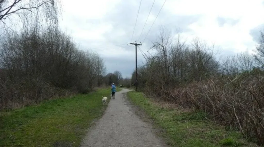
The Linesway follows a disused railway. This creates a relatively linear walking experience through the landscape. The route does not function like a traditional circular park walk. A casual explorer can therefore walk along the path for a chosen distance and return using the same corridor.
The route also connects with wider countryside. The Walk Wheel Cycle Trust describes the longer Garforth-to-Woodlesford route as a 7.8-mile journey through countryside, nature reserves, the River Aire and canal landscape.
Casual explorers do not need to complete that longer route. The value of the Linesway is its ability to support a shorter section while retaining the option of extending the outing.
Where can you take a short walk without committing to a long trail?
Local green spaces provide the simplest option for very short outdoor breaks. Garforth contains designated spaces including The Chase, White House Lane, BarleyHill Park, Glebelands Recreation Ground and Hollinhurst Wood, offering different settings close to the settlement.
Not every walking experience needs to involve a named trail.
Leeds City Council’s parks byelaws schedule identifies several green spaces in Garforth and surrounding areas. The list includes The Chase, White House Lane, BarleyHill Park, Glebelands Recreation Ground and Hollinhurst Wood.
The Chase is particularly small. Garforth’s Neighbourhood Plan identifies it as a 0.13-hectare grassed area at the junction of The Chase and The Grange. The plan describes it as informal amenity space within a housing development.
This makes The Chase more appropriate for a brief local outdoor stop than a destination hike. It demonstrates the difference between a recreational green space and a formal walking route.
White House Lane is also listed by Leeds City Council as local green space. Its importance increases because the wider Leeds Country Way route uses White House Lane near Mount Pleasant Picnic Site.
BarleyHill Park and Glebelands Recreation Ground provide further local outdoor options. Their role is primarily community recreation rather than long-distance walking.
Hollinhurst Wood offers a different landscape. It is identified by Leeds City Council as a woodland area and by Yorkshire Wildlife Trust as part of the wider green-space corridor associated with the Lines Way.
For casual explorers, these sites work best when the objective is fresh air, gentle movement and local landscape rather than distance.
Can you walk only part of the Leeds Country Way from Garforth?
Yes. The Leeds Country Way can be treated as a source of shorter Garforth walking sections rather than a single full-day commitment. The official route includes a 5.5-mile Barwick-in-Elmet-to-Garforth section and another 5.5-mile section towards the River Aire.
The Leeds Country Way is a 62-mile circular walking route around Leeds. Leeds City Council publishes detailed route information and divides the trail into sections.
Two sections are particularly relevant to Garforth.
The Barwick-in-Elmet to Garforth section is approximately 5.5 miles. The official route begins at the Maypole in Barwick-in-Elmet and continues through Carrfield Road, field paths, Scholes and rural tracks before reaching the northern edge of Garforth.
The route then enters Garforth and uses Main Street and Church Lane. It continues towards the cricket ground before following a path behind residential properties and towards school playing fields near Selby Road. The route eventually connects with the old railway line near the A63.
The Garforth to River Aire section is also approximately 5.5 miles. It begins around the A63 and uses the Linesway before continuing through Brecks Lane, White House Lane and countryside towards the River Aire.
These official distances are longer than a typical casual walk. Their value for this article comes from the ability to use individual sections rather than treating the complete Leeds Country Way as the only option.
Walkers should follow signed public rights of way and current route information. Agricultural access points, surfaces and path conditions change over time.
How does Garforth’s history shape its walking landscape?
Garforth’s walking landscape reflects centuries of farming, settlement, coal mining and railway development. Modern paths cross land shaped by these activities, while former railway corridors such as the Linesway preserve visible connections with the industrial history of east Leeds.
Garforth has a long settlement history. Leeds City Council’s Garforth Neighbourhood Plan states that the exact origins of the settlement are unclear, while archaeological evidence indicates earlier activity in the wider area.
The same document records Garforth in the Domesday Survey of 1086. The manor was described as approximately 1.5 miles long and 1.5 miles wide, with a church, priest, four villagers and one smallholder recorded.
Agriculture shaped the surrounding landscape. The area’s Magnesian Limestone supported productive farmland, while traces of medieval ridge-and-furrow cultivation remain visible in some grassed areas.
Industrial development later transformed Garforth. Leeds City Council records mining activity in the area from earlier centuries, with deeper industrial mining developing during the nineteenth century. The population increased from 782 in 1831 to 3,224 in 1899 as employment opportunities expanded.
The railway became another major influence on the settlement. Former railway corridors now provide recreational infrastructure, with the Linesway representing the clearest example.
As you explore the modern walking landscape, you are crossing land shaped by centuries of settlement, farming, mining and transport. Read about the full to understand its origins.
The historical connection is not simply decorative. It explains why walking routes have particular alignments. Railway paths follow former transport corridors, while field paths reflect older agricultural boundaries and settlement connections.
Garforth therefore provides a useful example of how historic infrastructure can acquire a new recreational role.
What can you see along the Linesway?
The Linesway provides access to former railway infrastructure, woodland, grassland and countryside. Its wider corridor connects with nature reserves including Hollinhurst Wood and other Lower Aire Valley sites, creating opportunities for casual landscape and wildlife observation.
The Lines Way is managed within a wider Lower Aire Valley green-space corridor. Yorkshire Wildlife Trust states that the route connects Garforth and Allerton Bywater and provides access to reserves including Letchmire Pastures, Hollinhurst Wood, Owl Wood and Pit Plantation and Townclose Hills.
This ecological setting gives the walk a stronger nature component than its former industrial purpose suggests.
Yorkshire Wildlife Trust records seasonal wildlife interest along the Lines Way. Spring observations include common frog and cuckoo, while summer includes whitethroat and ringlet. Autumn and winter bring species such as long-tailed tit, bullfinch and linnet.
Wildlife observation should remain compatible with the site’s recreational use. Walkers should stay on recognised paths, keep dogs under appropriate control and avoid disturbing animals.
The former railway structure also creates a distinctive landscape. Straight paths, embankments, cuttings and vegetation reflect the corridor’s industrial origins.
The route’s current function is therefore a combination of transport heritage, recreation and habitat connectivity.
For casual explorers, this creates a useful reason to slow down. The walk does not need to be measured only by distance. Landscape structure, seasonal vegetation and wildlife provide additional points of interest.
Is Hollinhurst Wood suitable for a gentle outdoor visit?
Hollinhurst Wood is a useful choice for visitors seeking woodland rather than open railway paths. Leeds City Council lists it as a woodland area, while Yorkshire Wildlife Trust places it within the Lower Aire Valley green-space network linked to the Lines Way.
Hollinhurst Wood provides a different experience from the open alignment of the Linesway.
Leeds City Council’s parks information identifies Hollinhurst Wood as a woodland area within the Garforth and Swillington area.
Yorkshire Wildlife Trust also identifies Hollinhurst Wood among the reserves connected with the Lines Way corridor.
Woodland walking brings different practical conditions. Ground surfaces can become muddy after wet weather, fallen vegetation can affect informal sections, and visibility differs from an open path.
For this reason, casual explorers should distinguish between a short woodland visit and a formal surfaced walking route. The Linesway provides clearer route information and a more linear walking structure. Hollinhurst Wood provides a woodland environment within the same broader recreational landscape.
The two settings can therefore complement one another when planning an outdoor visit.
Visitors should use current signs and recognised paths. Public access rights vary between paths and land types, so walkers should not assume that every visible track is a public right of way.
How accessible are Garforth’s short walks for visitors without a car?
Garforth is well positioned for car-free walking because the settlement has railway connections and routes that begin within the built-up area. The Linesway can be incorporated into a public-transport itinerary, reducing the need for dedicated parking.
Garforth’s transport position is one of its strongest advantages for casual outdoor visitors.
The Garforth Neighbourhood Plan describes the town as having two railway stations and strong connections to Leeds and surrounding destinations. It also records proximity to the A1, M1 and M62.
The Walk Wheel Cycle Trust specifically describes the Linesway as beginning from Garforth and provides route information linked with Garforth station.
This creates a practical itinerary for visitors. A person can travel into Garforth, walk a selected section of the Linesway and return using the same route or connect with another transport option.
Car-free walking also reduces the need to identify a suitable rural parking location.
Parking should not take place on verges, private land, entrances or locations that obstruct residents, agricultural vehicles or emergency access. Visitors should use designated parking where available and follow local restrictions.
The public-transport advantage also makes Garforth useful for domestic business travellers with limited free time. A short walk can be fitted around an existing visit to Leeds without requiring a separate full-day excursion.
What should casual walkers know about surfaces and route conditions?
Casual walkers should check current route information, weather and surface conditions before leaving. The Linesway contains unsealed firm surfaces, while rural paths and woodland sections can become muddy. Footwear should match the expected ground conditions.
Walking conditions in Garforth vary according to route type.
The Walk Wheel Cycle Trust records the open Route 697 section as 80.9% unsealed firm surface and 19.1% asphalt.
This means the Linesway is not equivalent to a fully paved urban promenade.
Dry conditions provide firmer walking surfaces. Wet weather changes the experience, particularly where unsealed surfaces become muddy.
The Leeds Country Way introduces further variation. Its official Garforth sections include dirt tracks, field paths, pavements, farm tracks and road-side sections.
Casual explorers should therefore select footwear based on the route rather than assuming that every Garforth walk has the same surface.
A weather check is also important. Rain can affect field paths, while winter conditions reduce daylight and visibility.
Navigation is another consideration. The Linesway has a relatively simple linear structure, but countryside connections require more attention to signs, path junctions and route maps.
Walkers should keep a charged mobile phone and use a current mapping service or official route information. Public rights of way can be altered by legal orders, maintenance or land-management requirements.
Leeds City Council maintains information on its definitive map and public path orders. This is the appropriate source for checking the legal status of public rights of way.
Which Garforth walk is best for a very short outdoor break?
For the shortest outdoor break, a local green space is the simplest choice. For a more structured walk, use a short out-and-back section of the Linesway. For countryside scenery, select a suitable section connected to the Leeds Country Way.
The best option depends on the time available.
A visitor with only a few minutes can use a local green space such as The Chase. Its 0.13-hectare size makes it an example of a small amenity space rather than a long walking destination.
A visitor with more time can use the Linesway. Its former railway alignment provides a straightforward route where the walking distance can be controlled by turning around at a chosen point.
A visitor seeking countryside can use part of the Leeds Country Way. The official Garforth sections demonstrate direct connections between the settlement, field paths, rural lanes and the River Aire corridor.
This makes route selection more important than finding one universally “best” walk.
Casual walking is defined by manageable commitment. The route should match the available time, physical ability, weather and preferred landscape.
The Linesway is particularly useful because it supports a gradual increase in distance. A short section can become a longer outing without requiring a completely different destination.
How can you combine a Garforth walk with local history?
A Garforth walking itinerary can combine outdoor activity with local history by following the relationship between settlement, agriculture, mining and railway infrastructure. Main Street, Church Lane and the Linesway provide useful contexts for understanding Garforth’s development.
Garforth’s heritage is distributed across its landscape rather than concentrated in one attraction.
The settlement’s documented history extends to the Domesday Survey. Later agricultural development, enclosure, mining, housing growth and railway construction changed the physical environment.
A short walk therefore provides an opportunity to observe how different periods overlap.
Main Street and Church Lane form part of the Leeds Country Way’s documented route through Garforth. The official description uses these streets before continuing towards paths behind residential properties and the old railway line.
The Linesway then provides a direct connection with the area’s railway history.
This historical context is especially relevant because Garforth’s industrial expansion was closely linked with transport. Mining increased employment, while railway and road connections strengthened the settlement’s links with Leeds and surrounding areas.
Leeds Libraries also maintains extensive local-history collections covering maps, photographs, newspapers, parish records and other historical material. A Garforth local-history workshop is scheduled at Garforth Community Hub and Library as part of the Leeds400 programme in September 2026.
Walking and local-history research therefore work together. The landscape provides the physical setting, while archives provide documentary evidence.
Explore More Area Guide
Garforth Best Places to Read and Relax in Leeds 2026
Garforth Independent Businesses & Local Experiences Guide 2026
Why are short walks useful for casual explorers?
Short walks provide accessible outdoor activity without requiring a full hiking commitment. Garforth offers particularly strong conditions because the Linesway, local green spaces and countryside rights of way allow visitors to control distance, terrain and walking time.
Short walking supports flexible travel planning.
A visitor does not need specialist hiking equipment for every Garforth outing. A brief local walk can fit between meals, shopping, business appointments or visits elsewhere in Leeds.
The Linesway provides the clearest structured option. Local green spaces provide shorter alternatives, while the Leeds Country Way supplies longer countryside connections.
The variety also supports repeat visits. A visitor can explore the railway corridor on one occasion and investigate a woodland or local green space during another visit.
Garforth’s location makes this particularly useful. Its transport connections provide access from Leeds and the surrounding region, while its countryside setting creates a clear change from the urban environment.
The wider green infrastructure also has ecological value. Yorkshire Wildlife Trust describes the Lines Way as part of a Lower Aire Valley corridor containing connected nature reserves and habitats.
The result is a walking environment that combines recreation, transport heritage, local history and nature.
What is the best short-walk strategy for a first visit to Garforth?
Start with the Linesway for a straightforward route, choose a local green space when time is limited, and use the Leeds Country Way when countryside distance is the priority. Always check current access, weather and surface conditions first.
For a first visit, the Linesway provides the clearest introduction to Garforth’s walking landscape.
Its former railway alignment creates a direct connection between the town and surrounding countryside. The official Leeds walking network recognises it as a shorter recreational route, while National Cycle Network information provides detailed distance and surface data.
A short out-and-back walk keeps the distance under control.
For visitors with minimal time, a local green space provides an even shorter option. The Chase is a documented example of a small Garforth amenity space.
For visitors with more time, the Leeds Country Way creates access to rural paths towards Barwick-in-Elmet, Scholes and the River Aire. The official route descriptions provide distances and navigation details for the Garforth sections.
The key principle is simple: choose the route according to time and ability rather than selecting a long-distance trail by name alone.
Garforth’s strength is its flexibility. The area provides a short railway walk, small local green spaces, woodland access and connections to a major Leeds walking route.
For casual explorers, that combination makes Garforth a practical destination for manageable outdoor activity while retaining strong links to the history and landscape of east Leeds.
What are the best short walks in Garforth?
The Linesway is one of the best options for a manageable walk in Garforth. It follows a former railway corridor towards Allerton Bywater and allows casual explorers to choose their own walking distance.