Garforth is a major settlement in east Leeds with a town centre, established residential areas, newer housing estates, green spaces, railway connections and routes into the surrounding countryside. Exploring it by neighbourhood gives visitors a clearer understanding of how the settlement developed and where different local experiences are concentrated.
- What are the main neighbourhoods in Garforth?
- Where should visitors begin when exploring Garforth?
- What is Central Garforth like to explore?
- What can visitors see in Church Garforth?
- How is West Garforth different from the central area?
- What makes Long Meadows and the Wimpey Estates distinctive?
- What should visitors know about East Garforth?
- Where can visitors find green spaces around Garforth?
- How can visitors explore Garforth on foot or by bicycle?
- How does Garforth’s railway network help visitors explore the neighbourhoods?
- What role does local planning play in Garforth’s neighbourhood identity?
- How should visitors plan a neighbourhood-focused Garforth visit?
The Garforth Neighbourhood Plan identifies seven character areas: West Garforth, Church Garforth, Long Meadows and Wimpey Estates, East Garforth, Lotherton Industrial Estate, Oak Estate and Crescent-Oval Estate, and Central Garforth. These areas reflect differences in housing, streetscapes, green spaces, employment land and local facilities.
Garforth also has an adopted Neighbourhood Plan. Leeds City Council records the plan as approved on 1 September 2023, giving its planning policies a formal role in decisions affecting the area.
For visitors, the neighbourhood structure provides a practical way to explore Garforth beyond the main shopping streets. It also connects transport, heritage, local businesses, residential areas, parks and walking routes into one geographical picture.
What are the main neighbourhoods in Garforth?
Garforth contains seven identified character areas: West Garforth, Church Garforth, Long Meadows and Wimpey Estates, East Garforth, Lotherton Industrial Estate, Oak Estate and Crescent-Oval Estate, and Central Garforth. Each area has distinct built and environmental characteristics.
These character areas come from the Garforth Neighbourhood Plan rather than representing separate towns or administrative districts. The distinction is useful because Garforth contains housing estates and built-up areas from different periods, alongside the town centre and employment areas.
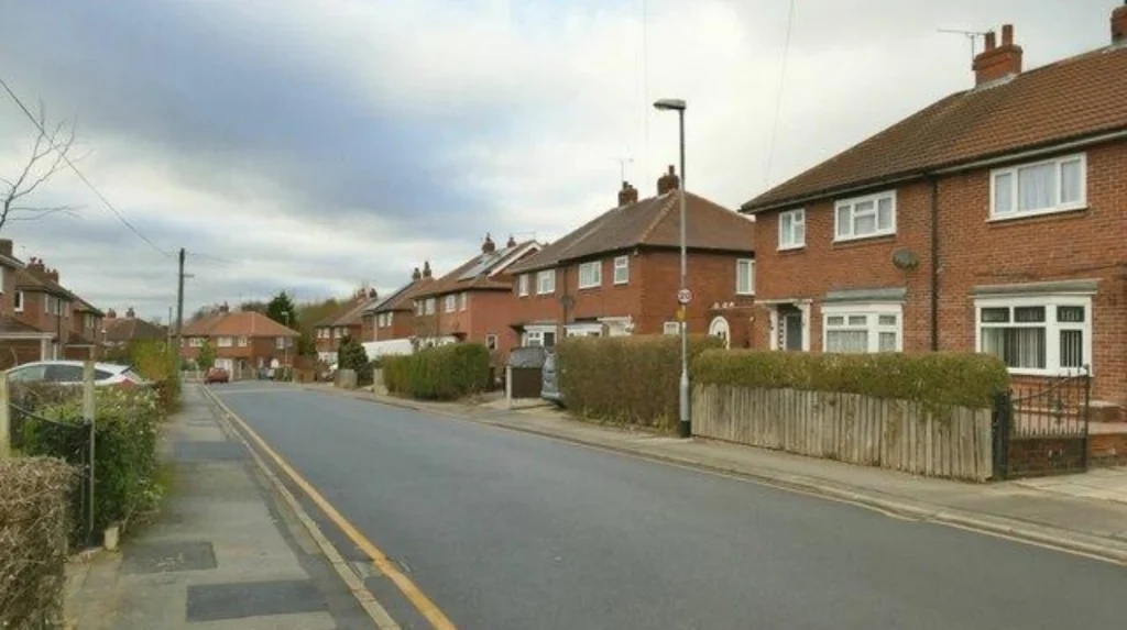
West Garforth is predominantly residential. The character assessment identifies red-brick properties, walled or hedged front gardens and informal pockets of open space as important features.
Church Garforth includes established residential development around Church Lane, Lidgett Lane, Selby Road and Ninelands Lane. The character assessment identifies red-brick properties, tiled roofs, hedges and street trees as notable features.
Long Meadows and Wimpey Estates represent another residential character, with planned housing and open spaces. The Lines Way is an important green connection through this part of Garforth.
East Garforth has a strong connection with the railway station and residential development. It provides an important eastern gateway for visitors arriving by train.
Lotherton Industrial Estate has a different function because it is primarily associated with employment and industrial activity rather than residential streets.
Oak Estate and Crescent-Oval Estate contain residential development with their own architectural and street layouts.
Central Garforth is the most important area for understanding the settlement’s town-centre function. It connects shopping, services, community facilities and transport routes.
Visitors do not need to treat these boundaries as tourist districts. Instead, they provide a framework for understanding why different parts of Garforth look and function differently.
Where should visitors begin when exploring Garforth?
Central Garforth and the town centre provide the strongest starting point because they bring together shops, services, food businesses, community facilities and connections towards residential neighbourhoods and railway stations. Starting centrally makes it easier to explore surrounding areas on foot.
Garforth is identified as a Major Settlement in the Leeds Core Strategy settlement hierarchy. Its town centre supports services for residents and surrounding communities. Leeds planning policy also places importance on locating shops, services, community facilities and other town-centre functions in accessible locations.
The town centre is therefore more than a shopping location. It is a geographical reference point for understanding the wider settlement.
A visitor beginning in Central Garforth can move towards Church Garforth, West Garforth or East Garforth depending on the purpose of the visit. This approach also helps visitors distinguish between Garforth’s historic core, later residential development and newer suburban areas.
The central area is particularly useful for a short visit because it provides access to everyday services without requiring a long journey across the wider neighbourhood.
Garforth’s town-centre planning framework recognises primary and secondary shopping frontages. The purpose is to maintain a reasonably compact centre where retail and related services remain concentrated.
This compact structure supports a simple walking strategy. Visitors can first explore the central streets, then continue towards nearby residential areas and green spaces.
The town centre also provides a useful reference when using local buses or travelling between the two railway stations. Garforth railway station lies on Station Road, while East Garforth station is on Woodlands Drive.
What is Central Garforth like to explore?
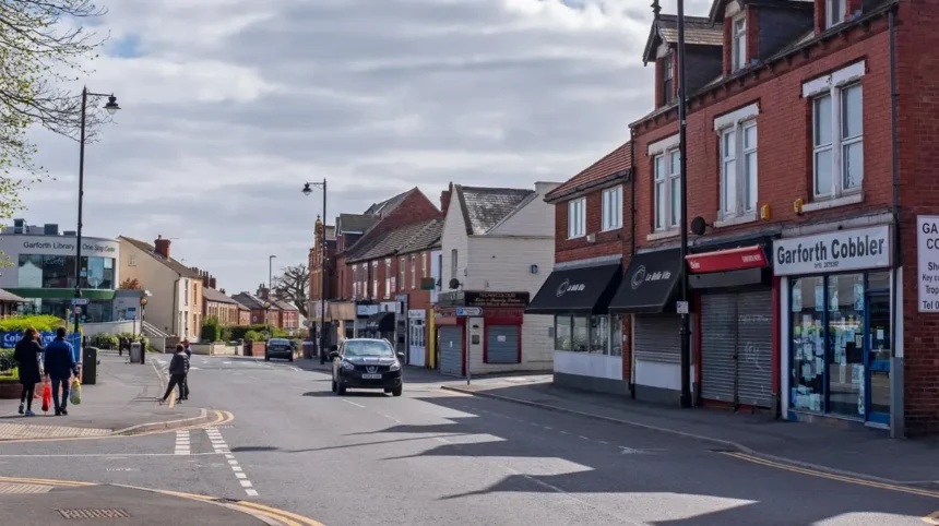
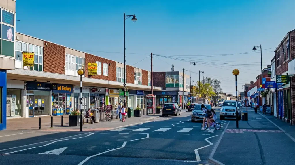
Central Garforth is the settlement’s main service and commercial area, with the town centre forming a compact focus for shopping, food, professional services and community activity. It is the most practical neighbourhood for visitors seeking everyday amenities close together.
Central Garforth provides the clearest view of the settlement’s contemporary role. It functions as a local centre rather than a conventional city-centre district.
The town-centre area contains the types of uses expected within a major settlement. Leeds planning policy identifies shops, supermarkets, restaurants, cafés, drinking establishments, leisure facilities, healthcare, offices and community facilities among appropriate town-centre uses.
This makes Central Garforth particularly relevant to visitors who want a low-pressure local visit rather than a sightseeing itinerary based entirely on major attractions.
The area also works as a transition zone. Streets leading away from the centre become increasingly residential, allowing visitors to see how the commercial core connects with established housing.
The compact nature of the centre means visitors can combine several activities without covering the full settlement. A café stop, local shopping, short walk and onward journey can all fit within one central visit.
For digital nomads and business travellers, the centre is also the logical area to investigate first for cafés, food outlets and everyday services. Specific opening hours and facilities should always be checked before travelling because individual businesses change over time.
Central Garforth is also where the settlement’s modern identity is most visible. The Neighbourhood Plan treats the town centre as an important contributor to local character and community identity.
What can visitors see in Church Garforth?
Church Garforth is an established residential character area associated with Church Lane, Lidgett Lane, Selby Road and Ninelands Lane. Its streets contain red-brick housing, tiled roofs, hedged boundaries and established green elements identified in the local character assessment.
Church Garforth is best explored as a residential neighbourhood rather than a conventional tourist attraction. Its value comes from understanding Garforth’s built environment.
The character assessment identifies several features that distinguish the area. Red-brick properties and tiled roofs are prominent around the Grange Estate. Natural hedged boundaries appear along Lidgett Lane, Selby Road and Ninelands Lane.
Street trees are also identified along Main Street and Lidgett Lane. These features demonstrate how planting, front boundaries and building materials contribute to neighbourhood identity.
Church Lane provides another important geographical reference. Visitors can use the area to understand how Garforth’s residential districts connect with its central streets and wider road network.
The neighbourhood also provides a useful transition between built-up Garforth and surrounding open areas. Visitors interested in architecture and urban form can observe changes in housing layout, road width, garden boundaries and green space.
As you explore the modern neighbourhood, you are crossing land with a deep heritage. Read about the full to understand its origins.
The historical connection is important because Garforth is recorded in the Domesday Book, although much of its earlier physical character has been replaced by later development. The Garforth Neighbourhood Forum notes that relatively little of the settlement’s early history remains visibly intact.
How is West Garforth different from the central area?
West Garforth is predominantly residential, with red-brick homes, front gardens, hedges and informal green spaces forming important parts of its character. It provides a quieter contrast to Central Garforth’s commercial streets and services.
West Garforth illustrates the suburban expansion that shaped much of modern Garforth. The neighbourhood assessment identifies red-brick properties as a dominant feature, alongside walled or hedged front gardens.
The area’s informal open spaces are also important. They provide small-scale green breaks within the residential environment and contribute to the visual structure of the neighbourhood.
For visitors, West Garforth is most useful for a local walking route rather than a concentrated sightseeing stop. The streets demonstrate how residential development expanded away from the town centre.
The neighbourhood also illustrates the relationship between housing design and local planning. Garforth’s adopted planning framework places emphasis on respecting existing character when considering development within identified character areas.
This matters when exploring the settlement because newer buildings do not simply appear in isolation. Their design, materials, spacing and relationship with streets contribute to the wider character of the neighbourhood.
West Garforth therefore suits visitors interested in everyday residential architecture, local planning and the physical development of Leeds communities.
What makes Long Meadows and the Wimpey Estates distinctive?
Long Meadows and the Wimpey Estates form a planned residential character area where housing, open spaces and the Lines Way contribute to the neighbourhood’s identity. The area demonstrates the planned suburban expansion that helped create modern Garforth.
This area is important because Garforth’s neighbourhood identity is not based solely on its older streets. Much of the settlement consists of post-war and later residential development.
The local character assessment identifies red brick and tiled roofs as important visual elements. It also identifies the retention of the Lines Way as a key consideration.
The Lines Way gives this residential area a direct relationship with Garforth’s wider green infrastructure. Visitors can use the route as a way of moving from the built-up settlement towards countryside and neighbouring communities.
The route from Garforth to Woodlesford is part of the National Cycle Network. Walk Wheel Cycle Trust records the route as 7.8 miles or 12.6 kilometres, with 96.1% traffic-free sections.
This makes the area particularly relevant to walkers and cyclists. It also provides an alternative to exploring Garforth entirely by road.
The neighbourhood’s planned structure is visible in the relationship between houses, roads, open spaces and pedestrian connections. This gives visitors a practical example of how suburban neighbourhoods operate as connected systems rather than isolated streets.
What should visitors know about East Garforth?
East Garforth is a residential area with a major transport connection through East Garforth railway station. The neighbourhood provides access to local recreation areas and links towards eastern parts of Garforth and the wider countryside.
East Garforth is particularly convenient for visitors arriving by rail. National Rail lists East Garforth station at Woodlands Drive, with step-free access to both platforms through ramps. The station is managed by Northern.
The station has sheltered waiting facilities and bicycle storage, but it does not have station parking. It is therefore more suited to visitors arriving by train, walking or cycling than visitors relying on station car parking.
East Garforth also contains residential areas and recreation spaces. Leeds City Council’s parks information identifies East Garforth Recreation Ground and East Garforth Field among local sites.
This combination makes East Garforth useful for visitors who want to combine transport convenience with a local neighbourhood walk.
The railway station also changes how the area functions geographically. Instead of treating East Garforth as a remote edge of the settlement, visitors can regard it as one of the main arrival points into Garforth.
Where can visitors find green spaces around Garforth?
Garforth has a network of parks, recreation grounds, woodland, local green spaces and countryside connections. Important examples include Barleyhill Park, East Garforth Recreation Ground, Glebelands Recreation Ground, Hollinhurst Wood and the Lines Way.
Green space is a major part of understanding Garforth’s neighbourhood structure. Leeds City Council lists multiple green and recreational sites across the Garforth and Swillington area.
Barleyhill Park is classified as a community park. Hollinhurst Wood is identified as woodland. Glebelands Recreation Ground and East Garforth Recreation Ground provide recreation space. Other local green spaces include sites around Brierlands Lane, Firthfield, Glencoe Estate, Goosefields and Longmeadows.
These sites serve different purposes. A recreation ground provides space for active use, while woodland and local green spaces contribute to walking, biodiversity and neighbourhood character.
The Garforth Neighbourhood Plan also identifies green corridors, local green spaces, public rights of way and biodiversity networks as important planning considerations. Its map framework specifically includes the Lines Way and public rights-of-way network.
For visitors, this means a neighbourhood exploration does not need to remain on commercial streets. Green spaces provide natural extensions to residential walks.
How can visitors explore Garforth on foot or by bicycle?
Walking works best when visitors combine the central area with one nearby residential character area, while cycling provides access to longer green routes such as the Lines Way. Garforth railway stations provide useful starting points for both local and longer journeys.
A walking itinerary should focus on geographical continuity. Starting in Central Garforth and moving towards Church Garforth creates a straightforward transition between commercial and residential environments.
A second option is to start around Garforth railway station and explore nearby streets before continuing towards the town centre.
Cyclists have a longer-distance option through the Lines Way. The Garforth-to-Woodlesford route covers 12.6 kilometres and is predominantly traffic-free. It passes countryside, a nature reserve, an RSPB site, a river and the canal before reaching Woodlesford station.
This route gives Garforth a strong connection with the wider green infrastructure of east Leeds.
The National Cycle Network route also means visitors do not need to restrict cycling to residential streets. The route provides a defined corridor through which visitors can move between urban and rural environments.
Accessibility should still be considered before starting a route. Surface conditions vary, and the Lines Way includes both asphalt and unsealed firm surfaces. Walk Wheel Cycle Trust records the route as 71.2% unsealed firm, 28.0% asphalt and 0.8% unsealed loose.
How does Garforth’s railway network help visitors explore the neighbourhoods?
Garforth has two railway stations, Garforth and East Garforth, which provide different arrival points for exploring the settlement. Garforth station has lifts and parking, while East Garforth provides ramped platform access and bicycle storage.
Garforth station is located on Station Road and is managed by Northern. National Rail records 250 parking spaces, including 15 accessible spaces, together with lifts connecting the platforms.
East Garforth station is located on Woodlands Drive. It has step-free access through long or steep ramps and bicycle storage, but no station parking.
The differences between the stations are useful when planning a neighbourhood visit.
Visitors who want a central arrival point can use Garforth station and continue towards Central Garforth. Those interested in East Garforth and the eastern residential areas can use East Garforth station.
The two stations also demonstrate how railway infrastructure has influenced Garforth’s modern geography. Rail provides connections beyond the settlement while also creating local arrival points within it.
Before travelling, visitors should check current train times, engineering works and accessibility information through the relevant rail operator or National Rail because services and facilities can change.
Explore More Area Guide
Best Garforth Afternoon Tea Places in Leeds
Garforth Guide: Plan a Low-Stress Visit in Leeds
What role does local planning play in Garforth’s neighbourhood identity?
Local planning protects and manages Garforth’s distinctive character by identifying character areas, green spaces, heritage assets, town-centre functions and development principles. The adopted Garforth Neighbourhood Plan provides the formal planning framework for these local priorities.
Neighbourhood planning gives communities a formal mechanism for influencing development. Leeds City Council states that a made neighbourhood plan becomes part of the statutory development plan and is considered when planning applications are assessed.
Garforth’s plan includes policies covering housing, heritage, employment, transport, green infrastructure, community facilities and town-centre development.
The character-area approach is particularly relevant to visitors because it explains why different neighbourhoods have different physical identities.
The plan identifies seven character areas and uses a character assessment to guide development within them. The examiner’s report required changes to the wording of the relevant policy, but retained the principle that development should have regard to the Garforth Character Assessment.
Garforth’s heritage framework is also significant. The neighbourhood plan documentation states that the settlement has eight designated heritage assets, all Grade II listed structures, while also identifying additional non-designated heritage assets.
At the same time, Garforth has no formal conservation area designation within the town according to the neighbourhood plan’s heritage assessment.
This distinction is important. A conservation area protects the character and appearance of a whole designated area, while listed-building protection applies to individual designated structures. Leeds City Council currently lists 80 conservation areas across the wider Leeds district, but Garforth is not identified among them.
How should visitors plan a neighbourhood-focused Garforth visit?
A neighbourhood-focused Garforth visit works best when it combines the town centre, one residential character area, a green space and a transport connection. Visitors can then understand Garforth as a connected settlement rather than a collection of unrelated streets.
A practical short visit can begin in Central Garforth. The town centre provides access to everyday services and establishes the geographical centre of the settlement.
From there, visitors can continue towards Church Garforth to examine established residential streets, hedged boundaries, red-brick buildings and street trees.
A longer walk can extend towards West Garforth, where the residential environment provides a different example of suburban development and informal green space.
Visitors interested in newer residential patterns can explore the Long Meadows and Wimpey Estates character area. The Lines Way then provides a direct route into the wider green network.
Rail travellers have another option. Garforth station is suited to arrivals requiring station parking and lift access, while East Garforth provides access to the eastern side of the settlement and has ramped access and cycle storage.
Cyclists and walkers seeking a longer outing can follow the Lines Way towards Woodlesford. The route’s traffic-free character and connection with countryside, waterways and nature sites make it the strongest option for extending a Garforth neighbourhood visit beyond the built-up area.
The most important point is to match the neighbourhood with the purpose of the visit. Central Garforth is strongest for services and local commerce. Church and West Garforth suit built-environment exploration. East Garforth works well for rail-based visits. Long Meadows and the Wimpey Estates connect residential development with the Lines Way. The surrounding green spaces provide opportunities for walking, recreation and nature observation.
Garforth’s seven character areas therefore provide a useful framework for understanding the settlement. They show how housing estates, the town centre, employment land, railway infrastructure, green spaces and historic assets operate together within one part of east Leeds.
For tourists, this approach reveals a side of Leeds that is different from the city centre. For residents, it provides a structured way to revisit familiar streets. For digital nomads and business travellers, it identifies where central services and transport connections fit into the wider settlement. For walkers and cyclists, it connects Garforth’s neighbourhoods with the surrounding countryside.
Garforth is best understood geographically. Its neighbourhoods explain the settlement’s present structure, while its planning framework protects important elements of that structure for future development. The result is a local destination where town-centre services, residential streets, railway connections and green corridors can all form part of one coherent visit.
What are the main neighbourhoods in Garforth?
Garforth has seven identified character areas: West Garforth, Church Garforth, Long Meadows and Wimpey Estates, East Garforth, Lotherton Industrial Estate, Oak Estate and Crescent-Oval Estate, and Central Garforth.