Garforth is a former mining settlement in east Leeds with direct access to countryside, public rights of way, former railway corridors, woodland, farmland and routes towards the River Aire. Its walking network combines short local paths with longer regional trails, giving outdoor explorers several ways to experience the landscape.
- What makes Garforth suitable for walking and outdoor exploration?
- Which Garforth walking route is best for a longer countryside walk?
- How can walkers explore the Linesway from Garforth?
- What longer walk can connect Garforth with the River Aire?
- What historic features can walkers see around Garforth?
- How does Garforth’s mining history influence today’s walking routes?
- Which shorter walking opportunities are available around Garforth?
- What should walkers know about public rights of way in Garforth?
- How should visitors prepare for Garforth walking routes?
- How can outdoor explorers extend a Garforth walk beyond the Linesway?
- Why is Garforth important within Leeds’s wider green infrastructure?
- What is the best way to choose a Garforth walking route?
- How can Garforth walking routes support future outdoor recreation?
Leeds City Council records 859 kilometres of public rights of way across the Leeds district, comprising 650 kilometres of footpaths, 199 kilometres of bridleways and 11 kilometres of byways. These routes connect urban neighbourhoods with rural landscapes and provide the legal framework for many walks around Garforth.
Garforth has particular importance within this network because the settlement sits close to the Leeds Country Way and the Linesway. The Leeds Country Way is a 62-mile circular route around Leeds, while the Linesway is a three-mile route along a former railway between Garforth and Allerton Bywater.
The surrounding landscape also reflects Garforth’s industrial history. Coal extraction shaped local roads, railways and settlement patterns for centuries. Today, several walking corridors follow former industrial infrastructure, while fields, woods and waterways provide a contrasting rural environment.
What makes Garforth suitable for walking and outdoor exploration?
Garforth combines village streets, public footpaths, former railway corridors, farmland, woodland and countryside connections. Walkers can choose short local outings or longer routes towards Allerton Bywater, Barwick-in-Elmet, the River Aire and wider Leeds walking networks.
The main strength of walking in Garforth is route variety. The area does not depend on one formal circular trail. Instead, a network of public rights of way provides connections between residential streets, agricultural land, former railway infrastructure and neighbouring settlements.
Leeds City Council identifies the Linesway as one of its shorter recreational routes. The route follows a three-mile disused railway between Garforth and Allerton Bywater. It forms part of a wider walking and cycling network and also connects with longer routes.
The Leeds Country Way provides another important option. Its Barwick-in-Elmet to Garforth section measures about 5.5 miles, while the following Garforth to River Aire section also measures about 5.5 miles. These sections create a practical way to experience Garforth within a longer rural walk.
The landscape changes noticeably around the settlement. Built-up areas give way to fields, hedgerows, wooded sections and former railway corridors. This variation gives outdoor explorers different walking environments without requiring a journey deep into the Yorkshire countryside.
Which Garforth walking route is best for a longer countryside walk?
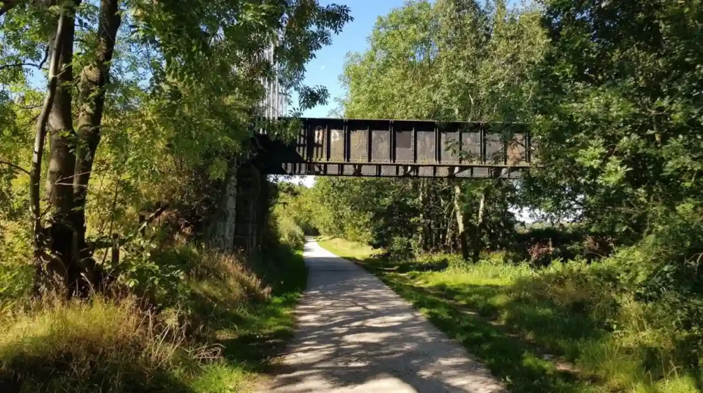
The Leeds Country Way provides the strongest long-distance option around Garforth, with its route passing through Barwick-in-Elmet, Garforth, the Linesway corridor and countryside towards the River Aire. Its documented sections provide clear distances for planning substantial walks.
The Leeds Country Way is a 62-mile circular footpath around Leeds. Leeds City Council divides the route into four main stages of roughly 15 miles, with shorter sections of approximately five miles. This structure allows walkers to complete manageable sections rather than the entire circuit.
The Barwick-in-Elmet to Garforth section is especially relevant to outdoor explorers entering Garforth from the north-east. The route starts at the Maypole in Barwick-in-Elmet and continues through rural tracks towards Scholes before approaching the northern edge of Garforth.
The official route then enters Garforth along Main Street before continuing towards Church Lane. It passes near the cricket ground and uses a path behind residential properties before reaching school playing fields near Selby Road. From there, the route connects with the old railway line leading towards the A63.
The next section runs from Garforth towards the River Aire. It begins from the A63 area and uses the old railway line now known as the Linesway. Walkers then continue towards Brecks Lane, White House Lane, Mount Pleasant Picnic Site and countryside around Methley.
These sections demonstrate why Garforth works well as a base for longer walking. A visitor can combine a village-based starting point with established rural paths and transport connections without committing to the complete Leeds Country Way.
How can walkers explore the Linesway from Garforth?
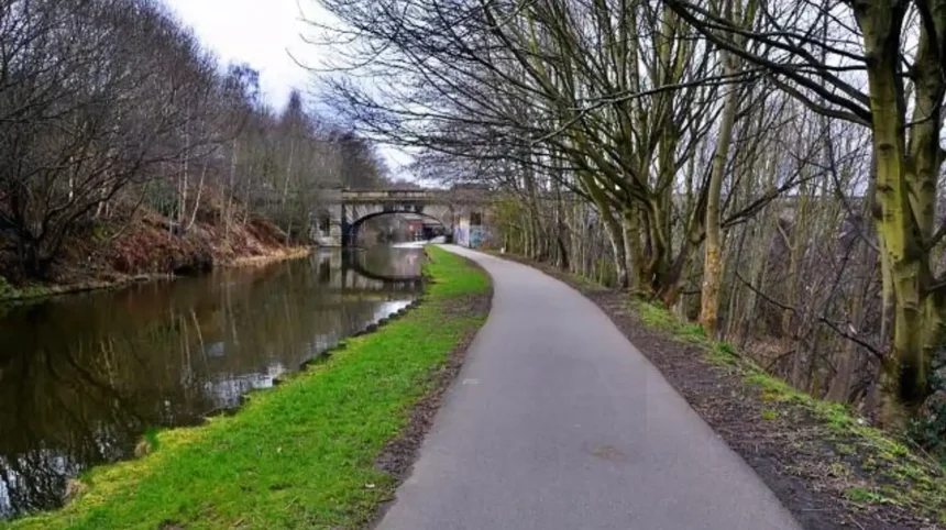
The Linesway follows a former railway corridor between Garforth and Allerton Bywater. Its firm, mostly traffic-free surface provides a straightforward walking environment and connects with wider paths towards the River Aire, St Aidan’s and other countryside destinations.
The Linesway is one of the most distinctive walking routes associated with Garforth. Leeds City Council describes it as a three-mile disused railway route between Garforth and Allerton Bywater. It is suitable for walking and forms part of the area’s wider recreational network.
The Walk Wheel Cycle Trust records the open section as National Cycle Network Route 697. Its published route information gives the section a distance of 3.6 miles, or 5.8 kilometres, and identifies it as 100% traffic-free. The surface is recorded as a combination of asphalt and unsealed firm material.
The route’s former railway character explains its relatively direct alignment. Instead of following the irregular pattern of field boundaries, a railway corridor creates a linear route through the landscape.
The Linesway also has historical significance. It developed from railway infrastructure associated with the coal industry. Former railway routes are particularly valuable for recreation because their gradients and alignments were originally designed for rail transport.
Walkers should still check the current condition before setting out. Path surfaces change with weather, maintenance and land management. The Walk Wheel Cycle Trust specifically notes that outdoor routes can change and that weather conditions affect surfaces.
The Linesway is therefore useful for walkers seeking a relatively straightforward route while retaining opportunities to extend the outing into neighbouring countryside.
What longer walk can connect Garforth with the River Aire?
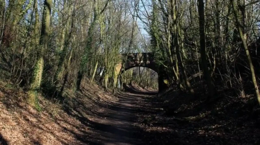
A documented Leeds Country Way section links Garforth with countryside towards the River Aire. The route uses the Linesway, Brecks Lane, White House Lane, Methley-area paths and rural tracks before continuing through fields and woodland.
The Garforth-to-River-Aire section of the Leeds Country Way is approximately 5.5 miles. The official route starts near the A63 and follows the Linesway for more than half a mile before turning towards Brecks Lane.
The route then uses a mixture of lanes, farm tracks, hedged paths and field-edge sections. Mount Pleasant Picnic Site provides a recognised stopping point along the route. The walk continues towards Watergate and Scholey Hill before entering further rural paths.
The route around Moss Carr Wood adds woodland and field-edge scenery. Walkers then continue towards Pennington Lane, Sanderson Lane and Dungeon Lane before reaching paths around Swithen’s Farm and eventually continuing towards Carlton.
This route demonstrates the geographical relationship between Garforth and the River Aire corridor. The walk does not simply remain within the built-up settlement. It uses a sequence of landscape types to move from an urban edge into open countryside.
The route also requires attention at road crossings. The official instructions identify roads including the A642 and other lanes where walkers must cross carefully. These crossings form an important part of route planning and should not be treated as incidental details.
For experienced walkers, the section provides a stronger countryside challenge than a short local stroll. It requires more navigation, greater time commitment and preparation for variable surfaces.
What historic features can walkers see around Garforth?
Garforth’s walking landscape reflects medieval settlement, nineteenth-century church development and centuries of coal mining. Church Lane, St Mary’s Church, former railway corridors and mining landscapes provide physical connections between the modern settlement and its historical development.
Garforth was recorded in the Domesday Survey of 1086. Archaeological research identifies three historic settlement areas shown on nineteenth-century mapping: West Garforth, Moor Garforth and Church Garforth. The historic core of Church Garforth centred on what is now Church Lane.
St Mary’s Church provides one of the most visible historic landmarks. The present building was constructed in 1845, with its foundation stone laid in July 1844. Earlier ecclesiastical buildings occupied the site, including evidence associated with an Early English church dating from around 1200.
The church’s tower reaches approximately 120 feet and forms a prominent landmark within the local landscape. Its position within Church Garforth also demonstrates the historical importance of the settlement around the church.
Mining history is equally important. Local historical records identify coal working in the area as far back as 1262. By the fourteenth century, shallow bell-pit workings were in use. The Gascoigne family later became strongly associated with local mining operations.
The industrial period changed the area’s transport infrastructure. Railways and colliery routes developed partly in response to coal extraction and distribution. Some former railway corridors now provide walking and cycling routes.
As you explore the modern footpaths, you are crossing land shaped by this industrial and rural history. Read about the full to understand its origins.
How does Garforth’s mining history influence today’s walking routes?
Garforth’s coal-mining history directly influenced several transport corridors now used for recreation. Former railway lines and colliery routes created linear pathways through the landscape, while restored industrial land contributes to today’s network of countryside and wildlife spaces.
Coal extraction was established in the Garforth area long before modern industrialisation. Local historical records place documented coal leasing in 1262, followed by shallow workings and later bell pits. Large-scale mining developed over subsequent centuries.
The Aire and Calder Canal opened in 1700 and helped strengthen regional coal transportation. Railways later became increasingly important. The industrial landscape therefore created infrastructure that continued to influence movement through the district after mining declined.
Garforth’s mining era eventually ended as collieries closed during the twentieth century. Historical records state that Garforth Collieries faced financial difficulties after the General Strike of 1926 and that Barnbow and Trench pits closed in 1930. Open-cast working continued in parts of the surrounding area into the twentieth century.
The transformation from industrial land to recreational landscape is visible along the Linesway. The former railway now supports walking and cycling, demonstrating how transport infrastructure can acquire a second function after industrial use ends.
For outdoor explorers, this history changes the interpretation of the route. A former railway is not simply a convenient path. It is evidence of the economic system that previously connected Garforth’s coalfield with wider markets.
Which shorter walking opportunities are available around Garforth?
Shorter Garforth walks include sections of the Linesway, local public footpaths, village-edge paths and connections through recognised green spaces. These options suit visitors seeking shorter outdoor breaks without committing to a full long-distance route.
Garforth contains several local green spaces recorded by Leeds City Council. These include BarleyHill Park, The Chase, White House Lane, East Garforth Recreation Ground, Glebelands Recreation Ground, Hollinhurst Wood and other designated green spaces.
These spaces have different functions. Recreation grounds provide local open space, woodland areas provide tree-covered environments and public rights of way connect separate areas through the wider landscape.
Short walks can also be created by using only part of a longer official route. The Leeds Country Way is specifically structured into shorter sections, allowing walkers to approach the trail as a series of manageable outings.
The Linesway is another practical option because its linear form makes distance easier to control. A walker can travel part of the corridor and return rather than completing a longer point-to-point route.
Visitors should distinguish between public rights of way and informal paths. Leeds City Council states that only routes recorded on the definitive map and statement are proven public rights of way. Walkers should therefore remain on the legal line of a recorded route when using public rights of way.
What should walkers know about public rights of way in Garforth?
Public rights of way give walkers legal passage along recorded routes, but users must follow the definitive line of the path. Footpaths are primarily for walking, while bridleways also support horse riding and cycling under defined access rights.
Leeds has an extensive public rights-of-way network. The council records 859 kilometres across the district, including footpaths, bridleways and byways. These classifications determine how different forms of travel can use each route.
A footpath is intended for walking and certain mobility uses. A bridleway supports walking, horse riding and cycling. Restricted byways provide wider non-motorised access, while byways open to all traffic have broader legal transport rights.
Waymarkers help identify routes. Leeds City Council states that yellow arrows normally identify footpaths, blue arrows identify bridleways, purple arrows identify restricted byways and red arrows identify byways open to all traffic.
Walkers must keep to the legal line of a public right of way. They can take a short reasonable detour around an illegal obstruction, but they should not create alternative routes across private land.
Dogs are permitted on public rights of way, subject to being on a lead or under close control. The Countryside Code also applies to responsible use of the wider countryside.
How should visitors prepare for Garforth walking routes?
Preparation should match the route length, surface and terrain. Walkers should use current mapping, check weather conditions, wear suitable footwear, carry water and follow waymarkers while remaining alert at road crossings and rural access points.
Route preparation is particularly important because Garforth’s walking network contains different surfaces. A former railway corridor differs from a grass field path, farm track or roadside section.
Firm surfaces generally provide easier walking conditions. Grass and agricultural paths become more difficult after prolonged rainfall. Mud, standing water and vegetation growth can affect walking speed and comfort.
Current route information should be checked before departure. Leeds City Council provides a definitive-map resource for public rights of way and information about reported problems.
Navigation is also important on longer routes. The Leeds Country Way includes field paths, lanes, stiles, gates and changes in direction. Official route instructions should therefore be used alongside a suitable current map.
Road crossings require particular attention. The official Leeds Country Way instructions identify several busy roads along the Garforth and River Aire sections. Walkers should cross only where safe and follow current road conditions rather than relying solely on historic route descriptions.
The Walk Wheel Cycle Trust also states that route conditions can change and that weather affects surfaces. This is particularly relevant when planning walks during wet or winter conditions.
How can outdoor explorers extend a Garforth walk beyond the Linesway?
The Linesway provides connections beyond Garforth towards Allerton Bywater and wider Aire Valley destinations. Longer outings can incorporate St Aidan’s, the River Aire, the Trans Pennine Trail and further routes towards Woodlesford and Rothwell.
The Linesway is not an isolated path. Its position allows walkers to connect with wider routes through the Aire Valley.
The Walk Wheel Cycle Trust describes a 7.8-mile Garforth-to-Woodlesford route using the Linesway and wider traffic-free corridors. The route passes Allerton Bywater and continues towards Woodend, where connections lead towards National Route 67 and the Trans Pennine Trail.
The same route provides access towards RSPB St Aidan’s. The reserve occupies a former opencast mining landscape that has been transformed into wetlands, grassland, woodland, lakes, ponds and islands. It supports birds, brown hares, roe deer and insects.
This landscape illustrates another major theme in Garforth’s outdoor environment: post-industrial land restoration. Former extraction areas can become important ecological and recreational assets.
Walkers seeking longer outings can therefore treat Garforth as a gateway rather than a final destination. The settlement provides access to multiple landscape types within the wider Leeds and Aire Valley network.
Why is Garforth important within Leeds’s wider green infrastructure?
Garforth forms part of a wider Leeds green infrastructure network linking parks, countryside, public rights of way and former industrial corridors. Its walking routes support recreation while maintaining connections between urban settlement, farmland, woodland, wildlife habitats and regional trails.
Leeds manages around 4,000 hectares of green space across the city. The council’s parks and countryside network includes parks, nature reserves, woodland, public rights of way and wider green gateways.
Green infrastructure describes connected natural and semi-natural spaces that provide environmental and recreational functions. In Garforth, this includes local green spaces, woodland, countryside paths and former railway corridors.
The council’s Country Parks and Green Gateways programme seeks to link countryside, parks and trails into larger connected landscapes. Its objectives include providing recreation areas, protecting wildlife habitats, preserving countryside and involving communities in planning.
Garforth’s position within this network gives walking a broader significance. A local path can form part of a connection between residential areas and regional countryside.
The Linesway demonstrates this principle particularly clearly. Its former industrial function has been replaced by recreational and ecological use, creating a corridor for people and wildlife.
For visitors, this means a Garforth walk can provide more than exercise. It offers direct access to the physical geography, industrial history and changing land use of east Leeds.
Explore More Area Guide
Horsforth Café Guide: Top Specialty Coffee, Brunch & Workspace Spots in LS18
Horsforth Public Transport Guide for Visitors to Leeds 2026
What is the best way to choose a Garforth walking route?
Choose a Garforth route according to distance, surface, navigation requirements and scenery. Use shorter local paths for brief outings, the Linesway for straightforward linear walking, and the Leeds Country Way for longer countryside exploration.
A short visit is best suited to local green spaces or a partial section of the Linesway. These options reduce navigation demands and make it easier to control walking distance.
A medium-length outing can use a larger section of the Linesway and connect with nearby countryside. This provides a stronger sense of Garforth’s former railway landscape without requiring a full-day commitment.
Experienced walkers can use the Leeds Country Way sections. The Barwick-in-Elmet to Garforth and Garforth-to-River-Aire sections each provide substantial countryside walking and require more preparation.
History-focused visitors should include Church Lane and St Mary’s Church alongside rural routes. This creates a connection between Garforth’s medieval settlement history and its nineteenth-century development.
Industrial-history enthusiasts should prioritise the Linesway and other former railway corridors. These routes provide direct evidence of how transport infrastructure supported the local coal industry.
Wildlife-focused walkers can extend their journey towards the Aire Valley and St Aidan’s. The restored wetland environment provides a different ecological setting from Garforth’s agricultural and residential edges.
The most suitable route therefore depends on the purpose of the outing. Garforth’s strength lies in having several distinct walking environments within one connected geographical area.
How can Garforth walking routes support future outdoor recreation?
Garforth’s walking potential remains closely linked to public-rights-of-way management, green-space protection and the reuse of former industrial land. Continued investment in connectivity can strengthen access between homes, countryside, wildlife areas and regional walking routes.
Leeds City Council’s green-space planning recognises the importance of maintaining and improving access to green infrastructure around Garforth. Its planning material identifies safe access to parks, open spaces, outdoor recreation and countryside as important elements of community wellbeing.
Public rights of way also change over time. Development can require formal diversion procedures, while new paths can be created to maintain connectivity.
A Garforth example is Public Footpath No. 1. Leeds City Council confirmed a diversion order in August 2024, replacing an existing section near Selby Road with an alternative route associated with approved development. The order also referenced an additional public path creation agreement.
This demonstrates why walkers should use current route information rather than relying indefinitely on older printed directions.
Future recreational value depends on maintaining legal access, clear waymarking, suitable surfaces and connections between individual paths. These elements determine whether local walking routes function as a coherent network.
For outdoor explorers, Garforth offers a strong combination of accessibility and landscape variety. The Linesway provides a distinctive former railway route, the Leeds Country Way supplies long-distance countryside walking, and local rights of way connect the settlement with surrounding rural areas.
Garforth’s walking routes also preserve a record of landscape change. Medieval settlement, nineteenth-century development, coal mining, railway construction, industrial decline and ecological restoration are all represented in the geography around the town.
That combination makes Garforth particularly relevant for walkers seeking routes with both recreational and historical value. The area’s paths provide practical outdoor access while connecting visitors with the wider story of east Leeds.
What are the best walking routes in Garforth?
The Leeds Country Way and Linesway are among the most useful established walking routes around Garforth. The Leeds Country Way provides longer countryside walking, while the Linesway follows a former railway corridor towards Allerton Bywater.