Horsforth is a north-west Leeds suburb with a strong network of parks, recreation grounds, woodland, protected local green spaces and routes towards the River Aire. The area supports short everyday walks as well as longer outings without requiring a journey into central Leeds.
- What makes Horsforth suitable for everyday green-space walks?
- Which green space is the main starting point for a Horsforth walk?
- How accessible is Horsforth Hall Park for regular walkers?
- What woodland spaces are available for walks around Horsforth?
- Is Hunger Hills Wood suitable for regular outdoor time?
- Which smaller green spaces support short walks in Horsforth?
- Where can walkers find recreation grounds in Horsforth?
- How does the River Aire connect with Horsforth’s green landscape?
- How do Horsforth’s protected green spaces support everyday walking?
- How can visitors combine green spaces with Horsforth’s wider attractions?
- What should walkers know about dogs and responsible use of Horsforth green spaces?
- How can people choose the best Horsforth green space for a regular walk?
- Why are Horsforth’s green spaces important for the future?
- What is the overall guide to everyday green spaces in Horsforth?
Its green infrastructure is distributed across the neighbourhood rather than concentrated in one destination. Horsforth Hall Park provides the principal community park, while Hunger Hills Wood, smaller woodland areas, recreation grounds and designated Local Green Spaces create additional options for regular outdoor time.
For visitors, this makes Horsforth useful as an outdoor-focused stop within a Leeds itinerary. For residents, the network supports repeated short walks close to home. The area also connects towards Newlay, the River Aire and wider Leeds walking routes.
What makes Horsforth suitable for everyday green-space walks?
Horsforth combines a major community park, woodland, recreation grounds and protected neighbourhood green spaces, creating varied walking opportunities close to residential areas. Horsforth Hall Park offers accessible paths, while Hunger Hills Wood and smaller spaces provide quieter woodland and local outdoor routes.
The main advantage is variety within a relatively compact area. Leeds City Council identifies Horsforth Hall Park as a community park and lists several other sites as Local Green Space or recreation grounds. These include Emmott Drive, Hall Lane, Layton Avenue, Leeds Road, Newlay, The Green, Woodside and other neighbourhood spaces.
This classification matters because green space in Horsforth performs several functions. A large park provides established paths, recreation facilities and open lawns. A woodland offers a more enclosed walking environment. A small neighbourhood green provides a convenient place for a short circuit or daily outdoor break.
The result is a practical local walking network rather than a single park destination.
Horsforth also sits around six miles north-west of Leeds city centre. Visit Leeds identifies the suburb as having its own railway station and regular bus connections with the city centre, making its outdoor spaces accessible as part of a wider Leeds visit.
For everyday walking, the strongest approach is to choose the green space according to the time available. A short break suits a neighbourhood green. A longer walk suits Hall Park, woodland or routes towards Newlay and the River Aire.
Which green space is the main starting point for a Horsforth walk?
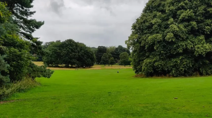
Horsforth Hall Park is the principal starting point because Leeds City Council identifies it as a community park with scenic walks, accessible paths, a Japanese garden, trim trail, cricket pitch, skate park and play facilities. It combines recreation, landscape and everyday walking in one location.
Horsforth Hall Park is on Hall Lane, Horsforth, LS18 5JE. Leeds City Council describes it as a large community park approximately six miles north-west of Leeds city centre.
The park includes several features that make it useful beyond a single-purpose walk. Scenic paths support walking, while the trim trail provides an additional outdoor activity. The Japanese garden creates a landscaped section within the wider park.
The cricket pitch gives the park a sporting function, while the skate park and play areas add facilities for younger visitors. The integrated play facility was developed for disabled and non-disabled children under eight, with Leeds City Council identifying it as the first facility of its kind in Leeds.
The park therefore works for different types of everyday outdoor time. A visitor can walk through the landscape without using the sports facilities. A family can combine a walk with the playground. An individual can use the paths for a short outdoor break.
Its accessibility is particularly important. Leeds City Council states that the paths are suitable for wheelchair users and that all entrances are wheelchair accessible. The main car park off Hall Lane has two disabled parking bays.
The park is also significant historically. The present landscape occupies the former grounds of Horsforth Hall, a house associated with the Stanhope family and built between 1699 and 1707. The hall was demolished in the 1950s, while the surrounding landscape remains part of Horsforth’s heritage.
As you explore the modern park, you are walking through a landscape shaped by centuries of local development. Read about the full [Horsforth history and heritage of its historic landscapes] to understand its origins.
How accessible is Horsforth Hall Park for regular walkers?
Horsforth Hall Park is one of the most accessible green spaces for regular walking in the area. Leeds City Council states that its paths are suitable for wheelchair users and that all entrances are wheelchair accessible, with disabled parking available beside the main Hall Lane car park.
Accessibility changes the role of a park from an occasional destination into a practical everyday space. Paths suitable for wheelchair users support people who require smoother routes and reduce the need to rely on uneven woodland surfaces.
The park’s multiple entrances also provide flexibility for visitors approaching from different parts of Horsforth. Its location on Hall Lane makes it a recognisable central green-space destination.
There is one important distinction between accessibility and universal convenience. Leeds City Council confirms accessible paths and entrances but states that there are no disabled toilets at the site. Visitors who require accessible toilet provision need to plan accordingly.
The park also contains inclusive play equipment. The integrated play facility was designed to provide opportunities for disabled and non-disabled children under eight, making the site relevant to family outdoor time as well as walking.
For a regular walking routine, the park’s combination of accessible paths and open landscape makes it particularly useful. It supports short visits without requiring specialist equipment or a countryside excursion.
What woodland spaces are available for walks around Horsforth?
Horsforth has several woodland areas associated with Leeds City Council, including Hunger Hills Wood, Whetstone Plantation, Swain Wood and smaller wooded sites. Hunger Hills covers 6.96 hectares, while Whetstone Plantation covers 11.64 hectares, providing distinct woodland environments.
Hunger Hills Wood is one of the most notable woodland areas connected with Horsforth. The Woodland Trust records it as a Leeds City Council wood covering 6.96 hectares, equivalent to 17.19 acres.
Its name has historical roots. The Woodland Trust states that Hunger Hills derives from the Old English or Norse word “Hangra”, meaning a wooded hillside. The site also contains evidence connected with historic coal extraction, including bell pits.
The woodland has an especially strong relationship with the history of Horsforth Hall. In 1785, W S Stanhope of Horsforth Hall planted 3,000 saplings to create a scenic woodland riding. The woodland was later enlarged and became known locally as Hunger Hills or the Bluebell Wood.
Whetstone Plantation provides another substantial wooded area. The Woodland Trust records it as a Leeds City Council wood covering 11.64 hectares, or 28.76 acres.
Other nearby woodland sites include Swain Wood, recorded at 2.21 hectares, and Cragwood Road Wood, recorded at 0.36 hectares. These smaller areas demonstrate how woodland is distributed across the wider Horsforth landscape.
Woodland walks differ from Hall Park walks because surfaces, gradients and vegetation vary more. Walkers should select footwear and routes according to ground conditions, particularly after prolonged rain.

Is Hunger Hills Wood suitable for regular outdoor time?
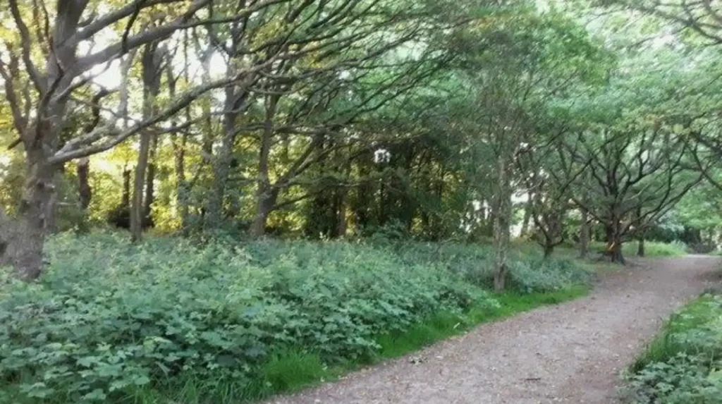
Hunger Hills Wood provides a substantial woodland setting for regular outdoor walks close to Horsforth. Its 6.96-hectare area contains mature woodland and historic landscape features, including evidence of former coal workings and the remnants of a planned eighteenth-century woodland landscape.
The woodland’s history adds an important dimension to everyday walking. Bell pits are associated with historic coal extraction in the area, while the 1785 planting programme transformed the landscape into a managed woodland riding.
This means the landscape is not simply undeveloped woodland. It reflects earlier land management, industrial activity and estate planning.
For regular walks, woodland provides a different environment from open parkland. Tree cover changes the visual character of the route and creates a more enclosed setting. Seasonal changes are also more visible through woodland vegetation.
The Woodland Trust identifies Hunger Hills Wood alongside Horsforth Hall Park and other nearby Leeds City Council woods, showing the wider relationship between the park and surrounding woodland.
Walkers should distinguish between an informal woodland outing and a formally surfaced accessible park route. The council’s accessibility information for Hall Park does not automatically apply to woodland areas.
Which smaller green spaces support short walks in Horsforth?
Smaller Horsforth green spaces support short local walks because they sit within residential areas and form part of the neighbourhood’s protected green infrastructure. Examples include Newlay Green, Woodbine Green, Victoria Gardens, Peace Garden, Old Ball Garden and The Jumps at Newlay Grove.
Horsforth’s Neighbourhood Plan identifies a network of Local Green Spaces. These sites include Old Ball Garden, Woodbine Green, Regent Road and Featherbank Lane Corner, Church Road Burial Ground, Salmon Crescent Green, Newlay Green, Church Lane and Church Road Green, and the Horsforth Town Council Jubilee and Library Gardens.
The same policy identifies Broadway East green road strips, Peace Garden at The Green, Victoria Gardens South, The Jumps at Newlay Grove, Newlay Grove “D” and the Stanhope Drive/Broadway Green Triangle.
These spaces have a different function from Hall Park. They are local-scale green areas embedded in the residential environment. Their importance comes from proximity, visual relief, mature vegetation, informal recreation and local character.
The Jumps at Newlay Grove provides a particularly clear example. The Neighbourhood Plan records the site at approximately 0.2 hectares. It identifies mature trees, local wildlife value and recreational value, and describes it as a small haven for wildlife within the housing estate.
Small spaces are important for everyday walking because they reduce the need for travel. A ten-minute outdoor break can use a neighbourhood green even when there is insufficient time for a larger park or woodland visit.
Where can walkers find recreation grounds in Horsforth?
Horsforth has several recreation grounds and playing fields listed by Leeds City Council, including Cragg Hill Recreation Ground, King George’s Playing Fields and Stanhope Recreation Ground. These spaces provide additional outdoor areas alongside the area’s main community park and smaller Local Green Spaces.
Recreation grounds differ from formal gardens and community parks because their primary role often centres on sport, play and open-air recreation. They still contribute to the wider walking network.
King George’s Playing Fields is specifically identified in the Horsforth Neighbourhood Plan in connection with children’s play facilities. The plan also identifies Cragg Hill and Woodside as areas requiring woodland and green-space management.
Woodside Recreation Ground is separately listed by Leeds City Council as a Local Green Space. This illustrates the layered nature of Horsforth’s green infrastructure, where parks, recreation grounds and smaller protected spaces overlap as parts of the wider local environment.
These locations are most useful when walkers want a short local route combined with everyday community activity. They are less about landmark attractions and more about maintaining access to outdoor space within residential neighbourhoods.
How does the River Aire connect with Horsforth’s green landscape?
The River Aire forms an important natural corridor near Horsforth and Newlay, linking local green areas with wider riverside landscapes. Leeds planning documents identify the River Aire corridor and Oil Mill Beck as important protected green infrastructure around Horsforth and neighbouring areas.
The River Aire is central to the geography of north-west Leeds. Around Horsforth and Newlay, the river corridor provides a connection between urban neighbourhoods and the wider landscape.
Leeds planning documentation identifies land around Fleet Road and Newlay Lane as part of an area where protection was intended for the River Aire corridor. It also identifies Oil Mill Beck at Hawksworth Road as part of an important green corridor between Horsforth and Hawksworth.
These corridors are important because green infrastructure does not depend only on individual parks. Watercourses, woodland, open land and footpaths connect separate green spaces into a wider landscape network.
For walkers, this creates opportunities to extend an ordinary neighbourhood walk towards Newlay and the riverside environment. The character changes from formal parkland to a more linear landscape shaped by water, vegetation and surrounding landform.
Visitors should follow signed public paths and observe local access conditions. Riversides can contain uneven surfaces, muddy sections and changing conditions.
How do Horsforth’s protected green spaces support everyday walking?
Protected green spaces preserve accessible outdoor areas within the built-up neighbourhood and prevent the local landscape from becoming entirely dominated by development. Horsforth’s Neighbourhood Plan identifies Local Green Spaces because they have local landscape, recreational, environmental or community significance.
Local Green Space is a planning designation used to protect specific areas that are demonstrably special to a local community. Horsforth’s Neighbourhood Plan establishes Policy GE3 for designated Local Green Spaces and states that inappropriate development will not be permitted except in very special circumstances.
The designation applies to spaces such as Newlay Green, Woodbine Green, Victoria Gardens and The Jumps. These areas are smaller than major parks but have local importance.
The Jumps demonstrates how this significance is assessed. The site was considered close to the community it serves, local in character and significant for landscape, recreation and wildlife. Mature trees and a fox den were among the features recorded in the assessment.
This approach has direct relevance to everyday walking. Green spaces within housing areas provide destinations and routes without requiring residents to travel to a major park.
The network also supports local identity. A neighbourhood green can retain mature trees, open views and established landscape features even where surrounding development has changed significantly.
How can visitors combine green spaces with Horsforth’s wider attractions?
Visitors can combine Horsforth’s green spaces with local heritage, cafés, food venues and transport connections to create a compact outdoor-focused visit. Horsforth Hall Park provides the strongest starting point, while Newlay, woodland areas and local streets allow visitors to extend time outdoors.
Horsforth is approximately six miles from Leeds city centre and has its own railway station. Visit Leeds also identifies regular bus services connecting the area with central Leeds.
This makes the area suitable for visitors who want outdoor time without travelling to a distant countryside destination.
A practical visit can begin at Horsforth Hall Park, continue through nearby residential green spaces and extend towards Newlay. A separate outing can focus on Hunger Hills Wood and surrounding woodland.
Horsforth’s Town Street also provides food and drink options for visitors. Visit Leeds describes the area as having a strong selection of bars and restaurants, creating opportunities to combine a walk with refreshments.
The area is therefore suitable for both outdoor-focused visitors and travellers using green space as part of a broader Leeds itinerary.
What should walkers know about dogs and responsible use of Horsforth green spaces?
Leeds parks are generally dog friendly, but specific restrictions apply in designated areas. At Horsforth Hall Park, dogs must be kept on leads in the Japanese Garden. Walkers should follow signs, use bins and respect other visitors, wildlife and planted areas.
Leeds City Council states that its parks are dog friendly and provides dog bins at several locations. The council also operates a Public Spaces Protection Order covering specific sites and activities.
At Horsforth Hall Park, the Japanese Garden is specifically designated as a dogs-on-leads area. This restriction protects a more carefully managed landscaped environment and helps maintain conditions for other visitors.
Responsible walking also involves keeping to appropriate paths, avoiding damage to planted areas and disposing of waste correctly.
Woodland areas require particular care because they provide habitat for wildlife. Visitors should avoid disturbing animals and should follow any local signs or temporary restrictions.
The basic principle is straightforward: use the green space according to its designated purpose and respect the conditions applying to each individual site.
How can people choose the best Horsforth green space for a regular walk?
The best Horsforth green space depends on the type and length of walk required. Hall Park suits accessible everyday walking, Hunger Hills suits woodland environments, smaller Local Green Spaces suit short neighbourhood outings, and Newlay provides a route towards the River Aire corridor.
For an accessible routine, Horsforth Hall Park is the clearest choice because Leeds City Council confirms accessible entrances and wheelchair-suitable paths.
For woodland, Hunger Hills Wood provides 6.96 hectares of Leeds City Council woodland with a documented historical landscape. Whetstone Plantation provides a larger 11.64-hectare woodland area.
For a very short local outing, the smaller Local Green Spaces identified in the Horsforth Neighbourhood Plan provide nearby alternatives. Examples include Newlay Green, Woodbine Green, Victoria Gardens and Peace Garden.
For a longer landscape-focused outing, Newlay and the River Aire corridor provide a transition from the built-up neighbourhood towards riverside green infrastructure. Leeds planning documents specifically recognise the importance of this corridor.
This variety makes Horsforth particularly suitable for repeated walks. The same neighbourhood supports different walking environments without requiring every outing to follow the same route.
Explore More Area Guide
Best Breakfast Places in Horsforth, Leeds
Horsforth Independent Shops & Local Finds Guide
Why are Horsforth’s green spaces important for the future?
Horsforth’s green spaces are important because they provide recreational access, protect local landscape character, support wildlife and connect the built-up area with wider environmental corridors. Their future value depends on continued maintenance, responsible use, tree management and protection through local planning policies.
The Horsforth Neighbourhood Plan recognises green-space management as an ongoing local priority. Its environmental programme includes woodland and green-space management around Cragg Hill and Woodside, alongside management of Whetstone Plantation and other environmental assets.
Investment also continues at Horsforth Hall Park. Leeds City Council’s 2024/25 Infrastructure Funding Statement records funding for improvements including picnic tables, benches, a path to the bandstand and a five-a-side football goal at Woodside Recreation Ground.
These improvements demonstrate how everyday green spaces require continuing investment rather than simply being preserved as static landscapes.
The environmental role is equally significant. Woodland, mature trees, grassland and water corridors contribute to local habitat networks. Small spaces such as The Jumps show how even approximately 0.2 hectares can provide local wildlife value within a residential setting.
For residents and visitors, the implication is clear. Horsforth’s green network supports regular outdoor activity while retaining links with the area’s history and wider landscape.
What is the overall guide to everyday green spaces in Horsforth?
Horsforth offers a layered green-space network centred on Horsforth Hall Park and supported by woodland, recreation grounds, Local Green Spaces and the River Aire corridor. This structure provides accessible short walks, woodland outings, neighbourhood routes and longer landscape walks within north-west Leeds.
Horsforth Hall Park is the strongest general-purpose destination. Its scenic walks, accessible paths, Japanese garden, trim trail and recreation facilities make it suitable for frequent visits.
Hunger Hills Wood and Whetstone Plantation provide larger woodland environments. Smaller sites such as Newlay Green, Victoria Gardens and The Jumps demonstrate the importance of protected green spaces within residential areas.
The River Aire and Oil Mill Beck corridors add a wider environmental dimension, connecting Horsforth with neighbouring landscapes and providing opportunities for longer walks.
Together, these spaces make Horsforth well suited to everyday outdoor time. The network serves residents looking for routine walks, visitors seeking accessible green areas, families requiring recreational space and travellers wanting to experience a greener side of Leeds.
The strongest feature is not one individual park. It is the combination of different types of green space operating within the same local landscape.
What is the best green space for walking in Horsforth?
Horsforth Hall Park is the best general-purpose green space for walking in Horsforth. It has accessible paths, open parkland, landscaped areas and recreational facilities, making it suitable for regular walks, family outings and short outdoor breaks.