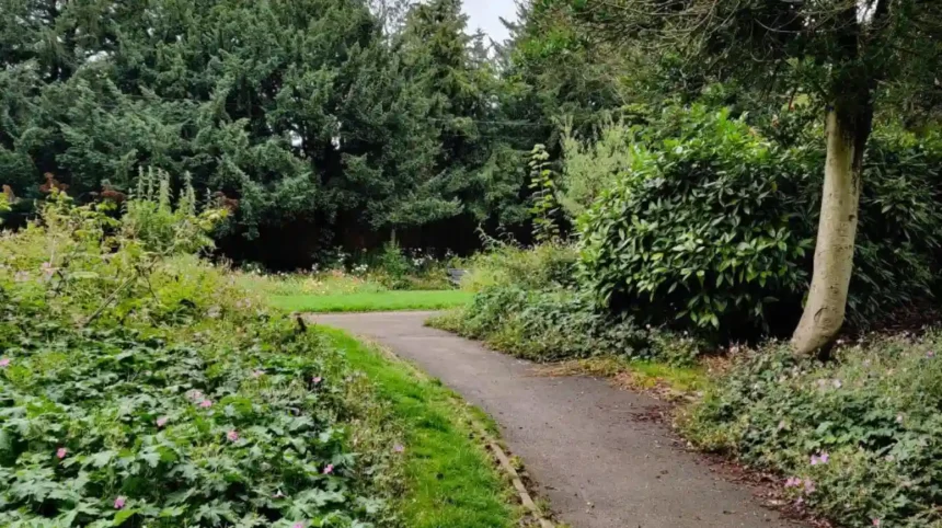
Horsforth offers a strong mix of parkland paths, woodland routes, riverside trails, canal towpaths and countryside footpaths. The Leeds suburb sits close to the River Aire and several established green spaces, giving walkers access to both short local outings and longer routes connecting Horsforth with surrounding areas.
- Why is Horsforth a good place for walking?
- What are the best walking routes around Horsforth?
- How can you walk from Horsforth towards Newlay and the River Aire?
- What can walkers see around Horsforth Hall Park?
- Is the Horsforth area suitable for short scenic walks?
- What makes Newlay woodland and the River Aire route distinctive?
- How can walkers connect Horsforth with Kirkstall Abbey and the Leeds canal?
- What longer walking routes connect Horsforth with the Leeds countryside?
- Is Golden Acre Park suitable for a Horsforth walking day?
- What should walkers know about paths, terrain and accessibility in Horsforth?
- When is the best time to walk around Horsforth?
- How should visitors plan a Horsforth walking itinerary?
- What are the main walking safety considerations in Horsforth?
- Why are Horsforth walking routes important for local tourism?
- What is the best way to experience Horsforth walking routes?
The area is particularly useful for visitors who want outdoor scenery without travelling far from Leeds city centre. Horsforth Hall Park provides an accessible starting point, while Newlay connects walkers with woodland, historic architecture and the River Aire. Longer walks extend towards Kirkstall, Golden Acre Park, Rodley and the wider Leeds countryside.
Leeds City Council records 859 kilometres of public rights of way across the city, including 650 kilometres of footpaths, 199 kilometres of bridleways and 11 kilometres of byways. These routes form a wider network linking urban neighbourhoods with countryside and green spaces.
Why is Horsforth a good place for walking?
Horsforth is well suited to walking because it combines parks, woodland, waterways, historic landscapes and public footpaths within a compact area. Walkers can choose accessible park paths, riverside trails, canal towpaths or longer countryside routes according to distance and terrain.
Horsforth sits approximately six miles north-west of Leeds city centre. Its location creates several useful walking connections between residential streets, public parks, the River Aire corridor and neighbouring communities.
The area’s walking appeal comes from its varied landscape rather than one single long-distance trail. A short walk in Horsforth Hall Park provides managed parkland and established paths. A route towards Newlay introduces steeper ground, woodland and views towards the River Aire. A longer excursion towards Kirkstall adds the Leeds & Liverpool Canal and Kirkstall Abbey.
Horsforth also connects into Leeds’ wider public rights-of-way system. This matters for walkers seeking longer routes because footpaths do not operate as isolated paths. They form a network that allows experienced walkers to combine shorter sections into larger circuits.
The result is a destination suitable for different walking purposes. A visitor with one hour can remain around Horsforth. A leisure traveller with several hours can combine Horsforth, Newlay and the River Aire. A dedicated walker can use surrounding rights of way to extend the outing into the wider Leeds countryside.
What are the best walking routes around Horsforth?
The strongest walking options around Horsforth include Horsforth Hall Park, Newlay and River Aire paths, Kirkstall and the canal corridor, and longer countryside connections towards Golden Acre Park. Each offers different scenery, surfaces, distances and levels of difficulty.
Horsforth Hall Park walks
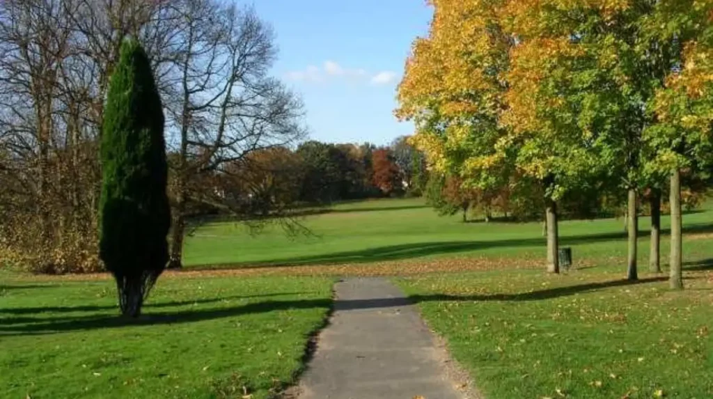
Horsforth Hall Park is the most straightforward starting point. Leeds City Council describes it as a large community park with scenic walks, a Japanese garden, cricket pitch, trim trail, skate park and play facilities. Its paths are suitable for wheelchair users, and all entrances are wheelchair accessible.
The park is useful for visitors who want a low-complexity outdoor walk. Paths within the park allow walkers to concentrate on scenery rather than navigation. Families can combine walking with the park’s recreational facilities.
The park also provides a practical meeting point for longer local walks. Walkers can begin with a circuit through the park before continuing towards Horsforth’s surrounding streets and public paths.
Newlay and River Aire walking
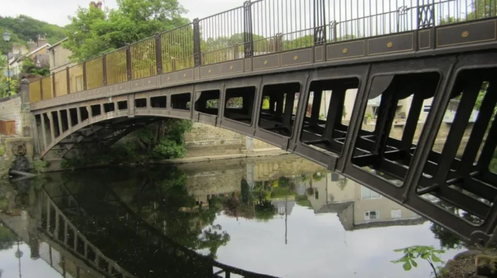
Newlay provides a more varied walking environment. Leeds City Council’s conservation assessment identifies a steep landscape leading down towards the River Aire, with linking bridleways and footpaths, woodland and the listed iron footbridge and toll house.
This makes Newlay particularly relevant for walkers seeking woodland and river scenery. The terrain is more demanding than the level paths in Horsforth Hall Park, so footwear with reliable grip is appropriate.
Kirkstall and canal walking
The Kirkstall direction provides a natural extension for longer walks. The River Aire and Leeds & Liverpool Canal create a substantial water-based landscape south of Horsforth.
The Canal & River Trust confirms that routes around Kirkstall include riverside paths and the canal towpath. A 2026 seven-mile multi-terrain route at Kirkstall Abbey uses sections of both environments.
The canal section is particularly useful when a walker wants a flatter route with continuous waterway scenery.
How can you walk from Horsforth towards Newlay and the River Aire?
A Horsforth-to-Newlay walk combines residential paths, woodland, descending terrain and riverside scenery before returning through the local road and footpath network. It suits walkers seeking more variety than a park circuit while remaining close to established neighbourhoods and transport connections.
Newlay is one of the most distinctive walking areas close to Horsforth. Its landscape differs from the open character of Hall Park because the ground falls towards the River Aire.
Leeds City Council identifies Newlay’s conservation area as a settlement with Victorian development, woodland and open spaces. The area was designated as a conservation area in 1981, originally as the Newlay, Horsforth conservation area.
A typical outing begins from Horsforth and heads towards Newlay through local streets and connecting footpaths. As the route approaches the river, the landscape becomes more enclosed and wooded.
The descent towards the River Aire adds a physical element to the walk. Walkers should remember that a downhill section becomes an uphill section on the return unless a different transport or route arrangement is used.
The River Aire itself provides a strong natural landmark. It also links this local walking area with the wider Leeds riverside network.
As you explore the modern landscape, you are crossing land with a deep heritage. Read about the full [Insert Anchor Text for History Article Here] to understand its origins.
What can walkers see around Horsforth Hall Park?
Horsforth Hall Park combines mature landscape, historic structures, formal garden features and recreational facilities. Its setting reflects the former grounds of Horsforth Hall, making the park both a practical walking destination and an important part of Horsforth’s local heritage.
Horsforth Hall Park is more than a recreational green space. Leeds City Council’s character assessment states that the park reflects the grounds associated with the demolished Horsforth Hall.
Horsforth Hall was built between 1699 and 1707 and demolished during the early 1950s. The former grounds retain archaeological significance connected with the hall and its formal gardens.
Several historic features remain. These include the listed stable block, war memorial and bandstand. The surviving structures provide identifiable points of interest during a walk.
The park therefore works particularly well for visitors interested in combining outdoor activity with local history. A walking route through the grounds provides physical access to a landscape shaped over several centuries.
The Japanese garden adds a more formal landscaped element. The cricket pitch and trim trail introduce recreational uses, while the play facilities make the park suitable for family visits.
The council identifies the park as Horsforth’s most accessible public green space. This status makes it a useful starting location for visitors who require paths suitable for wheelchair users.
Is the Horsforth area suitable for short scenic walks?
Yes. Horsforth supports short walks that require limited planning, particularly around Horsforth Hall Park, local green spaces and Newlay. These options suit visitors with limited time, families and travellers combining outdoor activity with cafés, shopping or other Leeds attractions.
Short walks are important because not every visitor wants a long countryside hike. Horsforth’s urban structure allows walkers to create shorter outings without committing to a major trail.
Horsforth Hall Park provides the simplest option. The park contains established paths and several attractions within one location. Its accessible design also reduces barriers for visitors with mobility requirements.
Newlay offers a different short-walk experience. The landscape includes woodland and a descent towards the River Aire. The route therefore feels more rural while remaining close to built-up areas.
Local green spaces listed by Leeds City Council include The Green, Newlay public open space, Hall Lane, Woodside Recreation Ground, Cragg Hill Recreation Ground and King George’s Playing Fields.
These spaces can support shorter walks, although their individual path networks and facilities differ. Walkers should check current access information before setting out.
Short routes are also useful for digital nomads and business travellers staying locally. A one-hour walk can provide outdoor time without requiring a full-day itinerary.
What makes Newlay woodland and the River Aire route distinctive?
Newlay combines woodland, historic buildings, steep slopes and the River Aire in a compact walking landscape. The combination creates more varied terrain than Horsforth’s main parks and provides a direct connection between suburban streets and the river corridor.
Newlay’s landscape has a strong relationship with its topography. The settlement occupies higher ground while the River Aire lies below. Footpaths and bridleways therefore cross sloping terrain.
Leeds City Council describes Newlay as an area containing large open spaces and woodland. Its conservation appraisal also highlights the area’s distinctive stone buildings and mature landscape.
The listed iron bridge is another important feature. It provides a visual landmark within the river corridor and contributes to the area’s historic character.
Walkers should expect changes in elevation. The route is not equivalent to a flat park circuit. Wet conditions also affect woodland paths and slopes, particularly during periods of persistent rain.
The river environment provides additional visual variation. Water, woodland and open sections appear within a relatively short distance.
For photography, landscape observation and quiet outdoor recreation, this combination provides a strong reason to include Newlay in a Horsforth walking itinerary.
How can walkers connect Horsforth with Kirkstall Abbey and the Leeds canal?
Walkers can extend an outing south from Horsforth towards Kirkstall, where the landscape connects with Kirkstall Abbey, the River Aire and the Leeds & Liverpool Canal. The combined route provides heritage, waterway scenery and longer-distance walking opportunities.
Kirkstall is one of the most useful extensions for walkers based in Horsforth. The area provides a clear change from residential Horsforth into a landscape dominated by the river, canal and historic abbey estate.
Kirkstall Abbey is a major historic landmark. The surrounding grounds form part of Leeds’ public park system, with Kirkstall Abbey Estate listed as a city park in Leeds City Council’s parks information.
The Leeds & Liverpool Canal adds another walking environment. Canal towpaths provide relatively consistent gradients and continuous linear navigation, making them useful for longer walks.
The Canal & River Trust describes the Leeds & Liverpool Canal as a historic waterway with significant scenery and engineering features. Its Newlay, Forge and Kirkstall locks remain part of the active waterway network.
Walkers should remember that a canal towpath is a shared environment. Cyclists, anglers, boaters and other pedestrians can use sections of the waterway corridor.
The Kirkstall route is particularly suitable for visitors who want a walking day with multiple points of interest. Abbey grounds, river paths and canal sections can be combined rather than treated as separate attractions.
What longer walking routes connect Horsforth with the Leeds countryside?
Longer routes around Horsforth connect into Leeds’ extensive rights-of-way network and provide access towards Golden Acre Park, countryside north of the city and wider long-distance trails. The Leeds Country Way is the principal long-distance option within Leeds.
The Leeds Country Way is a 62-mile circular footpath around Leeds. Leeds City Council divides it into four main stages of roughly 15 miles, with shorter sections of approximately five miles.
The route demonstrates the scale of walking available around Horsforth. Although the full circuit is not a single Horsforth walk, its northern sections connect with the wider countryside around Golden Acre Park and nearby settlements.
Golden Acre Park is particularly relevant to walkers in northern Leeds. The Leeds Country Way includes a section from Golden Acre Park towards Lofthouse Lodge. The official route describes paths through the park, woodland, bridleways and countryside.
Leeds City Council also identifies several other established routes, including the seven-mile Meanwood Valley Trail, 19-mile Dales Way Link and 70-mile Ebor Way.
These routes demonstrate that Horsforth sits within a much larger walking geography. A visitor can use Horsforth as a base and select routes according to available time.
Longer-distance walking requires more preparation. Maps, weather conditions, footwear, water and daylight hours become increasingly important as distance from the urban area increases.
Is Golden Acre Park suitable for a Horsforth walking day?
Golden Acre Park is suitable for a longer outdoor day because it combines landscaped parkland, a lake, woodland and links to the Leeds Country Way. Its location north of Horsforth provides a practical transition from urban walking to countryside routes.
Golden Acre Park provides a different experience from Horsforth Hall Park. Its lake and broader landscape create longer visual lines and a more countryside-oriented setting.
The park also acts as a recognised point on the Leeds Country Way. The official route begins one stage at Golden Acre Park and continues through woodland and rural paths towards Lofthouse Lodge.
This makes the park valuable for walkers who want to combine a manageable park outing with a section of a longer trail.
Access by car is also established. Leeds City Council currently lists parking charges at Golden Acre Park’s Otley Road and Arthington Road car parks. The published information gives a maximum stay of 23 hours during charging hours.
Visitors should check current parking and access conditions before travelling because operational arrangements can change.
Golden Acre Park is particularly suitable for a full outdoor day when combined with a planned section of the Leeds Country Way.
What should walkers know about paths, terrain and accessibility in Horsforth?
Horsforth offers different walking surfaces, including managed park paths, pavements, woodland tracks, grass paths, bridleways and canal towpaths. Accessibility therefore varies by route, with Horsforth Hall Park providing the clearest officially confirmed accessible walking environment.
Surface type is one of the most important practical differences between Horsforth walking routes.
Horsforth Hall Park has paths suitable for wheelchair users and wheelchair-accessible entrances. Leeds City Council also lists two disabled parking bays at the main car park off Hall Lane.
Newlay is different. Sloping terrain, woodland paths and river access create more physical challenges. The route is therefore better suited to walkers who can manage uneven or changing surfaces.
Canal towpaths around Kirkstall generally provide flatter walking conditions. The Canal & River Trust lists the Kirkstall Brewery towpath area as very flat, with a grass and fine-gravel surface at that location.
Public rights of way also include footpaths, bridleways and byways. These classifications matter because surface conditions and permitted uses differ.
Walkers should check the current route before departure, particularly after severe weather. Mud, fallen branches, flooding and temporary closures can affect outdoor access.
When is the best time to walk around Horsforth?
Horsforth walking routes are usable throughout the year, but route conditions change with daylight, rainfall, temperature and ground conditions. Park and canal paths provide simpler options in poor weather, while woodland and countryside routes require greater attention to surface conditions.
Every season changes the walking experience.
Spring provides increasing daylight and fresh vegetation. Summer offers the longest daylight hours and supports longer walks. Autumn brings changing woodland colours but also wetter ground and fallen leaves. Winter reduces daylight and increases the likelihood of muddy paths.
Canal routes provide a useful option during variable weather because the towpath offers a consistent linear route. Park paths are also easier to navigate than open countryside footpaths.
Longer countryside walks require additional planning during winter. Reduced daylight limits the practical duration of an outing, while wet conditions increase slipping risks on slopes and unsealed paths.
Visitors should check the weather forecast before leaving. Clothing should match the conditions rather than the calendar season.
Good walking practice also includes carrying drinking water, keeping a charged phone and using an up-to-date map or official route information.
Explore more Area Guide
Best Places to Visit in Garforth for First-Time Tourists
A Complete Travel Guide to Garforth for Leisure Travellers
How should visitors plan a Horsforth walking itinerary?
A practical Horsforth walking itinerary starts with the desired distance and terrain, then selects a suitable combination of parkland, woodland, river or canal paths. Visitors should confirm access, transport, weather, daylight and return arrangements before starting longer routes.
Planning becomes more important when several walking areas are combined.
For a short outing, Horsforth Hall Park provides the simplest structure. Visitors can explore the park and return to Horsforth without complex navigation.
For a medium-length walk, Horsforth and Newlay provide a stronger combination. The route introduces woodland and River Aire scenery while remaining within the local area.
For a longer outing, walkers can extend towards Kirkstall Abbey and the Leeds & Liverpool Canal. This creates a route with historic, riverside and canal environments.
Experienced walkers can use the public rights-of-way network to connect towards Golden Acre Park and sections of the Leeds Country Way.
Transport planning is also important. A linear walk requires a different return arrangement from a circular walk. Public transport information is available through the regional transport network, while parking information is published by Leeds City Council.
Visitors should also avoid assuming that every path has identical accessibility. The official accessibility information for Horsforth Hall Park should be used when planning an accessible outing.
What are the main walking safety considerations in Horsforth?
Walking around Horsforth is straightforward when visitors use recognised paths, check conditions and plan their route. The main practical considerations are traffic crossings, uneven ground, steep sections, waterway edges, shared paths, changing weather and reduced winter daylight.
Urban walking introduces road crossings. Walkers should use designated crossings where available and take particular care near busy roads.
Newlay introduces additional terrain considerations because paths descend towards the River Aire. Wet leaves, mud and steep sections require suitable footwear.
Canal paths create a different set of considerations. Towpaths are shared spaces, and the canal edge remains a water environment. Walkers should maintain awareness around boats, cyclists and narrow sections.
The Leeds public rights-of-way network is formally recorded on the Definitive Map. Leeds City Council provides information on access rights and allows members of the public to report problems affecting public footpaths, bridleways and byways.
This system is important because official access information is more reliable than informal route descriptions.
Before starting a longer walk, visitors should identify the planned route, check current conditions and allow enough time to return before darkness.
Why are Horsforth walking routes important for local tourism?
Horsforth walking routes strengthen local tourism by connecting green spaces, heritage sites, waterways and neighbouring communities without requiring a long journey from Leeds city centre. They support short visits, longer leisure itineraries, outdoor recreation and exploration of local landscapes.
Walking contributes to the wider visitor economy because it allows travellers to experience several destinations within one outing.
Horsforth Hall Park provides a local green-space attraction. Newlay adds conservation-area character and River Aire scenery. Kirkstall introduces an important historic abbey and canal landscape. Golden Acre Park provides a larger countryside-oriented setting.
The routes also connect visitors with the broader Leeds walking network. Leeds City Council’s official walking programme includes long-distance and shorter routes across the district, demonstrating the city’s extensive recreational path infrastructure.
For domestic business travellers, these routes provide structured downtime close to the city. For leisure visitors, they create opportunities to combine walking with heritage, food, shopping and public transport.
For residents, the same network supports regular outdoor recreation without requiring a dedicated day trip.
The long-term value comes from the combination of accessibility and variety. Visitors can choose a short park circuit or build a longer itinerary around established public rights of way.
What is the best way to experience Horsforth walking routes?
The best approach is to match the route with available time, fitness, accessibility requirements and interest in parks, woodland, rivers, canals or heritage. Horsforth Hall Park suits simple walks, Newlay adds terrain, and Kirkstall and Golden Acre support longer adventures.
Horsforth works particularly well as a walking base because different environments are close together.
A first-time visitor can begin with Horsforth Hall Park and explore its historic landscape. A walker seeking more varied terrain can continue towards Newlay and the River Aire. A visitor wanting a longer day can extend south towards Kirkstall and the canal.
Golden Acre Park provides another direction for countryside-focused walking and links directly into the Leeds Country Way.
The wider network also gives experienced walkers opportunities to build longer routes from several shorter sections. Leeds City Council’s 62-mile Leeds Country Way demonstrates how local paths connect into a substantial circular walking system.
The key to a successful Horsforth walking day is route selection rather than distance alone. Park paths, woodland trails, river corridors and canal towpaths offer different physical demands and scenery.
Horsforth therefore provides a practical starting point for scenic outdoor adventures across northern Leeds. Its combination of green space, waterways, historic landscapes and established public rights of way gives walkers multiple ways to explore the area while remaining connected to the wider Leeds countryside.
Is Newlay suitable for scenic walks?
Yes. Newlay offers woodland, open spaces, historic buildings, the River Aire and the listed Newlay iron footbridge. Its varied terrain provides a more demanding walking experience than level park paths.