If you see flooding near the Otley riverside, call the Environment Agency on 0800 807060 for river flooding, or Leeds City Council on 0113 222 4407 for watercourse flooding from brooks, streams, or culverts. In an emergency where people or property are at immediate risk, dial 999.
- What should you do immediately if flooding near Otley riverside puts people or property at risk?
- How do you report flooding from the River Wharfe near Otley?
- Who do you contact for watercourse flooding from streams, beck, or culverts near Otley riverside?
- How can you report blocked gullies, drains, or manholes near Otley riverside that may worsen flooding?
- What is the Wharfe Valley Alert system and how can Otley residents register for flood warnings?
- How do official flood warning areas for the River Wharfe at Otley work?
- What should you do if flooding is caused by private drains or sewers near Otley riverside?
- How can you check flood risk and existing flood reports for Otley riverside areas?
- What happens after you report flooding near Otley riverside to Leeds City Council or the Environment Agency?
- How can you prepare for flooding near Otley riverside and reduce potential damage?
This article explains exactly how residents, visitors, and businesses in and around Otley can report flooding concerns near the riverside, including the Otley Cut, River Wharfe, and nearby watercourses. It covers emergency contacts, online reporting methods, flood warning schemes, and what happens after a report is made.
What should you do immediately if flooding near Otley riverside puts people or property at risk?
Call 999 if there is an immediate risk to life or serious danger to property. This is the first and most critical step whenever flooding creates a threat to human safety, blocks roads with fast-flowing water, or endangers buildings near the Otley riverside.
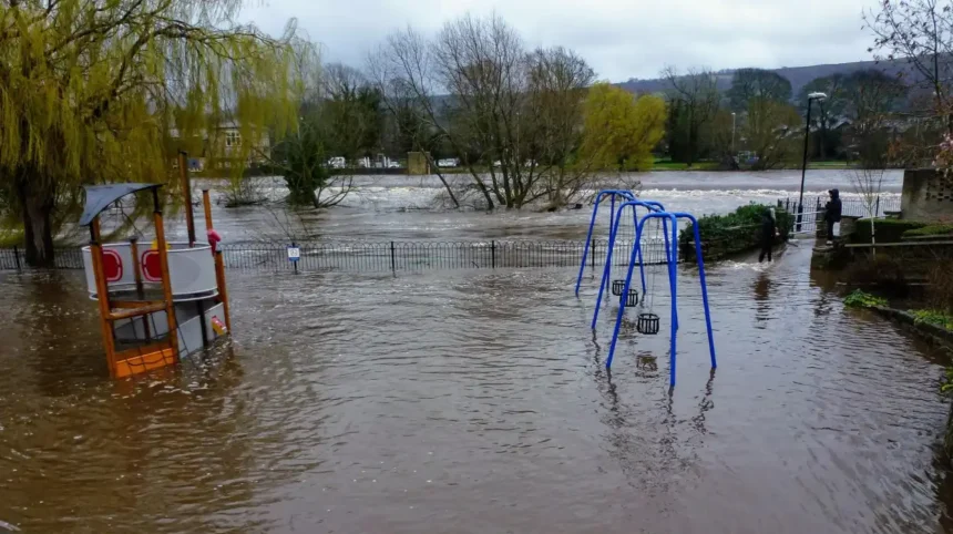
In Otley, the riverside includes areas along the River Wharfe, the Otley Cut (a canalised section of the river), and neighbouring watercourses such as Beck. When these areas flood rapidly, water can rise quickly, especially after heavy rain or when upstream inflows increase. In such cases, emergency services must be contacted first to manage evacuation, traffic, and safety before any council or environmental agency report is made.
After calling 999, you should also contact the relevant authority to log the incident formally. For river flooding from main rivers like the River Wharfe, the Environment Agency is responsible. For watercourse flooding from streams, brooks, culverts, and smaller channels, Leeds City Council handles reports. This ensures that both emergency response and long-term flood management actions are triggered.
How do you report flooding from the River Wharfe near Otley?
Call the Environment Agency on 0800 807060 (24 hours) to report flooding from the River Wharfe near Otley. This dedicated line allows anyone to report river floods, blockages such as fallen trees, collapsed or damaged river banks, and unusual changes in river flow in the Otley area.
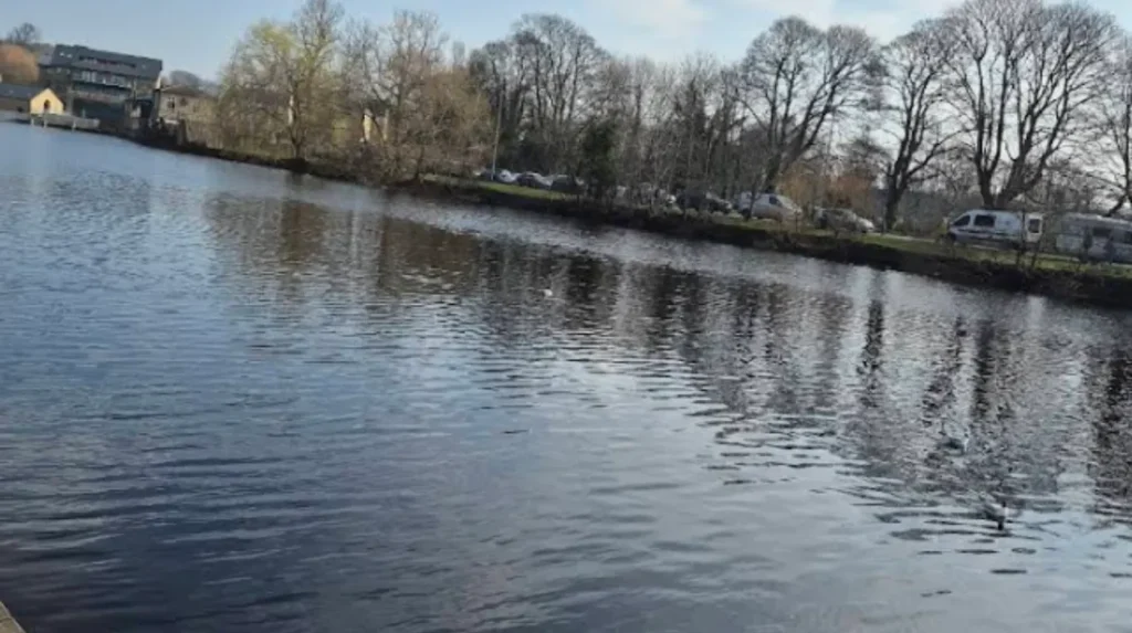
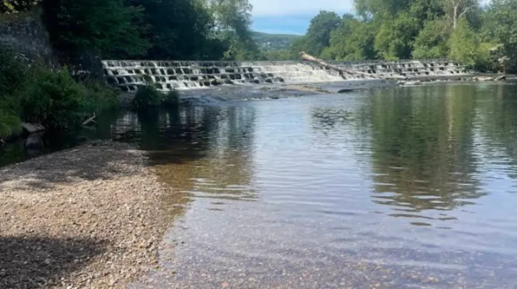
The River Wharfe is a main river in West Yorkshire and is the primary watercourse flowing through Otley. Flooding from the Wharfe can affect properties along Newhall Park, Mill Lane, Riverdale Road, the Sports Pavilion at Wharfemeadows Park, and isolated properties between Otley and Pool-in-Wharfedale. These areas are officially recognised as flood warning zones for the River Wharfe at Otley.
When you call 0800 807060, be ready to provide:
- Your name and contact details
- Exact location of the flooding (street name, landmark, or property)
- Description of the problem (e.g., water rising, debris blocking the river, damaged bank)
- Whether people or property are at risk
- Any photos or observations you can share
The Environment Agency will assess the situation, update flood warnings if necessary, and may deploy teams to inspect the river channel, remove obstructions, or coordinate with Leeds City Council and Yorkshire Water if sewers or drains are involved.
Who do you contact for watercourse flooding from streams, beck, or culverts near Otley riverside?
Call Leeds City Council on 0113 222 4407 (Monday to Friday, 9am to 5pm) or the out-of-hours emergency line 0113 376 0499 to report watercourse flooding near Otley riverside. This covers brooks, streams, culverts, and becks that flow through or alongside the Otley area.
Leeds City Council is responsible for watercourses that are not classified as main rivers. These include smaller channels, Beck systems, and culverted waterways that feed into the River Wharfe or run along parks, footpaths, and residential streets near the Otley Cut and riverside promenades. When these watercourses become blocked or overflow, they can cause localised flooding on roads, pavements, and private land.
To report such flooding, you can:
- Use the online form to report watercourse flooding on the Leeds City Council website
- Call 0113 222 4407 during office hours
- Call 0113 376 0499 out of hours or on bank holidays for emergencies
The council can inspect the watercourse, remove obstructions, and where necessary require landowners to clear debris or vegetation that may be contributing to flooding. In some cases, the council will coordinate with the Environment Agency if the watercourse is closely linked to a main river system like the Wharfe.
How can you report blocked gullies, drains, or manholes near Otley riverside that may worsen flooding?
Report blocked gullies, street drains, or manholes near Otley riverside using Leeds City Council’s online forms or by calling 0113 222 4407 during office hours, or 0113 376 0499 out of hours. Blocked drainage infrastructure can significantly worsen surface water flooding along the riverside and in nearby streets.
Gullies are metal-grated drains found at the edge of roads and pavements. When they become blocked with leaves, litter, or silt, water cannot drain properly and may pool on roads or spill onto footpaths. Manholes and covered drains can also become obstructed, leading to surface flooding that affects drivers, pedestrians, and properties near the Otley Cut and River Wharfe.
Leeds City Council provides specific online reporting tools for:
- Blocked gullies
- Damaged gullies or missing manhole covers
- Surface water pooling on roads
When reporting, you should:
- Pin the exact location on the council map
- Describe the problem (e.g., water rising, gully covered in debris, manhole cover missing)
- Upload a photo if possible
- Provide your contact details if you want updates
Council teams will inspect the site, clear blockages, and repair or replace damaged infrastructure as needed. Persistent problems in riverside areas may lead to longer-term drainage improvements.
What is the Wharfe Valley Alert system and how can Otley residents register for flood warnings?
The Wharfe Valley Alert system is a Leeds City Council emergency messaging scheme that sends SMS and email warnings to businesses and organisations located within 500 metres of the River Wharfe floodplain, including Otley and surrounding villages. It is designed to give advance notice of rising river levels and potential flooding.
This system is particularly relevant for properties and businesses along the Otley riverside, the Otley Cut, and areas near Wharfemeadows Park. Registrants receive alerts before flood warnings are issued publicly, allowing them to prepare by moving vehicles, securing equipment, or activating flood protection measures.
To register for Wharfe Valley Alert:
- Contact the Leeds City Council Emergency Planning Unit by telephone on 0113 247 4822
- Email the unit using the address provided on the Otley Town Council or Leeds City Council emergency planning pages
- Provide your name, organisation, location, and contact details (phone and email)
- Confirm that your premises are within 500 metres of the River Wharfe channel in the Otley area
All registrations may be verified by phone or email. Once registered, you will receive alerts when river levels rise to a threshold that indicates a risk of flooding. You can also remove yourself from the system at any time by contacting the same number or email.
How do official flood warning areas for the River Wharfe at Otley work?
Official flood warning areas for the River Wharfe at Otley identify specific streets and properties at risk, such as Newhall Park, Mill Lane, Riverdale Road, the Sports Pavilion, and isolated properties between Otley and Pool. These areas are monitored by the Environment Agency, which issues flood warnings when river levels reach defined thresholds.
Flood warning areas are mapped zones where the Environment Agency expects flooding to occur if river levels rise further. Each area has a unique code; for example, “122FWF560” refers to the River Wharfe at Otley flood warning area. When a warning is issued for this area, residents and businesses should take prepared actions such as:
- Moving vehicles to higher ground
- Checking flood protection equipment (e.g., sandbags, flood doors)
- Monitoring local news, radio, and Environment Agency updates
- Preparing to evacuate if instructed
The Environment Agency publishes flood warning information on GOV.UK and through Floodline, which can be contacted on 0345 988 1188 (24 hours) for advice during a flood event.
What should you do if flooding is caused by private drains or sewers near Otley riverside?
If flooding near Otley riverside is caused by private drains or blocked sewers, contact Yorkshire Water to report blocked sewers or burst water mains, and understand that private drains are the responsibility of the property owner. Yorkshire Water can advise or arrange drainage contractors for a fee.
Private drains serve individual properties and are not the responsibility of Leeds City Council or the Environment Agency. When these drains become blocked or damaged, water may back up into gardens, cellars, or ground-floor rooms, especially in low-lying riverside areas where the water table is high. In such cases, property owners must arrange and pay for drainage clearance or repairs.
Public sewers and water mains are managed by Yorkshire Water. If you suspect a blocked public sewer or a burst water main near the Otley Cut or riverside:
- Call Yorkshire Water on 0345 124 2424
- Report the location and nature of the problem
- Provide details of any visible damage, overflowing manholes, or persistent surface water
Yorkshire Water will investigate, clear blockages, and repair or replace damaged infrastructure as required.
Explore More Help & Resources
How to get a free home security check in Morley
How to find free warm spaces near Horsforth this winter
How can you check flood risk and existing flood reports for Otley riverside areas?
You can check your long-term flood risk, view active flood warnings, and see existing flood reports for Otley riverside areas on GOV.UK and Leeds City Council’s flood mapping tools. These platforms show whether your property is in a designated flood warning area and whether a report has already been logged.
Leeds City Council maintains an online map where you can:
- View reported flooding incidents across the city, including Otley
- Check the status of existing reports (e.g., “in progress”, “resolved”)
- See whether a problem has already been reported by someone else
The Environment Agency provides flood warning maps and live data for the River Wharfe at Otley, showing current river levels, forecast levels, and whether warnings are in force. This information is available on GOV.UK under the River Wharfe at Otley flood warning area page.
By consulting these resources before or during a flood event, you can avoid duplicate reports, understand the scale of the problem, and take appropriate action based on official guidance.
What happens after you report flooding near Otley riverside to Leeds City Council or the Environment Agency?
After you report flooding near Otley riverside, the relevant authority will log your report, assess the risk, and either clear the problem, deploy emergency teams, or refer the case to another agency if it falls outside their responsibility. Your report may appear on public maps with a status pin for at least 28 days.
For Leeds City Council reports:
- The council assigns a reference number and updates the status on its map
- Teams may inspect the site, clear blockages, or arrangements are made for landowners to remove obstructions
- Persistent or high-risk areas may be prioritised for longer-term flood alleviation works, such as the Otley Flood Alleviation Scheme, which aims to reduce flood risk to properties around Wharfemeadows Park
For Environment Agency reports:
- The Agency evaluates river levels, blockages, and bank stability
- Flood warnings may be updated or issued if necessary
- In some cases, engineering teams are deployed to remove debris, reinforce banks, or coordinate with other agencies
In both cases, you can follow up using your reference number and check the status online or by phone. Large-scale or recurring issues near Otley riverside may lead to investment in flood defence infrastructure, improved drainage, or enhanced monitoring systems.
How can you prepare for flooding near Otley riverside and reduce potential damage?
Residents and businesses near Otley riverside can reduce flood damage by signing up for flood warnings, preparing an emergency plan, and considering flood protection measures such as sandbags, flood doors, and raised electrical sockets. Leeds City Council and the Environment Agency provide guidance on preparation and response.
Key steps include:
- Registering for Wharfe Valley Alert if you are within 500 metres of the River Wharfe floodplain
- Signing up for Environment Agency flood warnings via GOV.UK
- Keeping emergency contact numbers visible (999, 0800 807060, 0113 222 4407, Yorkshire Water)
- Storing important documents and valuables on higher floors where possible
- Installing flood protection products if you are in a high-risk zone
During a flood event:
- Follow advice from Floodline (0345 988 1188) and local authorities
- Do not walk or drive through flowing water
- Evacuate if instructed by emergency services
By preparing in advance and knowing exactly how to report flooding near the Otley riverside, you can help protect your property, support effective emergency response, and contribute to longer-term flood management in the Otley area.
What should I do first if I see flooding near Otley riverside?
If there is immediate danger to life or property, call 999 straight away. After that, report river flooding to the Environment Agency or local surface water issues to Leeds City Council.