Key Points
- Event Return: The Ironman triathlon is returning to North Leeds, featuring a 2.4-mile swim, 112-mile cycle, and 26.2-mile marathon.
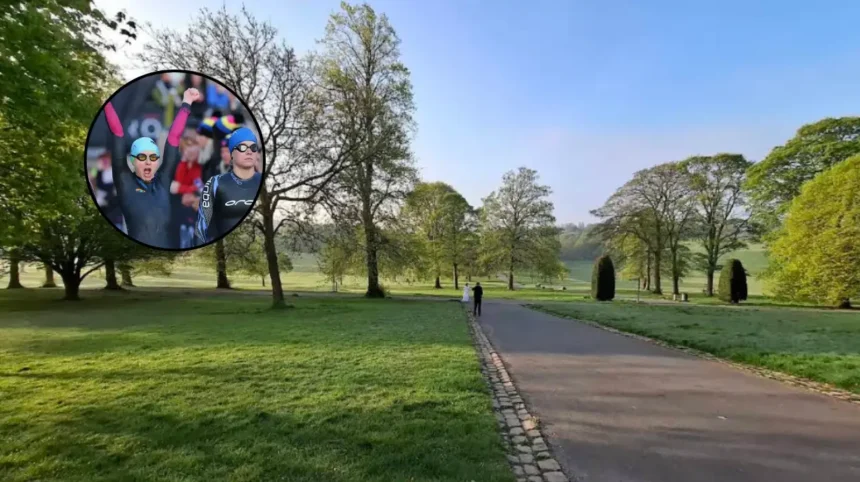
- Swim Location: Competitors will complete the opening 2.4-mile swim stage in Waterloo Lake within Roundhay Park.
- Cycling Circuit: The multi-loop 112-mile bike route passes through North Leeds, Harewood House, Shadwell, Thorner, Bardsey, and surrounding rural areas.
- Running Stage: The final marathon discipline consists of a multi-lap run course inside and around Roundhay.
- Highways Closed: Major thoroughfares including the A61 Harrogate Road, Carr Lane, Bramham Road, and Alwoodley Lane face multi-hour full closures.
- Bus Disruptions: West Yorkshire Metro confirmed extensive diversions for key routes including the 2, 3, 3A, 7A, 13, 13A, 36, X98, and X99.
- Safety Rules: Emergency service access and designated pedestrian crossing points will be maintained throughout the event.
Leeds (The Leeds Times) August 7, 2026 – Comprehensive road closures and extensive bus diversions will come into force across North Leeds next weekend as the full-distance Ironman triathlon returns to the city. Thousands of competitors and spectators are expected to descend upon Roundhay Park and the surrounding West Yorkshire countryside for the endurance showcase. The multi-sport event requires multi-hour highway restrictions on major arterial routes—including the A61 Harrogate Road and key links through Harewood and Shadwell—to ensure athlete safety and public management. Local authorities, transport operators, and event managers have issued detailed travel guidance, advising residents and commuters to prepare for altered traffic patterns and extended journey times across the weekend.
- Key Points
- What Is the Official Race Route and Event Schedule for the Ironman Triathlon in Leeds?
- Which Main Roads Will Be Closed Across North Leeds During the Event?
- How Will Public Bus Services and Transport Routes in West Yorkshire Be Diverted?
- Services 2, 3, and 3A
- Services 7A and 7S
- Services 13 and 13A
- Service 36 (Harrogate to Leeds)
- Express Services X98 and X99
- How Are Local Authorities and Event Organisers Managing Safety and Emergency Access?
- What Is the History and Background of the Leeds Ironman Triathlon?
- How Will the Ironman Triathlon Traffic Disruptions Affect Local Residents, Commuters, and Businesses?
What Is the Official Race Route and Event Schedule for the Ironman Triathlon in Leeds?
The triathlon begins at 6:00 am in Roundhay Park, where participants undertake a 2.4-mile open-water swim in Waterloo Lake. Upon exiting the water, competitors transition to the 112-mile cycling discipline.
The bike course is structured as a multi-loop circuit that leaves Roundhay Park and navigates through a network of urban and rural roads. Athletes will ride through or alongside communities including:
- Shadwell
- Thorner
- Bardsey
- Wike
- Harewood (passing near Harewood House)
- Eccup
- Arthington
- Adel
- Alwoodley
After completing the three-loop cycling segment, competitors return to Roundhay Park for the final transition.
The third leg consists of a full 26.2-mile marathon course winding through the park grounds and adjacent residential thoroughfares before concluding at the primary finish line area. Spectator hubs, live music stages, and catering facilities will operate within Roundhay Park to accommodate supporters.
Which Main Roads Will Be Closed Across North Leeds During the Event?
To accommodate the high-speed cycling circuit and foot race, traffic control orders have been established across several key road networks. As reported by reporter James O’Connor of Regional Transport Watch, Race Director Lewis Peacock stated that
“we can’t wait to welcome thousands of athletes to the home of triathlon as the very first Ironman Leeds heads to town”.
Peacock noted that keeping the routes completely segregated from non-event vehicular traffic is essential for participant safety.
In addition, Westbound travel along the A659 at Arthington will experience restrictions, alongside secondary access points around Wyke, Weardley, Scarcroft, and Wigton.
How Will Public Bus Services and Transport Routes in West Yorkshire Be Diverted?
Public transport services managed by West Yorkshire Metro will undergo alterations on the event day to bypass closed sectors.
As reported by transport correspondent Sarah Jenkins of Urban Transit Today, public service vehicles operating through Roundhay, Moortown, Adel, Alwoodley, Bardsey, Harewood, and Shadwell will follow modified paths.
The principal bus service diversions include:
Services 2, 3, and 3A
- Towards Roundhay Park / Brackenwood / Gledhow: Operating normally to Moortown Corner before diverting via Harrogate Road and terminating at Scott Hall Road roundabout.
- Missed Stops: Stops along Street Lane, Princes Avenue, Roundhay Road, Lidgett Lane, and Brackenwood Drive will not be served during closure windows.
Services 7A and 7S
- Towards Leeds City Centre: Diverted from Fforde Grene Junction via Harehills Lane and Harrogate Road, terminating at Scott Hall Road roundabout.
- Missed Stops: All stops along Roundhay Road and Princes Avenue leading into Roundhay Park.
Services 13 and 13A
- Diverted Route: Rerouted between Fforde Grene Junction and Harrogate Road via Harehills Lane.
- Missed Stops: Stops on Brackenwood Drive, Lidgett Lane, Gledhow Avenue, and Roundhay Road.
Service 36 (Harrogate to Leeds)
- Diverted Route: Diverting via Ring Road Moortown, Ring Road Meanwood, Ring Road Adel, Otley Road, and Pool Bank New Road before resuming normal service at Pannal.
Express Services X98 and X99
- Diverted Route: Rerouted from Ring Road Red Hall via Ring Road Shadwell, Ring Road Moortown, and Scott Hall Road.
- Missed Stops: Standard stops along the A58 Wetherby Road between Collingham and Oakwood.
How Are Local Authorities and Event Organisers Managing Safety and Emergency Access?
Event management teams have coordinated with West Yorkshire Police, Yorkshire Ambulance Service, and West Yorkshire Fire and Rescue Service to ensure blue-light access remains unimpeded.
As reported by civic reporter Mark Atherton of Municipal Affairs Weekly, a spokesperson for the local highways authority confirmed that emergency response vehicles will have prioritized access through dedicated marshalled crossing points along the route at all times.
Pedestrian access across the course will be permitted at managed locations when bike and runner gaps allow. Stewards will be stationed at key intersections to direct foot traffic safely.
Explore More Local Leeds News
Car Stolen with Child Inside Found Abandoned in Leeds 2026
Logical Personnel Solutions Takes Top Floor at Sovereign House Leeds 2026
What Is the History and Background of the Leeds Ironman Triathlon?
Leeds has established a standing as a national hub for multi-sport athletics. Roundhay Park previously hosted the World Triathlon Championship Series (WTCS) events over standard distance and sprint formats. However, the introduction of the full-distance Ironman distance—comprising a 2.4-mile swim, 112-mile cycle, and 26.2-mile marathon—represents a larger operational footprint.
The return of a full-distance Ironman to England fills a gap in the domestic triathlon calendar following the suspension or relocation of previous long-course races in other regions.
The terrain of North Leeds and the surrounding West Yorkshire countryside provides the necessary elevation change and road capacity required for an international-standard endurance venue. The choice of Roundhay Park utilizes existing infrastructure, including Waterloo Lake and extensive open grasslands capable of supporting large spectator numbers and transition zones.
How Will the Ironman Triathlon Traffic Disruptions Affect Local Residents, Commuters, and Businesses?
The extensive transport disruptions around North Leeds will have measurable short-term impacts on local communities, businesses, and transit users:
- Impact on Residents: Households in Roundhay, Shadwell, Thorner, Harewood, and Alwoodley face limited vehicular access to their properties during active closure hours. Residents needing to travel on Sunday are advised to park vehicles outside restricted zones prior to the 6:00 am start time.
- Impact on Public Transit Commuters: Passengers relying on core bus lines (such as the 2, 3, 7, 13, and 36) will experience longer journey times and modified walking distances due to temporary terminations at Scott Hall Road and alternative ring-road diversions.
- Impact on Local Businesses: While hospitality venues inside Roundhay Park and along pedestrianized spectator areas may benefit from increased footfall, businesses reliant on vehicular drop-offs, deliveries, or passing drive-by customer traffic along the A61 and A58 corridors will likely observe reduced access during operational hours.
- Impact on Visitors to Nearby Attractions: Venues such as Harewood House—which is also hosting scheduled regional events on the same weekend—will be inaccessible via the main A61 northbound route between 7:00 am and 5:30 pm, requiring visitors to follow longer secondary diversions.