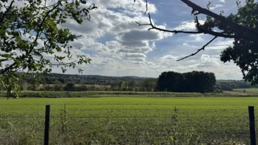
Garforth is an east Leeds settlement where built-up streets meet open farmland, former railway corridors, woodland, wetlands and the wider Aire Valley. Its scenery is shaped by both natural geography and industrial history. The result is a varied landscape with accessible walking routes and countryside viewpoints.
- What makes Garforth a scenic destination in east Leeds?
- Which Garforth landscapes offer the best countryside views?
- What is the Linesway and why is it important for Garforth scenery?
- Where can you find woodland and green spaces around Garforth?
- How does the River Aire landscape change the scenery around Garforth?
- What scenic areas near Garforth are best for wildlife?
- How has Garforth’s industrial history shaped its modern landscape?
- Can visitors explore scenic countryside from Garforth without a long journey?
- What should visitors know before exploring Garforth’s scenic areas?
- Why are Garforth’s landscapes important for the future?
For visitors, Garforth offers a practical base for exploring east Leeds without travelling deep into the Yorkshire countryside. The settlement connects with the Leeds Country Way, Linesway, local green spaces and routes towards the River Aire. Leeds City Council records 859 kilometres of public rights of way across the district, including 650 kilometres of footpaths, 199 kilometres of bridleways and 11 kilometres of byways.
The surrounding countryside also demonstrates how landscapes change over time. Coal mining, railways, agriculture and later environmental restoration all influenced the appearance of the area. Nearby Fairburn Ings and St Aidan’s provide particularly strong examples of former industrial land becoming important wildlife landscapes.
What makes Garforth a scenic destination in east Leeds?
Garforth is scenic because its urban settlement sits beside farmland, woodland, former railway corridors, local green spaces and wider Aire Valley landscapes. These environments provide contrasting views within short distances and connect directly with established walking routes around east Leeds.
Garforth does not have a single defining landscape. Its appeal comes from the transition between different environments.
The town itself contains residential streets, established trees, church grounds and local recreational spaces. Beyond the built-up area, fields, hedgerows and rural lanes create a more open setting. Former railway corridors provide another distinct landscape, particularly along the Linesway.
Leeds City Council lists several green spaces in the Garforth and Swillington area. These include BarleyHill Park, The Chase, Hollinhurst Wood, East Garforth Recreation Ground, Glebelands Recreation Ground, White House Lane and Swillington Park Lakes.
The wider landscape is also protected and managed through planning policies. Leeds Green Belt covers approximately 33,851 hectares, representing around 61% of the Leeds district. The council describes the countryside surrounding Leeds as important for farming, recreation, scenic beauty and environmental functions.
Garforth therefore works well for visitors looking for accessible countryside rather than remote wilderness. A short journey from the town centre leads towards open landscapes, while established paths provide connections to larger rural areas.
The landscape also has a strong historical dimension. Coal mining shaped Garforth for generations, and railway infrastructure developed partly to move coal and other goods. Some of those former industrial corridors now provide recreational access.
As you explore the modern landscape, you are crossing land with a deep heritage. Read about the full [Insert Anchor Text for History Article Here] to understand its origins.
Which Garforth landscapes offer the best countryside views?
The strongest countryside views around Garforth occur along the Leeds Country Way, Linesway connections, field-edge paths and routes towards the River Aire. These locations combine open farmland, hedgerows, woodland, railway corridors and elevated rural sections.
The Leeds Country Way provides the clearest way to experience Garforth’s surrounding countryside. It is a 62-mile circular walking route around Leeds, with official sections passing directly through the Garforth area.
The Barwick-in-Elmet to Garforth section measures approximately 5.5 miles. It moves through a sequence of village streets, dirt tracks, fields, farm routes and open countryside before reaching the northern edge of Garforth.
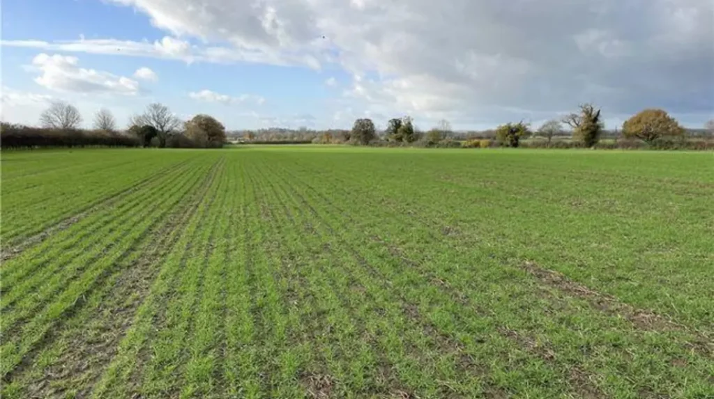
The route demonstrates the changing character of the landscape. Fields dominate sections outside the settlements. Hedgerows divide agricultural land. Trees create enclosed stretches. Open areas provide wider views across east Leeds.
The Garforth-to-River-Aire section adds another 5.5-mile stretch. It begins around the A63 and uses the former railway route known as the Linesway before continuing through Brecks Lane, White House Lane and countryside towards the Aire Valley.
Visitors seeking views should consider the relationship between open and enclosed landscapes. Field-edge paths provide wider sightlines, while wooded sections offer more contained scenery. Railway corridors provide linear perspectives through vegetation and surrounding fields.
The best visual experience therefore comes from combining different route environments rather than concentrating on one viewpoint.
Garforth also benefits from its location near neighbouring settlements including Barwick-in-Elmet, Aberford, Swillington, Allerton Bywater and the wider Aire Valley. Each provides additional countryside connections.
What is the Linesway and why is it important for Garforth scenery?
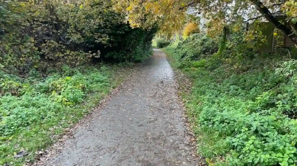
The Linesway is a three-mile former railway corridor between Garforth and Allerton Bywater. Its traffic-free alignment provides a direct countryside route through vegetation and open land while preserving a visible connection with Garforth’s industrial and railway landscape.
The Linesway is one of Garforth’s most distinctive outdoor corridors. Leeds City Council identifies it as a three-mile disused railway route between Garforth and Allerton Bywater.
Its former railway alignment explains its relatively straight route. Railways required controlled gradients and direct connections between industrial locations. Today, those characteristics provide a useful walking and cycling corridor.
The Linesway forms part of National Cycle Network Route 697. The Walk Wheel Cycle Trust records the Garforth-to-Woodlesford route at 7.8 miles, with 96.1% of the route traffic-free. The recorded surface includes 71.2% unsealed firm material and 28% asphalt.
The corridor provides a different type of scenery from open farmland. Trees and vegetation often frame the route. Gaps reveal surrounding fields and infrastructure. The linear route also creates a clear visual progression from the settlement towards the wider countryside.
The Linesway has particular value for visitors who want an outdoor experience without immediately committing to a long-distance walk.
A short out-and-back journey allows visitors to experience part of the corridor. Longer walks can use it as a connection to the Leeds Country Way and Aire Valley routes.
The former railway also gives the landscape historical meaning. Industrial infrastructure remains visible through the route’s alignment even where the original railway function has disappeared.
Where can you find woodland and green spaces around Garforth?
Garforth has several designated green spaces and woodland areas that provide shorter scenic walks, local recreation and wildlife habitat. BarleyHill Park, Hollinhurst Wood, The Chase, East Garforth Recreation Ground and Glebelands Recreation Ground are recognised local sites.
Leeds City Council’s parks byelaw information identifies a range of green spaces within the Garforth and Swillington area.
Hollinhurst Wood provides a woodland environment within the local green-space network. Woodland scenery differs from open agricultural land because mature trees create shade, enclosed paths and seasonal changes in vegetation.
BarleyHill Park is listed as a community park. Its designation reflects a local recreational role rather than the larger-scale countryside character found along the Leeds Country Way.
The Chase is identified as a local green space. Local green spaces are important because they provide accessible open land within and around developed areas.
East Garforth Recreation Ground and Glebelands Recreation Ground provide further recreational open space. These areas are particularly relevant for residents and visitors seeking a short outdoor break rather than a long countryside expedition.
White House Lane is also listed as local green space. The name connects with the wider countryside route structure around Garforth, where lanes and paths link built-up areas with agricultural land.
Visitors should distinguish between public green spaces and private agricultural land. A rural appearance does not automatically establish public access. Public rights of way provide legally defined access, while private land remains subject to landowner rights.
Leeds has an extensive public-rights-of-way network, and the council provides an official map and information service for checking routes.
How does the River Aire landscape change the scenery around Garforth?
The River Aire creates a wetter and more varied landscape beyond Garforth, with waterways, wetlands, grassland, woodland and former industrial sites. Routes towards the Aire Valley provide a clear contrast with Garforth’s urban streets and agricultural surroundings.
The River Aire is an important geographical feature in the wider landscape around Garforth. Routes from the settlement lead towards the river corridor through rural paths and former industrial infrastructure.
The Garforth-to-River-Aire section of the Leeds Country Way demonstrates this transition. After using the Linesway, the route continues through Brecks Lane, White House Lane and countryside towards the river.
The landscape becomes increasingly associated with water, wet grassland and woodland as routes approach the Aire Valley.
Nearby Swillington Ings and St Aidan’s provide particularly important examples. The area contains water, wetland and wooded habitats and has long been recognised for birdlife.
The ecological character of the Lower Aire Valley also reflects major changes in land use. Former industrial sites have developed into habitats supporting wildlife.
RSPB information describes St Aidan’s and Fairburn Ings as former coal-mining landscapes that now support wetland environments. Flooding, subsidence and restoration processes created pools, reedbeds, wet grasslands and woodland.
This transformation is significant for understanding scenery around Garforth. The modern landscape is not entirely natural. Human activity shaped many of its present features, followed by ecological recovery and land management.
The River Aire therefore adds another layer to Garforth’s outdoor geography. It links countryside, water, wildlife and industrial heritage.
What scenic areas near Garforth are best for wildlife?
Fairburn Ings, St Aidan’s and Swillington Ings provide the strongest wildlife-focused landscapes near Garforth. Their wetlands, lakes, reedbeds, grasslands and woodlands support diverse birdlife and create specialist environments beyond ordinary town parks.
RSPB Fairburn Ings is one of the most significant wildlife destinations accessible from the wider Garforth area. The reserve sits between Leeds, York and Wakefield and occupies a former industrial landscape.
Fairburn Ings has changed substantially over approximately six decades. The RSPB describes its transformation from coal face to wild place. Collapsed land became open water, reedbeds, wet grasslands and wet woodland, while former spoil tips became grasslands and woodland.
The reserve now supports breeding and wintering wildfowl and a range of specialist birds. Recorded species include bittern, bearded tit, Cetti’s warbler, little egret and spoonbill.
Fairburn Ings also has more than 9 kilometres of trails and five signposted trails. Its visitor infrastructure includes three hides and two viewpoints.
This makes it especially useful for visitors who want scenery combined with wildlife observation.
Swillington Ings provides another wildlife-rich environment closer to Garforth. The wider area contains wetlands, woodland and water bodies, including Astley Lake.
St Aidan’s is also notable for its former mining landscape. The RSPB identifies the site as another example of industrial land transformed into a wildlife habitat.
Visitors should follow reserve-specific access rules. Wildlife sites contain sensitive habitats. Dogs should remain under control, and visitors should stay on designated routes where required.
How has Garforth’s industrial history shaped its modern landscape?
Coal mining and railway development transformed Garforth’s land use, transport routes and settlement pattern. Former industrial corridors now contribute to recreation and green infrastructure, showing how an industrial landscape has evolved into a mixed urban, rural and ecological environment.
Garforth’s scenery cannot be separated from its industrial past.
Leeds City Council historical documentation records mining activity in the area from at least the medieval period, with large-scale industrial development occurring later. The Gascoigne family expanded mining interests, and deeper shafts were developed during the nineteenth century.
The population increased substantially alongside industrial employment. Recorded population figures rose from 782 in 1831 to 3,224 by 1899. The same council document records the eventual closure of the pits in 1930.
Railways then became an important component of the industrial landscape.
The Parlington Estate near Aberford provides an especially clear historical connection. Leeds City Council’s neighbourhood plan records a two-mile eighteenth-century wagonway known as the Fly Line. It transported coal from Gascoigne family collieries in Garforth towards a coal staithe at Aberford. The route later became part of the Aberford-Garforth Railway in 1837 and remained in use until 1924.
This history explains why former railway corridors and industrial routes remain visible around east Leeds.
Today, the Linesway demonstrates how former transport infrastructure can serve recreational purposes. The same basic corridor that once supported industrial movement now provides walking and cycling access.
The wider landscape also shows the ecological consequences of industrial land use. Fairburn Ings and St Aidan’s demonstrate how former mining areas can become wetlands, grasslands and woodland habitats.
Garforth’s scenic identity is therefore partly a story of landscape regeneration.
Can visitors explore scenic countryside from Garforth without a long journey?
Yes. Garforth provides direct access to local green spaces, the Linesway, public footpaths and Leeds Country Way sections. These routes allow short outdoor breaks near the settlement while also supporting longer journeys towards Allerton Bywater, the River Aire and wider countryside.
Garforth is particularly convenient for visitors with limited time.
The Linesway provides an immediate route into a greener environment. Its connection with Allerton Bywater creates a longer linear option, while the Leeds Country Way provides access to rural landscapes in several directions.
Leeds City Council’s public-rights-of-way network supports this connectivity. The district contains 859 kilometres of recorded rights of way.
Visitors can therefore select a route based on available time.
A short visit can focus on a local green space or a section of the Linesway. A longer afternoon can use the Leeds Country Way. A full outdoor day can extend towards the River Aire, St Aidan’s or the wider Aire Valley.
The Garforth-to-Woodlesford route demonstrates the potential for longer exploration. The Walk Wheel Cycle Trust records it at 7.8 miles and describes it as a largely traffic-free route through countryside, passing a nature reserve and RSPB site before reaching Woodlesford station.
This route structure also benefits visitors using public transport because Woodlesford provides a railway connection at the end of the route.
Scenic exploration around Garforth therefore does not require a car-based itinerary. The area’s paths and transport connections allow visitors to combine walking, countryside and rail travel.
Explore More Area Guide
Garforth Morning Visits: Best Early Starts in Leeds 2026
Garforth Leisure Facilities and Recreation Guide 2026
What should visitors know before exploring Garforth’s scenic areas?
Visitors should check current route information, public access status, weather, ground conditions and site restrictions before walking. Rural paths include roads, fields, tracks and variable surfaces, while nature reserves have specific rules protecting wildlife and habitats.
Good route planning is important around Garforth because not every attractive-looking path has the same access status.
Leeds City Council maintains information about public rights of way and provides a definitive map and statement. These resources establish the legal status of recorded paths.
Weather also affects walking conditions. The Walk Wheel Cycle Trust notes variations in surface types along the Garforth-to-Woodlesford route, including unsealed firm and loose sections.
Footwear should therefore match the route and season.
Road crossings require particular care. Leeds Country Way instructions include sections alongside and across roads. Visitors should follow current signage and traffic conditions rather than relying entirely on older route descriptions.
Nature reserves require additional consideration. At Fairburn Ings, dogs are permitted on public footpaths and bridleways but must remain under control. Dogs are not permitted inside the visitor centre and shop except for assistance dogs. Drones are not permitted to take off or land without permission from site management.
Fairburn Ings also provides accessible infrastructure. Its visitor centre has an accessible toilet, and viewing structures include steps or ramps.
These details make the area suitable for different types of visitors, provided routes are selected according to individual access requirements.
Why are Garforth’s landscapes important for the future?
Garforth’s landscapes provide recreation, wildlife habitat, public access and evidence of industrial heritage. Maintaining connections between green spaces, footpaths, woodland, farmland and waterways will remain important for protecting east Leeds’ landscape character as surrounding communities continue to develop.
The future value of Garforth’s scenery depends on connectivity.
A single green space provides local recreation, but linked green spaces create a broader landscape network. Public footpaths connect settlements to countryside. Former railway routes connect communities with rivers and nature reserves. Wetlands provide wildlife habitat and ecological functions.
Leeds Green Belt policy already recognises the importance of surrounding countryside for farming, recreation, scenic beauty and environmental functions.
The Parlington planning framework also identifies landscape-management priorities including maintaining wooded valleys, restoring hedgerows and trees, and improving continuity between wildlife and recreation corridors.
These principles are directly relevant to Garforth because the town sits close to several rural and ecological corridors.
Landscape quality also supports outdoor tourism. Visitors increasingly use established walking and cycling networks to explore areas beyond major city centres. Garforth’s links to the Leeds Country Way and Linesway give it a defined position within this wider network.
The area’s industrial history adds further value. Former railway lines, mining landscapes and restored wetlands demonstrate the physical transformation of east Leeds.
Garforth therefore offers more than isolated scenic spots. Its importance lies in the relationship between settlement, countryside, transport infrastructure, agriculture, woodland and restored industrial land.
For tourists and leisure travellers, this creates an accessible outdoor destination within the Leeds district. For residents, it provides local recreation and walking opportunities. For business travellers and digital nomads with limited downtime, the network provides straightforward ways to reach open landscapes without a lengthy journey.
Garforth’s scenic character is ultimately defined by variety. The Linesway provides a former railway landscape. The Leeds Country Way provides farmland and rural paths. Hollinhurst Wood and local green spaces provide woodland and neighbourhood scenery. The River Aire and nearby nature reserves provide wetlands and wildlife.
Together, these landscapes make Garforth a useful starting point for exploring the quieter outdoor side of Leeds.
What are the best scenic areas in Garforth?
Garforth’s best scenic areas include the Linesway, Leeds Country Way, Hollinhurst Wood, local green spaces and countryside towards the River Aire. These locations offer farmland, woodland, former railway landscapes, wetlands and wildlife habitats within easy reach of the town.