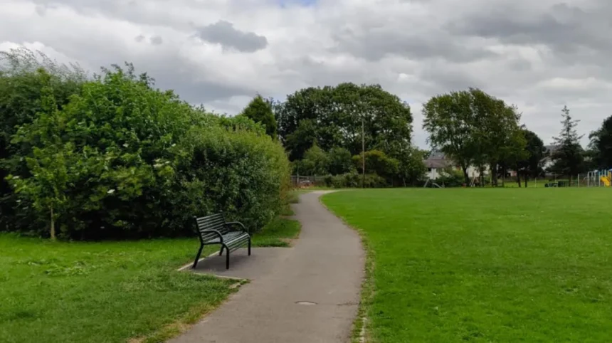
Garforth is a town in the east of Leeds with a strong network of parks, recreation grounds, local green spaces, public rights of way, woodland areas and former railway corridors. This combination gives visitors and residents practical options for short everyday walks, longer countryside routes and regular outdoor time.
- What makes Garforth suitable for everyday green-space walks?
- Which green spaces in Garforth are useful for regular walks?
- What is the Lines Way and why is it important for walking?
- How can walkers use the Leeds Country Way around Garforth?
- Which Garforth green spaces work for short everyday walks?
- Are Garforth’s green spaces connected to public rights of way?
- What natural features can walkers expect around Garforth?
- How accessible are Garforth’s green spaces for different walkers?
- Can visitors combine Garforth green spaces with a longer day out?
- What should walkers check before using Garforth’s paths?
- Why are Garforth’s green spaces important for the future?
- How can you plan an everyday walking routine in Garforth?
Leeds City Council records a wide range of green-space categories around Garforth and Swillington, including Barley Hill Park, Firthfield, Glencoe Estate, Goosefields, Longmeadows, Primrose Hill Drive, The Chase, White House Lane, East Garforth Recreation Ground, Glebelands Recreation Ground and Hollinhurst Wood.
The Garforth Neighbourhood Plan also identifies numerous local green spaces and green infrastructure sites. These include Jubilee Gardens, Barley Hill Park, Glebelands Recreation Ground, Firthfields, Long Meadows, Goosefields, Garforth Cricket Club, East Garforth Field, Stub Wood and the area associated with the Lines Way.
For everyday walking, the important feature is variety. A short local walk can stay within residential green spaces, while a longer outing can follow a public footpath towards countryside beyond the settlement. The Lines Way provides a particularly useful link between Garforth and the wider walking network.
Leeds has 859 kilometres of recorded public rights of way, consisting of 650 kilometres of footpaths, 199 kilometres of bridleways and 11 kilometres of byways. These routes connect urban areas with countryside and form an important part of the city’s walking infrastructure.
What makes Garforth suitable for everyday green-space walks?
Garforth combines neighbourhood parks, recreation grounds, woodland, green corridors and established walking routes within a relatively compact area. The network supports short local walks, longer countryside outings and regular outdoor exercise without requiring a journey into central Leeds.
The main advantage of Garforth’s green-space network is its range of route types. Walkers can use maintained recreation grounds for straightforward outings, local green spaces for short neighbourhood loops and public rights of way for journeys between built-up areas and open countryside.
The council’s parks and countryside records specifically classify several Garforth locations as Local Green Space. These include The Chase, Firthfield, Glencoe Estate, Goosefields, Longmeadows, Primrose Hill Drive, White House Lane and other sites.
The Garforth Neighbourhood Plan expands this picture. Its local green-space policy identifies more than 40 sites or areas, including existing recreational facilities, allotments, playing fields, verges, community gardens and natural areas.
This creates a layered walking environment. A visitor staying in Garforth can choose a short walk near accommodation or local facilities. A resident can build a regular route using several connected spaces. A business traveller with limited free time can use a short green-space circuit instead of travelling into Leeds city centre.
The local network also has a practical relationship with public rights of way. Leeds City Council defines a public right of way as a highway where the public has a legal right of passage over another person’s land. Recorded routes appear on the definitive map and statement.
Which green spaces in Garforth are useful for regular walks?
Useful Garforth walking spaces include Barley Hill Park, Glebelands Recreation Ground, The Chase, Firthfields, Longmeadows, Goosefields, East Garforth Field, Jubilee Gardens and Hollinhurst Wood, with each providing a different setting for short local outdoor time.
Barley Hill Park is recorded by Leeds City Council as a community park. Its designation places it within the formal green-space network serving Garforth and Swillington.
Glebelands Recreation Ground is another recognised recreational area. The council records the site as a recreation ground and separately lists its playground and skate-park facilities.
The Chase is designated as a Local Green Space. It forms part of the wider collection of smaller green areas that support everyday outdoor access within Garforth’s residential environment.
Firthfields is another important local green-space area. The council records Firthfield as a Local Green Space, while the Garforth Neighbourhood Plan also identifies Firthfields and Firthfields Allotments within its green-space framework.
Longmeadows and Goosefields provide additional neighbourhood green areas. Both appear in the council’s local green-space records and in the neighbourhood plan’s designated green-space framework.
Hollinhurst Wood is categorised by Leeds City Council as a woodland area. Woodland provides a different walking environment from open recreation grounds, particularly for visitors looking for tree cover and a more natural setting.
Jubilee Gardens is also identified in the Garforth Neighbourhood Plan. Community gardens and smaller green areas are important because they provide outdoor space within the built environment rather than requiring a journey to a major country park.
The East Garforth Field near Aberford Road is another green-space site identified in the neighbourhood plan. Its inclusion demonstrates the breadth of Garforth’s green infrastructure beyond formal parks.
What is the Lines Way and why is it important for walking?
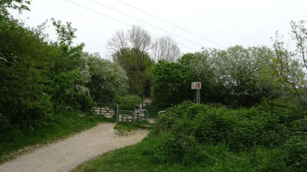
The Lines Way is a roughly three-mile disused railway route between Garforth and Allerton Bywater. Leeds City Council promotes it as a shorter walking route, while Garforth planning documents identify its connectivity role within the local green infrastructure network.
The Lines Way follows a former railway alignment. Leeds City Council lists it among the shorter walking routes in the district and gives its length as three miles between Garforth and Allerton Bywater.
The route is significant because former railway corridors often provide relatively direct connections through landscapes that have changed substantially since their railway use ended.
Leeds City Council’s description of the Leeds Country Way provides additional detail for walkers approaching the Lines Way from Garforth. The Garforth-to-River-Aire section begins at the A63 and follows the old railway line, now called the Lines Way, for more than half a mile before continuing towards Brecks Lane and the surrounding countryside.
The Garforth Neighbourhood Plan identifies the Lines Way as part of the area’s green infrastructure and supports protecting its connectivity function. The plan also identifies an opportunity to improve the connection between the Lines Way and Green Lane Cricket Club.
The route therefore serves more than recreational walking. It forms part of a broader movement network linking Garforth with neighbouring areas.
As you walk along a modern green corridor, you are also crossing land shaped by Garforth’s industrial and transport history. Read about the to understand the origins of the former railway landscape.
How can walkers use the Leeds Country Way around Garforth?
The Leeds Country Way provides longer countryside walking around Garforth, including a 5.5-mile section from Barwick-in-Elmet to Garforth and another 5.5-mile section from Garforth towards the River Aire through the Lines Way and surrounding rural routes.
The Leeds Country Way is a 62-mile circular walking route around Leeds. Leeds City Council divides the route into stages, making sections practical for walkers who do not want to complete the entire circuit.
The Barwick-in-Elmet to Garforth section covers approximately 5.5 miles. The route passes through Scholes and rural land before reaching the northern edge of Garforth. It then enters the town and continues towards the old railway line near Selby Road.
The Garforth-to-River-Aire section is also approximately 5.5 miles. It begins at the A63, uses the Lines Way and then continues along rural paths, lanes and countryside towards the River Aire.
This makes the Leeds Country Way useful for visitors who want a substantially longer walk than a neighbourhood circuit.
The route also demonstrates how Garforth’s local green spaces connect with the wider Leeds countryside. A short local walk and a longer countryside route are therefore part of the same geographic network.
Walkers should use the official route information before setting out because public paths, surfaces and access arrangements can change. Leeds City Council’s definitive map records the legal status of public paths, while promoted recreational routes can contain a mixture of public rights of way, permissive paths and adopted highways.
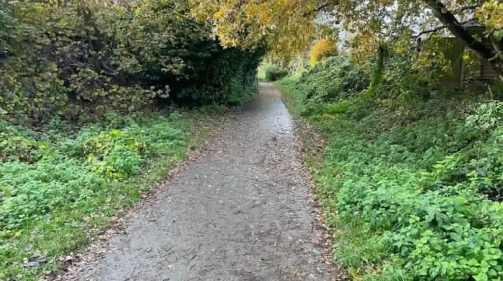
Which Garforth green spaces work for short everyday walks?
Short everyday walks work particularly well around neighbourhood green spaces such as The Chase, Firthfields, Longmeadows, Goosefields, Jubilee Gardens and local recreation grounds because these sites sit within Garforth’s built environment and support convenient outdoor access.
Short walks do not require a long-distance trail. Garforth’s network contains numerous small green areas that can form part of a regular walking routine.
The Chase is recorded as a Local Green Space. Its neighbourhood position makes this type of site useful for residents who want outdoor time without travelling to a larger destination.
Longmeadows and Goosefields are also recorded as Local Green Spaces. The Garforth Neighbourhood Plan identifies both locations within its wider green-space policy.
Glebelands Recreation Ground provides another option. Recreation grounds serve a different function from nature reserves because they accommodate active recreation alongside informal outdoor use.
Local verges and smaller green areas also have a role. The Garforth Neighbourhood Plan identifies green spaces on locations including Fairburn Drive, Cotswold Drive, Green Lane and Woodlands Drive.
These smaller areas matter because everyday walking depends on proximity. A green space that sits close to homes, shops, community facilities or public transport can become part of a regular routine without requiring dedicated travel.
For visitors, these locations are useful for low-commitment outdoor time. They can also complement a wider Garforth itinerary that includes local cafés, shops, heritage sites and transport connections.
Are Garforth’s green spaces connected to public rights of way?
Yes. Garforth’s green spaces sit within a wider public-rights-of-way network that connects neighbourhoods with countryside. Leeds records 859 kilometres of public rights of way across the district, including footpaths, bridleways and byways.
Public rights of way provide a legal access framework for walking. Leeds City Council states that only routes shown on the definitive map and statement are proven public rights of way.
Footpaths are available for walking and several forms of mobility equipment. Bridleways provide additional rights for activities including cycling and horse riding.
The Garforth Neighbourhood Plan places particular emphasis on improving accessibility and connectivity within its public rights-of-way network. Its policy supports improvements to signage and accessibility and encourages new development to connect with existing paths.
The plan also highlights trees and hedgerows along public rights of way as features that should be retained where appropriate.
This network allows a walker to move from an urban street into a more rural environment without relying entirely on roads.
Walkers should distinguish between a public right of way and an informal path. An informal route does not automatically have the same legal status as a recorded public path. Leeds City Council’s definitive map is therefore the appropriate reference when legal access is important.
What natural features can walkers expect around Garforth?
Garforth’s walking environment includes woodland, grassland, hedgerows, former railway corridors, playing fields, allotments and smaller natural areas. These features create varied outdoor settings within and around the built-up area.
The Garforth Neighbourhood Plan identifies several natural areas as part of its green-space framework. These include Stub Wood, described as ancient woodland, and Owl Wood/Newfield Chase, associated with a disused sand quarry and tree preservation orders.
Woodland changes the character of a walking route by providing tree cover and habitat. Open grassland provides a different landscape, particularly around playing fields, recreation grounds and larger green spaces.
Hedgerows are another recurring feature. The Garforth Neighbourhood Plan’s examiner’s report notes that trees and hedgerows are features of the public-rights-of-way network.
Former railway corridors such as the Lines Way add another landscape type. Their linear structure provides a clear walking connection between places that were historically linked by rail.
The combination of these features gives Garforth a green infrastructure network rather than a collection of isolated parks.
How accessible are Garforth’s green spaces for different walkers?
Accessibility varies by location, route surface and path type. Leeds guidance states that accessible green-space paths should be hard surfaced and appropriately wide, while public rights of way provide established access routes with defined legal status.
Leeds City Council’s green-space guidance states that paths within accessible green spaces should be hard surfaced and wide enough for their intended use. It gives a minimum width of 2 metres for footpaths, with wider paths recommended in areas of higher pedestrian activity.
The same guidance states that informal recreational pedestrian routes should generally be at least 2 metres wide, with a 1.5-metre minimum where passing places are provided. It also promotes circular path systems and seating within green spaces.
These design standards apply to green-space planning rather than guaranteeing identical conditions at every Garforth site.
Actual walking conditions vary according to the individual route. A surfaced recreation-ground path is different from a rural public footpath across fields. Weather also affects unsealed paths, particularly during periods of persistent rain.
People using wheelchairs, mobility scooters or pushchairs should check the specific route surface and access points before starting a longer walk.
Leeds’ public-rights-of-way guidance states that prams, pushchairs and wheelchairs can be used where practical and that dogs can be taken on public rights of way when kept on a lead or under close control.
Can visitors combine Garforth green spaces with a longer day out?
Visitors can combine Garforth’s local green spaces with longer routes through the surrounding countryside. The Lines Way and Leeds Country Way provide the strongest connections between everyday neighbourhood walking and extended outdoor excursions.
A visitor with limited time can choose a short green-space walk before continuing with other activities in Garforth or Leeds.
A longer visit can incorporate the Lines Way. Its approximately three-mile length makes it suitable for a more substantial linear walk, while its position within the former railway corridor connects Garforth with Allerton Bywater.
The Leeds Country Way provides another option for experienced walkers. The route’s Garforth sections connect the town with Barwick-in-Elmet, Scholes and countryside towards the River Aire.
This creates a useful progression for visitors. A short neighbourhood walk requires limited planning. A Lines Way outing requires more time. A Leeds Country Way section requires greater preparation for distance, navigation and countryside conditions.
The distinction is important for travellers because not every green space is designed as a destination attraction. Many of Garforth’s smaller spaces serve local residents first and work best as part of everyday outdoor activity.
What should walkers check before using Garforth’s paths?
Walkers should check the official route status, distance, surface, weather conditions and access information before setting out. Leeds City Council’s definitive map provides the legal record for public paths, while promoted routes provide additional walking information.
The definitive map and statement provide the legal record of public paths in Leeds. The map identifies recorded routes, while the accompanying statement records details such as status, description, width, length, structures and surface.
Leeds City Council also warns that its online definitive map is a working copy and should not be treated as a legal document for determining exact path alignment.
For everyday walks, checking the route before departure helps identify whether a path is surfaced, rural, linear or suitable for a particular type of mobility.
Weather is another practical consideration. Field paths and unsealed sections become wetter and more difficult after sustained rainfall. Footwear should match the surface and season.
Dog walkers should follow public-rights-of-way requirements. Leeds states that dogs can be taken on public rights of way when kept on a lead or under close control.
Cyclists should also distinguish between footpaths and bridleways because the legal rights differ. A footpath is primarily a walking route, while a bridleway provides additional rights including cycling.
Explore More Area Guide
Garforth Breakfast: Best Cafés and Leisurely Morning Spots
Garforth Independent Shops and Local Finds Guide
Why are Garforth’s green spaces important for the future?
Garforth’s green spaces form part of a planned green infrastructure network that supports walking, connectivity, recreation, biodiversity and local quality of life. The neighbourhood plan specifically seeks stronger links between existing green spaces and public rights of way.
Green infrastructure refers to connected natural and semi-natural spaces that provide environmental and recreational functions. In Garforth, this includes parks, woodland, recreation grounds, allotments, local green spaces, hedgerows and walking corridors.
The Garforth Neighbourhood Plan identifies opportunities to connect existing green spaces and improve walking and cycling links. Its mapping work identifies green spaces, green corridors and other green infrastructure opportunities across the area.
The plan specifically identifies the Lines Way as an important connection and supports improvements between the route and Green Lane Cricket Club.
This approach gives everyday walking a long-term planning role. Green spaces are not simply areas of unused land. They form part of the movement, recreation and environmental structure of the settlement.
The wider Leeds strategy also recognises walking as an everyday activity. Leeds City Council states that a brisk 10-minute daily walk provides health benefits and contributes towards the recommended 150 minutes of weekly exercise.
For Garforth, the value of the network therefore comes from regular use as well as occasional longer walks.
How can you plan an everyday walking routine in Garforth?
An effective Garforth walking routine starts with a nearby green space, then expands towards connected routes such as the Lines Way or Leeds Country Way. The approach allows walkers to match distance, terrain and available time without leaving the local area.
Start with the green space closest to your accommodation or home. Barley Hill Park, Glebelands Recreation Ground, The Chase, Firthfields, Longmeadows and Goosefields represent different parts of Garforth’s local green-space network.
For a short outing, use a local green space or recreation ground and return through surrounding residential streets.
For a longer walk, identify a connection to a public right of way. Leeds provides an online public-rights-of-way map and route information for walkers.
For a substantial countryside walk, consider a section of the Leeds Country Way. The Garforth sections are approximately 5.5 miles each, making them considerably longer than a short neighbourhood circuit.
The Lines Way provides another intermediate option at approximately three miles between Garforth and Allerton Bywater.
This layered approach makes Garforth suitable for different walking habits. Short routes support everyday outdoor time. Medium routes provide a stronger exercise session. Longer routes connect the town with the wider Leeds countryside.
The result is a practical walking network built from many different types of green space rather than one single destination.
Garforth’s local green spaces therefore work best when viewed as a connected system. Parks, recreation grounds, woodland, neighbourhood green spaces, public rights of way and former railway corridors each perform a different function.
For tourists, the network provides an opportunity to experience a greener side of east Leeds. For residents, it creates regular outdoor options close to home. For business travellers and digital nomads, nearby green spaces provide convenient downtime without requiring a journey into central Leeds.
The Lines Way and Leeds Country Way provide the strongest links into longer walking territory, while smaller sites such as The Chase, Longmeadows, Goosefields, Firthfields and local recreation grounds support everyday use.
With official route information checked before departure, Garforth offers a practical combination of accessible local spaces and longer countryside connections for regular walking throughout the year.
What are the best green spaces for walks in Garforth?
Garforth has several green spaces suitable for everyday walks, including Barley Hill Park, Glebelands Recreation Ground, The Chase, Firthfields, Longmeadows, Goosefields, Jubilee Gardens and Hollinhurst Wood. Each provides a different type of local outdoor environment.