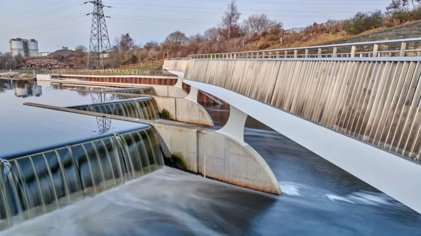
Headingley is a residential and commercial district in north-west Leeds, West Yorkshire. Understanding flood risk in Headingley requires checking river flooding, surface water flooding, drainage conditions and local topography. Official flood maps, Environment Agency warnings and Leeds City Council information help visitors, residents and property users make informed decisions about travel, accommodation and access to local amenities.
- What does flood risk mean in Headingley?
- What types of flooding affect Headingley and the wider Leeds area?
- How can you check the official flood risk for a Headingley postcode?
- What does the surface water flood risk map show?
- How does Headingley’s landscape influence surface water flooding?
- Where can you find flood warnings and current information for Headingley?
- How does Leeds City Council manage flood risk and surface water?
- How does climate change affect flood risk in Headingley?
- How should tourists and visitors prepare for flooding in Headingley?
- What should Headingley residents check before buying or renting a property?
- What is the historical context of flooding and drainage in Leeds?
- What should you do if surface water flooding occurs in Headingley?
Flood risk information is relevant throughout the year. Heavy rainfall, blocked drains, saturated ground and overflowing watercourses create different types of flood hazards. Surface water flooding is particularly important in urban areas because rainfall runs across roads, pavements, car parks and other hard surfaces when drainage systems cannot remove water quickly enough.
This guide explains how to find reliable flood-risk information for Headingley, interpret official maps, understand local drainage considerations and prepare for disruption when travelling around Leeds.
What does flood risk mean in Headingley?
Flood risk in Headingley refers to the likelihood and potential consequences of flooding from sources such as heavy rainfall, rivers, overflowing drainage systems and groundwater. Official maps identify areas requiring closer attention, while local conditions determine the practical risk at a particular property or street.
Flood risk combines two main factors: the probability of flooding and its potential consequences. Probability describes how likely a flood event is to occur within a specified period. Consequences include damage to buildings, disruption to transport, danger to people and interruptions to local services.
Headingley forms part of the wider Leeds urban area, where residential streets, commercial premises, university-related accommodation and public transport routes occupy a varied landscape. Differences in ground elevation, drainage infrastructure and proximity to watercourses influence local flood exposure.
The term flood risk does not mean that every property within a mapped area will flood. Equally, a property outside a high-risk zone is not guaranteed to remain dry during extreme rainfall. Floodwater follows local ground levels and drainage pathways, which sometimes extend beyond the boundaries shown on a national map.
The most reliable assessment combines official flood mapping with the exact property address, current weather warnings, local authority information and observations of the immediate surroundings.
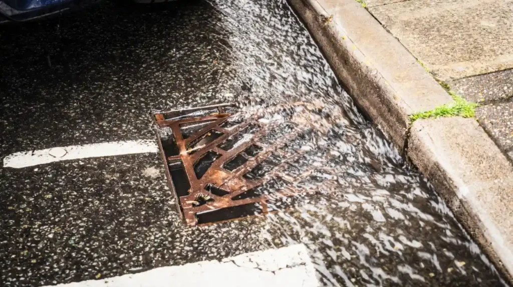
What types of flooding affect Headingley and the wider Leeds area?
Three important flood mechanisms are river flooding, surface water flooding and flooding associated with drainage systems. River flooding occurs when watercourses overflow, surface water flooding follows intense rainfall, and drainage-related flooding develops when sewers or other drainage infrastructure cannot manage water effectively.
These mechanisms have different causes and require different information sources. Identifying the type of flooding under consideration helps visitors and residents interpret warnings accurately.
River flooding
River flooding occurs when a watercourse exceeds its normal capacity and water spreads onto surrounding land. The Environment Agency monitors designated rivers and issues warnings for relevant locations in England.
The wider Leeds area includes the River Aire and its tributaries. Their flood behaviour is relevant to the city’s broader flood-management system, although river proximity and exposure vary considerably between neighbourhoods.
A river flood warning for one part of Leeds does not automatically establish that Headingley is directly affected. The precise warning area, river catchment and local elevation determine its relevance.
Surface water flooding
Surface water flooding, also called pluvial flooding, occurs when rainfall accumulates faster than the ground or drainage network can absorb or carry it away.
Paved roads, building roofs, driveways and car parks prevent rainfall from soaking directly into the ground. During intense downpours, water travels along the surface and collects in low-lying locations.
This form of flooding is particularly difficult to predict at individual street level because rainfall intensity, gradients, drain capacity and maintenance conditions all affect where water accumulates.
Drainage and sewer flooding
Drainage-related flooding occurs when sewers, culverts, gullies or other drainage infrastructure become overwhelmed, obstructed or damaged. Water then backs up or escapes onto roads and surrounding properties.
Blocked road gullies are an important local consideration during heavy rainfall. Leaves, litter and other debris restrict the entry of water into drains, increasing the likelihood of temporary surface accumulation.
Sewer flooding also presents a potential internal property hazard. Yorkshire Water provides information about sewerage services and reporting drainage problems across its service area.
Groundwater flooding
Groundwater flooding occurs when the water table rises sufficiently to affect land or buildings. It differs from surface water flooding because the source is water moving through underground soil and rock.
Its relevance depends on local geology, groundwater levels and the characteristics of individual sites. National surface water maps do not provide a complete assessment of every groundwater-related hazard.
How can you check the official flood risk for a Headingley postcode?
The Environment Agency’s GOV.UK long-term flood risk service provides postcode-based information about river, surface water, reservoir and available groundwater risks in England. Enter the exact Headingley postcode, examine each flood source separately, and check future climate-related changes before making decisions.
The official starting point is the Check your long-term flood risk service. It provides mapped information for the area surrounding a searched address and helps users identify the principal sources of flooding.
Follow this process when checking a location in Headingley:
- Enter the postcode for the accommodation, property or destination.
- Select the relevant location on the map.
- Review the separate results for surface water, rivers and the sea, reservoirs, and groundwater where information is available.
- Open the surface water map to examine the potential extent and depth of flooding.
- Review the information about how climate change affects long-term flood risk.
- Record the date of your assessment and revisit the service before a significant journey or property decision.
The results distinguish between different flood mechanisms. A low river flood risk does not automatically mean low surface water risk. Likewise, a mapped surface water risk does not establish that every building on the affected land will flood.
The Environment Agency expressly states that its long-term service does not assess every property individually. It also excludes certain problems, such as flooding caused by burst pipes and blocked drains.
For a more detailed planning assessment, consult the Leeds City Council Strategic Flood Risk Assessment. The council uses flood mapping and catchment modelling to inform planning policy and identify locations requiring flood mitigation.
What does the surface water flood risk map show?
The surface water flood risk map identifies areas where rainfall runoff is likely to accumulate under modelled conditions. It shows different levels of risk and provides information about potential flood extent and depth, but it does not confirm whether an individual building will flood.
Surface water maps are useful because they show hazards that river flood maps do not capture fully. A road far from a major river can still experience flooding when intense rainfall exceeds the capacity of drains and the surrounding ground.
The Environment Agency’s Risk of Flooding from Surface Water mapping uses modelling to estimate how rainfall moves across the landscape. The results account for terrain and the likely behaviour of water during different rainfall scenarios.
The map presents risk categories ranging from very low to high. These categories describe the modelled likelihood of flooding in an area, not a guarantee about the outcome of the next storm.
When examining a Headingley location, pay attention to three details.
Flood extent: This shows the land expected to be affected under a particular modelled scenario. Check whether the mapped area overlaps an access road, car park, entrance or nearby pedestrian route.
Flood depth: This indicates the estimated depth of water under the relevant scenario. Even shallow water creates hazards for pedestrians, cyclists and drivers when it conceals uneven surfaces or moving water.
Flood likelihood: This indicates how frequently flooding is expected under the model’s assumptions. Compare this information with other flood sources rather than relying on one category alone.
The map also has limitations. Local construction, changes in drainage, debris, maintenance conditions and the precise layout of a building influence actual flooding. A model cannot represent every temporary obstruction or individual property feature.
For these reasons, use the surface water map as an initial screening tool. A detailed property assessment requires additional evidence about ground levels, drainage, historical incidents and building construction.
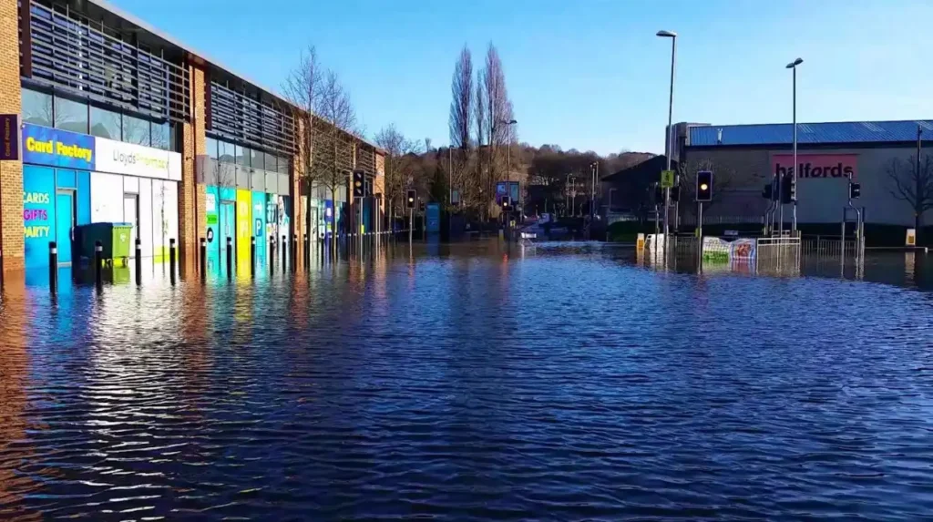
How does Headingley’s landscape influence surface water flooding?
Surface water flooding depends on rainfall intensity, ground gradients, drainage capacity and the amount of impermeable land. In Headingley, these factors need to be assessed at street and property level because urban development changes how quickly rainfall reaches drains and lower ground.
Impermeable surfaces include concrete, asphalt, paving and rooftops. These surfaces restrict infiltration, which is the process through which water enters the soil. During heavy rainfall, a larger share of the water runs over the surface instead.
Local topography also affects runoff. Water generally flows downhill, collecting in depressions, along road channels and behind barriers. A property on higher ground can have different exposure from a property on a lower section of the same road.
The wider Leeds area contains a mixture of elevated urban land, valleys and watercourses. Leeds City Council’s Strategic Flood Risk Assessment identifies surface water and drainage hazards across the district, including isolated areas of increased risk within the urban area. It also examines the influence of watercourses and culverted channels.
These district-wide findings provide context, not proof that a particular Headingley street has a specific flood classification. An address-level map check remains necessary.
Why do drains and paved areas matter?
Road gullies collect rainwater and transfer it into drainage systems. When gullies become obstructed or the network reaches capacity, rainfall accumulates on the road surface.
Large paved areas also generate runoff. Examples include shop forecourts, residential driveways and parking areas. Their drainage arrangements influence whether water flows towards a building or away from it.
Why do slopes and low points matter?
Sloping roads direct runoff towards lower ground. Water can collect at junctions, underpasses, entrances and dips in the road surface. The presence of a drain does not guarantee that these locations remain clear during intense rainfall.
Visitors should treat standing water on a road as a potential hazard rather than assuming it is shallow. Pedestrians should avoid entering moving or deep water, and drivers should never attempt to cross floodwater when its depth or road condition is uncertain.
Where can you find flood warnings and current information for Headingley?
Use the Environment Agency’s live flood service to check current warnings, alerts, rainfall and river levels, and the five-day flood outlook. For local surface water incidents and drainage problems, consult Leeds City Council because national warnings do not cover every sudden urban flood.
Long-term flood maps and current flood warnings serve different purposes. A long-term map describes potential exposure over time, while a live warning service provides information about developing or forecast flood conditions.
Check the Environment Agency’s current flood information before travelling during periods of heavy rain. Search using Leeds or the relevant postcode, then examine the warning area and its stated conditions.
The service includes flood alerts, flood warnings, river and rainfall levels, and a forecast covering the next five days. A warning for another part of Leeds does not automatically indicate a direct threat to Headingley. Read the location and description carefully.
For localised surface water flooding, use Leeds City Council’s flooding information. The council’s flood risk management responsibilities cover sources such as surface water, ordinary watercourses, groundwater and rainfall-related sewer flooding.
Yorkshire Water is another relevant source for drainage and sewerage issues. Its services help residents distinguish problems with public sewerage infrastructure from surface water collecting on a road.
If you need telephone advice about flood information in England, Floodline is available on 0345 988 1188. The government service lists this as a 24-hour helpline.
Check official information again when weather conditions change. A map viewed several months earlier cannot establish whether a road is safe during today’s rainfall.
How does Leeds City Council manage flood risk and surface water?
Leeds City Council manages local flood risk through strategic assessment, planning requirements, drainage considerations and coordination with other responsible organisations. Its Local Flood Risk Management Strategy considers surface water, ordinary watercourses, groundwater and sewer flooding associated with rainfall.
Flood management involves more than constructing barriers beside rivers. It also requires identifying runoff pathways, protecting drainage capacity, controlling development in vulnerable locations and improving the resilience of existing communities.
The council’s Strategic Flood Risk Assessment supports planning decisions across Leeds. It identifies areas exposed to different flood sources, considers climate change and informs land-use policies. The assessment also examines the potential need for mitigation measures in new development.
A related approach is sustainable drainage systems, commonly abbreviated to SuDS. These systems manage rainwater close to where it falls rather than directing all runoff immediately into conventional drains.
Examples include:
- Permeable paving, which allows some rainwater to pass through the surface into underlying materials.
- Rain gardens, which collect runoff and allow vegetation and soil to help manage it.
- Swales, which are shallow, vegetated channels that convey and temporarily store water.
- Detention basins, which hold runoff temporarily and release it at a controlled rate.
- Green roofs, which retain some rainfall and slow the movement of water from rooftops.
These measures reduce runoff pressure when designed, maintained and installed appropriately. Their effectiveness depends on site conditions, available storage, soil characteristics and the capacity of the drainage system.
Leeds City Council’s planning standards address flood risk and surface water drainage for development proposals within its boundary. Applicants need to consider applicable planning requirements and the advice of relevant authorities.
Flood management also involves the Environment Agency and Yorkshire Water, alongside other relevant organisations. Responsibilities differ according to the water source and infrastructure involved.
For residents, the practical implication is straightforward: report a drainage problem to the appropriate organisation and use official maps to understand the wider context. A proposed development or drainage improvement should be assessed on its own evidence rather than assumptions based on nearby properties.
How does climate change affect flood risk in Headingley?
Climate change influences flood risk by changing rainfall patterns and increasing the likelihood of some intense rainfall events. Long-term flood assessments therefore consider future conditions alongside present-day exposure, helping residents, planners and property owners evaluate risks over the lifespan of buildings and infrastructure.
Heavy rainfall creates pressure on urban drainage systems. When rainfall intensity exceeds the rate at which water can enter drains or infiltrate the ground, surface water accumulates.
Climate change does not affect every flood source in the same way. River flooding depends on catchment-wide rainfall, river levels, soil saturation and other hydrological conditions. Surface water flooding responds more directly to intense local rainfall, ground gradients and drainage capacity.
The Environment Agency’s long-term flood risk service includes information about how climate change affects flood risk. This helps users distinguish present-day modelled exposure from potential future conditions.
For Headingley property owners, future risk matters when planning renovations, extensions, landscaping and drainage improvements. A design that manages current runoff adequately requires consideration of the relevant planning standards and future rainfall assumptions.
Visitors also benefit from understanding the issue. A dry pavement during the morning does not establish that the same route will remain safe during a later downpour. Local weather, current warnings and observed conditions remain important when planning outdoor activities.
Long-term planning therefore combines flood mapping, suitable drainage design, maintenance and preparedness. No single measure eliminates every flood hazard, so assessments need to account for the limitations of individual defences and drainage systems.
How should tourists and visitors prepare for flooding in Headingley?
Visitors should check weather forecasts, current flood information and transport conditions before travelling during periods of heavy rain. They should identify alternative routes, avoid flooded roads and underpasses, and follow official instructions when flooding disrupts access to accommodation, shops or public transport.
Headingley attracts visitors to its local shops, restaurants, pubs, accommodation and sporting venues. Heavy rainfall can disrupt ordinary journeys even when a destination itself is not flooded.
A practical travel plan starts with the route. Check the forecast and current flood information before leaving, especially if travelling on foot or cycling between locations.
Visitors should take the following precautions:
- Check official flood information before setting out during severe weather.
- Allow extra travel time when heavy rainfall affects roads or public transport.
- Avoid walking or driving through floodwater.
- Follow road closures and instructions from emergency services.
- Keep a charged mobile phone available for travel updates and emergency communication.
- Contact accommodation providers if access routes become unsafe or disrupted.
Floodwater presents hazards beyond its visible depth. It can conceal potholes, debris, damaged surfaces and open drainage features. Moving water can also destabilise pedestrians and vehicles.
Drivers should never assume that a flooded road is passable because another vehicle has crossed it. Turn around and follow a safe alternative route.
People attending sporting events or visiting local businesses should check venue communications when extreme weather affects access. Travel disruption can occur outside the immediate location of an event, particularly where routes pass through lower ground or drainage problem areas.
Visitors should also distinguish between a general weather warning and a confirmed flood warning for a specific location. Both are useful, but they provide different information.
What should Headingley residents check before buying or renting a property?
Anyone buying or renting a property in Headingley should check its postcode against official flood maps and investigate the building’s history, drainage arrangements and access routes. For higher-stakes property decisions, obtain suitable property-specific evidence rather than relying solely on a general flood risk category.
A postcode search is an appropriate first step, but property decisions require a closer examination of the building and its surroundings.
The Environment Agency states that its long-term flood risk service provides an area-based indication rather than a definitive assessment of an individual property. Its results do not capture every issue involving blocked drains, burst pipes or the exact elevation of a building.
Previous flooding: Ask the owner, landlord or managing agent about known flood incidents. Establish whether water entered the building, affected external areas or disrupted access.
Ground-floor and basement exposure: Examine basement rooms, below-ground entrances, light wells and low-level doorways. These features require particular attention where surface water collects.
Drainage maintenance: Ask how gullies, gutters, downpipes and private drainage features are maintained. Blockages can increase the likelihood of localised water accumulation.
External ground levels: Check whether paving slopes towards the building or whether raised thresholds and other features provide suitable protection.
Insurance and disclosure: Ask relevant questions about buildings insurance, previous claims and any flood-related information supplied during the transaction. Obtain professional advice where necessary.
Future changes: Review planning information for relevant nearby development and drainage proposals. Changes to land cover, site levels and drainage design affect runoff patterns.
A formal flood risk assessment provides more detailed evidence where the circumstances warrant it. Planning applications also face specific requirements according to the location, proposed development and applicable planning policy.
For rented accommodation, visitors and prospective tenants should pay attention to safe access, emergency arrangements and the availability of suitable alternative accommodation if flooding disrupts the building.
These checks help establish a more complete picture than a single map classification. They also provide a clear basis for discussing potential hazards with a surveyor, insurer, landlord or property solicitor.
Explore More Area Guide
Headingley Roads and Traffic Bottlenecks: A Leeds Travel Guide
Headingley Car Parks Near Shops and Local Amenities
What is the historical context of flooding and drainage in Leeds?
Flood risk management in Leeds has developed through a combination of flood experience, engineering, land-use planning and improved environmental modelling. The city’s wider history explains why river defences and urban drainage both matter, although historical events do not establish the present-day risk of every Headingley property.
Leeds developed around the River Aire and its tributaries, with urban expansion changing how land was used and drained. As buildings, roads and paved surfaces spread, managing rainfall runoff became an important part of the city’s infrastructure.
Historical flooding also influenced investment in flood protection. Leeds City Council reports that its flood alleviation work has improved resilience for thousands of properties across the wider city. The council’s Phase 1 Leeds Flood Alleviation Scheme was delivered between 2017 and 2024, with further work planned or under development through subsequent schemes.
These city-wide schemes are not evidence that every neighbourhood receives the same level of protection. Their locations, designs and intended benefits differ, so property-level assessments remain necessary.
Historical context is useful when interpreting present-day maps. Old drainage routes, culverted watercourses and changes to land use can influence where water travels. Modern modelling combines information about terrain, rainfall and drainage-related factors to identify potential hazards.
To explore the wider development of the neighbourhood, use the site’s dedicated [Insert Anchor Text for Headingley History Article Here] article. It should explain how Headingley’s settlement, buildings and infrastructure evolved alongside the modern landscape.
Historic records provide context, while current official maps and local flood information provide the more appropriate starting point for present-day decisions. Both types of evidence serve different purposes.
What should you do if surface water flooding occurs in Headingley?
If surface water flooding occurs, move away from rising or moving water, avoid flooded roads and follow emergency instructions. Report drainage problems through the appropriate local service, protect people before property, and contact emergency services when there is immediate danger to life.
Safety takes priority over belongings, vehicles and property repairs. Do not enter floodwater to inspect a drain, retrieve possessions or help a vehicle that has become stranded.
If water threatens a building, move people away from affected areas and follow official emergency advice. Avoid electrical equipment and installations in flooded spaces. Do not touch electrical equipment while standing in water.
For an immediate threat to life, call 999.
Once conditions are safe, record the location and nature of the flooding. Photographs taken from a safe position can help explain the problem when reporting it.
The appropriate reporting route depends on the source:
- Contact Leeds City Council about relevant local flood incidents, road drainage and local flood risk enquiries.
- Contact Yorkshire Water about sewerage problems and issues involving its drainage infrastructure.
- Consult the Environment Agency for relevant river flood information, warnings and environmental reporting.
- Report dangerous road conditions through the appropriate council or highways service.
Do not assume that one organisation handles every type of flooding. The source of the water and the infrastructure involved determine which authority or service provider is responsible.
After a flood, arrange professional assessment before cleaning or repairing a significantly affected property. Floodwater can introduce contamination, damage building materials and create electrical hazards.
Keep records of damage and communications with relevant organisations and insurers. Follow public health guidance about cleaning, drying and reoccupying affected buildings.
Is Headingley at risk of flooding?
Headingley has potential exposure to surface water flooding and other local flood hazards. The risk varies by street and property. Check the Environment Agency’s official flood map using the exact postcode.