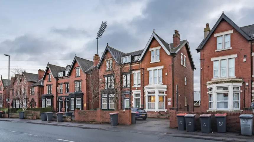
Planning applications in Headingley are managed by Leeds City Council, which publishes application details, supporting documents and decisions through its online Public Access system. Residents, visitors, property owners and researchers use these records to understand proposed building work, changes to land use and the area’s future development.
- What is a planning application in Headingley?
- Where can you find current planning applications in Headingley?
- What types of development projects affect Headingley?
- Residential building and housing projects
- Student accommodation and shared housing
- Shops, restaurants and commercial premises
- Historic buildings and redevelopment sites
- How does Headingley’s planning history influence new developments?
- What planning policies guide development in Headingley?
- Adopted Leeds Local Plan
- Headingley and Hyde Park Neighbourhood Design Statement
- Emerging Leeds Local Plan
- How can you check whether a Headingley development has planning permission?
- What information should you examine in a planning application?
- How can residents and visitors comment on a Headingley planning application?
- How do conservation areas affect planning applications in Headingley?
- How can you track major development proposals and future planning changes in Headingley?
- How do Headingley development projects affect residents, businesses and visitors?
- Which official resources provide reliable information about Headingley planning?
- What should you remember when researching Headingley planning applications?
Headingley is an established residential and commercial district in north-west Leeds. Its streets include traditional housing, student accommodation, independent shops, hospitality businesses and buildings with historic character. Development proposals affect how these places function, how streets look and how local services meet changing needs.
The most reliable starting point is the council’s planning application search. It provides access to new, existing and historical applications across Leeds. Users can search by address, postcode, application reference or development description.
Understanding this information helps visitors explore the built environment, prospective residents research neighbourhood changes and local businesses assess proposed developments around their premises.
What is a planning application in Headingley?
A planning application is a formal request for permission to carry out development or change land use under the planning system in England. Leeds City Council assesses proposals against relevant planning policies, site conditions, consultation responses and other material planning considerations before reaching a decision.
Planning applications cover proposed changes to buildings, land and some business activities. A householder application typically concerns work to an existing home, while a full planning application addresses a more detailed development proposal. Other applications concern listed buildings, advertisements, changes of use and variations to existing permissions.
In Headingley, examples of proposals that warrant investigation include:
- Converting a residential property into a house in multiple occupation, subject to the relevant planning requirements.
- Extending a shop or altering its frontage.
- Constructing additional accommodation on an existing residential site.
- Replacing an existing building with a new structure.
- Altering a historic building that requires listed building consent.
- Changing a commercial premises to another use.
An application does not automatically mean that construction will proceed. The council must determine the proposal, and the applicant must satisfy any applicable conditions and other legal requirements before starting the relevant work.
Planning permission also differs from building regulations approval. Planning deals with land use, design and the development’s effect on its surroundings. Building regulations address matters such as structural safety, fire safety, ventilation and energy efficiency.
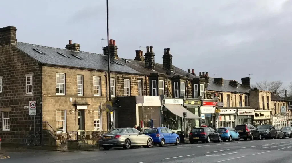
Where can you find current planning applications in Headingley?
Leeds City Council’s Public Access planning portal is the principal official source for researching applications in Headingley. It provides application descriptions, reference numbers, documents, important dates and decision information, helping users establish whether a proposal is pending, approved, refused or otherwise concluded.
Narrow results using the search filters available on the portal. Where relevant, examine weekly or monthly application lists and restrict results by ward or parish.
Review the description, submitted plans, supporting documents, consultation details and decision notice. Check the application reference to ensure that documents relate to the correct property.
The council also allows registered users to save searches, track individual applications and receive email notifications when relevant records change. This is useful for monitoring a particular street or following applications close to a business, accommodation or regular visitor destination.
A search should include alternative descriptions where the first attempt returns no results. A proposal for student housing, for example, is not necessarily described using the words student development. Searching by the full property address or postcode helps identify records that a broad keyword search misses.
What types of development projects affect Headingley?
Development projects in Headingley include residential alterations, housing schemes, commercial changes, student accommodation and work involving historic buildings. Each proposal has different planning requirements, and the council assesses its effects on neighbouring properties, local character, transport, environmental quality and other relevant planning considerations.
The following categories provide a practical framework for understanding local applications. They describe types of development to investigate, not a verified list of currently approved or proposed projects.
Residential building and housing projects
Housing applications include extensions, loft conversions, new homes, redevelopment of existing residential sites and changes to residential layouts. Larger proposals often require detailed drawings and supporting assessments.
Important considerations include building height, privacy, daylight, access, landscaping and the relationship between new structures and existing homes. The number and type of homes proposed also affect how a development fits the surrounding neighbourhood.
Student accommodation and shared housing
Headingley’s proximity to Leeds’ universities makes student housing and shared accommodation relevant subjects for local planning research. Applications can involve new purpose-built accommodation, changes to existing properties or alterations to the number of occupants and the property’s use.
Researchers should examine the application description and planning history rather than assume that every student-related property requires the same consent. The applicable requirements depend on the proposed use, the existing lawful use and the circumstances of the property.
Shops, restaurants and commercial premises
Commercial proposals include shopfront alterations, restaurant extensions, signage, new entrances and changes between different business uses. These applications influence the appearance and operation of local shopping streets.
Planning assessments consider issues such as external design, the effect on nearby residents, noise, access and servicing where relevant. Advertisement consent is a separate consideration for certain signs, particularly in protected areas.
Historic buildings and redevelopment sites
Some proposals involve older buildings or land within a conservation area. These applications require particular attention to architectural features, materials, demolition and the effect on the wider historic environment.
Leeds City Council publishes conservation area maps and related guidance to help users identify relevant restrictions.
How does Headingley’s planning history influence new developments?
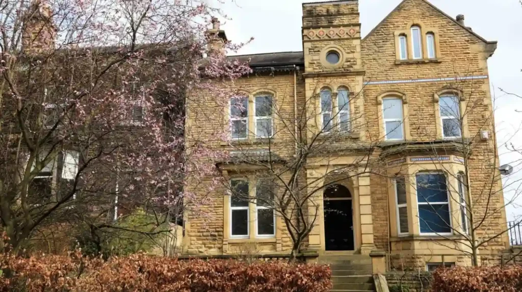
Headingley’s planning history provides context for understanding the area’s buildings, streets and changing land uses. Historic development patterns help explain why some sites accommodate modern buildings while others face tighter design controls, particularly where conservation policies protect architectural character and the appearance of the wider area.
Headingley developed as a residential district beyond Leeds city centre, with older buildings and established streets forming part of its present-day character. Victorian and Edwardian architecture remains an important feature of the wider Headingley and Hyde Park area.
The relationship between historic buildings and modern development is documented in the council’s planning guidance. The Headingley and Hyde Park Neighbourhood Design Statement discusses local character, urban design, residential architecture and conservation considerations.
For a fuller understanding of the buildings and streets visible today, explore the historical development of Headingley and its architectural heritage. This is the single recommended internal link to the matching historical background article.
Planning history matters because an existing building’s age or appearance does not, by itself, determine whether alterations are permitted. The property’s designation, the scale of the proposed work and the applicable planning policies all influence the assessment.
A building within a conservation area is not automatically protected as an individual listed building. Conservation area controls protect the character and appearance of the wider area, while listed building controls apply to designated buildings and their protected significance.
Researchers should therefore check the precise designation of a site before drawing conclusions about its development potential.
What planning policies guide development in Headingley?
Planning proposals in Headingley are assessed against the adopted Leeds Local Plan, relevant neighbourhood planning documents and applicable national planning policy. These frameworks guide decisions on housing, design, transport, environmental protection, heritage and infrastructure, while emerging policy helps indicate the council’s longer-term development priorities.
Leeds City Council maintains planning policies that establish how land should be used and developed across the district. Its adopted Local Plan provides the statutory development plan framework for determining applications, alongside relevant made neighbourhood plans and other applicable considerations.
Adopted Leeds Local Plan
The adopted Local Plan includes strategic policies, site allocations and environmental planning documents. These help determine whether a proposal fits the intended development pattern and satisfies relevant planning requirements.
Read the council’s adopted Local Plan to understand the documents used in planning decisions.
Headingley and Hyde Park Neighbourhood Design Statement
This document provides local design context. It discusses the character of residential streets, historic buildings, urban design and the relationship between development and its surroundings.
The statement is useful when examining whether a proposed extension or replacement building respects the character of an established street. It should be read alongside current adopted policies rather than treated as a substitute for them.
Emerging Leeds Local Plan
The council is preparing a new Local Plan covering the period from 2022 to 2042. Its published consultation information explains the intended framework for future development, including housing, transport, environmental protection and the design of places.
The Issues and Options consultation ran from 7 July to 15 September 2025. Existing adopted policies continue to guide planning decisions while the replacement plan is being prepared.
Consultation proposals and emerging policies indicate planning priorities, but they do not automatically grant permission for individual developments. Always distinguish between an adopted policy, a draft proposal and an approved planning application.
How can you check whether a Headingley development has planning permission?
The planning application record and its formal decision notice provide the strongest starting points for verifying a development’s status. Check the application reference, decision date, approved drawings and conditions, then distinguish between an application under consideration, permission granted, refusal and any subsequent changes.
A development’s status requires more than a quick review of its description. The record might show an original application, a later amendment and a separate decision relating to conditions.
Use the following sequence when investigating a site:
- Find the correct property using its address or postcode.
- Record the planning application reference.
- Check the decision status and date.
- Open the decision notice, where available.
- Compare the approved plans with the drawings describing the original proposal.
- Check for later applications, amended permissions or conditions affecting implementation.
A grant of planning permission does not establish that construction has started. Likewise, a site displaying a planning notice does not establish that permission has been granted.
Some developments also require listed building consent, building regulations approval or other permissions. These requirements are separate from the principal planning decision and depend on the work involved.
What information should you examine in a planning application?
A planning application should be assessed through its description, location plan, proposed drawings, supporting reports, consultation information and decision notice. Together, these records explain the intended work, its physical scale, the site’s constraints and the reasons behind the council’s decision or proposed conditions.
The application description establishes the basic purpose of the proposal. Drawings then show its physical form, including elevations, floor plans, boundaries and access arrangements where these documents are provided.
A location plan identifies the application site. A site plan shows the relationship between the proposed work and surrounding land. Elevation drawings illustrate the external appearance, while floor plans explain the internal arrangement.
Supporting documents vary according to the nature and scale of the proposal. They include design statements, heritage assessments, transport assessments, drainage information and ecological reports where relevant.
What do planning conditions mean?
Planning conditions are requirements attached to a permission. They control specific aspects of a development, such as approved materials, landscaping, working details or the timing of certain activities.
A permission with conditions is still a grant of planning permission, but the applicant must comply with the conditions that apply. Some conditions require approval of further details before particular work starts.
What are planning obligations?
Planning obligations are legal agreements or undertakings associated with development. Section 106 agreements are used to secure measures that address a development’s effects, where the relevant legal tests are satisfied.
Reviewing these documents gives a more accurate picture of a project’s likely effects than relying on a short planning register summary.
How can residents and visitors comment on a Headingley planning application?
Leeds City Council allows people to comment on eligible planning applications through its Public Access portal. Contributors should identify the relevant application, understand its consultation arrangements and submit clear, evidence-based comments about material planning considerations before the applicable deadline.
Public participation gives residents an opportunity to explain how a proposal affects the surrounding area. Visitors researching a development can also examine the application record, although their comments should address relevant planning issues rather than general preferences.
The council identifies issues such as design, scale, privacy, overshadowing, noise, flooding, trees, landscaping, sustainability and conservation as relevant examples of planning considerations.
A useful comment explains the relationship between a specific planning issue and the proposed development. For example, a concern about overlooking should identify the relevant windows, boundaries or outdoor spaces and explain the potential loss of privacy.
General objections without a planning-related reason carry less weight than comments connected to the decision-making framework. Private disputes and changes in property value are not, by themselves, material planning considerations.
The council states that statutory consultation periods are usually 21 days for the application types covered by its guidance, although requirements vary by application type. Check the individual record and notification details for the applicable deadline.
Comments are submitted through the portal after registration and login. The council explains that public comments are not displayed online, although relevant points are summarised in the planning officer’s report.
How do conservation areas affect planning applications in Headingley?
Conservation areas protect places with special architectural or historic interest, including the character and appearance of streets and groups of buildings. In Headingley, conservation area boundaries and appraisals help determine which additional controls and design considerations apply to alterations, demolition and new development.
Leeds City Council lists both Headingley and Headingley Hill, Hyde Park and Woodhouse Moor among its conservation areas. The council’s published guidance identifies 80 conservation areas across the Leeds district, with appraisals and management plans available for 55 of them. These figures relate to the district as a whole, not Headingley alone.
Conservation status does not prohibit all new development. Instead, proposals must address the area’s special character and satisfy applicable planning requirements.
When investigating a proposal, check the conservation area map and any available appraisal. Look for descriptions of significant buildings, architectural details, street patterns, trees, boundaries and views that contribute to the area’s character.
Demolition controls also require attention. Leeds City Council states that planning permission is required for certain demolition within conservation areas, subject to specified exceptions. Listed buildings are subject to separate listed building controls.
How can you track major development proposals and future planning changes in Headingley?
The best way to track future development in Headingley is to combine application searches with council planning policies, site allocation maps and published committee information. These sources distinguish individual building proposals from wider planning strategies and help researchers identify changes that are proposed, permitted or still awaiting decisions.
First, monitor the planning register for individual sites. Saved searches and email notifications help identify new applications and changes to existing records.
Second, consult the council’s planning policy maps. These maps show where relevant planning policies apply across Leeds, including allocations and environmental designations. They provide context for understanding a development’s location within the wider planning framework.
Third, review the council’s planning permission pages for information about Plans Panel meetings and planning inquiries. These resources help explain how certain applications proceed through formal decision-making processes.
For an individual development, record the address, application reference, submission date, current status and latest decision. Rechecking these details helps prevent outdated announcements from being presented as current proposals.
It is also important to distinguish an allocated development site from an approved building project. Site allocation identifies land for a particular planning purpose within the relevant policy framework. It does not mean that every subsequent proposal has received planning permission.
How do Headingley development projects affect residents, businesses and visitors?
Development projects influence Headingley’s housing supply, local services, streetscape, transport requirements and environmental quality. Their actual effects depend on the location, scale, design and intended use of each scheme, together with the infrastructure available and the planning conditions or obligations attached to its permission.
Housing proposals influence the types of accommodation available in the neighbourhood. Commercial developments affect local services and the appearance of shopping streets. Changes to existing buildings also influence the architectural character of individual streets.
Transport is another important consideration. A development’s access arrangements, parking provision, cycle storage and relationship with public transport help explain how it connects with the surrounding area.
Environmental considerations include drainage, trees, landscaping, biodiversity and energy performance where relevant to the application. Larger projects often require more extensive supporting information than minor household alterations.
For visitors, planning records provide useful context when exploring Headingley’s architecture, shopping streets and residential areas. Digital nomads researching potential work locations can use them to understand proposed changes near cafés, commercial premises and transport connections, without assuming that an application will necessarily change the current facilities.
Residents and business owners benefit from checking approved plans and conditions before drawing conclusions about construction activity, future access or changes to neighbouring land.
Explore More Area Guide
Headingley Flood Risk: Surface Water Maps and Leeds Guide
Headingley Roads and Traffic Bottlenecks: A Leeds Travel Guide
Which official resources provide reliable information about Headingley planning?
Leeds City Council’s planning register, policy documents, conservation guidance and development plan resources provide the most relevant official starting points for Headingley planning research. Each source serves a different purpose, from checking an individual property’s application history to understanding the policies that guide future development across the Leeds district.
These sources should be used together when researching a major proposal. The planning register establishes the status of an individual application, while policy documents explain the framework used to assess it. Conservation records identify additional considerations for designated areas.
What should you remember when researching Headingley planning applications?
Reliable research into Headingley planning applications starts with the official council register and continues through supporting documents, decision notices and relevant planning policies. Checking application status, conservation designations and later amendments helps residents, property researchers and visitors understand proposed changes without confusing early plans with approved development.
Headingley’s built environment reflects established residential streets, commercial activity, student accommodation and historic architecture. Planning applications provide a practical way to investigate how individual sites are expected to change within this wider context.
The most effective approach is to verify each proposal against its current official record, review the relevant drawings and conditions, and consult adopted policies where necessary. This process gives a clearer understanding of development activity and its potential implications for the neighbourhood.
For ongoing research, save relevant searches on the council portal and revisit application records when their status changes. This creates a dependable picture of planning activity in Headingley without relying on unverified project announcements or outdated information.
Where can I find planning applications in Headingley?
You can find planning applications in Headingley through the Leeds City Council planning application search. Search by property address, postcode, application reference or development description.