Horsforth provides an exceptional combination of ancient woodland, managed municipal parks, and historic waterway trails situated just five miles northwest of Leeds city centre. Its unique geography offers accessible outdoor spaces for leisure, wellness, and remote working breaks.
- How does Horsforth Hall Park serve as a central public green space?
- What natural features can visitors explore in Hunger Hills Wood?
- How do the River Aire and Leeds and Liverpool Canal support peaceful outdoor walking routes?
- What hidden woodland spaces exist around Haigh Wood and Springhead Park?
- How can leisure travellers and digital nomads plan an efficient outdoor itinerary in Horsforth?
- Frequently Asked Question
Located in the City of Leeds borough in West Yorkshire, England, Horsforth is a substantial suburban settlement defined by its proximity to the River Aire valley. The settlement covers an area of approximately 3.2 square miles and possesses an abundant inventory of public green infrastructure. This geographical positioning creates an ideal environmental boundary between dense urban development and the rural landscapes of West Yorkshire.
The landscape architecture of Horsforth relies on three principal geological and ecological zones: the valley floor of the River Aire, elevated sandstone ridges, and semi-natural ancient woodland fragments. The municipal authorities and local community groups maintain over 50 mapped walking routes throughout the area, ranging from flat canal towpaths to challenging hill ascents. These environmental features serve multiple user populations, including domestic tourists exploring Yorkshire, regional residents, hybrid working professionals seeking outdoor desk breaks, and business travellers utilizing nearby transport corridors like Leeds Bradford Airport.
Environmental monitoring data highlights that green spaces in Horsforth contribute significantly to local air quality filtration and flood alleviation along the River Aire catchment basin. The interconnected network of footpaths enables continuous pedestrian transit through connected habitats without requiring major reliance on vehicular transport.
How does Horsforth Hall Park serve as a central public green space?
Horsforth Hall Park serves as the primary urban green space in Horsforth, offering formal gardens, sports infrastructure, walking loops, and peaceful zones. It provides accessible, multi-use outdoor grounds suitable for all mobility levels throughout the calendar year.
Horsforth Hall Park is a public municipal park situated off Hall Lane in central Horsforth. The park occupies the former estate grounds of Horsforth Hall, a grand manor house constructed in 1721 by the Spencer-Stanhope family and subsequently demolished in 1953. The remaining 29-acre public park contains a varied array of recreational, historical, and ecological facilities.
The park features a structured layout anchored by a central circular walking perimeter measuring exactly 1.0 mile (1.61 kilometres) in length. Key features within the grounds include a traditional Japanese Garden—opened in 2009 to promote quiet reflection—a restored Victorian bandstand, a skate park, a dedicated trim trail exercise installation, and active cricket pitches.
As you explore the modern site, you are crossing land with a deep heritage. Read about the full [Discovering nature-focused outdoor areas and peaceful walking locations.] to understand its origins.
The ecological ecosystem within Horsforth Hall Park includes mature broadleaf trees, decorative flower displays, and managed wildlife hedges. For tourists and local visitors, the park delivers structured, low-intensity exercise corridors with flat, paved surfaces compliant with accessibility standards. Digital nomads routinely utilize the park’s peripheral seating areas due to high cellular data coverage and quiet working environments situated close to Town Street amenities.
What natural features can visitors explore in Hunger Hills Wood?
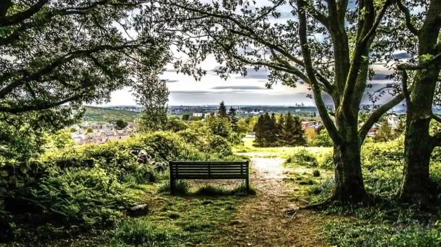
Hunger Hills Wood offers visitors an immersive ancient woodland experience featuring steep elevated paths, native broadleaf canopy coverage, and expansive scenic viewpoints over the Aire Valley. It represents a key semi-natural nature reserve within Horsforth.
Hunger Hills Wood Local Nature Reserve is an ancient woodland area positioned on a sandstone escarpment directly northeast of Horsforth Hall Park. The nature reserve encompasses a steep elevation gain of approximately 97 metres across its primary trail network, providing a contrasting topography to the adjacent manicured parkland.
The woodland is characterized by heavy canopy coverage consisting of mature Pedunculate Oak (Quercus robur), Silver Birch (Betula pendula), and Sycamore trees. The forest floor hosts seasonal flora, including extensive carpets of native English bluebells (Hyacinthoides non-scripta) during spring months.
The primary hiking loop through Hunger Hills Wood extends across 3.1 miles (5.0 kilometres) and connects directly to paths leading toward Leeds Trinity University and Rawdon Trig Point. Pedestrians navigating these trails encounter unpaved earth footpaths, natural stone steps, and timber retaining structures. The high point of the reserve yields panoramic vistas across the lower Aire Valley, making it a key site for wildlife observation, birdwatching, and trail running enthusiasts who require variable elevation training.
How do the River Aire and Leeds and Liverpool Canal support peaceful outdoor walking routes?
The River Aire and the parallel Leeds and Liverpool Canal supply flat, continuous water-level walking routes through Horsforth. These linear green corridors connect historical industrial infrastructure with pristine aquatic and riparian wildlife habitats.
The southern boundary of Horsforth is defined by the River Aire and the Leeds and Liverpool Canal towpath, running parallel through the valley floor. This hydrographic corridor represents a continuous green movement line linking Horsforth eastwards toward Leeds city centre and westwards toward Shipley and Bingley.
The primary route in this sector is the Kirkstall Abbey Ruins to Newlay Lock circuit, a popular 4.3-mile (6.9-kilometre) walking loop that takes pedestrians an average of 1 hour and 45 minutes to complete. The surface infrastructure consists of compacted gravel, stone paving, and asphalt canal towpaths designed for multi-user access.
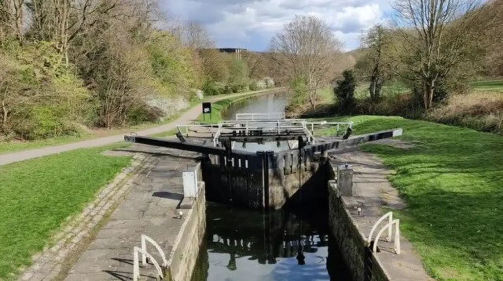
Key environmental and infrastructural components along this water corridor include:
- Newlay Bridge: A Grade II* listed cast-iron bridge constructed in 1819, serving as a historic river crossing point.
- Newlay Locks: A multi-chamber canal lock system managing water levels for canal traffic on the Leeds and Liverpool Canal.
- Rodley Nature Reserve Proximity: Wetland habitats situated adjacent to the canal corridor supporting gray herons, kingfishers, and various dragonflies.
- River Aire Fish Pass: Specialized river infrastructure engineered to facilitate salmon and trout migration upriver.
These flat, low-impact paths offer long-distance endurance walks for hikers, secure commuting corridors for active travel, and calming natural surroundings for remote workers needing mid-day break locations.
Explore more Area Guide
Top Things to Do in Garforth for Visitors and Weekend Travellers
Top Reviewed Restaurants in Leeds 2026
What hidden woodland spaces exist around Haigh Wood and Springhead Park?
Haigh Wood and Springhead Park are hidden green escapes tucked into Horsforth’s residential boundaries. They provide quiet, stream-side woodland walking routes, native wildlife habitats, and peaceful spaces away from major traffic routes.
Haigh Wood is a linear strip of ancient semi-natural woodland concealed between the Harrogate railway line and suburban housing developments in northern Horsforth. Springhead Park forms an adjacent ecological corridor fed by local natural spring tributaries that drain into the oil-mill beck catchments.
Geologically, Haigh Wood sits upon gritstone sandstone beds overlaid with rich clay soils, creating damp woodland conditions ideal for specific plant communities. The woodland features a central running stream framed by tree species such as Alder (Alnus glutinosa), Willow (Salix), and Beech (Fagus sylvatica).
The walking trails within Haigh Wood cover approximately 1.2 miles of unpaved footpaths. The lack of commercial development in this pocket park ensures low human traffic volume compared to Horsforth Hall Park. Visitors to Haigh Wood experience dense canopy shade, natural acoustic dampening of suburban noise, and opportunities to observe woodland birds such as the Eurasian nuthatch and treecreeper. The site exemplifies how small pocket woodlands function as vital stopover habitats for urban biodiversity corridors.
How can leisure travellers and digital nomads plan an efficient outdoor itinerary in Horsforth?
Planning an efficient outdoor itinerary in Horsforth involves combining structured park visits with connected woodland or canal hikes, utilizing public transport nodes, and leveraging local hospitality venues for remote work or relaxation breaks.
Horsforth is exceptionally well-connected by regional transport infrastructure, making it highly accessible for domestic visitors and remote workers. Horsforth Railway Station sits on the Harrogate Line, providing direct passenger rail services to Leeds City Station in 12 minutes and Harrogate in 22 minutes.
To maximize a day visit, travellers can follow a structured geographical progression through Horsforth’s green spaces:
Hospitality options along Town Street and New Road Side feature independent coffee shops, historic public houses, and cafes equipped with Wi-Fi power outlets. These establishments allow digital nomads to transition seamlessly between outdoor exercise and remote work tasks.
For optimal travel experiences, visitors should prepare appropriate footwear suitable for unpaved woodland mud during autumn and winter months while relying on paved canal towpaths during wet weather conditions.
Frequently Asked Question
How far is Horsforth from Leeds city centre, and how do I get there?
Horsforth is located approximately 5 miles (8 km) northwest of Leeds city centre. It is easily accessible by a 12-minute direct train ride from Leeds Station to Horsforth Railway Station, or via regional bus routes (such as the First Bus 27 and 50/50A).