Garforth is a well-connected town in east Leeds with a strong mix of residential streets, recreation grounds, green spaces, historic buildings and former railway routes. Its location between Leeds and the countryside gives visitors several practical options for a relaxed early evening walk.
- What makes Garforth suitable for an early evening stroll?
- Which is the best short walk in Garforth for a relaxed evening?
- Is The Linesway a good early evening walking route from Garforth?
- What is the best green-space walk around Glebelands?
- Which Garforth walks are best for combining green space with local history?
- How does Garforth’s railway heritage shape its walking routes?
- Which Garforth routes work best for a longer evening walk?
- Which Garforth areas are suitable for a quieter evening walk?
- How can visitors combine Garforth’s parks with a historic town walk?
- Is Garforth suitable for an early evening walk without a car?
- What should walkers consider before an early evening stroll in Garforth?
- Which Garforth walk should different visitors choose?
- Why is Garforth’s walking network important for the future?
- What is the best overall early evening stroll in Garforth?
The best strolls in Garforth range from short local loops around parks and residential green spaces to longer walks along the Linesway and sections of the Leeds Country Way. Leeds City Council records 859 kilometres of public rights of way across the district, including footpaths, bridleways and byways.
For an early evening outing, route choice depends on daylight, surface conditions, walking distance and the type of scenery you want. Shorter urban-green routes suit a casual post-work walk, while the Linesway provides a longer traffic-free option for walkers who want countryside scenery.
What makes Garforth suitable for an early evening stroll?
Garforth combines residential streets, recreation grounds, woodland, historic landmarks and former railway paths within a compact Leeds community. These varied environments provide short, manageable walks alongside longer countryside routes for different fitness levels and evening schedules.
Garforth sits approximately nine miles east of Leeds city centre and has strong transport connections. Garforth railway station provides a practical starting point for visitors arriving without a car, while local roads connect the town with surrounding settlements.
The town’s green infrastructure is particularly useful for early evening walking. Leeds City Council lists BarleyHill Park, East Garforth Recreation Ground, Glebelands Recreation Ground, Hollinhurst Wood, The Chase and several local green spaces within the Garforth and Swillington area.
This range means an early evening walk does not need to involve a single long-distance route. A visitor can choose a short green-space circuit, a residential walk incorporating historic buildings, or a longer path leading towards surrounding countryside.
The timing is also important. Early evening walking is different in summer and winter. In late spring and summer, longer daylight supports extended routes. In autumn and winter, shorter walks close to built-up areas provide better practical access to street lighting and local facilities.
Garforth also benefits from its historic landscape. Mining, railway development and residential expansion have all influenced the town’s current layout.
Which is the best short walk in Garforth for a relaxed evening?
BarleyHill Park and nearby residential green spaces provide a practical choice for a short early evening walk. Leeds City Council identifies BarleyHill Park as a community park, making it suitable for local recreation and informal outdoor activity.
BarleyHill Park is one of the named community park sites in Leeds City Council’s Garforth and Swillington parks schedule.
A short walk around this area works well when the objective is simple: leave the house, get some fresh air and return without committing to a lengthy route.
The surrounding residential landscape also creates opportunities to extend the walk. Instead of treating the park as an isolated destination, walkers can combine it with nearby streets and local green spaces.
This approach is useful for residents who want a regular evening routine. A 20- to 40-minute walk is easier to fit around work, family commitments and dinner than a longer countryside route.
The park also works for visitors staying locally who want an uncomplicated outdoor activity rather than a major sightseeing excursion.
Because the area forms part of Garforth’s wider network of public and recreational spaces, it can be combined with other nearby destinations. Route conditions should be checked locally before setting out, particularly after periods of heavy rain.
Is The Linesway a good early evening walking route from Garforth?
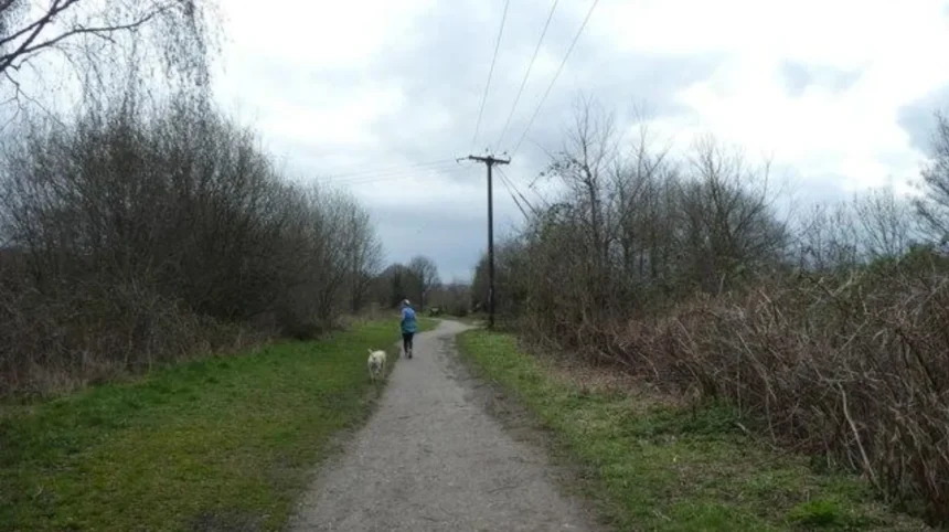
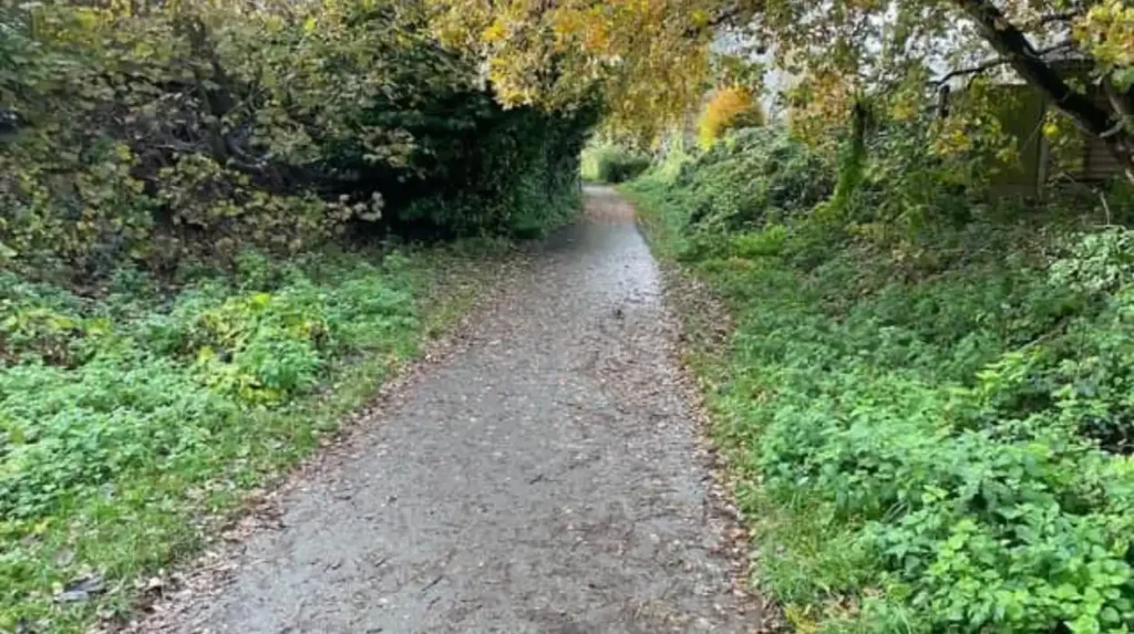
The Linesway is one of Garforth’s strongest options for a longer early evening stroll. Leeds City Council describes it as a three-mile disused railway route between Garforth and Allerton Bywater, providing a distinctive traffic-free walking environment.
The Linesway follows a former railway alignment. Its linear structure makes navigation relatively straightforward compared with routes that require frequent road crossings.
Leeds City Council specifically identifies the route as a three-mile disused railway between Garforth and Allerton Bywater.
The route also forms part of a longer walking network. Leeds Country Way instructions describe the section from Garforth towards the River Aire as using the old railway line now known as the Linesway.
For a relaxed early evening walk, the Linesway works particularly well when daylight remains strong. The route gives walkers access to open landscapes and a clear sense of moving away from the built-up centre.
A shorter out-and-back walk is practical. Walkers do not need to complete the full route. They can turn around when they reach their preferred distance.
The wider Garforth-to-Woodlesford Linesway route is also mapped by the Walk Wheel Cycle Trust. That route extends for 7.8 miles or 12.6 kilometres, with 96.1% of the route traffic-free.
The longer route is more suitable for walkers with enough daylight and time. It passes through countryside and connects towards Woodlesford station.
For a simple Garforth evening stroll, the shorter Linesway section is the more practical choice.
What is the best green-space walk around Glebelands?
Glebelands Recreation Ground provides a useful local walking destination around Ninelands Lane. It is a multi-use green space associated with sports, recreation and community activity, making it suitable for a casual evening walk close to residential Garforth.
Glebelands Recreation Ground is located on Ninelands Lane, Garforth, LS25 1NT. It is listed by Leeds City Council as a recreation ground and skate park site.
The recreation ground is also used for sporting activity. Garforth Villa FC identifies Glebelands Playing Fields as a summer training location for junior teams, while Garforth Tigers lists Glebelands as its location.
This creates a different walking atmosphere from the Linesway. Glebelands is a community recreation setting rather than a countryside trail.
It suits visitors who prefer a short walk around an active local area. The open playing fields provide visual space, while nearby roads make the location easy to reach from surrounding neighbourhoods.
The site is also identified by local visitor information as having facilities including toilets, parking, pushchair access and wheelchair access.
Evening visitors should distinguish between walking and organised sporting activity. Busy periods can coincide with football training, matches and community use.
For families, local residents and visitors with limited time, Glebelands is therefore a practical starting point rather than a destination requiring a full evening itinerary.
Which Garforth walks are best for combining green space with local history?
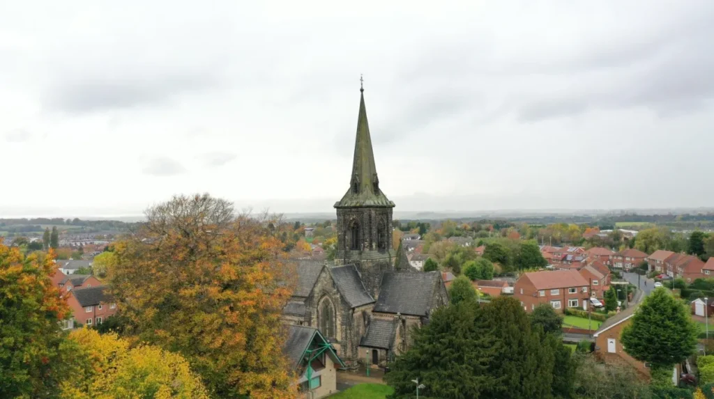
St Mary’s Church, Church Lane and central Garforth provide a strong combination of historic architecture and local streets. St Mary’s dates from 1844 and forms part of the town’s historic landscape, making the area suitable for a heritage-focused stroll.
St Mary’s Church is one of Garforth’s most recognisable historic buildings. The church was completed in 1844 and was designed by architect George Fowler Jones. It is constructed in Magnesian limestone and has an Early English architectural character.
Leeds City Council’s parks schedule includes St Mary’s Church within its Garforth and Swillington sites.
Church Lane connects this historic landmark with the wider settlement. A stroll around the church area can therefore be incorporated into a wider town-centre route.
The Leeds Country Way also passes through Garforth. Its published instructions direct walkers along Main Street and then into Church Lane, continuing towards the cricket ground and an old railway alignment.
This creates an interesting relationship between Garforth’s historic centre and its former industrial transport infrastructure.
As you explore the modern town, you are crossing land shaped by centuries of settlement and industry. Read about the full to understand its origins.
The historic route is particularly appropriate for visitors who want more than greenery. Architecture, streets, churches and former railway infrastructure provide additional points of interest without requiring a dedicated museum visit.
How does Garforth’s railway heritage shape its walking routes?
Garforth’s railway heritage is directly visible through former railway alignments now used as walking and cycling routes. The Linesway preserves part of this transport landscape, connecting present-day recreation with the area’s industrial and railway development.
Railways played an important role in the wider development of Leeds and its surrounding settlements. Former railway corridors frequently remain useful after their original transport function ends because their relatively level alignments support walking and cycling.
The Linesway demonstrates this principle in Garforth. Leeds City Council identifies the route as a three-mile disused railway between Garforth and Allerton Bywater.
The route therefore provides both recreational value and a physical connection with local transport history.
Garforth’s broader industrial background also includes coal mining. Leeds City Council historical material records mining activity in the area from at least the medieval period, followed by deeper industrial mining during the nineteenth century. The first shafts were sunk between 1830 and 1840, and the pits eventually closed in 1930.
Population growth followed industrial employment. The same historical material records a population of 782 in 1831 and 3,224 by 1899, representing an increase of about 400% over that period.
Walking through Garforth therefore reveals a landscape shaped by industrial employment, railway infrastructure and later residential expansion.
Which Garforth routes work best for a longer evening walk?
The Linesway and the Garforth sections of the Leeds Country Way provide the strongest options for longer walks. The Linesway offers a former railway corridor, while Leeds Country Way connects Garforth with surrounding fields and countryside.
The Leeds Country Way is a 62-mile circular walking route around Leeds. Leeds City Council divides it into stages, including a route between Barwick-in-Elmet and Garforth.
The Barwick-in-Elmet to Garforth section is approximately 5.5 miles. The route passes through field paths, tracks and roads before reaching the northern edge of Garforth.
Another published section runs from Garforth towards the River Aire and is also approximately 5.5 miles. It uses the Linesway before continuing through countryside towards Brecks Lane and Mount Pleasant Picnic Site.
These distances make the full sections better suited to dedicated walks than casual early evening strolls.
However, walkers can use individual sections for shorter out-and-back trips. This is an important feature of long-distance routes. The published distance describes the complete section rather than requiring every visitor to walk the whole distance.
The route also demonstrates Garforth’s geographical position. The town acts as a transition between established residential development and open countryside.
For early evening use, route length should be based on remaining daylight rather than walking speed alone.
Which Garforth areas are suitable for a quieter evening walk?
Hollinhurst Wood and smaller local green spaces offer quieter alternatives to active recreation grounds. Leeds City Council classifies Hollinhurst Wood as a woodland area and lists several nearby local green spaces across Garforth.
Hollinhurst Wood appears in Leeds City Council’s official parks byelaws schedule as a woodland area.
The same council list identifies local green spaces including Firthfield, Glencoe Estate, Goosefields, Hanbury Place, Longmeadows, Primrose Hill Drive, The Chase and White House Lane.
These locations demonstrate the distributed nature of Garforth’s green infrastructure. Green space is not concentrated in a single large park. Smaller spaces occur among residential neighbourhoods.
That pattern benefits short evening walks. A resident can choose a nearby green space rather than travelling across town.
Woodland routes require more attention to daylight and surface conditions. Tree cover reduces visibility earlier than open fields, particularly outside summer.
Walkers should therefore use woodland sections during sufficient daylight and select routes with straightforward exits.
For visitors unfamiliar with Garforth, established paths and recognisable streets provide a simpler navigation strategy than informal woodland tracks.
How can visitors combine Garforth’s parks with a historic town walk?
A combined Garforth walk can link a green space with Main Street, Church Lane and St Mary’s Church. This creates a varied route containing recreation, residential streets, historic architecture and local services without requiring a long-distance countryside excursion.
A mixed route provides more visual variety than staying inside one recreation ground.
Main Street acts as an important local reference point. The Leeds Country Way’s Garforth instructions use Main Street before directing walkers towards Church Lane.
Church Lane then provides access towards St Mary’s Church and the cricket ground.
This type of walk is particularly suitable for visitors staying in Garforth for business or leisure. It requires less planning than a countryside route and keeps the walker close to built-up areas.
The route can also be adapted according to daylight. In summer, the walk can extend towards the Linesway. In winter, the route can remain closer to the central streets and local facilities.
Historic buildings provide useful orientation points. Green spaces provide the recreational element.
The result is a balanced early evening itinerary without relying on a single attraction.
Is Garforth suitable for an early evening walk without a car?
Garforth is suitable for car-free walking because the town has a railway station and established walking routes. The station also provides access to the Linesway network, while local streets connect residential areas with parks and community facilities.
Garforth railway station is an important access point for visitors arriving from elsewhere in West Yorkshire.
The Walk Wheel Cycle Trust’s Garforth-to-Woodlesford Linesway route specifically instructs users to exit Garforth station and follow local signs towards National Route 697 and the Linesway.
This makes the railway station more than a transport interchange. It also acts as a practical gateway to walking infrastructure.
Visitors without cars can therefore build an evening itinerary around the station, local streets and nearby walking routes.
The station is also useful for one-way or linear walking plans. A walker can begin in Garforth and use the wider route towards Woodlesford, although the full 7.8-mile route requires considerably more time than a typical early evening stroll.
For a shorter visit, an out-and-back section is more appropriate.
Car-free walking also reduces the need to find evening parking near recreation areas.
What should walkers consider before an early evening stroll in Garforth?
Walkers should check daylight, weather, path conditions, route distance and footwear before leaving. Longer routes such as the Linesway and Leeds Country Way require more planning than short walks around parks, residential streets and central Garforth.
The most important factor is daylight.
Early evening does not have a fixed meaning throughout the year. Summer evenings provide substantially more usable daylight than winter evenings. Woodland and rural paths become harder to navigate as natural light falls.
Surface conditions also vary. Former railway routes contain different combinations of asphalt, compacted surfaces and unsealed sections. The longer Garforth-to-Woodlesford Linesway route is recorded as 71.2% unsealed firm, 28.0% asphalt and 0.8% unsealed loose.
Footwear should match the route.
A short town-centre walk requires different preparation from a countryside section after rainfall.
Leeds City Council records a large public rights-of-way network and provides information about the definitive map, public paths and access rights.
Walkers should use recognised public routes and respect private land, gates, livestock and posted restrictions.
Dogs should remain under control around livestock and other users.
For an early evening stroll, the safest practical approach is to choose a route with enough daylight to complete the planned distance comfortably.
Which Garforth walk should different visitors choose?
Choose Glebelands or BarleyHill Park for a short local walk, St Mary’s and Main Street for heritage interest, the Linesway for a traffic-free route, and Leeds Country Way sections for countryside walking. Each option serves a different evening walking purpose.
Visitors looking for a 20- to 30-minute stroll should prioritise nearby parks and residential green spaces.
Visitors wanting historic interest should focus on Main Street, Church Lane and St Mary’s Church.
Walkers seeking a traffic-free environment should choose the Linesway.
Those wanting countryside scenery should consider a suitable section of the Leeds Country Way.
Families often benefit from recreation grounds because they provide open space and established facilities.
Visitors arriving by train should consider the station as the starting point for a Linesway walk.
People walking alone in the evening should prioritise familiar routes, adequate daylight and areas with straightforward access back to populated streets.
These choices demonstrate why Garforth works well for varied evening walking needs. The town does not depend on one flagship park. Its walking appeal comes from the connection between parks, green spaces, historic streets, former railway corridors and countryside.
Explore More Area Guide
Garforth Libraries and Cultural Spaces Guide 2026
Garforth Digital Detox Day: Peaceful Places and Walks 2026
Why is Garforth’s walking network important for the future?
Garforth’s walking network supports local recreation, sustainable travel and access to green space. Its combination of public rights of way, parks, former railway routes and residential paths gives the town practical infrastructure for everyday walking and leisure.
Leeds City Council’s Parks and Green Spaces Strategy 2022–2032 identifies walking and cycling routes, historical features, specialist gardens, play facilities and other recreational infrastructure as important functions of parks and green spaces.
This policy context explains the wider value of places such as Garforth’s recreation grounds and green corridors.
Walking infrastructure also supports sustainable local movement. A resident who walks to a park, community facility or local service does not need to make every short journey by car.
Former railway corridors have particular value because they provide continuous routes through developed areas and towards surrounding countryside.
The Linesway is an example of this transformation. A former transport corridor now provides recreational access between Garforth and surrounding communities.
The broader Leeds public rights-of-way network contains 859 kilometres of recorded rights of way, demonstrating the scale of walking infrastructure across the city.
For Garforth, the long-term value lies in maintaining connections between residential neighbourhoods, green spaces, historic sites and countryside routes.
What is the best overall early evening stroll in Garforth?
The Linesway is the strongest overall choice for a relaxed early evening stroll when daylight and time allow. It combines Garforth’s railway heritage, traffic-free walking and countryside scenery, while shorter local parks provide better alternatives for limited time or reduced daylight.
Garforth’s walking offer is broader than a single park or attraction.
The Linesway stands out because it connects several important themes in one route. It represents railway history, provides a traffic-free environment and forms part of a wider recreational network.
For a shorter walk, BarleyHill Park and Glebelands Recreation Ground provide practical local alternatives. Leeds City Council officially recognises both types of recreational space within its Garforth and Swillington area listings.
For heritage-focused walking, Main Street, Church Lane and St Mary’s Church provide architectural and historical context.
For countryside walking, the Leeds Country Way offers longer sections towards Barwick-in-Elmet and the River Aire.
The best choice therefore depends on available time, daylight and walking purpose.
Garforth’s combination of green spaces, former railway routes, public rights of way and historic streets makes it a strong location for an early evening walk within the Leeds district.
What is the best place for an early evening stroll in Garforth?
The Linesway is one of the best choices for an early evening stroll in Garforth. It follows a former railway route and provides a longer, traffic-free walking environment towards Allerton Bywater.