Garforth is a settlement in east Leeds with a strong network of green spaces, recreation grounds, woodland, public rights of way and former railway routes. Its outdoor landscape supports short walks, longer countryside routes, cycling, wildlife observation and simple fresh-air breaks close to residential areas.
- What are the best outdoor spots in Garforth for a fresh-air break?
- Why is The Lines Way one of Garforth’s most useful walking routes?
- What is Barley Hill Park like for a short outdoor break?
- Where can visitors find woodland scenery around Garforth?
- Which Garforth green spaces work for a quick local walk?
- How does the Leeds Country Way add longer outdoor options near Garforth?
- How extensive are Garforth’s public rights of way?
- What makes Garforth suitable for different types of outdoor visitors?
- How does Garforth’s green infrastructure support future outdoor access?
- What should visitors check before taking a fresh-air break in Garforth?
- Why should Garforth’s outdoor spaces be part of a local Leeds itinerary?
Leeds City Council records 859 kilometres of public rights of way across the wider Leeds district, including 650 kilometres of footpaths, 199 kilometres of bridleways and 11 kilometres of byways. These routes connect urban neighbourhoods with farmland, woodland and open countryside.
Garforth has several particularly useful outdoor options. The Lines Way is the best-known linear route, while Barley Hill Park, Hollinhurst Wood, The Chase, Glebelands Recreation Ground and East Garforth Recreation Ground provide different types of open-air space.
The area also connects with the Leeds Country Way, a 62-mile circular walking route around Leeds. The Garforth sections provide access to fields, lanes, old railway routes and countryside beyond the settlement.
What are the best outdoor spots in Garforth for a fresh-air break?
The best outdoor spots in Garforth include The Lines Way, Barley Hill Park, Hollinhurst Wood, The Chase, Glebelands Recreation Ground and East Garforth Recreation Ground. They provide different settings for short walks, open-air exercise, woodland exploration, recreation and quieter countryside time.
These locations suit different types of outdoor visits. A visitor looking for a straightforward linear walk can use The Lines Way. Someone wanting a local green space close to homes can choose Barley Hill Park or Glebelands Recreation Ground.
Hollinhurst Wood provides a woodland setting. The Chase is recorded by Leeds City Council as a local green space. East Garforth Recreation Ground provides another designated recreation area.
Leeds City Council’s parks and countryside records specifically list these Garforth and Swillington locations within its parks byelaws schedule. The list identifies Barley Hill Park as a community park, Hollinhurst Wood as a woodland area and The Chase as local green space.
The range of spaces makes Garforth suitable for short outdoor breaks rather than requiring a full-day countryside excursion.
Why is The Lines Way one of Garforth’s most useful walking routes?
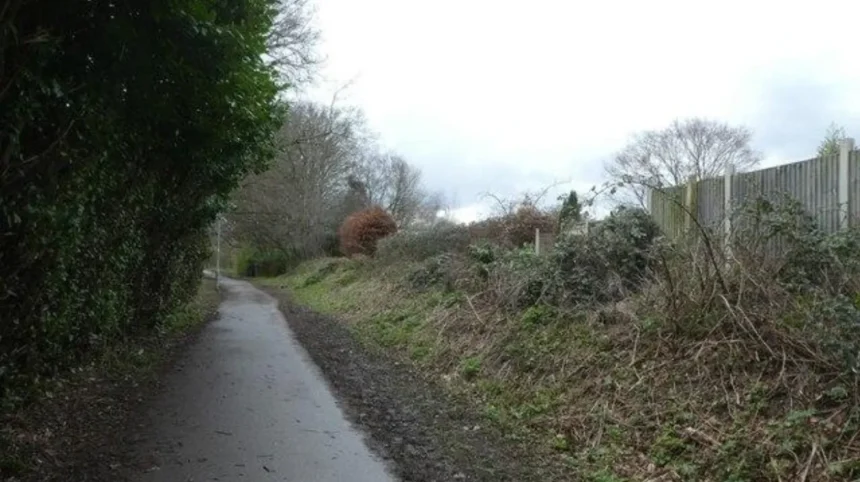
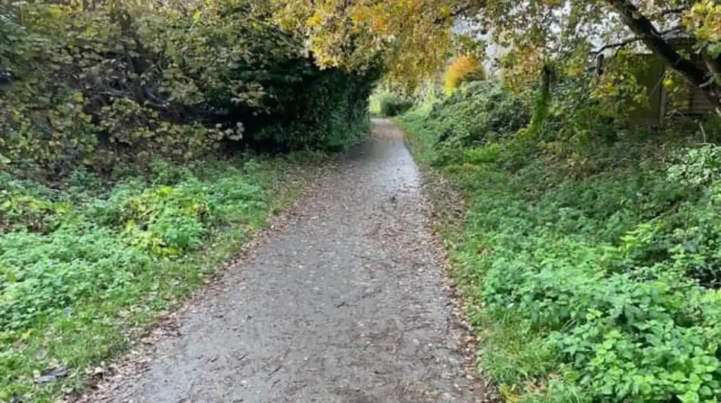
The Lines Way is a roughly three-mile disused railway route linking Garforth with Allerton Bywater. Its linear alignment provides a straightforward walking and cycling corridor with a strong connection to Garforth’s surrounding green infrastructure and former railway landscape.
Leeds City Council describes The Lines Way as a three-mile-long disused railway between Garforth and Allerton Bywater. It is included among the city’s shorter recreational walking routes.
The route has particular importance within Garforth’s local green network. The adopted Garforth Neighbourhood Plan identifies The Lines Way as an important green connection and states that development affecting the route should protect and enhance its connectivity function.
The same plan identifies several sections along The Lines Way as likely to be among Garforth’s most popular footpath and cycle routes.
The route is useful for people who want fresh air without committing to a long countryside hike. Its former railway alignment provides a relatively direct route through the landscape.
The Lines Way also forms part of longer walking possibilities. The Leeds Country Way route from Garforth towards the River Aire uses the old railway line before continuing towards Brecks Lane and Mount Pleasant Picnic Site.
For visitors interested in the relationship between Garforth’s present-day outdoor network and its earlier development, the route also provides a direct connection with the area’s railway heritage. Read about the full to understand its origins.
What is Barley Hill Park like for a short outdoor break?
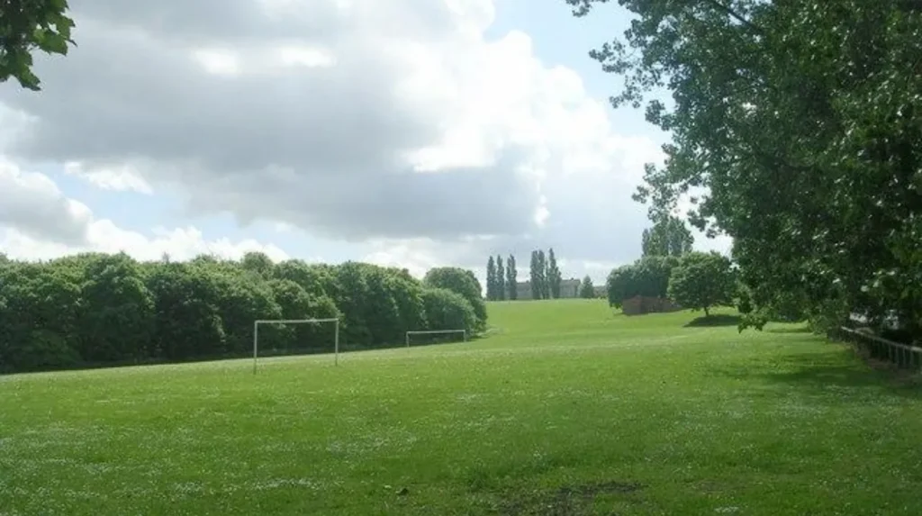
Barley Hill Park is a designated community park in Garforth that provides a local outdoor setting for recreation and fresh air. Its neighbourhood location makes it suitable for shorter visits when visitors want open space without undertaking a longer countryside route.
Leeds City Council classifies Barley Hill Park as a community park within the Garforth and Swillington area. The council’s parks schedule separately identifies Barley Hill Recreation Playground, showing that the wider Barley Hill area also supports children’s outdoor recreation.
Community parks perform a different function from long-distance walking routes. They provide accessible green space within the settlement and support everyday outdoor activity.
Barley Hill Park therefore fits a short-break itinerary. Visitors can combine time outdoors with other activities in Garforth rather than planning an entire visit around a single trail.
Its local position also makes it relevant for residents, business travellers and visitors staying nearby. A short outdoor stop can provide a change from indoor work, shopping or travel without requiring transport to a distant countryside destination.
The distinction between a community park and a countryside trail is important when choosing an outdoor location. A park is generally more appropriate for a brief local visit, while The Lines Way provides greater scope for continuous walking or cycling.
Where can visitors find woodland scenery around Garforth?
Hollinhurst Wood is one of the designated woodland areas recorded by Leeds City Council in Garforth and Swillington. It provides a different outdoor setting from open recreation grounds and linear paths, with trees and woodland character forming its principal landscape feature.
Leeds City Council’s official parks schedule lists Hollinhurst Wood as a Woodland Area within Garforth and Swillington.
Woodland changes the character of a fresh-air break. Trees create a more enclosed environment than open fields or recreation grounds. Woodland paths also provide a natural setting for quiet walking and observing seasonal changes.
Hollinhurst Wood fits visitors who want an outdoor setting that feels different from the built-up parts of Garforth.
The Garforth Neighbourhood Plan places wider emphasis on protecting green infrastructure, including woodland habitat, grassland habitat, wetland habitat and local wildlife sites. Its green infrastructure mapping identifies these environmental components across the neighbourhood area.
Woodland areas also contribute to wider ecological connectivity. Leeds City Council’s green-space guidance describes green corridors as connections that support people and wildlife through features such as linear parks, woodlands, planted verges and hedgerows.
Visitors should remain on recognised paths where required and respect signs, private land boundaries and local access arrangements.
Which Garforth green spaces work for a quick local walk?
The Chase, Glebelands Recreation Ground and East Garforth Recreation Ground provide local options for shorter outdoor visits. They are different from long-distance routes because their primary role is neighbourhood recreation, local open space and everyday access to outdoor areas.
Leeds City Council records The Chase as a local green space, Glebelands Recreation Ground as a recreation ground and East Garforth Recreation Ground as another recreation ground.
These spaces are useful when the objective is simply to get outside. A short walk does not require a formal hiking route. Local recreation grounds can support a brief break between other activities.
Glebelands also has a playground and skate park recorded in the council’s facilities schedule. This gives the wider recreation area a stronger family and active-recreation function.
East Garforth Recreation Ground provides another designated recreational space in the settlement.
The Chase has a different designation as local green space. Local green spaces form part of the wider planning framework that protects important outdoor areas within communities.
For visitors, these distinctions help match the location to the purpose of the visit. A recreation ground suits casual outdoor activity, while a woodland or former railway route provides a more walking-focused experience.
How does the Leeds Country Way add longer outdoor options near Garforth?
The Leeds Country Way provides a longer countryside option for visitors who want to extend a Garforth fresh-air break. The 62-mile circular route around Leeds includes a 5.5-mile section between Barwick-in-Elmet and Garforth and another 5.5-mile section towards the River Aire.
The Leeds Country Way is a 62-mile circular walking route around Leeds. Leeds City Council divides the route into stages and provides specific directions for the Garforth sections.
The Barwick-in-Elmet to Garforth section covers approximately 5.5 miles. The route passes through countryside, tracks, roads and paths before reaching the northern edge of Garforth. It then continues through the settlement towards the old railway line.
The Garforth to River Aire section is also approximately 5.5 miles. It starts at the A63 and follows the old railway line known as The Lines Way before continuing through Brecks Lane and surrounding countryside.
This creates a useful progression for walkers. A visitor can start with a short local route and then use the wider public-rights-of-way network for a longer excursion.
The countryside sections involve roads, tracks, field paths and railway-line routes. Appropriate footwear is therefore important, particularly after wet weather.
The Leeds Country Way is better suited to planned walking than a spontaneous ten-minute fresh-air stop. Its length and changing surfaces require more preparation.
How extensive are Garforth’s public rights of way?
Garforth forms part of a wider Leeds public-rights-of-way network that contains hundreds of kilometres of legally recorded paths. Local routes connect residential areas with fields, woodland, former railway corridors and surrounding settlements, creating multiple opportunities for outdoor movement.
Leeds City Council records 859 kilometres of public rights of way across the district. This includes 650 kilometres of footpaths, 199 kilometres of bridleways and 11 kilometres of byways.
A public right of way is a route where the public has a legally recognised access right. Leeds maintains a Definitive Map and Statement, which provides the legal record of public paths and their status.
The official map distinguishes definitive paths, permissive paths and recreational routes. Definitive paths have established legal public rights. Permissive paths rely on permission from a landowner. Recreational routes can combine different forms of access.
This distinction matters when planning a walk. Not every visible track across farmland has the same legal status.
The Garforth Neighbourhood Plan also identifies improvements to public rights of way as part of its local planning framework. Its policies support better signage, accessibility and connections between existing routes.
The plan specifically identifies objectives around replacing missing footpath signs and identifying circular and new routes.
For visitors, the official rights-of-way information provides a stronger basis for route planning than relying solely on informal tracks shown on general mapping applications.
What makes Garforth suitable for different types of outdoor visitors?
Garforth supports several outdoor-break formats because its green spaces range from community parks and recreation grounds to woodland, former railway routes and countryside rights of way. This variety accommodates short walks, family recreation, cycling, longer hikes and quiet outdoor time.
For a short fresh-air break, a local community park or recreation ground provides the simplest option. Barley Hill Park and Glebelands Recreation Ground fit this type of visit.
For a linear walk, The Lines Way provides a clearly identified route following a former railway corridor.
For woodland scenery, Hollinhurst Wood offers a different landscape from open recreation grounds.
For longer walking, the Leeds Country Way connects Garforth with surrounding countryside and neighbouring settlements.
For cycling, The Lines Way has particular relevance. Leeds City Council identifies it as both a walking route and part of the area’s wider walking and cycling network.
For families, recreation grounds with playground facilities provide a different type of outdoor visit. Glebelands Recreation Ground includes a recorded playground and skate park.
For digital nomads and business travellers, outdoor spaces provide opportunities to leave an indoor workspace during a break. The most practical choices are locations that fit around existing journeys rather than requiring a dedicated day trip.
For leisure travellers, the combination of Garforth’s green spaces and countryside routes creates scope for outdoor activity alongside local food, shopping and other attractions.
How does Garforth’s green infrastructure support future outdoor access?
Garforth’s green infrastructure planning focuses on maintaining connections between green spaces, habitats and public rights of way. The approach supports continued access to outdoor areas while protecting trees, hedgerows, woodland, wildlife habitats and important walking connections.
The Garforth Neighbourhood Plan was approved on 1 September 2023 and contains policies covering public rights of way, green infrastructure and The Lines Way.
Its green infrastructure policy identifies opportunities to improve connections between green spaces and habitats. The plan’s mapping includes local green spaces, woodland habitat, grassland habitat, wetland habitat, local wildlife sites and priority habitat information.
The plan also supports retaining trees and hedgerows along public rights of way. New development is expected to consider connections between existing green infrastructure and the wider public-rights-of-way network.
Leeds City Council’s wider green-space guidance identifies accessible natural green spaces as important for health, wellbeing, biodiversity and climate-change adaptation. It also promotes green corridors that connect people and wildlife with safe walking, cycling and wheeling routes.
This planning framework gives Garforth’s outdoor spaces relevance beyond individual walks. Parks, woodland, hedgerows, old railway routes and public paths operate as connected parts of the local landscape.
The result is an outdoor network that supports both everyday recreation and longer countryside journeys.
Explore More Area Guide
Garforth Meet-Up Guide: Best Cafés, Restaurants and Local Places
Garforth Places to Visit | Walks, Parks & Attractions
What should visitors check before taking a fresh-air break in Garforth?
Visitors should check the official route status, weather, ground conditions, distance, access points and facilities before setting out. Definitive public rights of way provide the strongest basis for route planning, while longer countryside routes require suitable footwear and preparation.
The official Leeds public-rights-of-way map is the key source for checking the legal status of routes. Leeds City Council states that its online definitive map is a working copy and should not be treated as a legal document for determining exact path alignment.
Ground conditions also matter. Former railway paths, woodland tracks, field paths and rural lanes have different surfaces. Wet weather changes the condition of unsealed routes.
Visitors planning a longer walk should consider the total distance rather than focusing only on the starting point. The Leeds Country Way sections around Garforth each cover approximately 5.5 miles, while The Lines Way is approximately three miles in total.
Cyclists should check the suitability of each route before setting out. Walkers should give way appropriately where paths are shared and follow local signs.
Dog owners should follow local regulations and keep dogs under control around livestock and wildlife.
The simplest approach is to select the outdoor space according to the available time. A short local break suits a community park or recreation ground. A longer outing suits The Lines Way or the Leeds Country Way.
Why should Garforth’s outdoor spaces be part of a local Leeds itinerary?
Garforth’s outdoor spaces add practical green-time options to an east Leeds itinerary. Visitors can combine a short walk with local activities, while residents and business travellers can use parks, woodland and paths for accessible breaks without travelling far beyond the settlement.
Garforth’s location within the Leeds district gives it access to a substantial wider network of green spaces and public rights of way.
The outdoor offer is not limited to one flagship attraction. Instead, it consists of connected landscape types. The Lines Way provides a linear former railway route. Hollinhurst Wood provides woodland. Barley Hill Park provides community park space. The Chase provides local green space. Glebelands and East Garforth provide recreation grounds. The Leeds Country Way adds longer countryside walking.
This variety is important for short visits because outdoor needs differ according to available time and activity.
A traveller with 20 minutes needs a different location from someone planning a half-day hike. A family looking for outdoor recreation has different requirements from a cyclist following a linear route.
Garforth’s planning documents recognise this network approach. The Garforth Neighbourhood Plan identifies public rights of way, green corridors, local green spaces and The Lines Way as connected elements of the settlement’s environmental and recreational structure.
The area therefore works well for visitors searching specifically for a fresh-air break in Garforth, rather than a conventional sightseeing attraction.
Its outdoor spaces provide accessible opportunities for walking, recreation and contact with green surroundings while remaining connected to the wider Leeds countryside.
What are the best outdoor spots in Garforth?
The best outdoor spots in Garforth include The Lines Way, Barley Hill Park, Hollinhurst Wood, The Chase, Glebelands Recreation Ground and East Garforth Recreation Ground. Each provides a different setting for walking, recreation or a short fresh-air break.