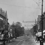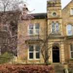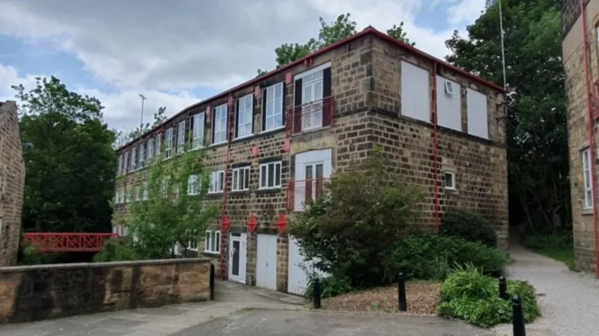
Headingley is widely recognised as a residential and cultural district of Leeds, but its landscape also records important stages in the economic development of the wider city. Former mills, quarries, transport infrastructure and industrial landscapes around the district reveal how natural resources, trade routes and urban growth changed the area.
- What is Headingley’s industrial and economic history?
- Why did industry develop around Headingley?
- Where can visitors find evidence of former industrial sites in Headingley?
- How did Headingley Station change the local economy?
- How was Headingley connected to the wider industrial economy of Leeds?
- What role did quarrying and building materials play in local development?
- How did former industrial land become part of modern Headingley?
- What was the economic impact of industrialisation on Headingley’s population and housing?
- How can visitors explore Headingley’s industrial and economic heritage today?
- Why does Headingley’s industrial history still matter?
- What does the future hold for Headingley’s industrial heritage?
This guide explains the former industrial sites and local economic history that shaped Headingley. It examines the relationship between Headingley and industrial Leeds, identifies surviving evidence in the landscape, and shows how former economic activity influenced the modern character of the area.
What is Headingley’s industrial and economic history?
Headingley’s economic history developed through agriculture, quarrying, water-powered industry and transport, while its later growth was strongly connected to industrial Leeds. The area became a residential suburb, but nearby mills, mineral resources and railway infrastructure formed an important part of its economic landscape.
Headingley did not develop into a major factory district on the scale of Holbeck, Hunslet or Armley. Its economic importance followed a different pattern. The district supplied land, building materials, water power and transport connections while becoming a desirable residential location for people connected with the expanding economy of Leeds.
The wider Leeds economy changed rapidly during the eighteenth and nineteenth centuries. Wool textiles and coal mining had long supported the region. Flax production, engineering, leather processing, printing, clothing and other industries expanded during the Industrial Revolution.
Headingley stood close enough to Leeds to benefit from this economic growth but retained a distinct physical character. Woodhouse Moor, the Meanwood Valley and surrounding higher ground created a transition between the industrial town and the northern countryside.
The result was a mixed economic landscape. Some locations supported direct industrial activity. Other parts were developed for housing, commerce and services because industrial growth in Leeds created new wealth, employment and transport networks.
Historic records show this distinction clearly. In the nineteenth century, Headingley emerged increasingly as a residential district while other communities within the historic Headingley-with-Burley township, including Kirkstall, developed stronger industrial identities.
Why did industry develop around Headingley?
Industry developed around Headingley because the area had access to water, stone, coal-bearing geology and improving transport routes. Meanwood Beck supported water-powered mills, local quarries supplied building stone, and road and railway connections linked the district to Leeds and regional markets.
Natural geography influenced the economic history of the area.
Meanwood Beck formed an important eastern boundary for Headingley. For centuries, flowing water provided a source of power for industrial processes before the widespread adoption of steam and electricity. The valley supported several mills as well as other forms of industrial activity.
Water-powered industry required a reliable combination of flowing water, suitable valley sites and access to workers and markets. The Meanwood Valley provided these conditions. Industrial activity developed along the beck even though Headingley village itself retained a more residential and commercial character.
Local geology also shaped economic activity. Parts of Headingley Hill, Woodhouse Cliff and nearby areas sit on beds of flagstone and other sandstone formations. Stone was quarried for local construction.
The wider Leeds area also contained coal, clay and other mineral resources. These resources supported industrial growth by providing fuel, building materials and raw materials. The geography of Leeds therefore connected industrial production with the expansion of surrounding settlements.
Transport completed this economic system. The Leeds-Otley Turnpike improved road connections from the mid-eighteenth century. A regular horse-drawn omnibus service began in 1838. Headingley Station opened in 1849, creating a faster connection with Leeds and northern Yorkshire.
These changes allowed Headingley to become increasingly integrated into a growing urban economy.
How did Meanwood Beck support industrial activity?
Meanwood Beck provided water power for mills and formed a corridor for industrial development.
Historical accounts identify four mills along the eastern boundary of Headingley. The valley also contained quarries and tanneries. These activities used the natural resources and physical geography of the area.
A mill was a building where machinery processed materials such as grain, textiles or other goods. Before steam power became dominant, many mills relied on water wheels driven by flowing rivers and streams.
The industrial sites along Meanwood Beck demonstrate that Headingley’s economic history extended beyond shops, housing and local services. The valley connected the district to the broader industrial economy of Leeds.
How did local geology support the economy?
Stone extraction supported the growth of buildings and infrastructure.
The flagstone beds around Headingley and Woodhouse provided construction material for local development. Historical conservation evidence also records a small sandstone quarry off Grosvenor Road, in an area now associated with Dagmar Wood.
Quarrying left a physical and economic legacy. Extracted stone contributed to buildings, boundary walls and streets. The industry also changed the landscape by creating excavations and altering natural slopes.
As Leeds expanded during the nineteenth century, demand for building materials increased. Local stone therefore formed part of the wider process of urban growth.
Where can visitors find evidence of former industrial sites in Headingley?
Evidence of Headingley’s industrial past survives most clearly in the Meanwood Valley, historic routes, former quarry landscapes and railway infrastructure. Street names and land patterns also preserve economic history, allowing visitors to identify how mills, transport and mineral extraction shaped the modern district.
Former industrial sites do not always survive as complete factory buildings. Industrial archaeology includes physical structures, altered landscapes, routes, place names and patterns of development.
The Meanwood Valley is one of the most important locations for understanding this history. The former mills along Meanwood Beck demonstrate how water power influenced the local economy.
Historic routes also preserve evidence. Oil Mill Lane and Mill Lane recorded connections between Headingley and former mill activity. Later suburban development changed the landscape, but these names preserve the economic function of the earlier area.
As you explore the modern site, you are crossing land with a deep heritage. Read about the full [Headingley Local History Guide] to understand its origins.
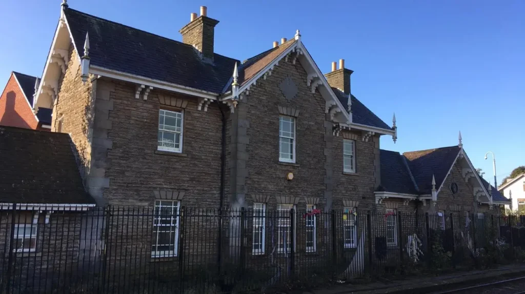
Headingley Station provides another important example. Railways changed how people, goods and coal moved through the district. The original railway infrastructure included a goods yard, coal sidings and coal drops.
Coal sidings were railway tracks used for handling coal wagons. Coal drops were structures that allowed coal to be unloaded efficiently into storage areas below or beside the railway.
These facilities demonstrate that the railway served both passengers and the local economy.
What can street names reveal about former industry?
Historic place names often preserve evidence after the original buildings disappear.
Oil Mill Lane and Mill Lane are direct examples of this process. Their names recorded routes associated with a former mill on Meanwood Beck.
Street names function as historical evidence because urban redevelopment often removes the original structures while retaining older routes and local names.
Visitors studying Headingley’s economic history should therefore look beyond surviving industrial buildings. Roads, lanes and property boundaries also provide evidence of former economic activity.
How did Headingley Station change the local economy?
Headingley Station changed the local economy by improving access to Leeds and northern Yorkshire from 1849. The railway supported commuting, commercial movement and coal distribution, while helping Headingley develop as an increasingly connected residential and service-based suburb.
The railway was a major economic transformation.
Headingley Station opened in 1849 on the Leeds and Thirsk Railway route. The railway created faster travel between Headingley, Leeds and destinations to the north.
The station’s original infrastructure reflected several economic functions. Passenger services moved people. Goods facilities handled commercial traffic. Coal sidings and coal drops supported the distribution of fuel.
This was particularly important during the nineteenth century. Coal powered factories, heated homes and supported transport systems. Railways reduced the cost and time required to move large quantities of fuel.
Headingley’s location became more attractive as transport improved. Residents could live outside the industrial centre while maintaining economic connections with Leeds.
This process contributed to the district’s suburban development.
Why was transport important to suburban growth?
Transport allowed economic activity and residential development to become geographically separated.
Industrial workers, merchants and professionals no longer needed to live immediately beside workplaces. Improved roads, omnibuses and railways expanded the practical distance between homes and places of employment.
Headingley benefited from this change.
The Leeds-Otley Turnpike improved connections from 1755 onwards. The first regular horse-drawn suburban bus service began in 1838. The railway followed in 1849.
Together, these transport developments connected the district to the expanding urban economy.
How was Headingley connected to the wider industrial economy of Leeds?
Headingley was connected to industrial Leeds through employment, transport, land development and nearby resource extraction. While major factories concentrated elsewhere, the wealth and population growth generated by textiles, engineering and other industries directly influenced Headingley’s residential and commercial expansion.
Leeds became one of Britain’s major industrial cities during the nineteenth century.
Textile manufacturing formed an important part of this economy. Engineering, leather processing, chemicals, printing, clothing and footwear also became significant sectors.
By the nineteenth century, Leeds had developed a diverse industrial base rather than relying on one activity alone.
Headingley was part of the economic geography created by this growth.
Industrialisation increased the population of Leeds and created wealth for merchants, manufacturers and professional businesses. Higher-income residents increasingly sought homes outside the most heavily industrialised and polluted parts of the town.
Headingley’s elevated position and access to open land made it attractive for suburban development.
Large villas and later terraces appeared as the population expanded. Shops, schools, religious buildings and local services followed the growth in housing.
This means the economic history of Headingley cannot be separated from the industrial history of Leeds.
Why did Headingley become more residential than industrial?
Headingley’s geography and location encouraged a different form of economic development.
The district had industrial activity around its edges and within nearby valleys, but it also offered higher ground, open land and cleaner conditions than the densely industrialised central areas of Leeds.
Improved transport made this residential development practical.
The expansion of Leeds therefore created demand for suburban housing. Headingley became part of the wider urban economy without becoming dominated by large factory complexes.
This distinction remains visible today. Headingley’s economy is strongly associated with education, hospitality, retail, professional services and leisure, while its industrial heritage survives in specific landscapes and historical infrastructure.
What role did quarrying and building materials play in local development?
Quarrying played an important role by supplying sandstone and flagstone for local construction during periods of urban expansion. Former extraction sites influenced the physical landscape, while locally sourced stone contributed to the buildings, walls and streets that still define parts of Headingley and neighbouring areas.
The relationship between industry and building development was particularly important in nineteenth-century Leeds.
Population growth created demand for homes, roads, public buildings and commercial premises. Construction required large quantities of stone, brick, timber and other materials.
Local quarries reduced the distance between source and building site.
The geology of Headingley and Woodhouse included stone suitable for construction. Historic records identify quarrying activity and surviving evidence of former extraction landscapes.
Small quarries were common in growing towns during earlier periods. As transport and mechanisation improved, larger operations increasingly supplied expanding urban markets.
The economic importance of quarrying therefore extended beyond the quarry itself. Stone extraction supported builders, transport workers and local property development.
The visual legacy also remains important. Stone buildings and boundary walls provide evidence of the relationship between local geology and the built environment.
How did former industrial land become part of modern Headingley?
Former industrial land became part of modern Headingley through redevelopment, changing land use and the growth of housing and services. Mills, quarries and transport facilities lost their original economic roles, but their locations, routes and landscape features continue to influence the area’s physical character.
Economic landscapes change when industries decline or move.
Water-powered mills became less important as industrial technology changed. Rail freight patterns also changed during the twentieth century. Small extraction sites ceased operating when resources were exhausted or larger suppliers became more efficient.
Land then acquired new uses.
In Headingley, redevelopment supported housing, education, commerce and community facilities. This process reflects a wider pattern across Leeds, where former industrial and institutional land has been adapted for modern urban needs.
Some former sites remain visible through buildings or landscape features. Others survive only through maps, archival photographs, street names and historical records.
This makes historic mapping particularly useful for visitors and researchers.
Comparing an older map with a modern street map can reveal former mill locations, railway goods areas, quarry sites and changing field boundaries.
Why is redevelopment part of economic history?
Redevelopment shows how local economies respond to changing technology and demand.
A site used for a mill in one period can become housing or a commercial property in another. A railway goods facility can lose its original purpose when transport systems change.
These transitions record shifts in employment, technology, property values and population.
Modern Headingley therefore represents several layers of economic history. Its current buildings and businesses occupy a landscape shaped by earlier agricultural, industrial and transport activity.
What was the economic impact of industrialisation on Headingley’s population and housing?
Industrialisation increased Headingley’s economic connections with Leeds and accelerated suburban development. Improved transport and industrial wealth encouraged housing growth, creating villas, terraces and local services while changing the district from a historic village into a major urban suburb.
The population and physical form of Headingley changed substantially during the nineteenth century.
Earlier Headingley was a village with agricultural land and local economic activity. As Leeds expanded, the district became increasingly connected to the urban economy.
The township’s population increased during the early nineteenth century. Road and public transport improvements strengthened the connection between Headingley and Leeds.
Landowners responded to growing demand by making land available for development.
Large houses appeared alongside terraces for working households. This created a socially and economically mixed suburban environment.
Housing growth also supported local businesses. Shops, inns, schools and other services developed to meet the needs of a larger population.
The economic impact therefore extended beyond industrial employment. Industrialisation changed property markets, transport demand and consumer activity.
How can visitors explore Headingley’s industrial and economic heritage today?
Visitors can explore Headingley’s economic heritage by following historic routes, examining the Meanwood Valley landscape, visiting railway areas and comparing historic maps with modern streets. These locations explain how natural resources, transport and suburban development connected Headingley to the industrial growth of Leeds.
A useful exploration begins with the landscape.
The Meanwood Valley provides direct evidence of the relationship between water and industry. Historic mill locations help explain why valleys were economically important before modern power systems.
Historic lanes provide another route into the past. Names associated with mills preserve connections between Headingley village and former industrial sites.
The railway corridor demonstrates the next stage of economic change. Headingley Station represents the nineteenth-century transport revolution that linked the district more closely to Leeds and the wider region.
Local stone buildings also provide evidence of resource extraction and construction.
Visitors can combine these locations with historical maps and archive photographs. This approach reveals changes that are not always visible from individual buildings alone.
A modern street can occupy former agricultural land. A woodland area can contain evidence of quarrying. A residential district can follow routes established for earlier economic purposes.
Explore More Area Guide
Headingley Historic Maps and How the Area Changed
Headingley Family History Guide: Leeds Records and Archives
Why does Headingley’s industrial history still matter?
Headingley’s industrial history matters because it explains the origins of the modern landscape, transport network and built environment. Understanding former mills, quarries and railway facilities provides essential context for the district’s transition from rural settlement to connected suburban and service-based economy.
Local history provides context for the present.
Headingley’s modern identity includes homes, independent businesses, universities, sports venues and visitor attractions. These features developed on a landscape already shaped by earlier economic decisions.
Watercourses determined where mills operated. Geological resources influenced quarrying and construction. Roads and railways changed travel patterns and property development.
The industrial history of Leeds also explains Headingley’s residential growth. The district developed alongside a major industrial city while maintaining a different economic role.
This distinction is important for anyone studying the wider area.
Headingley was not economically isolated. Its development depended on the growth of Leeds, but its physical geography encouraged a combination of residential, commercial and smaller-scale industrial activity.
The former industrial sites of Headingley therefore form part of a larger regional story.
They show how natural resources supported early production, how transport expanded economic connections and how urban growth transformed land use.
What does the future hold for Headingley’s industrial heritage?
Headingley’s industrial heritage will remain relevant through conservation, historical research and sensitive redevelopment. Former industrial landscapes provide evidence of economic change, while historic maps, archives and surviving structures help future residents and visitors understand how the district developed.
The future of industrial heritage depends on identifying and interpreting surviving evidence.
Not every former industrial site can remain unchanged. Cities and suburbs require housing, transport and commercial development. However, redevelopment can retain historical information through conservation, interpretation and careful recording.
Historic maps and archives are particularly important when physical structures have disappeared.
Digital mapping also makes it easier to compare past and present landscapes. Researchers can identify former routes, buildings and industrial sites using historical records alongside modern geographic information.
For visitors, this creates a deeper understanding of Headingley. The district is not simply a modern suburb beside Leeds. Its streets, valleys, buildings and transport links record centuries of economic change.
The most important lesson from Headingley’s former industrial sites is the connection between place and economy. Water, stone, roads and railways influenced where people worked and lived. Industrial growth in Leeds created new pressures and opportunities. Headingley responded by developing its own distinctive economic and physical identity.
Exploring this heritage provides a clear way to understand how the modern area was formed.
From the former mills along Meanwood Beck to the quarry landscapes and the railway infrastructure at Headingley Station, the evidence remains embedded in the local environment. These sites connect a historic village, an industrial city and a modern urban district through a continuous story of economic change.
For tourists and leisure travellers, this history adds depth to walks through Headingley and its surrounding valleys. For residents, it explains familiar streets and landscapes. For students, researchers and business visitors, it demonstrates how local geography and industrial development created one of Leeds’s most distinctive suburban areas.
Understanding Headingley’s former industrial sites means understanding the wider transformation of Leeds itself. The local landscape remains a record of that transformation.
What industries operated in Headingley historically?
Headingley’s historical economy included agriculture, quarrying, water-powered milling and transport-related activities. Mills along Meanwood Beck used water power, while local sandstone and flagstone resources supported quarrying and construction across the growing Leeds area.