Headingley is one of Leeds’s most recognisable historic districts. Historic maps show how the area changed from a rural township on the edge of Leeds into a densely developed urban neighbourhood shaped by housing, transport, education, sport and commerce. Comparing maps from different periods provides clear evidence of how streets, open land and local landmarks developed.
- What can historic maps reveal about how Headingley has changed?
- How did Headingley develop before large-scale urban expansion?
- Which historic maps are most useful for researching Headingley?
- How can you compare old maps with modern Headingley?
- How did Headingley’s streets and housing change during the nineteenth century?
- What role did transport play in changing Headingley?
- How have major institutions and landmarks changed the Headingley landscape?
- What happened to Headingley’s open land and green spaces?
- How can visitors and residents use historic maps to explore Headingley today?
- Where can you find reliable historic maps and records for Headingley?
- Why are historic maps important for understanding Headingley’s future?
- How has Headingley changed when its historic maps are viewed together?
For visitors, residents and researchers, historic maps offer a practical way to understand the modern landscape. Roads that appear ordinary today often follow older routes. Parks preserve former open land. Large institutions occupy sites once used for agriculture, while railway infrastructure and suburban housing reveal the periods of Headingley’s fastest physical growth.
What can historic maps reveal about how Headingley has changed?
Historic maps reveal Headingley’s transformation from a rural settlement into an urban district by recording changes to roads, fields, housing, institutions, transport routes and public spaces across successive periods of development from the nineteenth century to the present day.
Maps provide a dated record of the physical environment. They show where buildings stood, how land was divided and which routes connected local settlements. When several maps are compared, the changes become measurable and easier to interpret.
Headingley historically developed as a township north-west of Leeds. Its position on routes leading from Leeds towards Otley and the wider West Yorkshire countryside supported its growth. Earlier mapping shows a landscape with more open land and a smaller built-up settlement than the modern district.
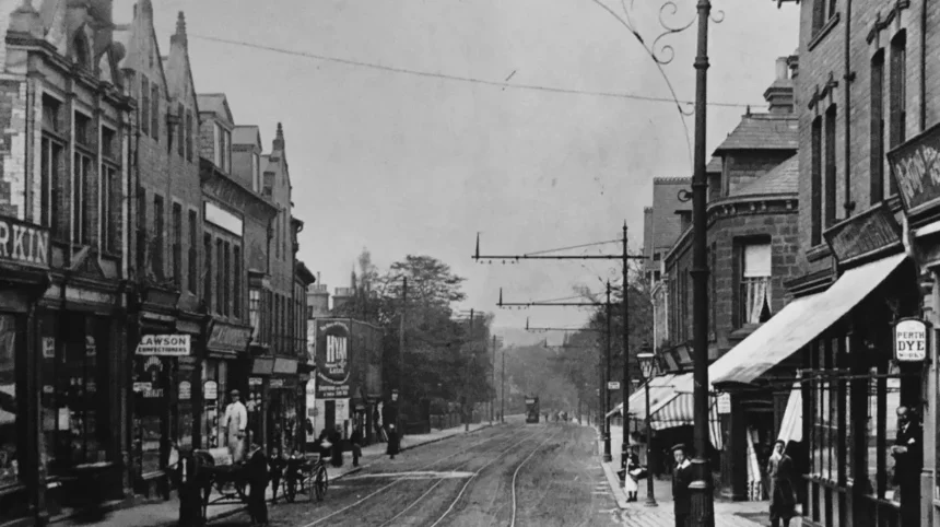
The expansion of Leeds during the nineteenth century changed Headingley rapidly. Housing extended across former fields. Roads were improved and new streets were laid out. Large villas and terraces appeared as the area became an established residential district.
Historic maps also identify the growth of major institutions. Educational sites, religious buildings, sports grounds and transport facilities became increasingly prominent features of the local landscape. These sites remain important reference points when comparing historic and modern Headingley.
The value of map comparison lies in its ability to connect a location with a specific period. A modern street can be checked against an Ordnance Survey map to establish whether it existed in the nineteenth century, whether its route changed or whether it replaced earlier land uses.
How did Headingley develop before large-scale urban expansion?
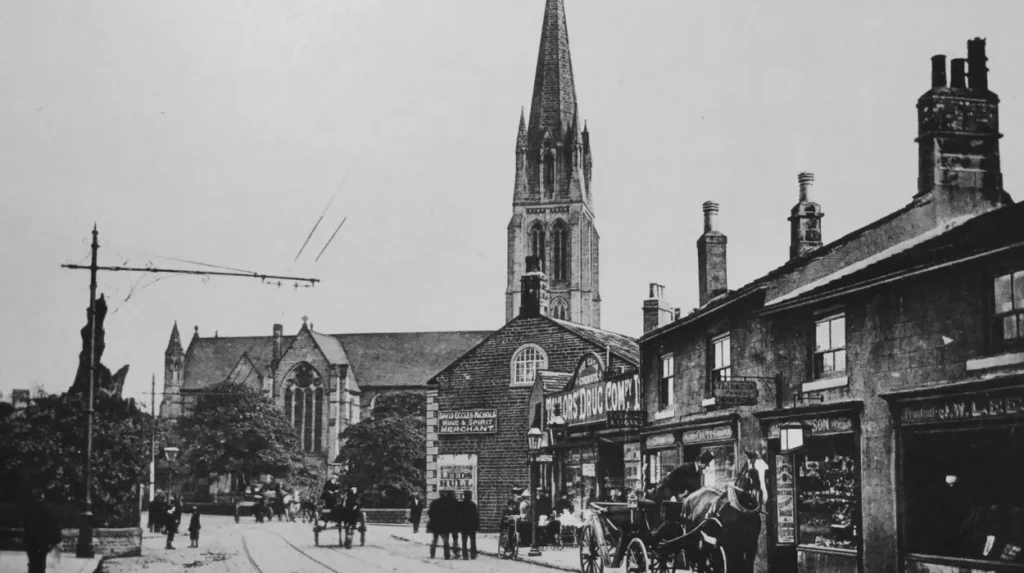
Before large-scale urban expansion, Headingley consisted of a smaller settlement surrounded by agricultural land, fields and rural routes, with development concentrated around established roads before nineteenth-century population growth connected the district more closely with expanding Leeds.
Headingley’s earlier landscape reflected its historic position outside the built-up core of Leeds. The settlement developed within a wider rural area containing agricultural land and dispersed buildings.
Historic county and township maps provide evidence of this earlier pattern. Field boundaries, farms and open spaces occupied land that later became residential neighbourhoods. The main routes through the area remained important because road alignments often survived later redevelopment.
The historic Otley Road corridor is particularly important for understanding local change. It formed a long-established route through Headingley and later became one of the district’s principal urban roads. Development increasingly concentrated along and around this transport corridor.
The transition from rural land to suburban development did not occur simultaneously across the district. Some areas were built up earlier because they stood close to established roads. Other sites remained open until later periods, when demand for housing and institutional land increased.
As you explore the modern site, you are crossing land with a deep heritage. Read about the full [Insert Anchor Text for History Article Here] to understand its origins.
Historic mapping therefore provides a baseline for understanding Headingley’s development. The contrast between early open landscapes and later dense streets shows the scale of urban expansion around Leeds.
Which historic maps are most useful for researching Headingley?
The most useful historic maps for researching Headingley include early county maps, nineteenth-century Ordnance Survey surveys, large-scale town plans and modern digital mapping collections, which allow users to compare land use, buildings, roads and boundaries across different dates.
Different maps serve different research purposes. A small-scale map gives a broad view of settlements and major roads. A large-scale map records individual buildings, field boundaries and detailed local features.
Early county and regional maps
Early county maps are useful for identifying Headingley’s position within the historic landscape of Yorkshire. Their level of detail is lower than later Ordnance Survey mapping, but they show major settlements, principal routes and the wider geographical context.
These maps help establish the relationship between Headingley and nearby places such as Leeds, Kirkstall and Meanwood. They are most useful for macro-level historical research rather than for identifying individual properties.
Ordnance Survey maps
The Ordnance Survey produced increasingly detailed mapping from the nineteenth century onwards. Large-scale editions recorded roads, buildings, railway lines, public facilities and land boundaries.
For Headingley, these maps provide a strong chronological record of suburban growth. Comparing successive editions can show when streets first appeared and when open land was replaced by housing or institutional development.
The National Library of Scotland provides online access to extensive historic map collections, including georeferenced Ordnance Survey mapping. Georeferencing places historic maps over modern geographic coordinates, allowing users to compare earlier features with the present-day landscape.
Local archives and specialist collections
Local archives preserve maps alongside photographs, planning records and other historical documents. These collections provide additional context because a map records physical features but does not always explain why they changed.
Leeds Libraries and local archive collections are important resources for researchers investigating the city’s historic development. The West Yorkshire Archive Service also preserves records relevant to local history, property and administrative change.
Using more than one source strengthens map research. A historic map can identify a former building, while a directory, photograph or archive record can establish its purpose and date.
How can you compare old maps with modern Headingley?
Comparing old and modern maps involves identifying fixed landmarks, matching road alignments, examining changed boundaries and checking successive editions to establish when physical features appeared, disappeared or changed function within Headingley’s evolving urban landscape.
The most effective comparison starts with features that have remained in place. Major roads, prominent buildings and established public spaces provide reference points between different map editions.
Road alignments are particularly useful. A road can retain its general route even when surrounding buildings change completely. Comparing historic and current mapping therefore reveals which parts of Headingley’s street network have long historical origins.
The next stage is to identify changes in land use. Open fields shown on an early map can later appear as housing estates, school grounds or public facilities. This establishes the approximate period in which development occurred.
Boundaries also provide important evidence. Historic parish, township and property boundaries influenced land ownership and development patterns. Some boundaries remain visible through roads, walls or changes in building layouts.
Digital mapping tools simplify this process. Overlay functions place a historic map on top of a modern basemap. Users can adjust transparency and inspect the relationship between old and new features.
Researchers should check map dates carefully. A map publication date and a survey date are not always identical. Understanding the date of the underlying survey is important when identifying the first appearance of a building or road.
How did Headingley’s streets and housing change during the nineteenth century?
Headingley’s nineteenth-century streets and housing expanded substantially as Leeds grew, replacing agricultural land with villas, terraces and planned residential streets that established the district’s distinctive suburban character and denser urban street pattern.
The nineteenth century was a major period of physical change across Leeds. Industrial growth increased the city’s population and expanded demand for housing beyond the historic centre.
Headingley became increasingly attractive as a residential location. Its position north-west of central Leeds, combined with established road connections, supported suburban development.
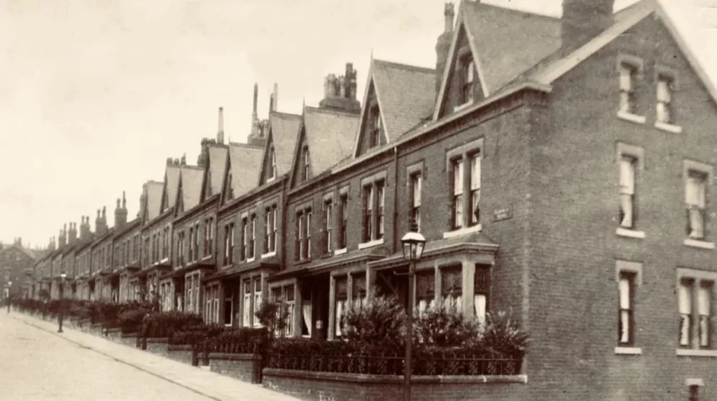
Historic maps show the gradual subdivision of larger plots and agricultural land. New streets created regular patterns of development. Houses were built in terraces and other forms of planned residential layouts.
The built environment also became more varied. Larger houses appeared in some locations, while denser housing developed in areas closer to established routes and local services. This created a mixed urban form that remains visible in parts of Headingley.
Street names are useful evidence when studying this change. A name can preserve an association with a former landowner, local feature or historic settlement pattern. However, researchers should verify historic names because streets have also been renamed or altered.
The expansion of housing changed local services. Shops, places of worship, schools and other community facilities developed alongside the growing population. Historic maps record many of these buildings and help establish their relationship with surrounding residential streets.
What role did transport play in changing Headingley?
Transport played a central role in Headingley’s development by improving connections with Leeds and surrounding areas, supporting residential growth and introducing major infrastructure that changed travel patterns, commercial activity and the physical organisation of the district.
Transport routes influenced Headingley before the arrival of modern rail and road systems. Established roads connected the settlement with Leeds and neighbouring communities.
During the nineteenth and twentieth centuries, improved transport increased the accessibility of suburban districts. This supported population growth and changed the relationship between Headingley and central Leeds.
Railways became an important part of the wider urban landscape. Railway mapping records lines, stations, bridges and associated infrastructure. These features changed the movement of people and goods across West Yorkshire.
Road transport later became increasingly significant. Major routes carried greater volumes of traffic and supported commercial development along key corridors. Historic maps document the changing scale and complexity of road infrastructure.
The relationship between transport and development is visible through map comparison. Areas close to major routes often experienced earlier or more intensive building activity. Transport therefore provides an important explanation for the pattern of Headingley’s urban growth.
For modern visitors, historic transport mapping also helps explain the layout of the district. Routes that now serve buses, pedestrians and vehicles often developed from much older connections.
How have major institutions and landmarks changed the Headingley landscape?
Major institutions and landmarks changed Headingley’s landscape by occupying large areas of land and creating permanent focal points for education, religion, recreation and sport, with historic maps recording their expansion and influence on surrounding development.
Large sites are often easy to identify on historic maps because their boundaries and buildings are clearly marked. Their development also provides useful chronological evidence.
Educational institutions became important land users in and around Headingley. The University of Leeds and other educational facilities contributed to changes in housing, services and travel patterns across the wider area.
Religious buildings also form important historic landmarks. Churches and chapels often appear on successive map editions, allowing researchers to track their continued use or later redevelopment.
Sport is another major element of Headingley’s identity. Headingley Stadium is a prominent modern and historic landmark associated with cricket and rugby. Mapping the area over time shows how large sporting facilities became established within the urban district.
Public open spaces provide another form of continuity. Parks and recreation grounds can preserve areas that remain undeveloped even as surrounding land changes. Comparing maps helps establish whether an open space has a long history or represents a more recent planning decision.
These institutions affect more than the land inside their boundaries. They influence surrounding streets, transport and commercial activity. Historic maps therefore provide evidence of both direct physical change and wider urban relationships.
What happened to Headingley’s open land and green spaces?
Headingley’s open land changed significantly as urban development expanded, with many former fields and agricultural areas replaced by housing and institutions while selected parks, recreation grounds and natural spaces remained as important elements of the local landscape.
Early maps contain more evidence of agricultural land than modern urban mapping. Fields were defined by boundaries that disappeared or changed as roads and buildings were constructed.
The loss of open land reflects the wider expansion of Leeds. Population growth created demand for homes, schools, services and infrastructure. Land close to established routes became increasingly valuable for development.
Not every open area was built upon. Public parks, sports grounds and recreation spaces remained part of the district’s physical structure. These spaces provide visible links between historic and modern land use.
Historic field patterns sometimes remain detectable even after development. Curved roads, irregular boundaries and changes in street layouts can reflect earlier property lines or landscape features.
Researchers can use successive maps to establish when an area changed. If a nineteenth-century map shows agricultural land and a later edition shows streets and housing, the development occurred between the dates of those surveys.
This approach provides a clear method for investigating local environmental change without relying on assumptions about the age of modern neighbourhoods.
How can visitors and residents use historic maps to explore Headingley today?
Visitors and residents can use historic maps to plan self-guided exploration, identify surviving landmarks, locate former buildings and understand street patterns, turning ordinary walks through modern Headingley into structured investigations of documented local change.
Historic maps are practical tools for exploring the district. A visitor can choose a short route and compare present-day streets with an earlier map before setting out.
Start with a clearly identifiable landmark. Major roads, churches, public spaces and sporting sites are useful reference points. Check how the surrounding area appeared on an earlier edition.
The next step is to identify visible evidence of change. A historic building can survive within a newer streetscape. A former field boundary can be reflected in the direction of a road. A site marked for a specific use can now contain a different type of development.
Visitors should also consider access and safety. Historic maps record past landscapes and do not provide current information about private property, road conditions or public access. Modern maps should be used alongside historic sources for route planning.
This type of exploration suits several audiences. Tourists can connect local attractions with historical context. Residents can investigate the origins of familiar streets. Digital nomads and business travellers can use short walks to understand the district between work commitments.
Historic map research also supports local heritage awareness. Understanding previous land uses gives greater context to conservation, redevelopment and changes in the urban environment.
Where can you find reliable historic maps and records for Headingley?
Reliable historic maps and records for Headingley are available through national mapping collections, local libraries, archive services and academic institutions, where dated surveys and supporting historical documents provide verifiable evidence of the district’s physical development.
The National Library of Scotland is a major digital source for historic Ordnance Survey mapping. Its online collections allow users to search, view and compare maps covering many parts of Great Britain.
The Ordnance Survey is the national mapping organisation for Great Britain. Its historic mapping provides an important foundation for studying changes in settlements, roads and land use.
Local resources add detailed context. Leeds Libraries holds local studies materials relevant to the city’s history. Archive services preserve historical records created by local authorities, businesses, organisations and individuals.
The West Yorkshire Archive Service provides access to archival material covering the wider county area. Its records support research into property, administration and community history.
Academic libraries and local history organisations can provide additional specialist resources. Researchers should distinguish between original historical records and later interpretations. Original maps, dated surveys and official records provide primary evidence, while books and articles explain historical context.
Reliable research requires source comparison. A single map records one point in time. A sequence of maps, supported by archive records, provides a more complete account of how Headingley changed.
Explore More Area Guide
Headingley Family History Guide: Leeds Records and Archives
Headingley Guide to Creative University Societies
Why are historic maps important for understanding Headingley’s future?
Historic maps are important for Headingley’s future because they provide evidence of long-term development patterns, surviving heritage and former land uses, helping communities understand change and assess how new development relates to the district’s established landscape.
Historic maps are not only records of the past. They provide evidence that informs present-day understanding of the built environment.
Planning and redevelopment take place within landscapes shaped by earlier decisions. Historic roads, boundaries and institutions continue to influence the use of land. Mapping helps identify this continuity.
Former land uses can also be relevant to redevelopment research. Historic maps provide an initial record of how a site was used, although they should be supported by specialist surveys and official records where detailed assessment is required.
Heritage conservation also depends on accurate historical evidence. Maps can establish the age and development context of buildings, public spaces and street networks.
For local communities, map comparison creates a documented record of change. It shows which elements of Headingley have survived and which have been replaced.
The future relevance of historic maps therefore lies in their role as evidence. They connect earlier landscapes with modern planning, heritage research and public understanding.
How has Headingley changed when its historic maps are viewed together?
Viewed together, historic maps show Headingley’s clear transition from a smaller rural settlement into a connected urban district, with expanding housing, transport infrastructure, institutions and services progressively reshaping its streets, land use and local identity.
The strongest conclusion from historic map comparison is the scale of Headingley’s physical transformation. Earlier landscapes contained more open land and a smaller concentration of buildings. Later maps record a denser urban environment.
Roads provide continuity across this transformation. Long-established routes remained important as new streets and developments appeared around them.
Housing demonstrates the expansion of the urban population. Former agricultural land was subdivided and developed, creating the residential patterns visible today.
Transport changed the district’s connections with Leeds and the wider region. Institutions introduced large, permanent sites that became major landmarks. Parks and recreation spaces preserved selected areas of open land.
Together, these changes created the modern character of Headingley. Historic maps provide a dated and verifiable method for examining that process.
For anyone exploring the area, the most effective approach is to compare several map editions rather than relying on a single image. This reveals when major changes occurred and separates long-standing features from recent development.
Headingley’s historic maps therefore offer more than visual interest. They provide a structured record of how geography, transport, housing and institutions shaped one of Leeds’s best-known districts. By comparing past and present mapping, visitors and residents can understand how the modern streetscape developed and identify the historical layers that remain visible across the area.
Where can I find historic maps of Headingley?
Historic maps of Headingley are available through the National Library of Scotland’s online map collection, Leeds Libraries and local archive services. These resources include historic Ordnance Survey maps, county maps and detailed local records.