Horsforth is a historic settlement in north-west Leeds with a distinctive landscape shaped by its position on the slope of the Aire Valley. Its scenery combines open green spaces, mature woodland, residential streets, historic buildings, valley views and accessible walking routes.
- What makes Horsforth a scenic area to visit?
- Where can you find the best views in Horsforth?
- What can you see from Horsforth’s elevated landscape?
- Why is Horsforth Hall Park important for scenic walks?
- Which woodland areas provide a different landscape experience?
- How does Horsforth’s historic landscape influence its views?
- Which green spaces are useful for short scenic walks?
- How can visitors combine scenery with the River Aire and canal landscape?
- What are the best scenic locations for photography in Horsforth?
- Which scenic areas are best for families and accessible visitors?
- How can digital nomads and business travellers use Horsforth’s scenic spaces?
- When is the best time to explore Horsforth’s landscapes?
- How should visitors plan a scenic day around Horsforth?
- Why are Horsforth’s landscapes important for the future?
The area sits approximately six miles north-west of Leeds city centre. Leeds City Council identifies Horsforth Hall Park as a major community green space, while the Horsforth conservation-area documentation identifies important long-distance, mid-distance and local views across the Aire Valley and surrounding landscape.
The landscape is particularly varied because Horsforth occupies elevated ground above the River Aire. Streets, lanes and footpaths create changing perspectives towards woodland, valleys, rooftops, church landmarks and open countryside. North Broadgate Lane, Hall Lane and parts of the Town Street conservation area are specifically associated with important views.
For visitors, this makes Horsforth suitable for scenic walks, landscape photography, relaxed outdoor breaks and short excursions away from central Leeds. The scenery also connects directly with the area’s history, conservation areas and surviving green spaces.
What makes Horsforth a scenic area to visit?
Horsforth is scenic because its elevated position overlooks the Aire Valley and combines mature woodland, open green spaces, historic streets, landscaped gardens, church landmarks and long-distance views into one compact urban landscape around north-west Leeds.
The defining geographical feature is Horsforth’s position on the slope of the Aire Valley. This elevation creates changes in level across the settlement and produces outward views from roads, paths and open spaces.
Leeds City Council’s conservation-area appraisal states that the location of Horsforth on the slope of the Aire Valley, together with the Old Mill Beck valley to the east, creates opportunities for broad panoramas and narrower views through the built environment.
This combination is important because scenic landscapes in Horsforth are not confined to one formal viewpoint. The visual experience changes between woodland, open parkland, residential streets and elevated roads.
The Horsforth Neighbourhood Plan also identifies long and mid-distance views, particularly southwards over the Aire Valley, as important to the character of the Town Street Conservation Area.
Horsforth therefore works as a landscape destination for visitors who want scenery without travelling far from Leeds city centre.
The area’s green infrastructure includes Horsforth Hall Park, Hunger Hills, Cragg Wood, Cragwood Road Wood, Little Hawksworth Wood, Swaine Wood and The Outwood. Leeds City Council lists these locations within its parks and countryside records for Horsforth.
Where can you find the best views in Horsforth?
The strongest views occur around elevated roads, open parkland and conservation-area locations, particularly Hall Lane, North Broadgate Lane, Broadgate Lane, Fink Hill and viewpoints facing south towards the Aire Valley from higher ground.
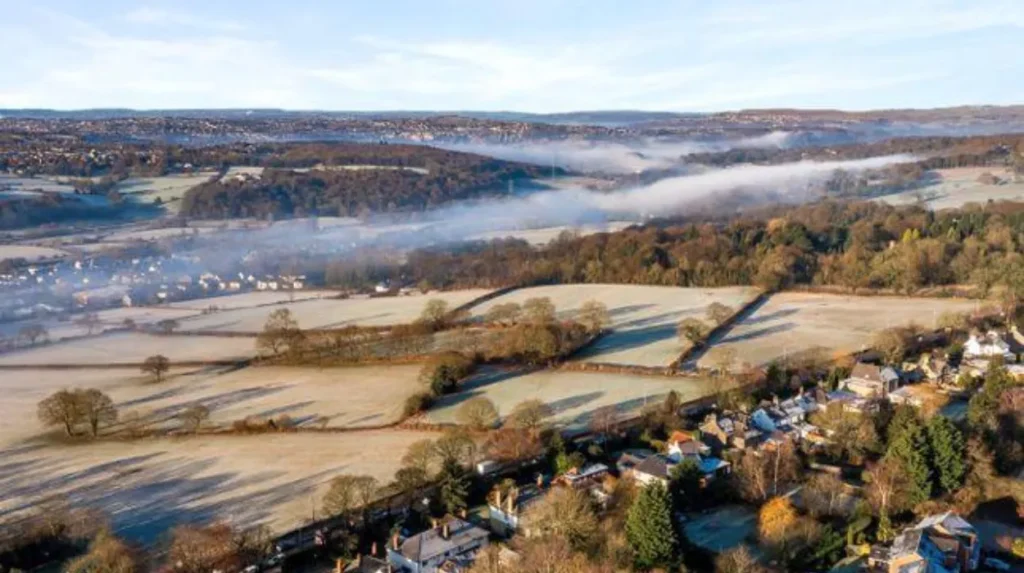
Hall Lane is one of the clearest locations for understanding Horsforth’s elevated landscape. The Leeds design statement describes dramatic south-facing views over the Aire Valley from this part of Horsforth.
North Broadgate Lane is another significant viewpoint. The conservation-area appraisal identifies a broad panorama looking north-east from North Broadgate Lane. This demonstrates how Horsforth’s road network itself creates important visual corridors.
Broadgate Lane also provides changing views as the road moves through elevated parts of the settlement. The official conservation-area documentation records a view eastwards from Broadgate Lane towards a green valley and distant housing.
Fink Hill provides another useful landmark-based perspective. The conservation documentation records views towards St Margaret’s Church from Fink Hill. The church’s prominent spire gives the surrounding landscape a recognisable vertical landmark.
The Town Street area contains additional visual sequences. The neighbourhood plan identifies 22 numbered view references within the Town Street Conservation Area, showing that the visual character is distributed across several streets rather than concentrated at one lookout.
For landscape photography, these locations provide different compositions. Elevated roads give wider horizons. Narrow streets create framed views. Green spaces provide foreground vegetation. Historic buildings provide architectural context.
Visitors should remain on public paths and respect residential areas because many scenic viewpoints are integrated into ordinary streets rather than dedicated viewing platforms.
What can you see from Horsforth’s elevated landscape?
From elevated parts of Horsforth, visitors can see sections of the Aire Valley, wooded slopes, open land, residential areas, church landmarks and distant landscape features, with the exact panorama changing according to position, vegetation, buildings and viewing direction.
The Aire Valley is the principal landscape reference point. Its valley form explains why several Horsforth locations have views extending beyond the immediate neighbourhood.
The southern-facing landscape around Hall Lane is particularly notable. The official Horsforth design statement describes the area as a south-facing valley side with dramatic views over the Aire Valley.
Woodland also contributes strongly to the visual character. Trees soften the edges of residential development and create layered views where built-up areas sit against wooded slopes.
St Margaret’s Church is an important landmark within these views. The church was built between 1877 and 1883, while its spire was added in 1902. Its elevated position makes it visible from several parts of Horsforth.
The visual landscape is therefore composed of several layers. The immediate layer contains streets, gardens and buildings. The middle layer contains trees, playing fields and woodland. The distant layer contains the Aire Valley and wider Leeds landscape.
This layered structure explains why Horsforth can feel visually open despite its suburban character. The settlement retains a strong relationship with its surrounding topography.
Why is Horsforth Hall Park important for scenic walks?
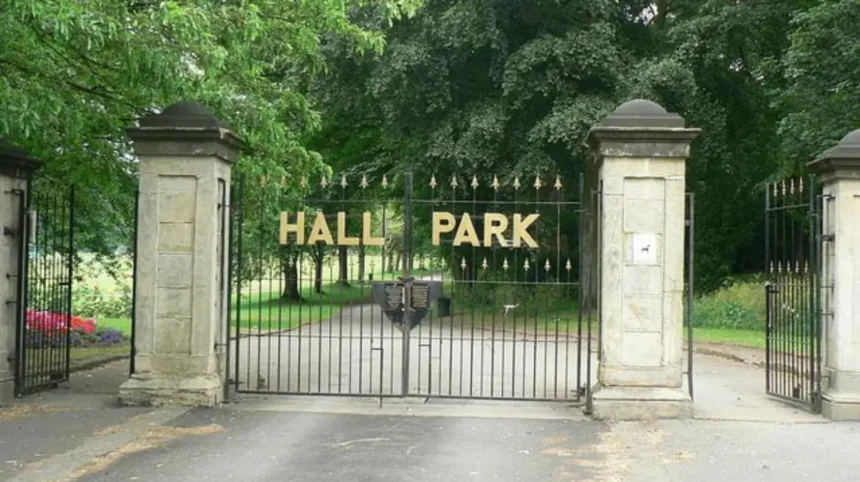
Horsforth Hall Park is the area’s principal community park and provides scenic walking routes, mature trees, landscaped gardens, open parkland and recreational spaces, making it a practical starting point for visitors seeking accessible scenery within Horsforth.
Horsforth Hall Park is located on Hall Lane and is approximately six miles north-west of Leeds city centre. Leeds City Council identifies scenic walks, a Japanese garden, cricket pitch, trim trail, skate park and inclusive play facilities among its features.
The park is important because it combines recreational infrastructure with established landscape features. Visitors can move from open grassed areas into tree-lined sections and landscaped garden spaces without leaving the park.
The Japanese garden provides a more enclosed visual environment. Water, rocks, bridges and planted areas create a distinct landscape within the wider park. The Friends of Horsforth Hall Park also identifies the Japanese garden and Millennium Garden as important parts of the park’s community landscape.
The park has accessible paths and wheelchair-accessible entrances. Leeds City Council also records two disabled parking bays in the main car park off Hall Lane.
This makes the park suitable for visitors who want scenery without committing to a long countryside walk.
The park also has historical importance. Its grounds relate to the former Horsforth Hall, making the landscape a combination of present-day recreation and historic estate grounds.
As you explore the modern park, you are crossing land with a deep heritage. Read about the full to understand its origins.
The park’s mature trees and open spaces also make it useful for visitors seeking quieter outdoor time close to Horsforth’s commercial centre.
Which woodland areas provide a different landscape experience?
Horsforth’s woodland areas provide a contrasting landscape of trees, shaded paths, wildlife habitat and seasonal vegetation, with Hunger Hills, Cragg Wood, Cragwood Road Wood, Little Hawksworth Wood, Swaine Wood and The Outwood forming important local green assets.
Woodland creates a different visual experience from the open views of Hall Lane and the Aire Valley.
Leeds City Council’s parks byelaw records identify Cragg Wood, Cragwood Road Wood, Hunger Hills, Little Hawksworth Wood, Swaine Wood and The Outwood as woodland areas within Horsforth.
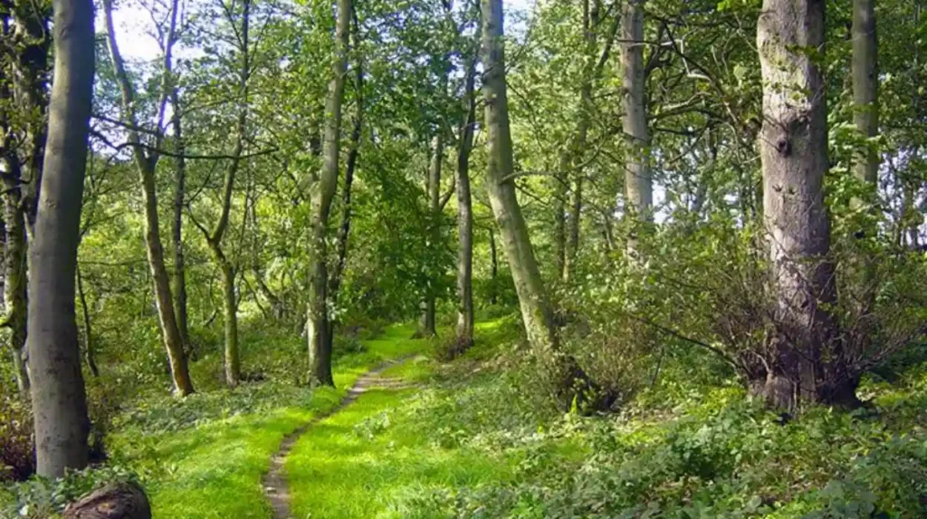
Hunger Hills is particularly relevant to visitors interested in woodland scenery. Discover Leeds describes it as a small urban woodland on the edge of Horsforth, while the Friends of Hunger Hills Woods undertake practical conservation activities and community events.
The eastern side of Hunger Hills opens into fields that slope towards Horsforth. This creates an important transition between enclosed woodland and open landscape. Discover Leeds specifically identifies views south-east towards Leeds city centre from the open fields on the eastern side.
This combination makes Hunger Hills valuable for visitors who want both woodland and wider urban views during one outing.
Cragg Wood and the other woodland areas contribute to the area’s wider green infrastructure. They also help retain visual separation between built-up neighbourhoods.
Woodland scenery changes considerably across the seasons. Spring brings fresh foliage and woodland flowers. Summer produces dense green canopies. Autumn changes the colour and texture of the landscape. Winter exposes tree structures and opens additional sightlines.
Visitors should use established paths where available and take account of wet or uneven ground after rainfall.
How does Horsforth’s historic landscape influence its views?
Horsforth’s historic landscape influences its scenery through medieval street patterns, stone buildings, historic green spaces, conservation areas, surviving field patterns and prominent landmarks that provide visual links between the settlement’s past and present.
Horsforth has a long settlement history. The Horsforth Town Council identifies the town as an ancient settlement recorded in the Domesday Book, while Leeds conservation documentation identifies links extending into the Anglo-Saxon period.
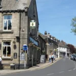
The historic core around The Green and Town Street retains elements of the medieval settlement pattern. Leeds City Council’s conservation appraisal states that medieval character remains particularly visible around The Green and the southern end of Town Street.
This historical structure affects the landscape because streets follow established patterns rather than a completely modern grid. Changes in direction create framed views of buildings, trees and landmarks.
Stone buildings also contribute to visual identity. Historic cottages, churches and other structures create a strong architectural foreground against the wider green landscape.
The Green at the junction of Town Street and Fink Hill remains an important green space. The Leeds design statement describes it as the heart of the original village. Chapel Green also provides a green link towards Horsforth Hall Park.
These spaces show how Horsforth’s scenic character is not purely natural. Its visual identity comes from the interaction between landscape, architecture and settlement history.
The conservation designation protects elements of this character. Leeds currently lists Horsforth and Horsforth Cragg Hill among its conservation areas.
Which green spaces are useful for short scenic walks?
Short scenic walks are available around Horsforth Hall Park, The Green, Chapel Green, Hunger Hills, woodland areas and local recreation grounds, allowing visitors to combine green space, residential scenery, historic streets and elevated views without completing a long-distance hike.
Horsforth has a substantial network of smaller green spaces beyond its principal park.
Leeds City Council’s records identify The Green, Newlay public open space, Woodside Park Avenue public open space, Woodside Recreation Ground, Cragg Hill Recreation Ground, King George’s Playing Fields and Stanhope Recreation Ground among local spaces.
These locations serve different purposes. A recreation ground generally provides open space for sport and informal activity. A local green space contributes to neighbourhood character. A woodland area provides tree cover and habitat.
For visitors, the practical value is variety. A short walk can connect streets and green spaces without requiring specialist walking equipment.
Horsforth Hall Park is the strongest starting point because its paths are specifically identified as scenic and suitable for wheelchair users.
Hunger Hills provides a more natural woodland setting. The Green and Chapel Green provide historic village scenery. Local recreation grounds offer open views and quieter spaces away from the main commercial streets.
A scenic route can therefore be adapted to available time. A short visit can focus on Hall Park. A longer walk can connect Hall Park with nearby streets, Hunger Hills or woodland areas.
Visitors should check current access conditions before setting out, particularly where routes cross private land, school grounds or roads.
How can visitors combine scenery with the River Aire and canal landscape?
The River Aire and Leeds & Liverpool Canal extend Horsforth’s scenic experience beyond its elevated streets, adding water, woodland, historic engineering and riverside landscapes around Newlay and Kirkstall for visitors seeking longer outdoor routes.
The River Aire forms the major valley feature below Horsforth. The settlement’s elevated position creates visual connections towards the river corridor even where the river itself is not directly visible.
The Newlay area provides an important connection between Horsforth’s elevated landscape and the river valley. Leeds’ design documentation describes Newlay’s south-facing valley side as sweeping down towards the River Aire, with woodland views to the south and east.
The Leeds & Liverpool Canal also forms part of the wider landscape network. The Canal & River Trust describes the waterway as a 127-mile canal connecting Leeds and Liverpool and supporting walking, cycling, wildlife watching and other outdoor activities.
Newlay and Kirkstall Forge are associated with locks on the Leeds & Liverpool Canal. The Canal & River Trust confirms that Newlay, Forge and Kirkstall locks form part of the Yorkshire and North East section of the canal.
These landscapes add a different visual character to Horsforth’s hilltop and suburban scenery.
Water reflections, canal-side vegetation, towpaths, bridges and industrial heritage create strong landscape features. The canal also provides a linear route for visitors who want to continue walking beyond the immediate Horsforth area.
The combination of elevated views, woodland and water creates a broader understanding of the area’s geography.
What are the best scenic locations for photography in Horsforth?
The strongest photography locations include Horsforth Hall Park, Hunger Hills, Hall Lane, North Broadgate Lane, Broadgate Lane, Fink Hill and historic areas around Town Street, where landscape, architecture, woodland and valley views create varied compositions.
Photography opportunities depend on the type of image required.
Hall Lane is suited to wider landscape photography because its elevated position provides views over the Aire Valley. North Broadgate Lane offers another broad perspective identified by the official conservation appraisal.
Hunger Hills provides woodland photography and elevated views towards Leeds. Its combination of trees and open fields creates foreground, middle-ground and distant landscape layers.
Horsforth Hall Park is suitable for garden and park photography. The Japanese garden, mature trees, open spaces and historic landscape provide several visual environments within one location.
Town Street and The Green are more appropriate for architectural photography. Historic stone buildings and established streets provide context for understanding Horsforth’s development.
Fink Hill is useful for landmark photography because St Margaret’s Church has a tall spire and prominent elevated position. The church was constructed in the late nineteenth century, with the spire added in the early twentieth century.
For responsible photography, visitors should avoid blocking pavements, entering private property or photographing people without appropriate consideration.
Which scenic areas are best for families and accessible visitors?
Horsforth Hall Park is the strongest option for families and visitors seeking accessible scenery because it provides wheelchair-suitable paths, accessible entrances, disabled parking bays, landscaped gardens, open parkland and inclusive play facilities within one managed community park.
Horsforth Hall Park provides the clearest combination of accessibility and scenery.
Leeds City Council confirms that the park’s paths are suitable for wheelchair users and that all entrances are wheelchair accessible. Two disabled parking bays are available in the main car park off Hall Lane.
The park also includes an integrated outdoor play facility designed for disabled and non-disabled children under eight to play together. This facility was developed through the Horsforth Integrated Play Project and Mencap with Leeds Parks and Countryside.
The wider park includes a Japanese garden, cricket pitch, trim trail, skate park and additional play facilities.
This range of features makes the park useful for mixed-age groups where some visitors want a walk while others want recreation.
Families can also use the open spaces around The Green and other local green spaces for shorter outdoor stops. However, Hall Park remains the most clearly documented location for accessible paths and facilities.
Visitors with specific accessibility requirements should check current conditions with Leeds City Council before travelling, because individual facilities and surfaces can change through maintenance works.
How can digital nomads and business travellers use Horsforth’s scenic spaces?
Digital nomads and business travellers can use Horsforth’s scenic spaces for walking breaks, screen-free downtime, informal thinking time and short outdoor sessions, while nearby Town Street provides cafés, food venues and everyday services between outdoor visits.
Horsforth combines outdoor scenery with an established local centre.
Visit Leeds identifies Town Street as a popular destination for food and nightlife and confirms that Horsforth has a train station with links to Leeds. Regular bus services also connect Horsforth with Leeds city centre.
This transport and commercial infrastructure allows business visitors to combine outdoor downtime with urban services.
A practical routine is to spend a short period walking through Horsforth Hall Park before returning to Town Street. A longer break can incorporate Hunger Hills or a route towards the valley.
Outdoor spaces are particularly useful for walking meetings, reflection breaks and exercise between indoor work sessions. These activities require no specialist booking.
The Horsforth Community Hub and Library is also located on Town Street and provides a public community facility. Leeds City Council records weekday and Saturday opening hours, although visitors should check current hours before relying on the building for work or services.
The combination of transport, cafés, library services and green spaces gives Horsforth practical value beyond traditional sightseeing.
When is the best time to explore Horsforth’s landscapes?
Horsforth’s landscapes are accessible throughout the year, with spring providing fresh vegetation, summer offering mature greenery, autumn producing changing woodland colours and winter revealing tree structures and some views that foliage normally obscures.
Each season changes the visual structure of Horsforth.
Spring is suitable for observing new growth in parks and woodland. Garden areas such as the Japanese garden provide structured planting alongside the wider green spaces.
Summer produces dense foliage and strong greenery. Mature trees in Horsforth Hall Park create shaded areas, while open spaces retain broader views.
Autumn changes the appearance of Hunger Hills and other woodland areas through seasonal leaf colour. Woodland paths also develop different textures as fallen leaves accumulate.
Winter exposes branches and trunks and can create clearer views through deciduous vegetation. The underlying topography becomes easier to identify when foliage is reduced.
Weather affects visibility. Clear conditions provide stronger distant views across the Aire Valley. Cloud, rain and mist reduce long-distance visibility.
For visitors seeking scenic photography, early morning and late afternoon provide changing natural light. However, public access rules and daylight conditions should always be considered when planning outdoor visits.
Explore More Area Guide
Horsforth Best Morning Places and Early Starts, Leeds 2026
Horsforth Leisure Facilities and Recreation Guide 2026
How should visitors plan a scenic day around Horsforth?
A scenic day in Horsforth works best when visitors combine one major green space, one woodland or valley viewpoint and one historic street area, creating a balanced route through parks, elevated landscapes, woodland, architecture and local amenities.
Horsforth is compact enough to support a flexible outdoor itinerary.
A straightforward visit can begin at Horsforth Hall Park. The park provides scenic walks, landscaped gardens and recreational facilities.
Visitors can then continue towards Hall Lane or Broadgate Lane to experience the elevated landscape and views towards the Aire Valley. These areas are documented within the official conservation and design assessments.
A woodland section at Hunger Hills provides a contrasting environment. The open fields on its eastern side also provide views towards Leeds.
The final section can focus on The Green and Town Street, where historic buildings and established streets demonstrate Horsforth’s village character.
Longer visits can extend towards Newlay and the River Aire or connect with the Leeds & Liverpool Canal landscape.
The route should be adapted to weather, daylight, mobility requirements and available time. Visitors should use public rights of way and avoid treating private land as public access.
Why are Horsforth’s landscapes important for the future?
Horsforth’s landscapes remain important because parks, woodland, conservation areas, historic streets and valley views protect local character while providing accessible outdoor recreation within an established urban area connected to Leeds city centre.
The future value of Horsforth’s scenery depends on maintaining the relationship between development, green space and views.
Leeds City Council identifies Horsforth as one of its conservation areas and separately recognises Horsforth Cragg Hill as a conservation area. Conservation-area designations provide a framework for protecting special architectural and historic character.
The Horsforth Neighbourhood Plan specifically recognises long and mid-distance views over the Aire Valley as part of the area’s character.
Green spaces also have practical environmental value. Woodland, grassland and planted areas contribute to urban biodiversity, shade, visual relief and recreation.
Community involvement supports this landscape management. Friends of Hunger Hills Woods undertakes activities to improve the woodland, while Friends of Horsforth Hall Park works to preserve and improve the park and its gardens.
This creates a long-term connection between residents, visitors and the local landscape.
For tourists, the result is a destination where scenic experiences are integrated into an established Leeds neighbourhood rather than separated into a single country park.
Horsforth’s defining landscape asset is therefore its combination of elevation, woodland, open space, heritage and accessibility. The Aire Valley views provide the broad geographical setting. Horsforth Hall Park provides the principal public green space. Hunger Hills and other woodland areas add natural texture. Town Street and The Green provide historic context.
Together, these locations create a comprehensive scenic experience close to central Leeds.
What are the best scenic places to visit in Horsforth?
Horsforth Hall Park, Hunger Hills, Hall Lane, North Broadgate Lane, Broadgate Lane, Fink Hill and The Green are among the strongest scenic locations. They provide a mix of Aire Valley views, woodland, gardens, historic buildings and open green spaces.