Garforth is a historic settlement in the east of Leeds, West Yorkshire, with a heritage shaped by medieval settlement, Victorian expansion, railway development, coal mining and community institutions. Its historic environment is distributed across streets, churches, bridges, former mining buildings, milestones, cemeteries and archaeological sites.
- What makes Garforth an important heritage destination?
- How should you start a self-guided Garforth heritage walk?
- What can you see along Garforth Main Street?
- Why is St Mary’s Church one of Garforth’s key landmarks?
- What railway heritage can you see at Garforth station?
- How does coal mining appear in Garforth’s heritage today?
- Which lesser-known heritage features should you look for?
- What archaeological history lies beneath and around Garforth?
- How can you extend a Garforth heritage walk into the countryside?
- What should visitors know before planning a Garforth heritage walk?
- Why is Garforth heritage still relevant today?
A self-guided Garforth heritage walk works best as a connected exploration rather than a single attraction visit. Main Street, Church Lane, the railway station area and Aberford Road contain several of the settlement’s most useful heritage reference points. The surrounding paths also connect Garforth with the wider countryside and the Leeds Country Way.
The town’s heritage has national, regional and local dimensions. St Mary’s Church is Grade II listed. The historic railway infrastructure includes a Grade II listed station footbridge. The Garforth Neighbourhood Plan identifies additional historic assets, including milestones, railway bridges, the Miners’ Welfare Hall and Garforth Country Club.
Garforth also has important archaeological significance. A previously unknown cemetery near Garforth produced evidence of more than 60 people dating from the late Roman and early Saxon periods, together with a lead coffin associated with a high-status burial. A gilded eighth-century silver cross was subsequently identified among discoveries from the area.
This guide provides a practical heritage route for visitors who want to understand how Garforth developed and how surviving buildings and landscapes record that development.
What makes Garforth an important heritage destination?
Garforth combines medieval origins, Victorian architecture, railway history, coal-mining heritage and archaeology within a compact Leeds settlement. Its most significant landmarks include St Mary’s Church, historic railway structures, the Miners’ Welfare Hall, former mining-related sites, milestones and surviving historic streets.
Garforth’s heritage is significant because several periods of development remain visible in the modern town. The settlement was established before the industrial period, while the nineteenth century introduced major changes through rail transport, coal mining, new housing and institutional buildings.
The archaeological record extends much further back. Research undertaken in the Leeds Historic Environment Record has identified evidence of activity around Garforth from the Roman and early medieval periods. The recent discovery of a late Roman to early Saxon cemetery demonstrates that the area’s historic importance is not limited to the Victorian mining era.
The nineteenth century produced another major transformation. Garforth railway station opened in 1834 as part of the Leeds and Selby Railway. Archaeological research describes this railway as one of Britain’s early main lines and the first main line built in Yorkshire. The railway strengthened connections with Leeds, Selby and York and contributed to further settlement growth.
Coal mining also became central to Garforth’s identity. The Gascoigne family owned local mining interests, while collieries generated employment and encouraged workers’ housing. The physical mining landscape has changed substantially, but buildings such as the Miners’ Welfare Hall preserve evidence of the industry’s social impact.
The result is a layered heritage environment. A visitor walking from the town centre towards Church Lane and the station can encounter buildings and structures associated with several centuries of development.
As you explore the modern streets, you are crossing land with a deep heritage. Read about the full to understand Garforth’s origins, settlement development and changing identity.
How should you start a self-guided Garforth heritage walk?
Start around Garforth’s central streets and plan a circular walk linking Main Street, Church Lane, St Mary’s Church, the railway station, historic bridges and Aberford Road. Allow extra time for photography, interpretation, architectural observation and optional countryside extensions.
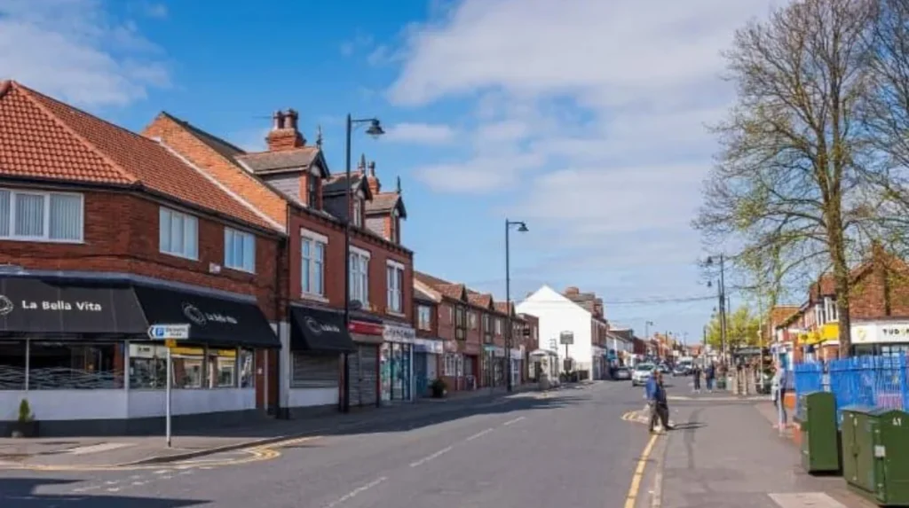
The most practical starting point is the central Main Street area because it provides access to several heritage points. Main Street developed as an important commercial and residential street during Garforth’s industrial expansion.
Walk slowly through the central section rather than treating the street as a transport corridor. Historic buildings, rooflines, masonry, terraces and community buildings provide evidence of different development phases.
The Garforth Neighbourhood Plan identifies several buildings and structures with historic or community value. These include the Miners’ Welfare Hall on Main Street and Garforth Country Club on Aberford Road.
From Main Street, Church Lane provides the logical connection towards St Mary’s Church. The church is one of the clearest architectural landmarks on the route. Its position also connects religious history with the older settlement pattern.
From Church Lane, continue towards Garforth railway station. The station area contains important railway infrastructure dating from the nineteenth and early twentieth centuries. The Grade II listed footbridge is particularly significant because it represents the standard engineering design of the North Eastern Railway.
The route can then continue towards Aberford Road. This creates a useful connection between railway heritage, Victorian settlement and the former industrial landscape.
Visitors who want a longer walk can incorporate sections of the Leeds Country Way. Leeds City Council describes a 5½-mile section between Barwick-in-Elmet and Garforth and a further 5½-mile section from Garforth towards the River Aire.
A heritage walk does not require entering every building. Many important assets are best viewed externally. Always respect private property, churchyard regulations, railway safety restrictions and public rights of way.
What can you see along Garforth Main Street?
Main Street records Garforth’s transition from village settlement to industrial and commercial community. Its historic interest includes Victorian housing, former shops, community buildings and the 1924 Miners’ Welfare Hall, which connects the street directly with Garforth’s coal-mining past.
Main Street is one of the most useful places to understand Garforth’s nineteenth- and early twentieth-century development. Its buildings reflect the expansion that accompanied mining, transport and population growth.
Historic settlement research identifies terraces along Main Street and Aberford Road as important components of Garforth’s industrial-period development. Later development created more organised residential blocks around the southern and western sides of Main Street.
Look closely at building proportions and street alignment. Historic terraces often have repeated elevations because they were constructed as groups rather than individual modern houses. Door positions, window arrangements, roof forms and brickwork provide clues about the period and purpose of construction.
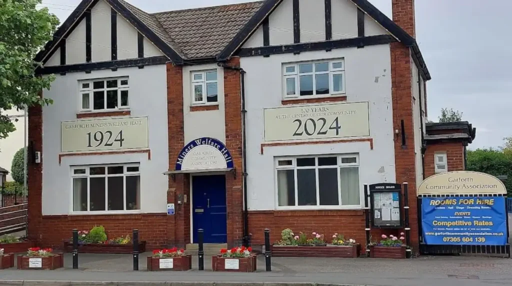
The Miners’ Welfare Hall at 56 Main Street is especially important. It opened in 1924 and was established by the Garforth Miners’ Welfare Institute. The Gascoigne family donated the land, while funding came through the Central Miners’ Welfare Committee and miners’ subscriptions.
The hall served multiple community functions. Historical records describe performances, concerts, dances, boxing, billiards, education, meetings and library use. It therefore represents the social infrastructure that developed around mining communities rather than mining production alone.
The building remains a community facility. The Garforth Community Association currently operates from the hall, demonstrating the continued community function of a building established more than a century ago.
This is an important principle when exploring heritage. A historic building does not need to be preserved as a museum to remain historically relevant. Continued community use provides evidence of how a building adapts while retaining its connection with local identity.
Why is St Mary’s Church one of Garforth’s key landmarks?
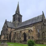
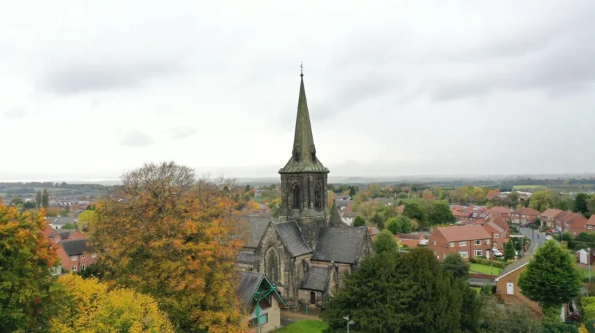
St Mary’s Church on Church Lane is a Grade II listed Anglican church built in 1844 to designs by George Fowler Jones. Its Early English Gothic Revival architecture, magnesian limestone construction, crossing tower and spire make it Garforth’s principal architectural heritage landmark.
St Mary’s Church is officially listed as the Church of St Mary the Blessed Virgin. Historic England records its Grade II designation under List Entry Number 1237398. The church was first listed on 15 September 1987.
The building dates from 1844 and was designed by architect George Fowler Jones. Its construction used dressed magnesian limestone with a slate roof. The plan includes a nave, aisles, transepts, chancel and crossing tower with a broach spire.
The architectural style is Early English. Features include tall lancet windows, buttresses, a corbel table and moulded door surrounds. These details make the church useful for visitors interested in Victorian ecclesiastical architecture.
The church also represents an earlier layer of Garforth’s history. Local heritage research records a church at Garforth in the Domesday Book of 1086 and identifies the nineteenth-century building as a replacement for an earlier church on the site.
The churchyard also contains evidence connected with Garforth’s mining period. The gravestone of John Backhouse is identified in the Garforth Neighbourhood Plan as a heritage asset. Backhouse was a 15-year-old mine worker employed as a “hanger on” and was killed in a colliery explosion in 1856.
This makes St Mary’s Church more than an architectural stop. The building and churchyard connect religious history, local burial practices and industrial history in one location.
Visitors should check access arrangements before planning an interior visit. Churches are working places of worship and access can change because of services, private events or maintenance.
What railway heritage can you see at Garforth station?
Garforth railway station opened in 1834 on the Leeds and Selby Railway and transformed the settlement’s connections with neighbouring towns. Historic railway structures include listed bridges and a Grade II footbridge added around 1900.
Garforth railway heritage is one of the strongest parts of a self-guided walk because the infrastructure remains integrated into the modern transport network.
The station opened in 1834. Historic England records that the Leeds and Selby Railway established the station before it was leased by the York and North Midland Railway in 1840 and purchased outright in 1844. The North Eastern Railway absorbed it in 1854.
The railway changed Garforth’s development pattern. Archaeological research into Leeds settlement history identifies the station as one of the major influences on nineteenth-century settlement growth. The railway improved access to Leeds, Selby and York and contributed to the development of villas and higher-status terraces.
The station’s Grade II listed footbridge is an important surviving structure. Historic England dates it to around 1900 and identifies it as a standard North Eastern Railway design. Its elliptical arch, roundels and decorative railings demonstrate the engineering and architectural treatment applied to railway infrastructure.
The railway environment also includes historic road bridges. Garforth’s Neighbourhood Plan identifies a 1834 railway bridge near the road between Garforth and Aberford and another 1834 bridge over the road towards Barwick.
One important change occurred recently. The historic station footbridge was removed as part of railway infrastructure works and relocated to a heritage railway site outside Garforth, according to the Garforth Neighbourhood Plan’s heritage documentation. Visitors should therefore distinguish between surviving listed railway structures and historic structures that have been relocated.
The station remains a useful heritage location because the railway continues to operate. This creates a direct connection between Garforth’s nineteenth-century transport revolution and its present-day role as a connected Leeds settlement.
How does coal mining appear in Garforth’s heritage today?
Coal mining shaped Garforth’s employment, housing, institutions and community identity during the industrial period. Surviving evidence includes the Miners’ Welfare Hall, workers’ housing patterns, mining-related graves and historic references to collieries such as Isabella and The Sisters.
Coal mining forms a central part of Garforth’s nineteenth- and twentieth-century heritage. The local mining industry influenced where people lived, how community facilities developed and how the town connected with surrounding settlements.
The Gascoigne family played an important role as local mine owners. Their influence appears in several heritage assets, including the Miners’ Welfare Hall and Garforth Country Club.
The Welfare Hall was established on land donated by the Gascoigne family. The miners themselves also contributed financially. The building therefore records relationships between mine ownership, organised labour and community welfare.
Garforth Country Club on Aberford Road provides another example. The Garforth Neighbourhood Plan identifies the original part of the building as dating from 1865 and records its connection with the Gascoigne family and local mining community. The building was associated with lectures, entertainment and social activities.
Mining history also appears in personal memorials. John Backhouse’s gravestone at St Mary’s churchyard records the death of a young mine worker in 1856. His occupation as a hanger-on provides a precise example of the specialised work undertaken around a nineteenth-century colliery.
Historic settlement analysis also identifies workers’ housing around the collieries. Moor Garforth developed areas of workers’ housing associated with nearby pits, while terraces expanded along Main Street and Aberford Road.
The mining industry eventually disappeared from Garforth, but its influence remains visible in the built environment and community institutions. A heritage walk therefore provides a way to understand industrialisation through buildings and streets rather than through a surviving mine site.
Which lesser-known heritage features should you look for?
Garforth’s lesser-known heritage includes historic milestones, railway bridges, Victorian houses, former community buildings, boundary markers and archaeological evidence. These features demonstrate that local heritage extends beyond major landmarks and survives through ordinary structures embedded within modern streets.
Milestones are particularly useful for understanding historic movement through Garforth. The local heritage inventory identifies mid-nineteenth-century milestones on Aberford Road, Wakefield Road and Selby Road. These objects formed part of the road network before modern navigation systems.
The railway bridges also deserve attention. Their 1834 dates connect them directly with the opening phase of the Leeds and Selby Railway. Their survival demonstrates how transport infrastructure can become heritage infrastructure when its original engineering remains visible.
Historic houses provide another layer. Garforth’s heritage evidence identifies Victorian houses on Lidgett Lane, including Nos. 78–84, where architectural details such as porch supports contribute to their historic character.
The town’s historic landscape also includes Barrowby Hall, identified as a Grade II listed heritage asset in the local heritage inventory. It represents the wider rural and estate context surrounding Garforth’s urban development.
The boundary stone at Garforth Cliff provides a different type of heritage feature. The Garforth Neighbourhood Plan describes it as a modern boundary marker with strong community value because it identifies the town boundary for travellers approaching from the Selby direction.
These features demonstrate an important heritage principle: historic significance does not always depend on architectural grandeur. Roads, milestones, bridges, graves and boundary markers can document how people travelled, worked, lived and organised communities.
What archaeological history lies beneath and around Garforth?
Archaeological discoveries near Garforth demonstrate occupation and burial activity spanning the late Roman and early Saxon periods. Excavations revealed more than 60 individuals and a lead coffin, while a later discovery produced an eighth-century gilded silver cross.
The archaeological record gives Garforth a much older history than the surviving Victorian streets suggest.
In 2023, Leeds City Council reported the discovery of a previously unknown cemetery near Garforth. The site contained the remains of more than 60 men, women and children associated with the late Roman and early Saxon periods. A lead coffin was also discovered and was thought to contain the remains of a late Roman aristocratic woman.
The cemetery is important because it expands knowledge of the area’s population and burial practices more than a thousand years before the industrial development of modern Garforth.
In 2025, Leeds City Council reported the discovery of a gilded pectoral cross believed to date from the eighth century. The object was made from solid silver covered with a thin layer of gold and was found by a metal detectorist during work connected with the archaeological discoveries.
The cross is evidence of high-status early medieval activity. Its design and materials demonstrate sophisticated metalworking and provide an important connection between Garforth’s landscape and early medieval society.
These discoveries are not necessarily points that visitors can enter or excavate. Archaeological sites require professional investigation and legal protection. Their importance lies in the evidence they provide about earlier populations and settlement.
For visitors, the archaeological story adds chronological depth to a heritage walk. The same broad landscape that now contains homes, roads and railway infrastructure also preserves evidence of communities living in Garforth during Roman and early medieval periods.
How can you extend a Garforth heritage walk into the countryside?
Garforth’s heritage walk can extend into the surrounding countryside through public rights of way and the Leeds Country Way. The official route connects Garforth with Barwick-in-Elmet, Scholes and the River Aire while revealing historic tracks, fields and landscape features.
The countryside around Garforth forms part of the wider historic landscape. Public paths provide opportunities to examine how the settlement relates to farms, lanes, railway infrastructure and open land.
The Leeds Country Way is particularly useful for visitors who want to combine heritage with walking. Leeds City Council identifies a 5½-mile section from Barwick-in-Elmet to Garforth. The route enters Garforth along Main Street and then continues through Church Lane towards the cricket ground before reaching paths associated with the old railway line.
A second 5½-mile section runs from Garforth towards the River Aire. The official route follows the old railway line, now known as the Linesway, before continuing towards Brecks Lane and surrounding countryside.
The old railway alignment is particularly valuable because it demonstrates how infrastructure can change function. A former railway corridor can become a walking route while retaining evidence of its industrial past.
Country walking requires different preparation from an urban heritage walk. Footwear should suit uneven surfaces and changing weather. Visitors should follow signed public rights of way and avoid entering private land.
The countryside extension also changes the focus of the visit. Main Street and Church Lane concentrate architectural heritage, while the surrounding paths reveal settlement morphology, transport routes, agricultural land and the relationship between Garforth and neighbouring communities.
Explore More Area Guide
Garforth Historic Places and Heritage Guide 2026
Horsforth Scenic Views, Landscapes and Outdoor Areas Leeds 2026
What should visitors know before planning a Garforth heritage walk?
Plan the walk around daylight, public access and railway safety. Check current access arrangements before visiting churches or community buildings, stay on public rights of way, respect residential areas and never enter railway infrastructure or archaeological sites without authorised access.
Garforth is an active residential and transport environment rather than an open-air museum. Historic streets are shared with residents, businesses, cyclists and vehicles. Visitors should therefore keep photographs and architectural observation compatible with normal street use.
Railway safety is particularly important. The railway line remains operational, so visitors must use designated crossings, footbridges and public routes. Railway tracks, embankments and restricted infrastructure should never be treated as walking routes.
Churches and community buildings can have changing opening arrangements. An external viewing is often possible even when an interior visit is unavailable. Visitors should check the relevant organisation before travelling specifically to see an interior.
Heritage protection also affects listed buildings. Leeds City Council states that listed buildings are protected through the planning system and that certain alterations require Listed Building Consent. The protection generally covers the building internally and externally and can include structures within its curtilage.
The wider Leeds district contains 80 conservation areas, although Garforth is not included among the conservation areas listed by Leeds City Council on its current conservation-area page. This distinction is important because heritage interest does not automatically mean an area has conservation-area designation.
Leeds also maintains a broader protected-heritage framework covering listed buildings, conservation areas, scheduled monuments, archaeological sites, registered parks and gardens and registered battlefields. The council states that the Leeds district contains 59 scheduled monuments and 166 Areas of Special Archaeological Value.
For a practical visit, allow enough time to stop rather than simply walk between destinations. Garforth’s heritage is distributed across ordinary streets and infrastructure, so careful observation is more useful than rushing between major landmarks.
Why is Garforth heritage still relevant today?
Garforth’s heritage remains relevant because historic buildings, transport infrastructure, community institutions and archaeological evidence explain how the settlement became part of modern Leeds. Its surviving assets also support local identity, education, walking, photography and responsible heritage tourism.
Heritage provides a framework for understanding Garforth’s present form. The railway explains its connectivity. Mining explains aspects of its industrial-era housing and institutions. St Mary’s Church explains an important part of its religious and architectural history. Archaeology establishes an even earlier chronology.
The Miners’ Welfare Hall provides a particularly clear example of continuity. Built in 1924 for a mining community, it remains a community facility more than a century later.
The railway provides another example. Garforth station began operating in 1834 and remains part of the modern transport network. The infrastructure has changed, but the fundamental role of railway connectivity continues.
The archaeological discoveries also demonstrate why heritage research remains active. The late Roman and early Saxon cemetery and eighth-century cross have added significant evidence to understanding the region’s earlier population and cultural connections.
For tourists, a Garforth heritage walk offers a focused alternative to Leeds city-centre sightseeing. For residents, it provides a structured way to investigate familiar streets. For business travellers and digital nomads, the route offers a practical cultural activity during free time without requiring a full-day excursion.
The strongest approach is to treat Garforth as a layered historic landscape. Main Street, Church Lane, St Mary’s Church, the station, Aberford Road and surrounding paths each reveal a different stage of development.
A self-guided Garforth heritage walk therefore works as both a walking activity and a historical study. It connects medieval records, Victorian architecture, railway engineering, coal-mining communities, twentieth-century social institutions and modern archaeological research within one accessible Leeds settlement.
Garforth’s heritage is not concentrated in one monument. It survives across streets, buildings, bridges, graves, milestones, landscapes and archaeological evidence. That distributed character is precisely what makes a carefully planned walking route valuable for understanding the town.
What are the main landmarks on a Garforth heritage walk?
The main landmarks include St Mary’s Church, Garforth railway station, Main Street, the Miners’ Welfare Hall, historic railway bridges, Garforth Country Club and several historic milestones. Together, they show Garforth’s religious, industrial, transport and community heritage.