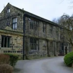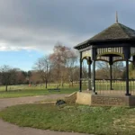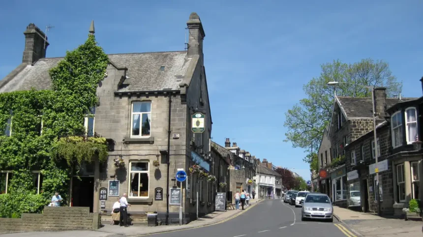
Horsforth is a north-west Leeds suburb with a strong historic street pattern, sandstone buildings, former farmsteads, churches, terraces and surviving spaces linked to its development as an independent settlement. Its historic character is concentrated around Town Street, The Green, Long Row, Back Lane, Church Lane and Hall Lane.
- What makes Horsforth’s streets historically important?
- Which streets form the historic core of Horsforth?
- What historic features can you see along Town Street?
- How does The Green reveal Horsforth’s medieval street pattern?
- Why is Long Row important when exploring historic Horsforth?
- What can you discover around Church Lane and St Margaret’s Church?
- What historic character can you find around Hall Lane?
- Where can you see surviving historic buildings near Horsforth Hall?
- How did sandstone shape Horsforth’s historic streets?
- Which residential streets show Horsforth’s later architectural history?
- How did transport change Horsforth’s historic street pattern?
- What is the best way to explore Horsforth’s historic streets on foot?
- Why does Horsforth’s historic street character still matter today?
The area sits on the side of the Aire Valley. Its changing elevation, sandstone geology and historic road network shaped the appearance of the settlement. Leeds City Council identifies Horsforth as a conservation area because its historic development, architecture, landscape and street pattern create a distinctive character.
For visitors, Horsforth works particularly well as a walking destination. The historic core is compact enough to explore on foot, while residential streets extend towards Horsforth Hall Park, St Margaret’s Church and the former railway-related areas. The streets also show how a rural settlement became a substantial Leeds suburb.
The strongest heritage experience comes from observing the relationship between buildings and streets rather than viewing individual landmarks in isolation. Stone walls, traditional terraces, historic routes, church architecture, former agricultural buildings and open spaces all contribute to Horsforth’s identity.
What makes Horsforth’s streets historically important?
Horsforth’s historic streets preserve evidence of a settlement that developed from an early rural community into a modern Leeds suburb. Town Street, The Green, Back Lane and Long Row retain the strongest concentration of historic buildings, routes and spaces today.
Horsforth has a long settlement history extending into the Anglo-Saxon period. Leeds City Council’s conservation appraisal states that medieval development remains particularly visible in the street pattern around The Green and the southern part of Town Street.
The settlement later developed through agriculture, quarrying, local commerce and transport. Sandstone was particularly important because the underlying geology supplied both construction material and a basis for quarrying activity. The conservation appraisal identifies Horsforth as being mainly situated on sandstone, with millstone grit and lower coal measures around it.
This geological setting is still visible in the built environment. Traditional local buildings frequently use sandstone walls and stone boundary walls. These materials give many streets a consistent visual character.
Horsforth also remained physically distinct from the industrial development that transformed parts of Leeds. Its position on the valley side limited the intrusion of heavy industry into the historic core. This helped preserve the village-like appearance identified by Leeds City Council.
The historic streets therefore represent several stages of development. Medieval routes survive within the core. Eighteenth- and nineteenth-century buildings show agricultural and commercial expansion. Victorian churches demonstrate population growth. Later terraces and suburban houses record Horsforth’s transformation into a residential district.
Which streets form the historic core of Horsforth?
The principal historic street sequence runs through Back Lane, The Green, Town Street and Long Row. Together, these streets form a linear historic core containing traditional buildings, commercial premises, terraces, walls, junctions and spaces that explain Horsforth’s development.
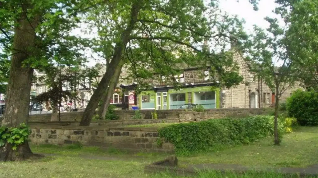
The Green is one of the most important spaces to understand when exploring historic Horsforth. It forms part of the older southern settlement and connects with the wider street network.
Town Street is the principal historic commercial route. It remains the centre of everyday activity, but its historic importance is deeper than its present shops and services. The conservation area appraisal describes Town Street as the core of Horsforth and identifies the street as an important part of the area’s historic character.
Long Row continues the historic street sequence northwards. Its traditional buildings and linear form demonstrate how Horsforth developed along a principal route.
Back Lane forms another important component of the historic street pattern. Together with The Green, Town Street and Long Row, it creates what Leeds City Council describes as an almost continuous chain of streets.
These streets are best understood as a connected heritage landscape. Looking at one building without considering its position on the street loses important information about Horsforth’s development.
The street pattern also demonstrates how settlement growth occurred incrementally. Buildings were added along established routes rather than being constructed entirely according to a single modern plan.
For visitors, this makes a walking route particularly effective. Moving gradually from The Green towards Town Street and Long Row reveals changes in building scale, frontage, materials and land use.
What historic features can you see along Town Street?
Town Street combines Horsforth’s historic commercial role with surviving traditional buildings, sandstone construction, older plot patterns and connections to surrounding heritage streets. Its position within the conservation area makes it the most important starting point for understanding the settlement’s historic character.
Town Street has experienced substantial change, particularly during the twentieth century. Leeds City Council records concerns about character degradation during the mid twentieth century, while also identifying historic buildings that remain in good repair.
Despite redevelopment, the street retains important heritage qualities. Traditional materials remain significant. Sandstone, stone boundary walls and older building proportions help establish continuity between historic and modern Horsforth.
The commercial function of Town Street is also historically relevant. Historic settlements commonly concentrated shops, services and public activity along established routes. Horsforth’s present-day commercial centre continues that pattern.
Street-level details are particularly useful for visitors. Look at stonework, window proportions, rooflines, shopfront proportions, boundary walls and the relationship between buildings and pavements. These details reveal different periods of construction.
The street also connects directly with the wider conservation area. This means a walk along Town Street naturally leads towards other historically important streets rather than ending at a single landmark.
Leeds City Council identifies improvements to shopfronts, street furniture, public spaces and paving as important elements in protecting the area’s historic appearance.
This makes Town Street useful for understanding conservation in practice. Historic character does not depend entirely on preserving every building unchanged. It also depends on maintaining materials, scale, street relationships and public-realm features.
How does The Green reveal Horsforth’s medieval street pattern?
The Green is significant because it sits within the older southern part of Horsforth and connects with a street pattern that retains medieval characteristics. Its relationship with Back Lane and Town Street helps visitors understand how the historic settlement developed before modern suburban expansion.
The medieval period is particularly important to Horsforth because surviving street arrangements provide physical evidence of settlement development.
The Green is not simply an attractive open space. Its importance comes from its position within the historic structure of Horsforth. The conservation appraisal identifies the area around The Green and southern Town Street as one of the clearest places where the medieval character of the street pattern remains visible.
The surrounding streets demonstrate a different form of urban development from twentieth-century estates. Older routes follow the established shape of the settlement and landscape.
The Green also provides a useful reference point when interpreting the changing density of Horsforth. Historic buildings cluster around the southern part of the conservation area before the settlement extends northwards.
Visitors should pay attention to how buildings face the space and how roads connect around it. The arrangement provides more historical information than any single façade.
The presence of traditional stone buildings reinforces the connection between local geology and architecture. Horsforth’s sandstone resources influenced the construction of buildings and walls across the settlement.
The Green therefore belongs at the beginning of a heritage walk. It provides context for the streets that follow.
For anyone researching local history, the area also demonstrates why conservation areas protect character rather than simply individual structures. The value lies in the combined relationship between buildings, routes, open spaces and landscape.
Why is Long Row important when exploring historic Horsforth?
Long Row forms part of Horsforth’s historic north-south street sequence and demonstrates the linear development of the settlement. Its traditional buildings, terraces and relationship with Town Street help show how Horsforth expanded along established routes before becoming part of metropolitan Leeds.
Long Row is particularly useful for understanding Horsforth as a linear settlement. Leeds City Council identifies it as part of the continuous historic chain running from Back Lane and The Green through Town Street.
The street contains traditional residential forms that contrast with later suburban development. Terraced buildings are especially valuable because they demonstrate how housing density increased as population and economic activity expanded.
The relationship between houses and the road is also significant. Older properties generally have a stronger connection with the street than many later detached suburban houses.
Walking Long Row allows visitors to identify changes in frontage, building materials and architectural details. These changes record different construction periods.
The street is also useful for understanding the transition from village to suburb. Horsforth remained an independent urban district until its formal amalgamation with Leeds in 1974.
This political change did not erase the older street structure. The historic routes continued to form the framework of everyday movement and development.
Long Row therefore provides an important link between Horsforth’s earlier settlement history and its modern role within Leeds.
What can you discover around Church Lane and St Margaret’s Church?
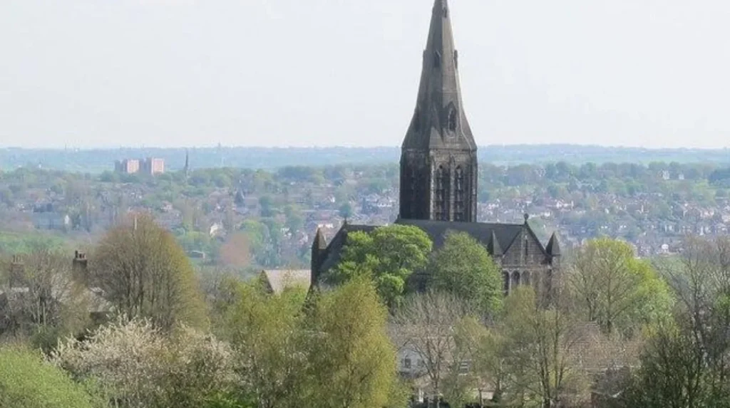
Church Lane leads to St Margaret’s Church, a Grade II listed Victorian church built between 1877 and 1883. Its prominent position, Gothic architecture and later spire reflect Horsforth’s nineteenth-century population growth and remain important features of the local historic landscape.
St Margaret’s Church is one of Horsforth’s most prominent heritage landmarks. Historic England records that the church was designed in 1874–76 and constructed between 1877 and 1883. It replaced an eighteenth-century chapel known as the Bell Chapel.
The church was designed in the Early English Gothic tradition. Its elevated position on the lower slopes of Hunger Hills made it a strong visual landmark.
The spire was added in 1902, further increasing the building’s prominence. Leeds City Council describes St Margaret’s as a key landmark in Horsforth and identifies its tall spire as a defining feature.
Church Lane is therefore important beyond the church itself. The road provides access to a heritage setting that includes the church, churchyard and associated buildings.
The surrounding landscape also demonstrates the relationship between topography and architecture. The church occupies elevated ground, giving it a visual presence across parts of Horsforth.
The site reflects the expansion of the local population during the nineteenth century. The earlier chapel had become inadequate for the growing congregation, leading to the construction of the larger Victorian church.
Visitors should distinguish between the listed church and later community buildings nearby. Leeds’ Neighbourhood Plan identifies the St Margaret’s Parish Centre as a non-designated heritage asset because its stone construction and design complement the listed church and Old Vicarage.
As you explore the modern site, you are crossing land with a deep heritage. Read about the full to understand its origins.
What historic character can you find around Hall Lane?
Hall Lane connects Horsforth’s historic core with Horsforth Hall Park and a residential landscape containing historic buildings, stone walls and traditional architecture. The route also provides access to views across the Aire Valley and illustrates the area’s relationship between heritage and landscape.
Hall Lane occupies an important position in western Horsforth. Leeds City Council describes it as a predominantly residential area that partially encircles Horsforth Hall Park and extends between the A65 and Town Street.
Its heritage character comes from a combination of buildings, landscape and views.
The street has strong connections with Horsforth Hall Park. Mature trees and stone boundary walls contribute to the area’s appearance, while the elevated setting creates views across the Aire Valley.
The surrounding streets include West End Rise, West End Lane and Hunger Hills Avenue. Leeds City Council identifies these roads as routes that radiate uphill from Hall Lane towards residential areas.
West End Lane is particularly notable for traditional local materials. Springfield Farm, a listed building, forms part of a group of buildings expressing Horsforth’s vernacular architectural character.
The street also contains examples of twentieth-century architectural styles. Leeds City Council identifies Arts and Crafts cottages, Tudor-style houses, interwar properties and later detached housing within the area.
This makes Hall Lane useful for visitors interested in architectural evolution. The area demonstrates that historic character does not stop at medieval or Victorian buildings. Later structures also contribute to the visual history of Horsforth.
Where can you see surviving historic buildings near Horsforth Hall?
The former Horsforth Hall area around Hall Lane contains surviving heritage structures, including the Grade II listed stable block. The stable block incorporates a 1707 datestone and retains sandstone construction, providing direct evidence of Horsforth’s earlier estate and agricultural history.
The stable block to the former Horsforth Hall is one of the clearest surviving historic structures associated with the estate.
Historic England lists the building at Grade II. It dates principally from the later eighteenth century but incorporates a datestone marked 1707. The building is constructed from coursed squared sandstone and has a stone slate roof.
The building demonstrates how sandstone functioned as a practical construction material in Horsforth. It also provides evidence of the estate-based landscape that existed before the area became a large suburban district.
Its original agricultural and estate function differs from the commercial role of Town Street. Together, the two locations demonstrate the range of activities that shaped Horsforth.
The building is now used for office and storage purposes, showing how historic structures can acquire new functions while retaining architectural significance.
The surviving datestone is particularly valuable because it provides a specific date connected to the structure. Features such as this allow visitors to connect physical buildings with documented history.
Hall Lane therefore complements the central heritage walk. Town Street explains commercial development, while the Hall Lane area reveals the estate, agricultural and landscape dimensions of Horsforth.
How did sandstone shape Horsforth’s historic streets?
Sandstone influenced Horsforth’s historic appearance by supplying a local construction material used in buildings, walls and other structures. The geology beneath the settlement supported quarrying and helped establish the distinctive stone-based architectural character visible across its conservation area.
Horsforth’s geology is central to its architectural identity.
Leeds City Council records that the conservation area is mainly located on sandstone, with millstone grit and lower coal measures around it. The sandstone supported quarrying and supplied building material for the settlement.
This created a direct connection between landscape and architecture.
Traditional sandstone buildings are found across the historic core. Stone boundary walls also contribute to the appearance of streets such as Hall Lane and West End Lane.
The material provides continuity between different periods. Older buildings use sandstone extensively, while some later developments incorporate stone elements to respond to the established local character.
Visitors can use material as a simple way to identify historic areas. Look for coursed stone walls, stone window surrounds, stone door surrounds, slate roofs and traditional masonry details.
The use of local material also explains why Horsforth differs visually from parts of Leeds dominated by red brick. Building traditions developed in response to locally available resources.
The connection remains important for conservation. Leeds City Council specifically identifies the use of local building materials as an opportunity to strengthen Horsforth’s historic character.
Which residential streets show Horsforth’s later architectural history?
Horsforth’s residential heritage extends beyond its oldest streets. Hall Lane, West End Lane, West End Rise and surrounding roads contain Victorian, interwar and twentieth-century houses that demonstrate how the settlement expanded from its historic core into a substantial suburban neighbourhood.
The residential streets around Hall Lane provide an important second layer of Horsforth’s heritage.
Leeds City Council records several architectural phases in this area. These include 1930s and 1940s Arts and Crafts cottages, Tudor-style detached houses, interwar properties, 1940s and 1950s semi-detached houses, and later 1970s and 1980s detached properties.
This chronological variety is valuable because it shows how suburbanisation changed Horsforth.
Earlier development remained concentrated around established routes. Later housing spread across surrounding land and introduced larger plots, detached houses, wider roads and new architectural forms.
Fraser Avenue contains an identified group of interwar detached houses with distinctive recessed entrances. These properties illustrate how architectural design changed during the interwar period.
The historic value of these areas therefore comes from groups of buildings and their relationship with streets, vegetation and boundaries.
Visitors interested in architecture should look beyond the commercial centre. The residential areas provide a more detailed picture of Horsforth’s twentieth-century transformation.
This also demonstrates why heritage exploration does not require a concentration of listed buildings. A neighbourhood can retain character through its layout, materials, landscaping and consistent architectural forms.
How did transport change Horsforth’s historic street pattern?
Transport influenced Horsforth’s growth by strengthening connections between the settlement and surrounding areas. Road improvements, railway development and later suburban expansion extended the settlement beyond its historic core while leaving the older Town Street and southern street sequence as important structural elements.
Horsforth developed partly in response to transport improvements. Leeds City Council describes the settlement as evolving as transport innovations required, while its historic core remained comparatively protected from heavy industry.
The railway helped connect Horsforth with the wider regional network. The conservation appraisal also identifies the long chain of historic structures extending towards the railway station and nineteenth-century industrial development around Troy Road.
Road development later accelerated suburban growth.
The 1938 Ordnance Survey map records significant development away from the historic core associated with Broadway, now part of the outer ring road. Housing continued to infill and expand around Horsforth during the twentieth century.
Population growth provides measurable evidence of this transformation. Horsforth parish had a population of 12,080 in 1939. By 2005, the population had increased to approximately 22,100, according to Leeds City Council’s conservation appraisal.
The result is a layered street network. Older roads retain their historic form while later roads reflect suburban planning and transport requirements.
This distinction helps visitors understand why some Horsforth streets feel considerably older than others despite being geographically close.
Explore More Area Guide
Horsforth Heritage Sites and Stories to Explore Leeds 2026
Garforth Scenic Areas, Views and Landscapes Guide 2026
What is the best way to explore Horsforth’s historic streets on foot?
A practical heritage walk starts around The Green, continues through Back Lane and Town Street, follows Long Row, then branches towards Church Lane, Hall Lane and Horsforth Hall Park. This route connects the settlement’s medieval, Victorian, estate and suburban heritage.
Begin around The Green to understand the older settlement structure. From there, move towards Back Lane and Town Street.
Town Street provides the strongest combination of historic buildings and present-day activity. Take time to examine façades, masonry, rooflines and plot arrangements.
Continue towards Long Row to experience the linear form of the historic settlement.
A separate walk towards Church Lane introduces St Margaret’s Church. The church is a Grade II listed building and represents the substantial Victorian expansion of Horsforth.
The Hall Lane route then introduces a different landscape. It connects residential streets with Horsforth Hall Park and provides views towards the Aire Valley.
Visitors should remain on public roads and paths when examining historic properties. Listed buildings and heritage sites often include private land.
Horsforth Hall Park is also officially recognised as a community park within Leeds City Council’s parks framework. The Green is separately identified as local green space.
A walking approach also reduces the need to move between individual attractions by car. It allows visitors to understand how streets, buildings and landscape interact.
The route works for tourists, local residents and business travellers with limited free time because the main historic areas sit within a connected neighbourhood.
Why does Horsforth’s historic street character still matter today?
Horsforth’s historic streets remain important because they preserve the physical structure of an independent settlement within modern Leeds. Their buildings, materials, landscape and street patterns provide evidence of centuries of development and support conservation, tourism, local identity and informed future planning.
Horsforth was formally amalgamated with the City of Leeds in 1974, but its historic identity remains visible through the built environment. Leeds City Council’s conservation appraisal specifically describes the area as retaining a sense of independence from surrounding urban development.
The conservation area designation provides formal recognition of this character. Leeds currently lists both Horsforth and Horsforth Cragg Hill among its designated conservation areas.
Heritage protection also affects future development. New buildings, alterations, shopfronts, boundary treatments and public-realm improvements all influence how historic streets appear.
The value extends beyond listed buildings. A historic street pattern can preserve information about settlement growth even where individual structures have been altered.
Horsforth demonstrates this clearly. Medieval street arrangements, Victorian religious architecture, estate buildings, nineteenth-century terraces and twentieth-century suburban houses occupy the same wider neighbourhood.
This layered environment makes Horsforth particularly useful for architectural and urban-history exploration.
For visitors, the most important lesson is to treat the streets themselves as heritage assets. The road alignment, building frontage, stonework, open spaces and relationship with the landscape all contribute to the historical character.
For residents, these features provide a direct connection with local history. For planners, they establish the context within which future change takes place.
Horsforth’s historic streets therefore remain relevant because they connect past development with the present-day structure of Leeds.
Which streets in Horsforth have the most historic character?
The streets with the strongest historic character include Town Street, The Green, Back Lane, Long Row, Church Lane and Hall Lane. These areas retain traditional buildings, sandstone walls, historic routes and architectural features connected with Horsforth’s development.