Garforth is an established settlement in east Leeds with a mix of green space, walking routes, heritage sites, community facilities and countryside connections. It sits close to the Leeds urban area while retaining direct access to former railway paths, woodland, villages and rural landscapes.
- What makes Garforth a useful place for a change of scenery?
- Where can visitors walk for a change of scenery in Garforth?
- Which green spaces are worth visiting around Garforth?
- What is special about the Linesway for visitors?
- Can visitors explore Garforth’s historic character while changing scenery?
- Where can visitors go near Garforth for a larger countryside experience?
- What nearby water and landscape areas can visitors explore?
- What can digital nomads and business travellers do during downtime in Garforth?
- How can visitors create a half-day change-of-scenery itinerary in Garforth?
- Is Garforth suitable for a longer day trip beyond the immediate area?
- Which Garforth places are most useful for different types of visitors?
- Why does Garforth remain useful for local visitors seeking a change of scenery?
The area works well for a short change of scenery because visitors do not need a long journey to experience a different setting. Garforth provides access to the Linesway, the Leeds Country Way, local parks, woodland and nearby attractions such as Lotherton.
Garforth also has useful transport connections. Garforth railway station and East Garforth railway station connect the area with the wider West Yorkshire network. Local roads provide access towards Aberford, Kippax, Swillington, Leeds and the A1(M) and M1 corridors.
The most useful places to visit depend on the type of scenery required. Walkers can use former railway routes and countryside paths. Families can use parks and leisure facilities. Visitors interested in heritage can explore historic buildings and settlements. Travellers wanting a longer day out can continue towards Lotherton and the surrounding countryside.
What makes Garforth a useful place for a change of scenery?
Garforth combines an established Leeds suburb with accessible countryside, former railway paths, woodland, parks and nearby heritage attractions. Its location allows visitors to move from residential streets into open landscapes without travelling far, making it suitable for short walks and relaxed local excursions.
Garforth’s geographical position explains much of this variety. The settlement lies east of Leeds city centre and is surrounded by a mixture of residential development, agricultural land and transport infrastructure.
The local landscape also reflects the area’s development. Garforth’s history includes farming, religious buildings, transport infrastructure and later industrial activity. These layers remain visible in the settlement and its surrounding landscape.
Leeds City Council’s Garforth Neighbourhood Plan records evidence of early settlement and describes the area’s connection with the agricultural landscape of the Magnesian Limestone region. The Domesday Survey of 1086 provides the first detailed written description of Garforth.
This background helps explain why Garforth offers more than conventional urban sightseeing. A visitor can combine a village-style local centre with paths, green spaces and rural surroundings.
For a deeper understanding of the area’s development, read the full to understand how Garforth’s past shaped its present-day landscape.
Where can visitors walk for a change of scenery in Garforth?
The Linesway and Leeds Country Way provide the clearest walking options around Garforth. They connect the settlement with former railway land, countryside and surrounding communities, giving visitors practical routes for short walks, longer outings and gradual changes in landscape.
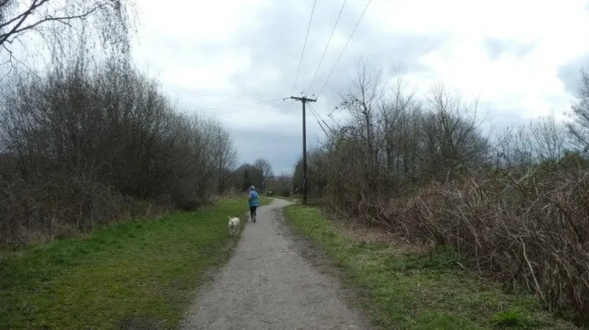
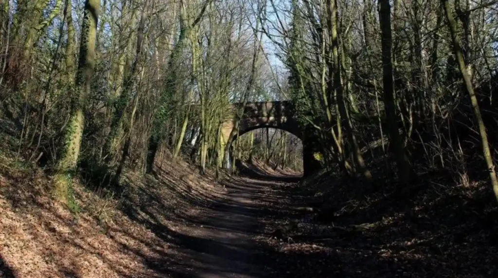
The Linesway is one of the most distinctive walking routes associated with Garforth. Leeds City Council describes it as a three-mile disused railway route between Garforth and Allerton Bywater.
A former railway corridor has a different character from ordinary pavements. The route follows a linear alignment through the landscape and provides an identifiable route away from busy residential streets.
The Linesway also forms part of longer walking connections. Leeds City Council’s route information describes a section from Garforth towards the River Aire, passing along the old railway line before continuing towards Brecks Lane and Mount Pleasant Picnic Site.
The Leeds Country Way provides another option. It is a 62-mile circular walking route around Leeds, with the Garforth section connecting the settlement with the surrounding countryside.
Visitors do not need to complete the entire route. The local sections can form part of shorter walking plans.
The combination of these routes creates several types of scenery. The former railway path provides a linear walking environment. The countryside sections provide wider views. Woodland and hedgerows introduce more enclosed landscapes.
For visitors staying in Garforth, these routes also provide a way to experience the surrounding area without relying entirely on a car.
Which green spaces are worth visiting around Garforth?
Garforth and its surrounding area contain community parks, local green spaces, woodland and recreation grounds. BarleyHill Park, Hollinhurst Wood, The Chase, East Garforth Recreation Ground and nearby green spaces provide different settings for walking, exercise and short outdoor visits.
Leeds City Council’s parks and countryside records identify several green spaces in the Garforth and Swillington area. These include BarleyHill Park, Hollinhurst Wood, The Chase, East Garforth Recreation Ground, Glebelands Recreation Ground, Longmeadows and White House Lane.
These sites serve different purposes. A community park suits a short local visit. Recreation grounds provide open areas for everyday activity. Woodland offers a more enclosed environment. Local green spaces provide smaller breaks from built-up streets.
Hollinhurst Wood is particularly relevant for visitors looking for woodland scenery. Its designation as a woodland area places it within Leeds City Council’s recorded local green-space framework.
BarleyHill Park is recorded as a community park. It therefore provides a more conventional local outdoor setting than the former railway environment of the Linesway.
Visitors should check current local information before travelling because paths, facilities and access conditions can change.
The advantage of these spaces is proximity. A change of scenery does not always require a full-day excursion. A short walk through woodland or a local park provides a distinct environment from Garforth’s main residential streets.
What is special about the Linesway for visitors?
The Linesway is a three-mile walking route following a disused railway between Garforth and Allerton Bywater. Its former railway alignment creates a continuous pedestrian route through changing landscapes and provides one of the area’s clearest options for an outdoor change of scenery.
The Linesway represents an important transition between Garforth’s built environment and its wider landscape.
Former railway corridors often retain long, relatively direct alignments. In Garforth, the route forms part of the local public-rights-of-way network and connects with longer routes towards the River Aire.
Leeds City Council specifically identifies the Linesway among the city’s shorter recreational routes.
The route is also significant because railway infrastructure forms part of Garforth’s local heritage. The Garforth Neighbourhood Plan identifies a historic road bridge dating from 1834 over the railway at Garforth station among the area’s heritage assets.
This creates an interesting relationship between past and present. The railway helped shape the area’s development, while a former railway corridor now functions as a recreational route.
For visitors, the route provides a straightforward way to leave the immediate townscape behind. It also links with other countryside paths, allowing longer walks for people who want more than a short local outing.
Comfortable walking footwear is appropriate for longer sections. Visitors should also check weather conditions and current path information before setting out.
Can visitors explore Garforth’s historic character while changing scenery?
Garforth’s historic character can be explored through St Mary’s Church, historic road infrastructure, older settlement patterns and surviving landscape features. These sites provide a different experience from modern residential areas and connect everyday scenery with the area’s documented development.
St Mary’s Church on Church Lane is one of Garforth’s identified heritage assets. Leeds City Council’s Garforth plan records the building as dating from 1844 and identifies its architectural, historic and community value.
The surrounding Church Lane area provides a useful starting point for understanding older Garforth.
Historic road infrastructure also survives. The Garforth Neighbourhood Plan identifies three mid-19th-century mileposts associated with Aberford Road, Wakefield Road and Selby Road. It also records the 1834 road bridge over the railway at Garforth station.
The wider landscape contains further historical evidence. The Garforth plan notes that traces of medieval field systems remain visible as ridge-and-furrow features in grassed areas such as Garforth Golf Course.
These features demonstrate how scenery can be interpreted through land use. Fields, roads, churches and railway infrastructure are not separate from the settlement’s history. They form part of the physical structure that developed over centuries.
Visitors interested in local history can therefore combine walking with heritage observation rather than treating the two activities separately.
Where can visitors go near Garforth for a larger countryside experience?
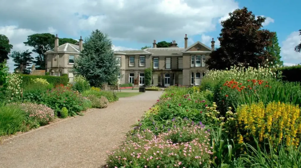
Lotherton provides a larger countryside destination close to Garforth, combining a historic estate, gardens, Wildlife World, café facilities and extensive grounds. Garforth railway station is about four miles away, while road access is available from the M1 and A1.
Lotherton is one of the most substantial nearby destinations for visitors seeking a full change of scenery.
The Leeds Museums and Galleries service describes Lotherton as an estate with a hall, Wildlife World, café and shop. Its grounds operate for extended daily periods, while the hall and Wildlife World have separate opening schedules.
The estate is located at Lotherton Lane, Aberford, Leeds, LS25 3EB. Garforth railway station is approximately four miles away. The attraction also has road access from M1 junction 47 and A1 junction 42.
Lotherton changes the scale of a Garforth visit. Instead of taking a short walk through a local park, visitors can spend substantially longer exploring an estate environment.
The combination of landscaped grounds, heritage buildings and wildlife facilities creates several distinct visitor settings within one destination.
Travel planning remains important. The Leeds Museums and Galleries information states that bus routes 64 and 64A travel to Aberford from Leeds city centre, followed by an approximately 20–30-minute walk along a public highway with limited footpaths.
Visitors travelling from Garforth can therefore consider rail plus taxi, driving or other local transport depending on their itinerary.
What nearby water and landscape areas can visitors explore?
Skelton Lake and the Swillington area provide additional outdoor options near Garforth. These locations extend the choice beyond parks and railway paths, with open landscapes and nature-focused settings that suit visitors looking for a different environment from the built-up settlement.
Leeds City Council’s parks byelaws schedule lists Skelton Lake among the local green-space sites associated with the Garforth and Swillington area. It also identifies Swillington Park Lakes as a Leeds nature area.
These destinations add variety to a Garforth-based itinerary.
A visit to a lake or water-associated landscape changes the visual character of an outing. Open water creates wider sightlines, while surrounding vegetation provides habitat and seasonal landscape changes.
The River Aire is also relevant to longer walking routes from Garforth. Leeds City Council’s Leeds Country Way information describes a Garforth-to-River Aire section that uses the Linesway before continuing through countryside towards Mount Pleasant Picnic Site.
This makes the area useful for visitors who want to extend a short walk into a longer countryside route.
The important distinction is distance. Skelton Lake, Swillington and the River Aire connections form part of the wider landscape around Garforth rather than being central-town attractions.
They work best as part of an outdoor itinerary planned around walking distance, weather and available transport.
What can digital nomads and business travellers do during downtime in Garforth?
Garforth provides practical downtime options through free Wi-Fi at the community hub, a local café, public computers, walking routes and Garforth Leisure Centre. These facilities support short work breaks, exercise sessions and simple activities between appointments or travel commitments.
Garforth is not only a leisure destination. Its community facilities also provide useful services for visitors spending part of a day in the area.
The Garforth community hub includes free Wi-Fi, free computer access with Microsoft Office and internet access, public toilets and a café. Leeds City Council states that the café operates from 10am to 2pm on Wednesday, Thursday and Friday.
This makes the community hub relevant to visitors who need a short work-friendly stop.
The facility also provides accessible entrances, lift access between two levels, disabled parking and a bus stop approximately 150 metres away.
For exercise-based downtime, Garforth Leisure Centre provides a 60-station gym, fitness studio, squash courts, a studio cycling room and a five-court badminton centre. It also provides free Wi-Fi.
These facilities broaden the meaning of a change of scenery. A business traveller does not need a full sightseeing itinerary. A short walk, café visit, leisure-centre session or quiet period at the community hub can provide a structured break from meetings.
Opening times should be checked before visiting because Leeds City Council notes that leisure-centre hours can vary on bank holidays and during festive periods.
How can visitors create a half-day change-of-scenery itinerary in Garforth?
A practical half-day itinerary can combine Garforth’s local heritage with a walking route and green space. Visitors can start around Church Lane, continue towards the Linesway, explore surrounding countryside and finish with refreshments or leisure facilities in the settlement.
A half-day visit works because Garforth contains several different environments within a relatively compact area.
Start with the historic centre around Church Lane and St Mary’s Church. The church is an identified heritage asset dating from 1844.
Continue towards the local walking network. The Linesway provides a three-mile route between Garforth and Allerton Bywater and offers a clear transition from the settlement into a former railway landscape.
Visitors with more time can extend their route using sections connected with the Leeds Country Way. The wider route is 62 miles long, but individual sections can be incorporated into shorter outings.
A local green space can provide the next stop. Leeds City Council lists BarleyHill Park, Hollinhurst Wood, The Chase and East Garforth Recreation Ground among the area’s green and recreational sites.
Finish in Garforth with refreshments or a practical activity. The community hub has a café and free Wi-Fi on specified days, while Garforth Leisure Centre provides several indoor exercise facilities.
This itinerary works without requiring a full day away from Leeds.
Is Garforth suitable for a longer day trip beyond the immediate area?
Garforth works as a base for longer local excursions because railway connections, major roads and countryside routes link it with destinations beyond the settlement. Lotherton, Aberford, Swillington, the River Aire and wider Leeds provide options for extending a short visit.
The area’s transport position supports broader exploration.
Garforth has both Garforth railway station and East Garforth railway station, providing rail connections for visitors travelling through the wider Leeds and West Yorkshire area.
Road access also supports excursions. Lotherton’s official visitor information identifies the M1 junction 47 and A1 junction 42 as road approaches to the estate.
Walking provides another form of connectivity. The Leeds Country Way links Garforth with countryside around Leeds, while the Linesway creates a direct recreational connection towards Allerton Bywater.
This makes Garforth particularly useful for visitors who prefer flexible itineraries. A short visit can remain within the settlement. A longer day can incorporate nearby villages, green spaces, historic locations or a major estate destination.
The surrounding landscape also provides a different experience from central Leeds. Instead of concentrating on museums, shopping streets and dense urban attractions, visitors can use Garforth as an entry point into east Leeds countryside.
Explore More Area Guide
Garforth Guide to Everyday Local Life in Leeds
Best Places to Spend Time Alone in Garforth | Leeds
Which Garforth places are most useful for different types of visitors?
Walkers can focus on the Linesway and Leeds Country Way. Heritage visitors can explore St Mary’s Church and historic infrastructure. Families can use parks and leisure facilities. Longer-stay visitors can add Lotherton, Skelton Lake, Swillington and River Aire routes.
Garforth’s appeal is based on variety rather than one single attraction.
For walkers, the Linesway provides a defined three-mile route, while the Leeds Country Way offers access to a much larger network.
For heritage visitors, St Mary’s Church, the historic road bridge and surviving mileposts provide documented examples of Garforth’s built and transport history.
For nature-focused visitors, Hollinhurst Wood, Skelton Lake, Swillington Park Lakes and other local green spaces provide alternatives to the town centre.
For families and active visitors, Garforth Leisure Centre provides indoor facilities including badminton courts, squash courts, cycling and a gym.
For digital nomads and business travellers, the community hub provides free Wi-Fi, computers and internet access, with a café operating on specified weekdays.
For day visitors, Lotherton provides the largest nearby attraction environment, with an estate, hall, Wildlife World, café and shop.
For local residents, these options also demonstrate that a change of scenery does not require travelling far from Garforth.
Why does Garforth remain useful for local visitors seeking a change of scenery?
Garforth remains useful because it connects everyday urban life with walking routes, woodland, parks, heritage assets, countryside and nearby attractions. Its transport connections also make it practical for short visits, half-day itineraries and longer excursions across east Leeds.
The area’s strength is its combination of accessibility and landscape variety.
Garforth is part of Leeds but retains direct connections to open countryside. The Linesway provides a three-mile former railway route. The Leeds Country Way provides access to a 62-mile circular network. Local green spaces include woodland, parks and recreation grounds.
The settlement also contains documented heritage. St Mary’s Church dates from 1844, while the local heritage record includes a road bridge dating from 1834 and several mid-19th-century mileposts.
Nearby destinations increase the choice further. Lotherton offers a large estate and wildlife attraction, while Skelton Lake and Swillington provide additional outdoor settings.
The result is a destination structure suited to different time budgets.
A visitor with one hour can use a local green space or short walking section. Someone with half a day can combine heritage and walking. A full-day visitor can travel towards Lotherton or extend into the wider east Leeds countryside.
For anyone searching for Garforth places to visit for a change of scenery, the area provides a practical combination of green space, heritage, walking, recreation and nearby countryside without requiring a journey into a distant tourist destination.
What are the best places to visit in Garforth?
Garforth offers several places for a change of scenery, including the Linesway, local parks, Hollinhurst Wood, East Garforth Recreation Ground, St Mary’s Church and nearby countryside. Lotherton is also a major nearby attraction.