Garforth is a historic settlement in east Leeds with a mix of former railway corridors, historic buildings, green spaces, woodland, village streets and accessible community facilities. These different environments provide distinct settings for photography, sketching, writing, visual research and quiet creative work.
- What makes Garforth suitable for creative inspiration?
- Which parts of Garforth are best for historic and architectural inspiration?
- Where can visitors find nature and landscape inspiration in Garforth?
- Why is the Linesway important for creative visitors?
- Which walking routes offer the best creative variety around Garforth?
- Where can photographers find different subjects in Garforth?
- Where can writers, illustrators and digital nomads work quietly in Garforth?
- How can visitors plan a creative day around Garforth?
- What historical details should creative visitors look for in Garforth?
- Why does Garforth remain relevant for creative visitors?
The settlement sits within the Garforth and Swillington area of Leeds. Its landscape reflects agricultural origins, medieval settlement, coal mining, railway development and later suburban growth. The Garforth Neighbourhood Plan identifies both industrial heritage and post-war development as important parts of the area’s character. It also records eight designated heritage assets, all Grade II listed.
For creative visitors, this combination creates a useful range of subjects within a relatively compact area. Historic streets provide architectural detail. Former railway routes provide linear landscapes. Parks and woodland provide natural textures. Libraries and cafés provide indoor spaces for research and focused work.
What makes Garforth suitable for creative inspiration?
Garforth combines historic architecture, former industrial landscapes, railway heritage, woodland, parks, village streets and accessible public spaces, giving creative visitors several distinct environments for observation, photography, sketching, writing and visual research within one Leeds neighbourhood.
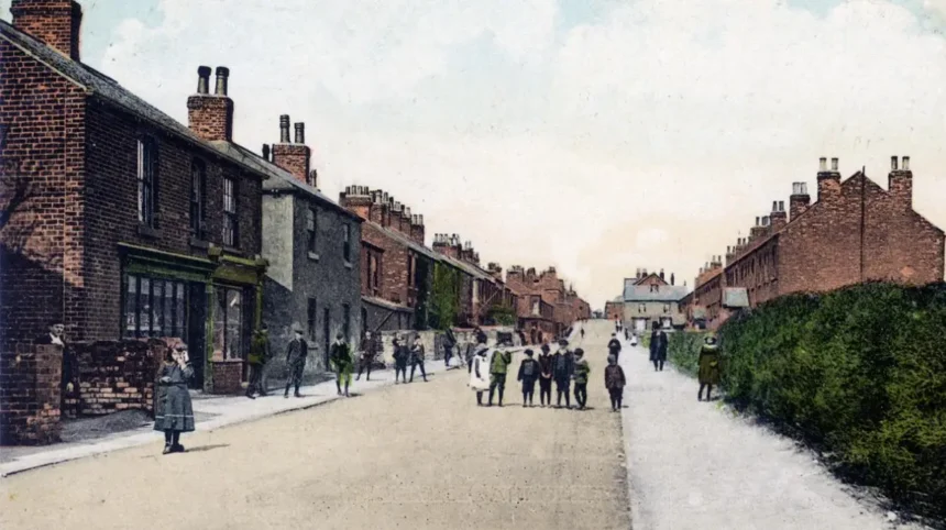
Garforth’s character developed through several phases. The settlement has agricultural roots, later industrial development and substantial twentieth-century expansion. The Garforth Neighbourhood Plan states that the name is probably Anglo-Saxon and records Garforth in the Domesday Survey of 1086.
The Domesday description recorded a church, priest, four villagers and one smallholder. The figures represented heads of households rather than the complete population. The plan also identifies surviving traces of medieval field systems, including ridge-and-furrow features.
Coal mining subsequently became a major influence on Garforth. Railway infrastructure connected the settlement to wider industrial networks. These historical layers remain visible in buildings, routes, landforms and street patterns.
The creative value of Garforth therefore comes from the contrast between different environments. A visitor can move from a built-up main street to open countryside, then from a former railway line into woodland and green space.
This variety supports different forms of creative activity. Photographers can work with architectural details and changing light. Artists can study textures and landscape forms. Writers can use the historic environment as research material. Digital nomads can combine outdoor breaks with library-based work.
Garforth also has practical transport connections. Garforth railway station is on Station Road and is managed by Northern. National Rail records step-free access in some areas, lifts, accessible toilets, bicycle storage and 250 station parking spaces.
Which parts of Garforth are best for historic and architectural inspiration?
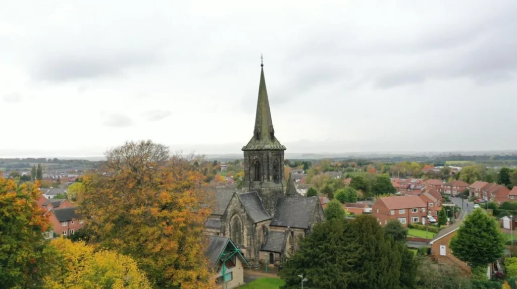
Main Street, Church Lane, St Mary’s Church and other heritage locations provide the strongest historic visual references in Garforth, combining traditional buildings, church architecture, mining-era associations and street patterns that reveal how the settlement developed over centuries.
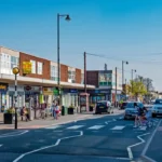
Main Street provides an important starting point for understanding Garforth’s built environment. It forms part of the route through the established settlement and connects with Church Lane and other older streets.
St Mary’s Church is one of the area’s recognised heritage locations. Leeds City Council lists St Mary’s Church, Garforth within its parks and byelaws schedule, while the Garforth Neighbourhood Plan identifies historic buildings and sites as important elements of local character.
Churchyards also provide architectural and documentary detail. Gravestones, walls, trees and church structures create different visual layers. The Garforth Neighbourhood Plan records a gravestone associated with John Backhouse, a teenage employee killed in a Garforth Colliery explosion in 1856. This provides a direct physical connection between the landscape and the area’s mining history.
The wider historic environment also includes buildings associated with the Gascoigne family and local mining activity. The Garforth Country Club, for example, originated in 1865 and was built for miners. The building later became a venue for lectures, social activities and community use.
The Miners’ Welfare Hall on Main Street dates from 1924. The Garforth Neighbourhood Plan records its connection with the Garforth Miners’ Welfare Institute and the local mining community. It later housed Garforth Library between 1939 and 1943.
These locations are useful for architectural observation because they demonstrate different periods of construction and community use.
As you explore the modern streets, you are crossing land shaped by farming, mining, transport and community development. Read the to understand the deeper origins behind Garforth’s present-day streets and landmarks.
Historic research also improves creative observation. A building becomes more informative when its function, construction period and social role are understood. This makes Garforth’s heritage useful for documentary photography, architectural sketching and local-history writing.
Where can visitors find nature and landscape inspiration in Garforth?
Garforth has several recognised green spaces, including BarleyHill Park, Hollinhurst Wood, The Chase, White House Lane and East Garforth Recreation Ground, providing woodland, open grassland, paths and changing seasonal landscapes for creative observation.
Leeds City Council’s parks information identifies numerous green and recreational spaces across Garforth and Swillington. These include BarleyHill Park, The Chase, White House Lane, Hollinhurst Wood, East Garforth Recreation Ground and Glebelands Recreation Ground.
Each type of landscape offers different visual material.
Hollinhurst Wood is particularly relevant for nature-focused creative work because woodland produces changing patterns of light, shadow, bark texture, leaves and seasonal colour. Woodland environments also create visual layers, with foreground vegetation, paths, trunks and distant openings.
BarleyHill Park provides a more open setting. Open grassland gives photographers broader sightlines and artists simpler compositional structures. The changing position of sunlight across open areas also alters the appearance of the same location during the day.
The Chase is another recognised local green space. Its inclusion within Leeds City Council’s parks schedule confirms its status as a local recreational landscape.
White House Lane is also identified as local green space. The area becomes particularly relevant when considered alongside nearby walking routes and agricultural land.
Garforth’s green spaces should be viewed as part of a wider landscape network rather than isolated parks. Leeds has 859 kilometres of recorded public rights of way, consisting of 650 kilometres of footpaths, 199 kilometres of bridleways and 11 kilometres of byways. These routes connect urban areas with surrounding countryside.
For creative visitors, this network makes walking an effective way to discover changing views. A short route can move between residential streets, fields, woodland and former industrial infrastructure.
Why is the Linesway important for creative visitors?
The Linesway is a three-mile disused railway route between Garforth and Allerton Bywater, providing a distinctive linear landscape where former transport infrastructure, vegetation, bridges, paths and surrounding countryside create strong subjects for photography and visual research.
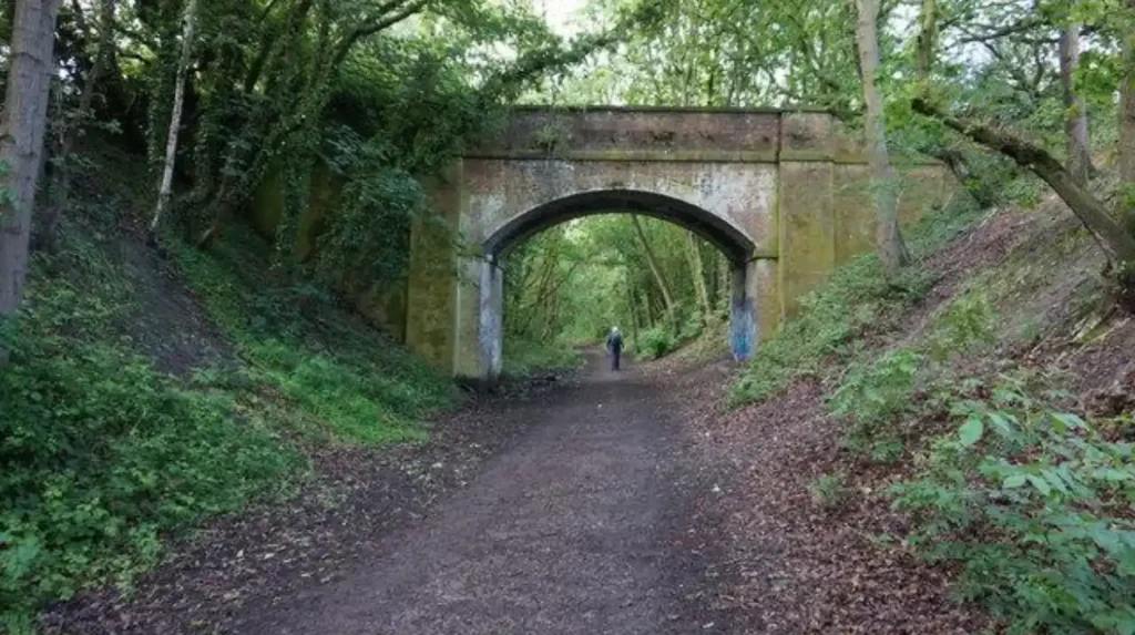
The Linesway is one of the most distinctive places for creative exploration around Garforth. Leeds City Council describes it as a three-mile route following a disused railway between Garforth and Allerton Bywater.
Its railway origins give the landscape a clear structural character. Railway routes are linear by design, creating long perspectives and repeated elements such as embankments, cuttings, vegetation and bridges.
The Leeds Country Way also passes through this landscape. The official route information describes the section from Garforth towards the River Aire as following the old railway line, now called the Linesway, before continuing towards Brecks Wood and the surrounding countryside.
This combination of transport history and natural regeneration creates several useful subjects.
Photographers can examine how vegetation has developed around the former railway infrastructure. Sketchers can use the path as a strong perspective line. Writers can document the relationship between the former railway and the modern settlement.
The route also demonstrates how disused infrastructure can acquire a new recreational function. A railway built for transportation becomes part of the public walking network after its original industrial role ends.
The Linesway therefore provides a direct connection between Garforth’s industrial past and its present outdoor environment.
Visitors should use established paths and respect signs, property boundaries and other users. Walking routes are shared public environments, so creative activity should not obstruct pedestrians, cyclists or other route users.
The route is particularly useful for visitors who want to combine physical activity with visual research. Its linear form also makes it easy to structure a short creative walk around a beginning, middle and endpoint.
Which walking routes offer the best creative variety around Garforth?
The Leeds Country Way and connected Garforth footpaths provide the greatest variety because they combine village streets, fields, hedgerows, railway infrastructure, woodland and river landscapes, allowing visitors to experience several contrasting environments during one structured walking journey.
The Leeds Country Way is a 62-mile circular walking route around Leeds. Leeds City Council divides it into four main stages, with shorter sections that can be completed separately.
One section specifically connects Barwick-in-Elmet with Garforth. The route approaches Garforth along Barrowby Lane before entering Main Street and continuing towards Church Lane. It then follows paths towards the old railway line and the A63.
Another section begins around Garforth and continues towards the River Aire. It follows the Linesway before reaching Brecks Lane, White House Lane and Mount Pleasant Picnic Site.
This creates a useful sequence of visual environments.
The route begins with established settlement and architecture. It then moves into agricultural land, where hedgerows, field boundaries and farm tracks become dominant. The route later reconnects with railway infrastructure and eventually reaches river-related landscapes.
The public rights-of-way network adds further flexibility. Leeds City Council provides information on footpaths, bridleways, byways and access routes, making it possible to build shorter walks rather than completing an entire long-distance route.
For a creative visitor, route length should match the purpose of the session. A short walk suits focused photography or sketching. A longer route supports landscape research and environmental writing.
Weather also changes the visual character of these landscapes. Wet conditions emphasise reflections and textures. Clear conditions produce stronger shadows and wider views. Autumn changes vegetation colour, while spring introduces new growth.
The important point is that Garforth’s walking network connects different landscape types. Creative visitors do not need to stay in one environment to study the area’s character.
Where can photographers find different subjects in Garforth?
Photographers can work across Garforth’s historic streets, churchyard, railway routes, woodland, parks and open countryside, creating opportunities for architectural, documentary, landscape, nature and transport photography without relying on a single type of visual environment.
Garforth supports several forms of photography because its landscape contains contrasting subjects.
Architectural photography is suited to Main Street, Church Lane, St Mary’s Church and other heritage-related locations. These settings provide buildings, masonry, rooflines, windows, walls and streetscape details.
Documentary photography benefits from the relationship between historic buildings and modern development. Garforth’s Neighbourhood Plan describes the town as containing both post-war development and industrial heritage. It also identifies eight designated heritage assets, all Grade II listed.
Landscape photography is better suited to the Linesway, surrounding fields, White House Lane and the Leeds Country Way. These areas provide longer sightlines and stronger relationships between built and natural environments.
Nature photography is supported by places such as Hollinhurst Wood and other local green spaces. Leeds City Council specifically categorises Hollinhurst Wood as a woodland area.
Railway photography has a particular role in Garforth because the modern railway remains an active part of local movement while the Linesway represents a former railway corridor.
Garforth railway station provides an accessible starting point for visitors arriving by train. National Rail lists the station at Station Road and records bicycle storage, parking, passenger assistance and accessibility facilities.
East Garforth station provides another rail access point. It is located on Woodlands Drive and has step-free access to all platforms, although National Rail records access through long or steep ramps and no station parking.
Photographers should distinguish between public access and private property. A visually interesting building does not automatically provide permission to enter private land. Public footpaths and publicly accessible spaces should be used for location-based photography.
Where can writers, illustrators and digital nomads work quietly in Garforth?
Garforth Library provides the clearest practical indoor base for research and focused creative work, with free Wi-Fi, computers, internet access, accessible facilities, a café and bookable rooms alongside outdoor locations for breaks and visual research.
Garforth Library and One Stop Centre is located on Lidgett Lane. Leeds Libraries lists free Wi-Fi, free computer access, internet facilities, public toilets, accessible facilities and room bookings. The building also has lift access between its two levels.
The library is particularly useful for research-led creative work. Writers can consult books and local information. Digital workers can use Wi-Fi and computers. Visitors can use the space as a practical base before exploring Garforth’s outdoor environments.
The library also hosts events covering family, learning and cultural activities. Its role therefore extends beyond conventional book lending.
The café provides another practical feature. Leeds Libraries lists café service during specified weekday hours, although visitors should check the current timetable before travelling because opening arrangements can change.
For digital nomads and business travellers, the library offers a combination of work infrastructure and local access. A visitor can work indoors, take a short walk through Garforth, observe the local environment and return to research or writing.
This arrangement also supports creative fieldwork. A photographer can collect visual references outdoors and organise notes indoors. A writer can research local history before documenting the places connected with that history.
The combination of public workspace and surrounding walking routes gives Garforth a practical structure for a creative day.
How can visitors plan a creative day around Garforth?
A productive creative day in Garforth can combine the railway station, historic streets, green spaces, the Linesway and Garforth Library, creating a practical sequence of arrival, outdoor observation, heritage research, walking and focused indoor work.
Start at Garforth railway station when arriving by train. National Rail provides current station information and live journey services, making it the appropriate source for checking travel arrangements before departure.
From the station, move towards the established central streets and historic areas. Main Street and Church Lane provide an introduction to Garforth’s built environment.
Continue towards St Mary’s Church and its surrounding historic setting. This part of the visit introduces religious architecture, memorials and evidence connected with the area’s earlier communities.
The next stage can focus on green space. Depending on the intended activity, visitors can explore recognised local spaces such as BarleyHill Park, The Chase or Hollinhurst Wood. Leeds City Council records these locations within its Garforth and Swillington parks schedule.
The Linesway provides a longer walking section for visitors interested in railway heritage and landscape. Leeds City Council identifies the route as three miles between Garforth and Allerton Bywater.
The day can then finish at Garforth Library. The library provides Wi-Fi, computers, internet access, toilets and room-booking facilities.
This sequence creates a clear creative workflow: observe, document, walk, research and develop.
Visitors should check opening times and route conditions before travelling. Library facilities and transport services have published operating arrangements that can change.
The route also works for different visitor types. Tourists can focus on local photography and heritage. Residents can use it for regular creative walks. Digital nomads can combine remote work with outdoor research. Business travellers can use the same approach during free periods.
Explore More Area Guide
Garforth Places to Explore on a Clear Summer Day
Garforth Meeting Points and Gathering Spots | The Leeds
What historical details should creative visitors look for in Garforth?
Creative visitors should look for evidence of farming, medieval settlement, coal mining, railway development and twentieth-century community life because these layers explain the buildings, routes, landscapes and public spaces that define Garforth’s visual character today.
Garforth’s historical development is visible in its physical landscape.
The Garforth Neighbourhood Plan states that the settlement’s origins are uncertain but identifies probable early cultivation linked to the fertile Magnesian Limestone landscape east of Leeds. It also associates the place name with an Anglo-Saxon origin.
The Domesday Survey of 1086 provides the first detailed written description. It recorded a church, priest, four villagers and one smallholder within the manor.
Medieval agriculture also left physical evidence. The neighbourhood plan notes traces of ridge-and-furrow field systems, including features visible in grassed areas such as Garforth Golf Course.
Industrialisation changed the settlement substantially. Coal mining created employment, infrastructure and community institutions. The mining connection is still represented by historic buildings, memorials and local records.
Railway development created another important layer. The present railway stations represent continuing transport infrastructure, while the Linesway represents a former railway route that now functions as a walking and cycling corridor.
Community buildings also preserve social history. The 1924 Miners’ Welfare Hall and the nineteenth-century Garforth Country Club demonstrate how industrial communities developed spaces for education, recreation and social activity.
These details are valuable for creative research because they transform individual locations into documented subjects. A photograph of a building can record architectural form. A written piece can explain its social function. A sketch can focus on construction details. A walking project can connect separate historical locations.
Garforth therefore works as a fieldwork environment where physical places and documented history overlap.
Why does Garforth remain relevant for creative visitors?
Garforth remains relevant because its public paths, green spaces, historic environment, railway infrastructure and community facilities create a durable local network for creative observation, research and work, while its connection to Leeds makes it practical for visitors seeking an accessible alternative to city-centre locations.
The future relevance of Garforth’s creative landscape depends on maintaining access to its public spaces and recognising the value of its heritage.
The Garforth Neighbourhood Plan was formally approved on 1 September 2023. It provides a local planning framework covering heritage, green space, development and community priorities.
The plan also identifies the importance of protecting local heritage assets. Its assessment records eight designated heritage assets and a wider group of potential non-designated heritage assets.
Green infrastructure is equally important. Leeds City Council’s public rights-of-way network connects urban and rural landscapes across the district. The 859-kilometre recorded network demonstrates the scale of accessible walking infrastructure available across Leeds.
Garforth contributes to this wider network through the Linesway, Leeds Country Way and local paths.
Its transport infrastructure also supports short visits. Garforth railway station provides rail access, while East Garforth provides another station serving the settlement.
This combination makes Garforth suitable for creative visitors who want a location with multiple layers rather than a single attraction.
The most useful approach is to treat Garforth as a connected creative landscape. Historic streets provide architectural research. The Linesway provides industrial and transport history. Parks and woodland provide natural subjects. Public footpaths connect these environments. Garforth Library provides an indoor base for research and focused work.
For tourists, this creates a structured local experience beyond central Leeds. For residents, it provides accessible places for regular creative activity. For digital nomads and business travellers, it combines practical workspace with short outdoor excursions.
Garforth’s creative value therefore comes from its combination of heritage, landscape, infrastructure and accessibility. These features are rooted in documented local history and remain visible across the settlement today.
What are the best places for creative inspiration in Garforth?
Garforth’s best creative locations include the Linesway, St Mary’s Church, Main Street, Church Lane, Hollinhurst Wood, BarleyHill Park and Garforth’s surrounding walking routes. These places offer historic architecture, woodland, open landscapes and former railway scenery.