Horsforth is a north-west Leeds suburb with a strong network of parks, waterways, woodland, playing fields, Green Belt and smaller protected green spaces. Its landscape is not formed by one large park. It is a connected environmental structure extending around and through the settlement.
- What are the main green corridors around Horsforth?
- How does Horsforth Hall Park fit into the local green network?
- Which open spaces are protected in Horsforth?
- How do Horsforth’s waterways create connected walking routes?
- What role does the Aire Valley play in Horsforth’s green landscape?
- Which woodland areas are important around Horsforth?
- How does Horsforth’s historic landscape influence today’s green corridors?
- How should visitors plan a green-space day in Horsforth?
- Why are green corridors important for Horsforth’s future?
- What should visitors remember about Horsforth’s green corridors?
The most important green corridors include Oil Mill Beck, Gill Beck, Scotland Beck and Old Mill Beck. These waterways connect wildlife habitats, amenity spaces and recreational routes. The wider landscape also links Horsforth with the Aire Valley, surrounding countryside and neighbouring communities.
Leeds City Council identifies green corridors as routes that connect green infrastructure for people and wildlife. These connections support walking, cycling, biodiversity and access to local amenities while reducing reliance on vehicle-based journeys.
Horsforth’s location gives it particular landscape value. The settlement sits north-west of Leeds and is substantially surrounded by open land. Historic planning documents describe green space and woodland along its eastern boundary, with the Aire Valley forming a wider green corridor to the south.
For visitors, this creates an outdoor network rather than a single destination. A day of exploration can combine Horsforth Hall Park, local recreation grounds, beck-side routes, village greens and surrounding open countryside.
What are the main green corridors around Horsforth?
Horsforth’s principal green corridors follow Oil Mill Beck, Gill Beck, Scotland Beck and Old Mill Beck, while the Aire Valley forms a major southern connection. Together, these routes link wildlife habitats, open areas, recreation spaces and countryside around Horsforth.
The Horsforth Neighbourhood Plan specifically identifies Scotland Beck, Old Mill Beck, Oil Mill Beck and Gill Beck as Local Green Infrastructure. The plan states that these corridors perform wildlife, amenity and recreational functions.
Oil Mill Beck is particularly significant because its corridor extends through the eastern and north-eastern parts of Horsforth. The surrounding Hawksworth and Daffy Woods contribute woodland habitat to this wider landscape structure.
Gill Beck forms another important linear environmental feature. Its connection with the wider Aire Valley strengthens the relationship between Horsforth’s urban area and larger areas of open land.
Scotland Beck and Old Mill Beck also have historic and environmental importance. Watercourses helped shape settlement patterns and supported earlier industrial activity. Today, their principal relevance includes habitat, visual amenity, drainage and recreational connectivity.
These corridors are different from conventional parks. A park is generally a defined destination. A green corridor is primarily a connecting landscape. It allows people and wildlife to move between separate green areas.
Leeds planning guidance describes green corridors as green infrastructure that creates safe and attractive links for people and wildlife, separated from vehicular traffic where appropriate.
This makes Horsforth useful for visitors who want outdoor exploration without travelling deep into the Yorkshire countryside.
How does Horsforth Hall Park fit into the local green network?
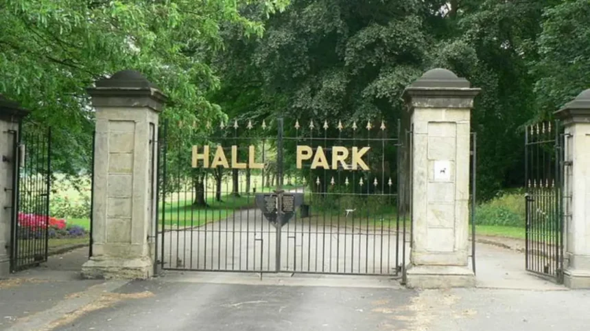
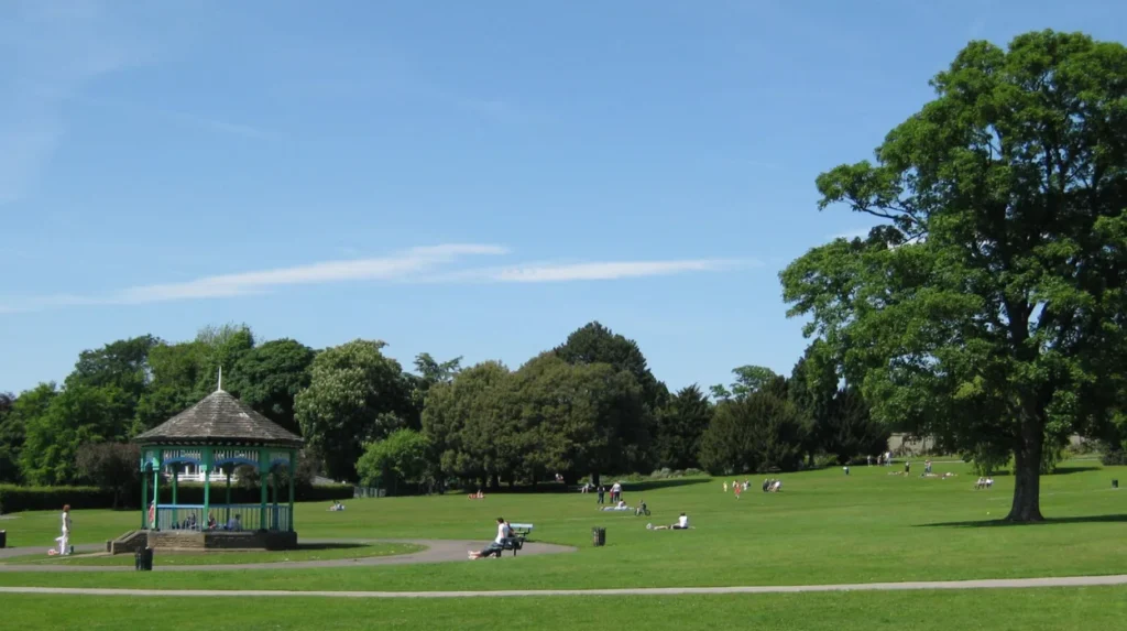
Horsforth Hall Park is the area’s principal community park, providing scenic walking routes, sports facilities, gardens, play areas and recreational infrastructure. Its paths and open spaces provide a practical starting point for exploring Horsforth’s wider network of green areas.
Horsforth Hall Park is approximately six miles north-west of Leeds city centre. Leeds City Council classifies it as a community park. Its facilities include scenic walks, a cricket pitch, a trim trail, Japanese garden, skate park and integrated play facilities.
The park also provides accessible infrastructure. Leeds City Council states that its paths are suitable for wheelchair users and its entrances are wheelchair accessible. Two disabled parking bays are available in the main car park off Hall Lane.
The park is therefore suitable for several types of outdoor use. Walkers can use its paths for short outings. Families can combine open space with playground facilities. Visitors with accessibility requirements can use the designated accessible routes and entrances.
Its Japanese garden provides a quieter landscaped environment within the larger community park. The cricket pitch and recreational facilities add structured uses to the open landscape.
Horsforth Hall Park also demonstrates how urban green infrastructure operates at neighbourhood level. It does not need to function as a wilderness area. Its value comes from combining recreation, planting, paths, sport and community facilities.
Leeds has 70 parks within its wider parks network, according to the city’s Parks and Green Spaces Strategy. The strategy states that parks receive around 45 million adult visits annually, based on the University of Leeds Parks Study.
This wider evidence shows why community parks remain an important part of urban green infrastructure.
Which open spaces are protected in Horsforth?
Horsforth contains numerous protected and designated green spaces, including Horsforth Hall Park, Newlay Green, Woodbine Green, Victoria Gardens, local recreation grounds and smaller neighbourhood greens. These spaces provide recreation, visual amenity, habitat and local landscape protection.
Leeds City Council’s parks information lists numerous Horsforth sites under different categories. These include community park, local green space and recreation ground designations.
The list includes Horsforth Hall Park, Emmott Drive POS, Hall Lane, Layton Avenue, Leeds Road, Newlay POS at Victoria Crescent, The Green, Woodside Park Avenue POS and Woodside Recreation Ground.
Recreation grounds include Cragg Hill Recreation Ground, King George’s Playing Fields and Stanhope Recreation Ground.
The Horsforth Neighbourhood Plan provides an additional layer of local protection. Its Local Green Space policy identifies sites including Old Ball Garden, Woodbine Green, Newlay Green, Salmon Crescent Green, Victoria Gardens and the Horsforth Town Council Jubilee Garden and Library Garden.
This distinction is important for visitors. Not every green area functions as a formal park. Some are small neighbourhood spaces designed for local amenity rather than extended recreation.
Small greens can still contribute to a walking itinerary. They break up the built environment and create visual connections between streets, parks and larger countryside areas.
The planning protection also has long-term implications. Designated Local Green Space receives a high level of protection against inappropriate development under the neighbourhood planning framework.
Visitors therefore encounter a landscape where large parks and small green spaces operate together.
How do Horsforth’s waterways create connected walking routes?
Horsforth’s waterways create linear connections through the settlement and surrounding landscape. Oil Mill Beck, Gill Beck, Scotland Beck and Old Mill Beck provide wildlife corridors, amenity areas and recreational access routes that connect built-up neighbourhoods with larger green infrastructure.
Watercourses are central to Horsforth’s green infrastructure because they provide continuous landscape features. Unlike isolated gardens or enclosed recreation grounds, a beck corridor follows a natural geographical route.
The Horsforth Neighbourhood Plan identifies the area’s watercourses as important for ecological habitats, recreation, visual amenity and historical water power.
Oil Mill Beck and Gill Beck are particularly important because parts of their corridors form part of Leeds’ wider Habitat Network. This gives their ecological function greater significance than their immediate recreational value.
The network approach also explains why individual green spaces should not be considered separately. A small wooded area beside a beck can support habitat continuity. A path beside a watercourse can provide pedestrian connectivity. A planted margin can improve the ecological quality of an otherwise urban landscape.
Leeds planning guidance states that green connections should connect existing green infrastructure with adjacent green infrastructure. It identifies walking, cycling and wheeling as important functions of green routes.
Visitors should therefore view Horsforth’s becks as parts of a larger landscape system rather than as standalone attractions.
Access conditions vary along individual corridors. Watercourses also contain uneven ground, vegetation and seasonal surface conditions. Sensible footwear is appropriate when exploring less formal sections.
What role does the Aire Valley play in Horsforth’s green landscape?
The Aire Valley forms a major green corridor south of Horsforth and connects the suburb with wider open landscapes around the River Aire. Its valley environment supports ecological networks, open land, recreation and landscape separation between urban communities.
The Aire Valley is one of the defining geographical features of the wider Horsforth landscape. Leeds planning documents identify the valley south of Horsforth as a broad Green Belt corridor containing washlands, Leeds Nature Areas and a Site of Special Scientific Interest.
A Site of Special Scientific Interest, or SSSI, is an area designated because of its special interest in wildlife, geology or physiography. Such sites receive statutory protection because of their scientific importance.
The Aire Valley therefore represents a much larger environmental system than Horsforth’s neighbourhood parks. Its landscape includes river processes, open land and habitats extending beyond the suburb.
This southern connection also gives Horsforth a distinctive relationship with the River Aire. The built-up settlement sits close enough to the valley for its landscape character to influence local planning and recreation.
The valley functions as a green buffer as well as a habitat network. Green corridors can help maintain separation between built-up areas and prevent continuous urban development.
The Leeds Green Belt covers approximately 33,851 hectares, equivalent to about 61% of the Leeds district. Leeds City Council defines Green Belt primarily as a planning tool designed to prevent urban sprawl and keep land permanently open.
Green Belt status does not automatically mean that every location is a public recreation site. Visitors should distinguish between public access land, rights of way, parks, private agricultural land and protected planning areas.
Which woodland areas are important around Horsforth?
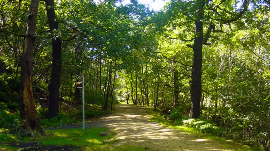
Woodland around Horsforth strengthens the green corridor network, particularly along the eastern and north-eastern edges. Hawksworth and Daffy Woods form part of the Oil Mill Beck landscape and provide habitat continuity between urban areas and surrounding open countryside.
Woodland is a major component of Horsforth’s green infrastructure. The Horsforth Neighbourhood Plan specifically highlights Hawksworth and Daffy Woods alongside Oil Mill Beck as part of the area’s surrounding open-space network.
Trees perform several environmental functions. They provide habitat, intercept rainfall, contribute to carbon storage, reduce surface-water flows and create shade. Woodland also strengthens the visual continuity of green corridors.
Horsforth’s woodland areas are particularly important because they occur around the edges of an established urban settlement. They help connect built-up streets with wider countryside.
The relationship between woodland and waterways is also significant. Beck corridors provide linear connections, while woodland provides broader habitat areas. Together, they form a more functional green infrastructure network.
Visitors should distinguish between managed public woodland, local paths and private woodland. Access rights depend on the specific land and route.
The Horsforth Neighbourhood Plan records strong local support for protecting woodland and wildlife habitat. During its 2018 Pre-Submission Plan consultation, approximately 97% of respondents supported the proposed Local Green Infrastructure policy.
That figure demonstrates the strength of local support recorded during the neighbourhood planning process.
How does Horsforth’s historic landscape influence today’s green corridors?
Horsforth’s current green network reflects centuries of settlement, agriculture, waterways and transport development. The historic village core, surrounding valleys and watercourses helped shape the settlement pattern that remains visible in today’s parks, open spaces and landscape corridors.
Horsforth has a long settlement history extending into the Anglo-Saxon period. Leeds’ conservation-area appraisal identifies medieval features around The Green and the southern end of Town Street.
The settlement developed on sloping land. Heavy industry did not dominate the historic core, allowing elements of its village character to survive.
Watercourses also influenced development. The Horsforth Neighbourhood Plan records the historical contribution of watercourses through water power, alongside their modern ecological and recreational functions.
This connection between historical geography and modern green infrastructure is important when exploring the area. Modern paths frequently occupy landscapes shaped by earlier agricultural, industrial and settlement patterns.
As you explore the modern green network, you are crossing land with a deep heritage. Read about the full to understand its origins.
Horsforth’s historic landscape is also recognised through conservation areas. Leeds City Council lists Horsforth and Horsforth Cragg Hill among its designated conservation areas.
The historic and environmental layers therefore overlap. A walk between green spaces can also pass through areas where settlement history remains visible in street patterns, buildings, walls, mature trees and open spaces.
How should visitors plan a green-space day in Horsforth?
A practical Horsforth green-space itinerary starts with an established park, follows accessible local paths, explores nearby open areas and connects with beck-side landscapes where public access exists. Planning around daylight, weather, terrain and access rights keeps the outing efficient and responsible.
Horsforth works well for flexible outdoor exploration because its green infrastructure is distributed across the settlement.
A short visit can focus on Horsforth Hall Park. Its formal paths, gardens and recreation facilities provide a straightforward starting point.
A longer outing can combine the park with neighbourhood greens and public routes towards the local beck corridors. Visitors should use signed public paths and avoid crossing private land.
For families, Hall Park offers the strongest concentration of facilities. Its integrated play area is designed for disabled and able-bodied children under eight, while a separate playground serves older children.
For walkers, the most interesting experience comes from combining formal parkland with the less structured green infrastructure around the becks and woodland.
For digital nomads and business travellers, the green spaces provide useful downtime between work commitments. Parks offer opportunities for walking breaks and outdoor relaxation without requiring a full day trip outside Leeds.
Weather affects outdoor conditions. Beck-side paths and woodland routes become more challenging during prolonged rainfall. Daylight also determines how practical less formal routes are.
Visitors should avoid treating Green Belt land as automatically accessible. Green Belt is a planning designation rather than a public access designation.
Explore More Area Guide
Horsforth Places for an Unplanned Day Out | Leeds 2026
Horsforth Independent Food Businesses Guide 2026
Why are green corridors important for Horsforth’s future?
Green corridors give Horsforth long-term environmental and recreational value by connecting habitats, open spaces and communities. Their continued protection supports biodiversity, active travel, landscape quality, climate resilience and access to nature within a growing urban area.
Green infrastructure is increasingly treated as an interconnected system rather than a collection of isolated parks. This approach is reflected in Leeds planning policy.
The Horsforth Neighbourhood Plan states that development affecting Local Green Infrastructure should maintain continuity and the functions provided by the network. It also calls for enhancement or extension where appropriate, with attention to public access.
Leeds City Council’s green-space guidance similarly requires development to retain existing green infrastructure and connect it with adjacent infrastructure.
These policies have direct environmental implications.
Connected habitats provide better ecological continuity than isolated pockets of vegetation. Watercourses provide movement routes through developed areas. Woodland patches provide habitat and shade. Parks provide accessible recreation. Street trees and planted verges connect these larger elements.
Green corridors also support active travel. A route that connects homes with parks, schools, services and public transport can reduce dependence on short car journeys.
Climate resilience is another function. Vegetation and open land contribute to rainfall management, shade and urban cooling. Watercourse corridors also provide space for natural drainage processes where land management permits.
Horsforth’s landscape structure gives these principles practical relevance. Its combination of becks, woodland, parks, recreation grounds, Green Belt and the Aire Valley forms a connected environmental framework.
The future importance of these spaces therefore extends beyond recreation. Protecting connections between them preserves the environmental structure of the suburb.
What should visitors remember about Horsforth’s green corridors?
Horsforth’s green network is defined by connections rather than one attraction. Hall Park, local greens, recreation grounds, woodland, beck corridors and the Aire Valley form a layered landscape that supports walking, recreation, wildlife and access to open space.
The best way to understand Horsforth’s outdoor environment is to look at the complete network.
Horsforth Hall Park provides the principal formal community-park experience. Oil Mill Beck and Gill Beck provide important linear green infrastructure. Scotland Beck and Old Mill Beck strengthen the eastern network. Hawksworth and Daffy Woods add woodland habitat. The Aire Valley creates a major southern landscape connection.
Smaller spaces also matter. Newlay Green, Woodbine Green, Victoria Gardens and other designated Local Green Spaces contribute to the local environmental structure.
For visitors, this creates several ways to experience Horsforth outdoors. A short visit can centre on Hall Park. A longer walk can incorporate neighbourhood green spaces and accessible public routes. A broader exploration can look towards the wider Aire Valley and surrounding countryside.
The network also explains why Horsforth retains a strong relationship with open landscape despite its urban location.
Its green corridors are not simply decorative spaces. They provide habitat, recreation, landscape separation, pedestrian connections and environmental functions.
That combination makes Horsforth an important green-space destination within north-west Leeds. Its strongest feature is the continuity between individual places.
What are the main green corridors in Horsforth?
The main green corridors in Horsforth include Oil Mill Beck, Gill Beck, Scotland Beck and Old Mill Beck. These waterways connect habitats, open spaces, recreation areas and surrounding countryside. The Aire Valley also provides an important wider green connection south of Horsforth.