Garforth is a historic town in east Leeds with a heritage shaped by farming, religion, coal mining, transport, industry and community life. Its historic character is distributed across streets, churches, railway infrastructure, former mining landscapes, community buildings and surviving residential architecture.
- What is the historical background of Garforth?
- Why is St Mary the Blessed Virgin Church important to Garforth heritage?
- How did coal mining transform Garforth?
- What can you see around Garforth’s historic Main Street?
- What is the history of Garforth Miners’ Welfare Hall?
- Why is Garforth Country Club part of the town’s industrial heritage?
- How did railways shape Garforth’s heritage?
- What archaeological discoveries reveal Garforth’s earlier history?
- Which other historic buildings and places should you look for in Garforth?
- How is Garforth’s heritage protected today?
- How can you explore Garforth’s heritage on foot?
- Why does Garforth’s heritage remain important today?
The settlement has roots extending well before the Industrial Revolution. Leeds City Council’s Garforth Neighbourhood Plan records evidence suggesting cultivation in the wider area during the Roman period and identifies the origin of the place-name as probably Anglo-Saxon. The name is interpreted as meaning a ford beside a triangular piece of land.
Garforth was recorded in the Domesday Survey of 1086. The survey described a manor measuring approximately 1.5 miles by 1.5 miles and recorded a church, a priest, four villagers and one smallholder. These figures represented heads of households rather than the entire population.
The town changed significantly during the nineteenth century as coal mining expanded. The Gascoigne family became closely associated with local mining interests, while industrial development created employment, housing and community institutions. Garforth’s population increased from 782 in 1831 to 3,224 by 1899, illustrating the scale of its industrial transformation.
Today, heritage in Garforth is not concentrated within one historic centre. The town has no formal conservation area, but its neighbourhood planning evidence identifies designated listed structures and a much wider collection of locally significant buildings and places.
For visitors, this makes Garforth particularly suitable for heritage exploration on foot. Main Street, Church Lane, St Mary’s Church, the railway area, former mining locations and historic community buildings each reveal different stages of the town’s development.
What is the historical background of Garforth?
Garforth developed from an early agricultural settlement into a major mining community, with medieval origins, nineteenth-century industrial expansion and twentieth-century suburban growth creating the layered townscape visible today. Its heritage therefore combines farming, religion, coal mining, transport, housing and community institutions.
The earliest development of Garforth is not precisely dated. Archaeological evidence from the wider area demonstrates activity during the Roman and early medieval periods. Leeds City Council records evidence of possible Roman cultivation on the fertile Magnesian Limestone landscape east of Leeds.
The Anglo-Saxon interpretation of the name provides another indication of early settlement. Garforth was incorporated into the Kingdom of Northumbria in AD 617 according to the Garforth Neighbourhood Plan.
The Domesday Survey provides the first detailed written description. In 1086, Garforth had a church and a small recorded population. Medieval agricultural organisation also left physical traces. Ridge-and-furrow earthworks survive in grassed areas, including parts of the landscape associated with Garforth Golf Course.
The character of the settlement changed substantially from the eighteenth century onwards. Land ownership became increasingly associated with the Gascoigne family, which also developed local coal mining.
Industrialisation transformed both employment and settlement patterns. The first deep mining shafts were sunk between approximately 1830 and 1840. Coal production then became a defining feature of Garforth’s economy and landscape.
This historical progression explains why modern Garforth contains such contrasting architectural forms. Older churches and stone buildings sit alongside Victorian terraces, mining-related buildings, railway structures and later twentieth-century housing.
For visitors researching the wider development of the town, the best approach is to treat individual heritage sites as parts of one continuous historical landscape.
As you explore the modern town, you are crossing land with a deep heritage. Read about the full [Insert Anchor Text for History Article Here] to understand its origins.
Why is St Mary the Blessed Virgin Church important to Garforth heritage?
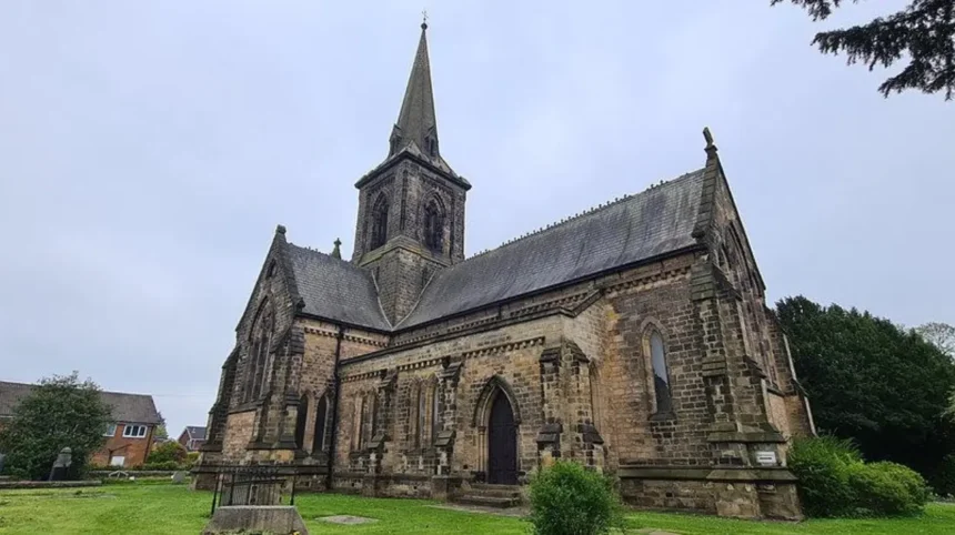
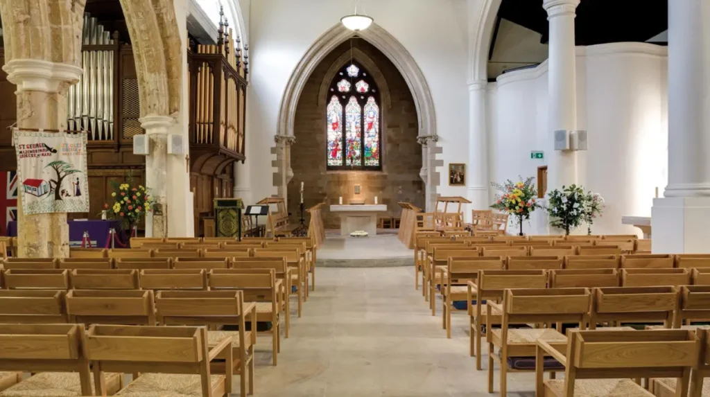
St Mary the Blessed Virgin Church is one of Garforth’s principal historic buildings. Constructed in 1844 to designs by George Fowler Jones, the Grade II listed church represents nineteenth-century religious architecture and remains an important landmark on Church Lane.
St Mary’s Church stands on Church Lane and is included on the National Heritage List for England as a Grade II listed building. Historic England records its construction date as 1844 and identifies architect George Fowler Jones as its designer.
The building uses dressed Magnesian Limestone with a slate roof. Its plan is cruciform, meaning the principal spaces form the shape of a cross. The design includes a nave, north and south aisles, transepts, chancel and crossing tower.
The tower has a broach spire, while the church incorporates Early English architectural features. Tall lancet windows, buttresses, moulded doorways and a corbel table contribute to its architectural character.
Its materials are also significant because Magnesian Limestone is closely associated with the geology and historic construction traditions of this part of Yorkshire.
The church provides evidence of Garforth’s nineteenth-century expansion. The population was growing rapidly as mining became more industrialised. New religious and community buildings became necessary as the settlement expanded.
Historic England’s listing also records the architectural importance of the building and its surviving historic form. Its Grade II designation recognises special architectural or historic interest.
Visitors should examine the relationship between the church, Church Lane and the surrounding residential area. The setting demonstrates how religious buildings became established within the growing industrial town.
The churchyard also contains historical evidence. Garforth’s Neighbourhood Plan identifies a gravestone associated with John Backhouse, a young mining worker killed in a colliery explosion in 1856. The record identifies him as a “hanger on”, an occupation involving movement of mine wagons at the bottom of a shaft. He was 15 years old.
This provides a direct connection between Garforth’s religious heritage and its mining history.
How did coal mining transform Garforth?
Coal mining transformed Garforth from a largely agricultural settlement into an industrial community. Deep shafts developed from the 1830s, employment increased, housing expanded and mining influenced local institutions, transport routes, population growth and the social identity of the town.
Coal extraction had existed in the wider Garforth area before the nineteenth century. The Garforth Neighbourhood Plan records evidence suggesting mining activity as early as the thirteenth century, although early workings were not deep.
The major transformation occurred under the Gascoigne family. Between 1830 and 1840, the first deep shafts were sunk and mining developed on a much larger industrial scale.
The economic effect was substantial. Garforth’s population rose from 782 in 1831 to 3,224 in 1899. This represented an increase of roughly 313 per cent, or more than four times the original population.
Mining also created a distinct social infrastructure. Workers required housing, welfare facilities, transport connections, recreational spaces and places for organised community activity.
The physical evidence of this period survives in less obvious forms than traditional monuments. Historic terraces, former miners’ facilities, street layouts and community buildings all provide evidence of the mining era.
Mining conditions were not always stable. The Garforth collieries experienced significant flooding during the 1870s and 1880s. The pits eventually closed in 1930, bringing an important chapter of Garforth’s industrial history to an end.
The closure of the mines did not erase their influence. Later development occurred on land associated with the former industrial landscape. Some mining structures were lost as new housing was constructed. The Garforth Neighbourhood Plan specifically identifies the loss of a pit winding building on Ninelands Lane as an example of heritage that disappeared during redevelopment.
For visitors, this means Garforth’s mining heritage requires interpretation rather than simply monument hunting. Streets, buildings and landscape patterns provide important evidence even where the original industrial structures no longer survive.
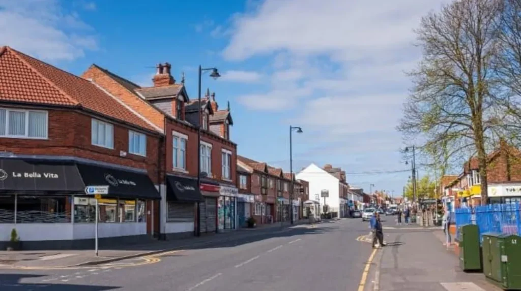
What can you see around Garforth’s historic Main Street?
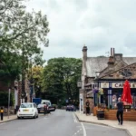
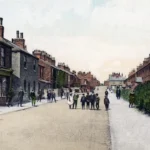
Main Street provides one of the clearest places to understand Garforth’s transition from village to industrial town. Victorian buildings, terraces, community structures, traditional brickwork, shops and former mining-related institutions reveal successive phases of nineteenth- and twentieth-century development.
Main Street forms an important part of Garforth’s central historic environment. The Garforth Neighbourhood Plan identifies Victorian character around Main Street, Moor Cottages, Town End, Salisbury Terrace, Coupland Road, Salem Place, Cyprus Terrace and Wakefield Road.
The architecture reflects Garforth’s industrial growth. Red brick, stone details, terraces and decorative features demonstrate construction associated with the expanding nineteenth-century settlement.
The Garforth Neighbourhood Plan also identifies distinctive brickwork brackets at the eaves of several buildings. Such details are small but important because they help distinguish older buildings from later development.
Historic Main Street is also connected to Garforth’s community institutions. The Miners’ Welfare Hall is identified as a non-designated heritage asset and forms part of the town’s mining and social history.
The street is therefore more than a commercial route. It provides a chronological record of how Garforth developed around employment, housing and community life.
A heritage walk should include close observation of façades, rooflines, window proportions, brickwork, stone detailing and the relationship between buildings and the road. These features help establish the age and function of individual structures.
Visitors should also look for changes between historic buildings and later redevelopment. Garforth experienced considerable housebuilding during the 1960s and 1970s, when its location and transport connections supported suburban expansion.
The contrast between older streets and post-war development is itself part of Garforth’s modern heritage story.
What is the history of Garforth Miners’ Welfare Hall?
Garforth Miners’ Welfare Hall was built in 1924 through the Garforth Miners’ Welfare Institute, with land donated by the Gascoigne family and funding involving miners’ subscriptions and a Central Miners’ Welfare Committee grant. It remains an important community heritage building.
The Miners’ Welfare Hall on Main Street represents the social side of Garforth’s industrial history.
It was erected in 1924 by the Garforth Miners’ Welfare Institute. The Gascoigne family donated the land, while funding came through a grant from the Central Miners’ Welfare Committee and weekly subscriptions paid by local miners.
The building therefore reflects several elements of mining society at the same time. It records the influence of mine owners, the organised contribution of workers and the wider welfare movement associated with British coal mining.
The hall also had an important civic role. Garforth Library occupied the building between 1939 and 1943 before moving because of limited space.
Its later use demonstrates how historic buildings can retain community functions after their original industrial context disappears.
The building is particularly useful for understanding that mining heritage is not limited to shafts and machinery. Coal mining affected education, recreation, welfare, social organisation and public life.
The hall is identified by the Garforth Neighbourhood Plan as a non-designated heritage asset. This category differs from statutory listed-building designation but recognises local historic significance within planning decisions.
For visitors, the building provides an opportunity to connect Garforth’s industrial economy with the institutions that supported everyday life.
Why is Garforth Country Club part of the town’s industrial heritage?
Garforth Country Club has a direct connection with the Gascoigne family’s mining interests and nineteenth-century worker recreation. Its origins date to 1865, when the Gascoignes established the building as a reward associated with local miners.
The Garforth Country Club on Aberford Road has an unusual place within the town’s heritage.
The original part of the building dates from 1865. Garforth’s Neighbourhood Plan records that the Gascoigne family, owners of the local mines, had it built as a reward for miners who did not strike that year.
The building demonstrates how industrial employers influenced recreational and social facilities.
Its rooms were used for lectures, magic lantern shows, chess and other social activities. These activities reveal the wider cultural life surrounding Garforth’s mining workforce during the nineteenth century.
The building’s importance therefore extends beyond its physical architecture. It provides evidence about leisure, education and employer-worker relationships during the industrial period.
The Country Club is identified in Garforth’s planning evidence as a non-designated heritage asset. It forms part of a wider group of locally important buildings that help explain the town’s historic identity.
When visiting the area, its relationship with Aberford Road is also relevant. Historic routes were essential to Garforth’s industrial economy, connecting the settlement with surrounding villages, coal transport routes and markets.
How did railways shape Garforth’s heritage?
Railways strengthened Garforth’s connection with regional markets and industrial transport. The town’s railway heritage is closely linked to coal movement, passenger travel and the wider Aberford-Garforth transport system, while the surviving station remains a locally identified heritage asset.
Transport was fundamental to Garforth’s industrial development. Coal required efficient routes from pits to markets, while workers and residents needed connections with surrounding settlements and larger towns.
The Aberford-Garforth Railway provides particularly important evidence of this history. Historic England records that a horse-drawn wagonway across the Parlington Estate transported coal from the Gascoigne family’s Garforth collieries towards a coal staith at Aberford on the Great North Road.
In 1837, this wagonway became part of the Aberford-Garforth Railway. The railway remained in use until 1924.
This system demonstrates how Garforth’s coal industry was connected to wider commercial networks. The railway was not simply a passenger facility. Industrial transport was central to its original economic purpose.
The Parlington route also contains the Dark Arch, a historic tunnel associated with the wagonway. Historic England records the structure as dating from around 1813 and explains that it helped conceal coal traffic from the hall and gardens.
Garforth railway station itself is identified in the neighbourhood planning evidence as a non-designated heritage asset.
The station therefore provides a practical starting point for understanding how transport infrastructure continues to shape the town.
Railway heritage is especially useful for visitors because it connects several themes: industrial production, passenger movement, urban growth and regional economic change.
What archaeological discoveries reveal Garforth’s earlier history?
Recent archaeological discoveries near Garforth demonstrate that the area’s history extends far beyond the documented medieval settlement. Excavations identified a previously unknown cemetery containing more than 60 individuals and a lead coffin associated with a woman from the late Roman period.
Archaeological research has added significant evidence to the understanding of Garforth’s ancient landscape.
In 2023, Leeds City Council reported the discovery of a previously unknown cemetery near Garforth. The site contained the remains of more than 60 men, women and children who lived in the area more than a thousand years ago.
A lead coffin was also discovered. The burial was associated with a woman estimated to have been between 25 and 35 years old. Leeds Museums and Galleries reported that the burial contained items including a bracelet, a glass bead necklace and a finger ring or earring.
The cemetery provided evidence covering the transition from the late Roman period into the early medieval period.
In 2025, Leeds City Council reported another significant discovery connected with the same wider archaeological picture. A gilded pectoral cross believed to date from the eighth century was found by a metal detectorist. The object was made from solid silver covered with a thin layer of gold leaf.
The cross is significant because it provides evidence of high-status individuals and early Christian activity in the wider Leeds area.
These discoveries change the way Garforth’s heritage can be understood. The town’s story does not begin with coal mining or the medieval church. Archaeology demonstrates that people lived, died and organised communities in the surrounding landscape many centuries earlier.
For heritage visitors, this archaeological evidence provides essential context when exploring Garforth’s churches, roads, fields and historic settlement pattern.
Which other historic buildings and places should you look for in Garforth?
Garforth contains a broader network of locally significant buildings beyond its best-known churches and mining sites. Historic terraces, chapels, pubs, houses, railway infrastructure, community buildings and surviving street features collectively demonstrate the town’s architectural and social development.
Garforth’s neighbourhood planning evidence identifies numerous non-designated heritage assets. These include Garforth railway station, historic shopfront and upper-floor architecture on Main Street, Lines Way, Gaping Goose public house, Miners’ Arms, Lord Gascoigne, Garforth House and several historic terraces.
The list also includes buildings and groups such as Sisters Villas, Kensington Terrace, The Beeches, Dar Villas, Westbourne House, Paradise Row, Town End Terrace, Salisbury Terrace, Salem Place, Cyprus Terrace and the Primitive Methodist Chapel.
These places are important because heritage is often preserved through groups of ordinary buildings rather than individual monuments.
Historic terraces demonstrate the housing requirements of an expanding industrial population. Public houses provide evidence of social and commercial life. Chapels reveal the development of religious communities outside the established church.
The Primitive Methodist Chapel is particularly relevant to understanding the diversity of nineteenth-century religious life.
The Garforth Neighbourhood Plan also identifies the Methodist Church and Salem Chapel among historic features in Central Garforth.
Visitors should therefore avoid limiting a heritage walk to listed buildings. Locally identified buildings can provide equally useful evidence about how residents lived and how the town functioned.
Garforth’s heritage is strongest when viewed as a network. Churches connect with burial grounds. Mining connects with welfare buildings. Railway routes connect with industrial production. Terraces connect with population growth. Main Street connects commercial activity with civic life.
How is Garforth’s heritage protected today?
Garforth has no formal conservation area, but heritage protection operates through listed-building legislation, planning policy and locally identified non-designated heritage assets. These mechanisms recognise architectural, archaeological and historical significance while managing change within the growing town.
Garforth’s planning position is distinctive. The neighbourhood plan states that there is no conservation-area designation within the town. It also identifies eight designated heritage assets in the form of listed structures, all Grade II, alongside non-designated heritage assets.
A conservation area is a designated area of special architectural or historic interest where planning controls help preserve the character and appearance of the whole area. Leeds currently has numerous conservation areas across the district, but Garforth is not one of them.
Listed buildings have statutory protection. Leeds City Council explains that listing recognises buildings of special architectural or historic interest and that protection can extend to interiors and associated structures within the building’s curtilage.
Non-designated heritage assets operate differently. They are locally identified buildings, structures or places with heritage significance that receive consideration through the planning process.
This distinction matters for visitors because not every important historic place will have a blue plaque, monument or Grade II listing.
Garforth’s neighbourhood planning evidence was developed through historical research, mapping, visual assessment and photographic evidence. The process identified buildings and features considered to make positive contributions to the town’s character.
Heritage protection therefore involves more than preserving old buildings. It also concerns historic streetscapes, archaeological evidence, landscape relationships and community identity.
Explore More Area Guide
Horsforth Best Places for an Independent Day Trip 2026
Horsforth Creative Inspiration Guide: Places to Explore
How can you explore Garforth’s heritage on foot?
A Garforth heritage walk works best as a connected route through Main Street, Church Lane, St Mary’s Church, the railway area, mining-related locations and historic residential streets. Allow time to examine buildings, street patterns, materials and surviving industrial evidence.
Begin around Main Street, where Victorian buildings and community structures provide an accessible introduction to Garforth’s industrial development.
Continue towards Church Lane and St Mary the Blessed Virgin Church. The Grade II listed church provides a strong architectural focus and links nineteenth-century population growth with religious development.
From the church area, explore surrounding historic streets and residential buildings. Look for brick terraces, stonework, decorative eaves, roof forms and surviving historic boundaries.
The railway area provides another historical layer. Garforth station is locally identified as a non-designated heritage asset, making it relevant to a wider exploration of industrial and transport history.
A route towards Aberford Road introduces the Garforth Country Club and its 1865 origins. The building provides a direct connection with mining employment and worker recreation.
Visitors interested in industrial archaeology can extend their exploration towards the historic transport landscape associated with the former Aberford-Garforth Railway and Parlington Estate. Historic England records the former wagonway’s role in transporting coal from Garforth towards Aberford.
A self-guided walk should focus on interpretation rather than simply photographing individual buildings. Historic streets reveal relationships between employment, housing, religion, transport and community life.
Visitors should also check current access arrangements before entering churchyards, community buildings or privately managed heritage sites. Some heritage assets are private properties or remain in active community use.
Why does Garforth’s heritage remain important today?
Garforth’s heritage explains how the town developed from an early settlement into a mining community and then a modern residential centre. Its churches, streets, railway infrastructure, archaeological discoveries and community buildings preserve evidence of changing economies, populations and social institutions.
The importance of Garforth’s heritage lies in its continuity.
The town experienced several major phases of development. Early settlement and agriculture established the landscape. Medieval Garforth developed around a church and manor. Industrial mining then transformed employment and population. Railway infrastructure connected the town with wider markets. Post-war expansion created the modern suburban landscape.
Each phase remains visible in a different form.
The continued existence of St Mary’s Church preserves nineteenth-century religious architecture. Main Street and its surrounding terraces retain evidence of industrial-era urban growth. The Miners’ Welfare Hall records the social infrastructure created by mining communities. The Country Club preserves a direct link with nineteenth-century worker recreation.
Archaeological discoveries add a much older layer. The cemetery near Garforth and associated artefacts demonstrate that the surrounding landscape was important during the late Roman and early medieval periods.
Heritage also has practical value for contemporary visitors. Historic buildings provide distinctive destinations for walking, photography and architectural study. Railway connections make Garforth accessible for short heritage visits, while its location within east Leeds allows visitors to combine town-based heritage with surrounding countryside.
For residents, heritage provides a framework for understanding local identity. For visitors, it provides context that transforms individual buildings into evidence of wider historical processes.
Garforth’s future development will continue to change the town. Its neighbourhood planning policies therefore emphasise protecting heritage assets and retaining historic character while accommodating new development.
The most effective way to explore Garforth is to recognise that its heritage is distributed across the town. The important stories are found not only in listed buildings but also in streets, community facilities, railway infrastructure, archaeological discoveries and surviving traces of the coal industry.
Garforth is consequently best understood as a layered historic landscape. Its heritage records more than individual buildings. It documents the changing relationship between people, work, religion, transport, housing and the surrounding land.
What are the most important heritage sites in Garforth?
Key Garforth heritage sites include St Mary the Blessed Virgin Church, Garforth Miners’ Welfare Hall, Garforth Country Club, Garforth railway station, historic Main Street buildings and locations connected with the former coal-mining industry.